Archives

Quick Facts: Location: Olympic Peninsula Coast Land Agency: Makah Nation Reservation Roundtrip: 1.5 miles Elevation Gain: 300 feet Contact: Makah Indian Nation Green Trails Map: Cape Flattery, WA- No 98S Notes: Dogs allowed on leash, Makah Recreation Pass required ($20, available at Washburn’s General Store ,the Makah Museum and several…

Quick Facts: Location: Sauvie Island (Portland, Oregon) Land Agency: Oregon Department of Fish and Wildlife Roundtrip: 6.5 miles Elevation Gain: 10 feet Access: From downtown Portland, follow US 30 west for just shy of 11 miles turning right onto the Sauvie Island Bridge. Follow Sauvie Island Road passing Cracker Barrel…
Quick Facts: Location: Mountain Loop Highway Land Agency: Mount Baker-Snoqualmie National Forest Roundtrip: 7.0 miles Elevation Gain: 2,650 feet Contact: Darrington Ranger District: Mount Baker -Snoqualmie National Forest Green Trails Map: Mountain Loop Highway 111SX Recommended Guidebook: Day Hiking North Cascades 2nd edition (Mountaineers Books) Special Note: Northwest Trail Pass…
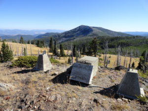
Mega-fauna hot spot in the Kettle River Range Quick Facts: Location: Kettle River Range Land Agency: National Forest Service Distance: 7.4 miles Elevation Gain: 1975 feet Contact: Colville National Forest Three Rivers Ranger District Recommended Guidebook: Day Hiking Eastern Washington (Mountaineers Books) Access: From Kettle Falls, travel west on SR…

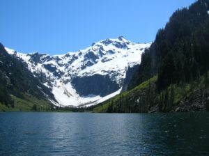
Bear haven in Olympic National Park Quick Facts: Location: Olympic National Park Land Agency: National Park Service Distance: 27.0 miles Elevation Gain: 4300 feet Contact: Olympic National Park www.nps.gov/olym Map: Green Trails Olympic Mountains East 168SX Notes: dogs prohibited; National Park entry fee (or Interagency pass) and Backcountry camping permit…
Quick Facts: Location: North Fork of the Skykomish River Land Agency: Mount Baker-Snoqualmie National Forest Roundtrip: 8.6 miles Elevation gain: 1450 feet Green Trails Maps: Monte Cristo, WA-No. 143 Contact: Skykomish Ranger District: Mount Baker Snoqualmie National Forest Notes: Northwest Forest Pass or Interagency Pass required. Access: The North Fork Skykomish…
Quick Facts: Location: Mountain Loop Highway near Darrington Land Agency: Mount Baker-Snoqualmie National Forest Roundtrip: 10.4 miles Elevation Gain: 1,400 feet Green trails Map: Mountain Loop Highway-No. 111SX Access: From Granite Falls, follow the Mountain Loop Highway east for 31 miles to Barlow Pass and end of pavement. Continue for 3.5…

Quick Facts: Location: Northeast Olympic Peninsula Land Agency: Olympic National Forest and Olympic National Park Roundtrip: 10.0 miles Elevation gain: 2800 feet Contact: Hood Canal Ranger District, Olympic National Forest; and Olympic National Park Green Trails Map: Olympics East no. 168SX Notes: Dogs are prohibited on trail in the national…
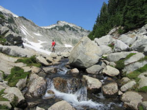
Quick Facts: Location: Henry M. Jackson Wilderness Land Agency: National Forest Service Roundtrip: 6.4 miles Elevation Gain: 1,800 feet Green Trails Map: Alpine Lakes Stevens Pass No. 176S Contact: Wenatchee River Ranger District: Okanogan-Wenatchee National Forest Access: From Everett head east on US 2 to Stevens Pass. Continue east for another…
Location: North Fork Sauk River Land Agency: Mount Baker-Snoqualmie National Forest Roundtrip: 19.4 miles High Point: 5,850 feet Elevation gain: 4,000 feet Difficulty: strenuous Green Trails Maps: Mountain Loop Highway 111SX Contact: Darrington Ranger District: Mount Baker-Snoqualmie National Forest Note: Northwest Forest Pass or Interagency Pass Required Access: From Darrington,…