Posts Tagged ‘dog-friendly’
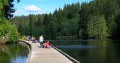
North Creek Park─Enjoy being “bogged” down for the holidays

Quick Facts: Location: Mill Creek Land Agency: Snohomish County Parks Roundtrip: 2.0 miles Elevation Gain: 30 feet Access: From I-5 Exit 183 follow 164th Street SE east to SR 527. Turn south and follow SR 527 to 183rd Street SE. Turn right (west) and proceed for a 0.5 mile to park entrance on right. Alternatively take…
Read MoreLake Sylvia─A great place to log some hiking miles
Quick Facts: Location: Montesano, Olympic Peninsula Land Agency: Washington State Parks Roundtrip: 4.9 miles Elevation Gain: 220 feet Access: From US 12 in Montesano, head north on Main Street past the county courthouse. Turn left onto Spruce Avenue proceeding three blocks. Then turn right on 3rd Street which becomes Sylvia Lake Road for 1.2 miles to…
Read MoreLa Center Bottoms─Wintering bird haven on the East Fork of the Lewis River
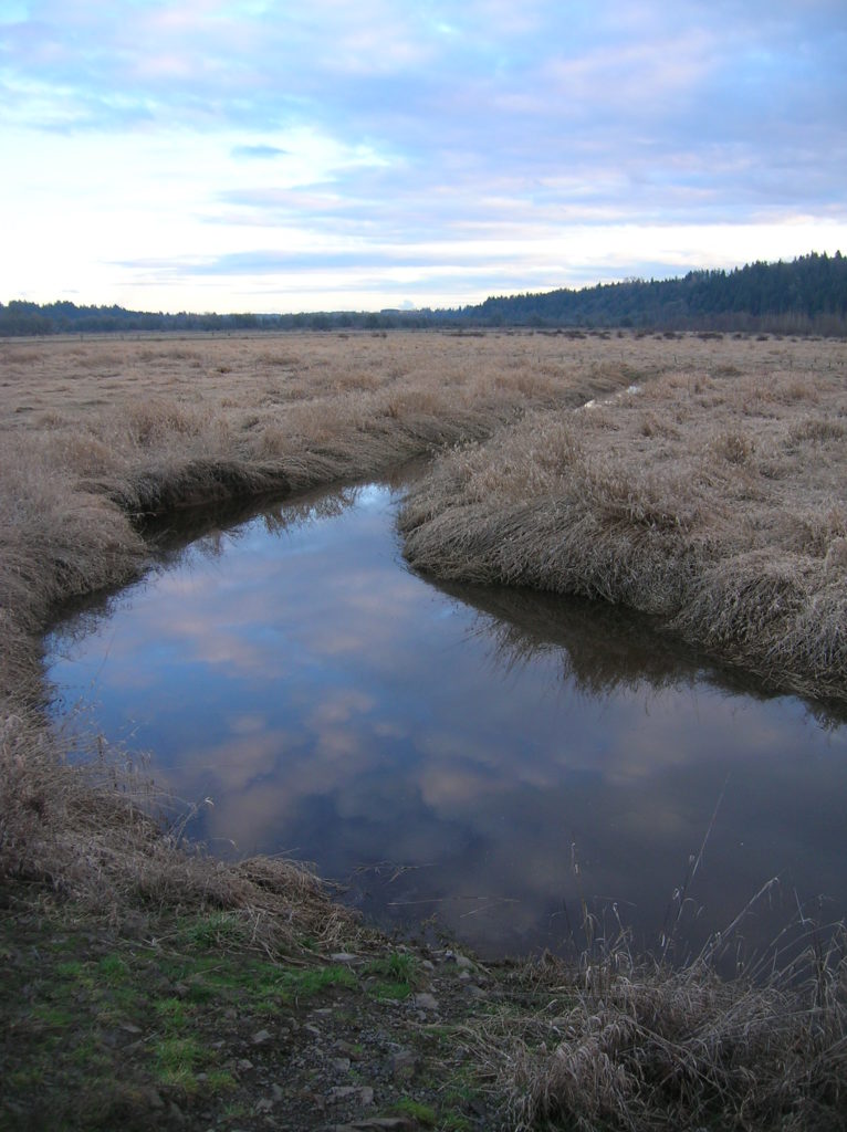
Quick Facts: Location: La Center, Clark County Wash. Land Agency: Clark County Parks Roundtrip: 2.0 miles Elevation Gain: 30 feet Special Note: Dogs permitted on leash. Access: From Vancouver, head north on I-5 to Exit 16. Turn right onto La Center Road and proceed for 1.6 miles to the bridge over the East Fork Lewis River.…
Read MoreLime Kiln Trail─Hop onboard for an historic hike along the Stillaguamish River

Quick Facts: Location: Stillaguamish River Valley, Granite Falls Land Agency: Snohomish County Parks Roundtrip: 7.0 miles Elevation Gain: 600 feet Contact: Snohomish County Parks Green Trails Map: Mountain Loop Highway 111SX Notes: Dogs must be on leash; park open dawn to dusk. Access: Follow SR 92 east to Granite Falls. Turn right onto Granite Ave. Continue…
Read MoreWhite Chuck Bench Trail — Glacier-fed Whitewater
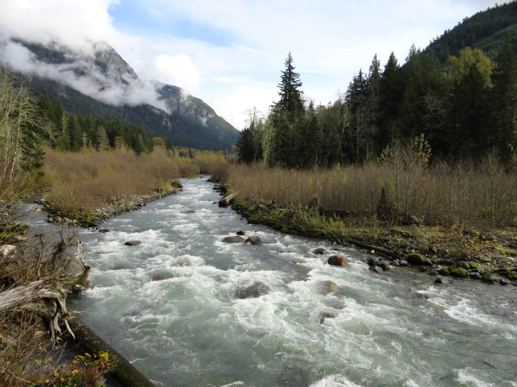
Quick Facts: Location: Mountain Loop Highway Land Agency: Mount Baker-Snoqualmie National Forest Roundtrip: 14 miles Elevation gain: 1500 feet Green Trails Map: Green Trails, Mountain Loop Highway, WA- no. 111SX Contact: Darrington Ranger District: Mount Baker Snoqualmie National Forest Access: From Darrington follow Mountain Loop Highway for 9.0 miles. Turn left onto FR 22 and…
Read MoreLewis and Clark State Park─Discover beautiful Old Growth Forest along the old highway ninety-nine
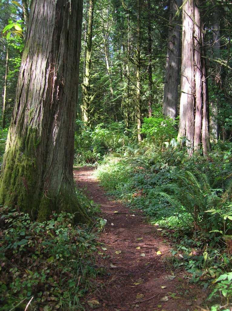
Quick Facts: Location: Chehalis River Valley Land Agency: Washington State Parks Roundtrip: 2.0 miles Elevation Gain: 125 feet Note: Discover Pass required; dogs permitted on leash. Access: From Exit 68 on I-5, proceed 2.5 miles east on US 12 to Mary’s Corner. Turn right onto Jackson Highway entering state park in .7 mile. Continue another…
Read MoreTracy Hill — Wild turkeys and sublime views
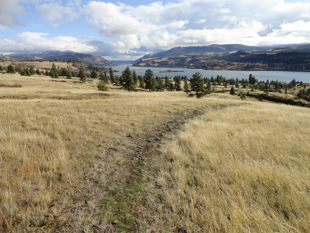
Quick Facts: Location: Columbia River Gorge National Scenic Area Land Agency: Columbia Gorge National Scenic Area Roundtrip: 5.0 miles Elevation gain: 1150 feet Difficulty: Moderate Contact: Columbia Gorge National Scenic Area Notes: Dogs permitted on leash. Be aware of ticks and poison oak. Green Trails Map: Columbia River Gorge East No. 432S Good to Know:…
Read MoreSkagit River Loop– Where eagles dine
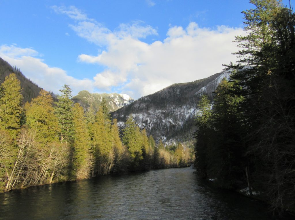
Quick Facts: Location: Ross Lake National Recreation Area, North Cascades Scenic Highway Land Agency: National Park Service Roundtrip: 1.8 miles Elevation gain: 100 feet Contact: NCNP Visitors Center Sedro-Woolley Green Trails Map: Marblemount, WA- No. 47 Guidebook: Day Hiking North Cascades 2nd edition (Mountaineers Books) Notes: dogs must be leashed, Practice Leave No Trace Principles Access:…
Read MoreCutthroat Pass — Shiny granite, golden larches and splendid vistas
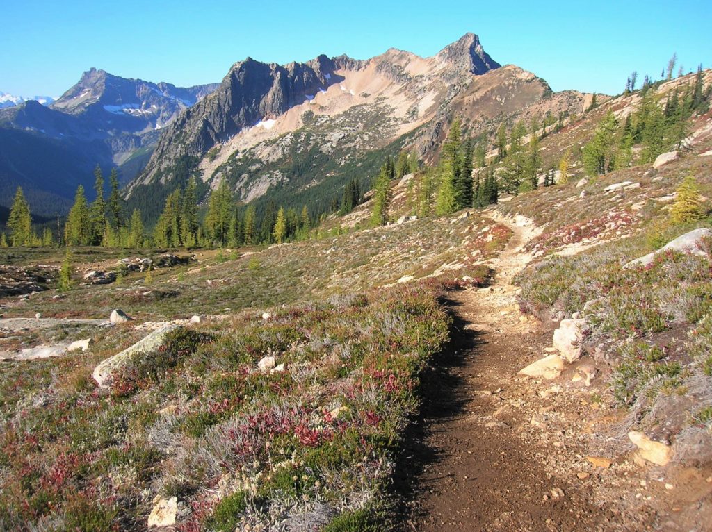
Quick Facts: Location: North Cascades Highway Land Agency: Okanogan-Wenatchee National Forest Round Trip: 10.0 miles Elevation Gain: 1850 feet Contact: Okanogan-Wenatchee National Forest, Methow Valley Ranger District, Green Trails Map: Washington Pass No. 50 Recommended Guidebook: Day Hiking North Cascades 2nd edition (Mountaineers Books) Notes: NW Forest Pass or Interagency Pass required. Access: From Marblemount,…
Read MoreTwisp Pass─Golden larches, fire-red meadows and sublime North Cascades views
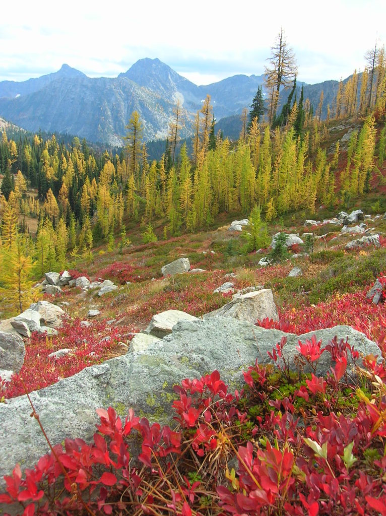
Quick Facts Location: Twisp River Valley-North Cascades Land Agency: US Forest Service and National Park Service Roundtrip: 9.2 miles Elevation Gain: 2,460 feet Green Trails Map: Stehekin, WA – No 82 Recommended Guidebook: Day Hiking North Cascades (Romano) Contact: Methow Valley Ranger District: Okanogan-Wenatchee National Forest Notes: Northwest Forest Pass required. Dogs prohibited beyond Twisp…
Read More