Posts Tagged ‘dog-friendly’
Blue Lake and Johnson Mountain–divine ridge walking

Quick Facts: Location: Mountain Loop Highway near Darrington Land Agency: Mount Baker-Snoqualmie National Forest Roundtrip: 28.3 miles Elevation Gain: 6,725 feet Green Trails Maps: Mountain Loop Highway 111SX Recommended Guidebook: Backpacking Washington (Romano; Mountaineers Books) Access: From Darrington, head south on the Mountain Loop Highway 16.0 miles turning left onto FR 49. Follow for 6.4 miles bearing…
Read MoreFortune Ponds–Two little tranquil bodies of water deep within the Henry M. Jackson Wilderness
Quick Facts: Location: Beckler River Valley Land Agency: Mount Baker-Snoqualmie National Forest Service Roundtrip: 13.0 miles Elevation Gain: 2,700 feet Green Trails Map: Benchmark Mtn- No. 144 Recommended Guidebook: Day Hiking Central Cascades Access: From Everett head east on US 2 for 50 miles to Skykomish turning left onto the Beckler River Road (FR 65). Continue north for 6.9 miles…
Read MoreSulphur Mountain –Savor Sweet Suiattle Valley Views
Quick Facts: Location: Suiattle River Road Land Agency: Mount Baker-Snoqualmie National Forest Roundtrip: 10.0 miles Elevation gain: 4,600 feet Green Trails Maps: Mountain Loop Highway Map 111SX Contact: Darrington Ranger District: Mount Baker-Snoqualmie National Forest Notes: Northwest Forest Pass or interagency pass required Access: From Darrington, travel north on SR 530 for 7.5 miles turning…
Read MoreTiffany Mountain — Enjoy horizon-spanning views at the edge of the North Cascades

Quick Facts: Location: Northeastern Cascades Land Agency: Okanogan-Wenatchee National Forest Roundtrip: 5.0 miles Elevation Gain: 1,700 feet Green Trails Map: Green Trails, Tiffany Mountain, WA- No. 53 Contact: Tonasket Ranger District, Okanogan-Wenatchee National ForestAccess: From Burlington follow SR 20 east to Winthrop. Then continue north on East Chewuch River Road for 6.5 miles and turn right onto FR…
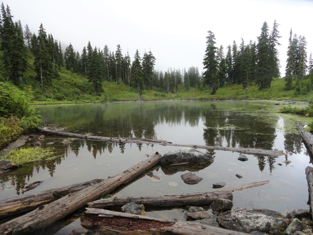
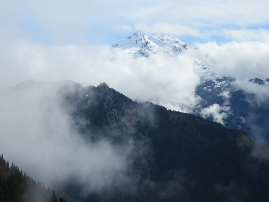
Read MoreAllen Mountain Trail Less Traveled near Mount Rainier
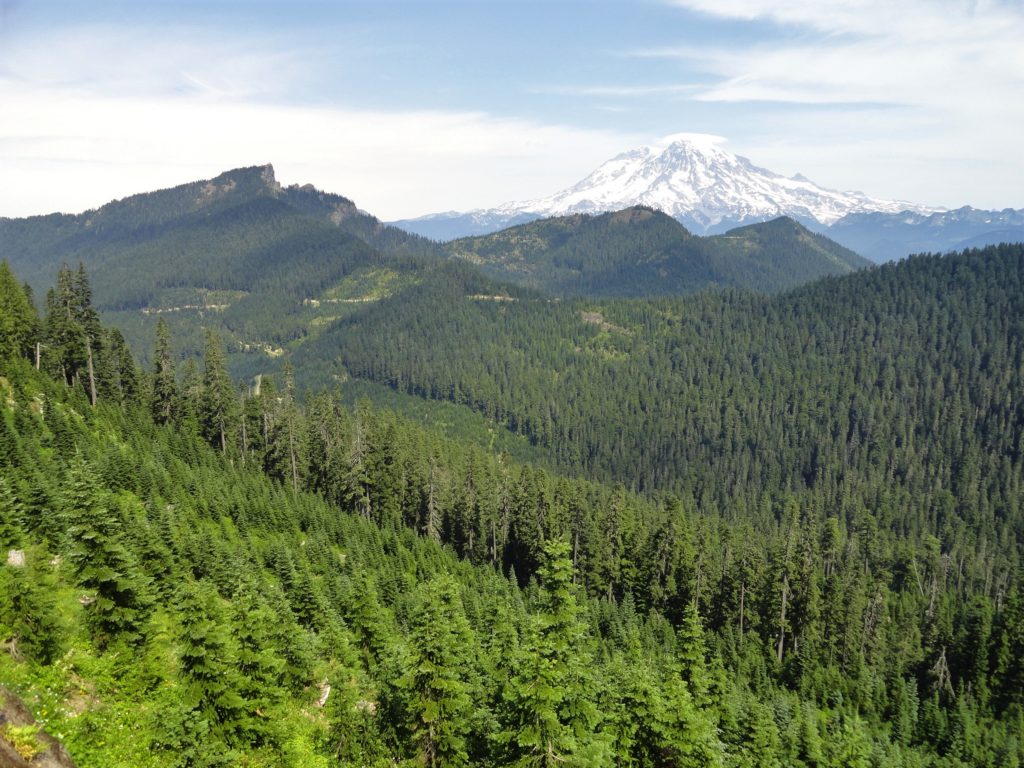
Quick Facts: Location: Mount Rainier region Land Agency: Gifford Pinchot National Forest Round Trip: 10.0 miles Elevation Gain: 2,350 feet Contact: Cowlitz Valley Ranger Station (Randle), Gifford Pinchot National Forest Green Trails Map: Randle, WA no. 301 Notes: Trails are also open to mountain bikes and motorcycles but use is light; this hike is lightly…
Read MoreHall Mountain via Noisy Creek –steep climb to stunning views and wildflowers
Quick Facts: Location: Selkirk Mountains Land Agency: Colville National Forest Round Trip: 14.0 miles Elevation Gain: 4,000 feet Contact: Sullivan Lake Ranger District, Colville National Forest Recommended Guidebook: Day Hiking Eastern Washington by Craig Romano and Rich Landers (Mountaineers Books) Notes: trail passes through a recent fire zone—be aware of hazards such as falling snags.…
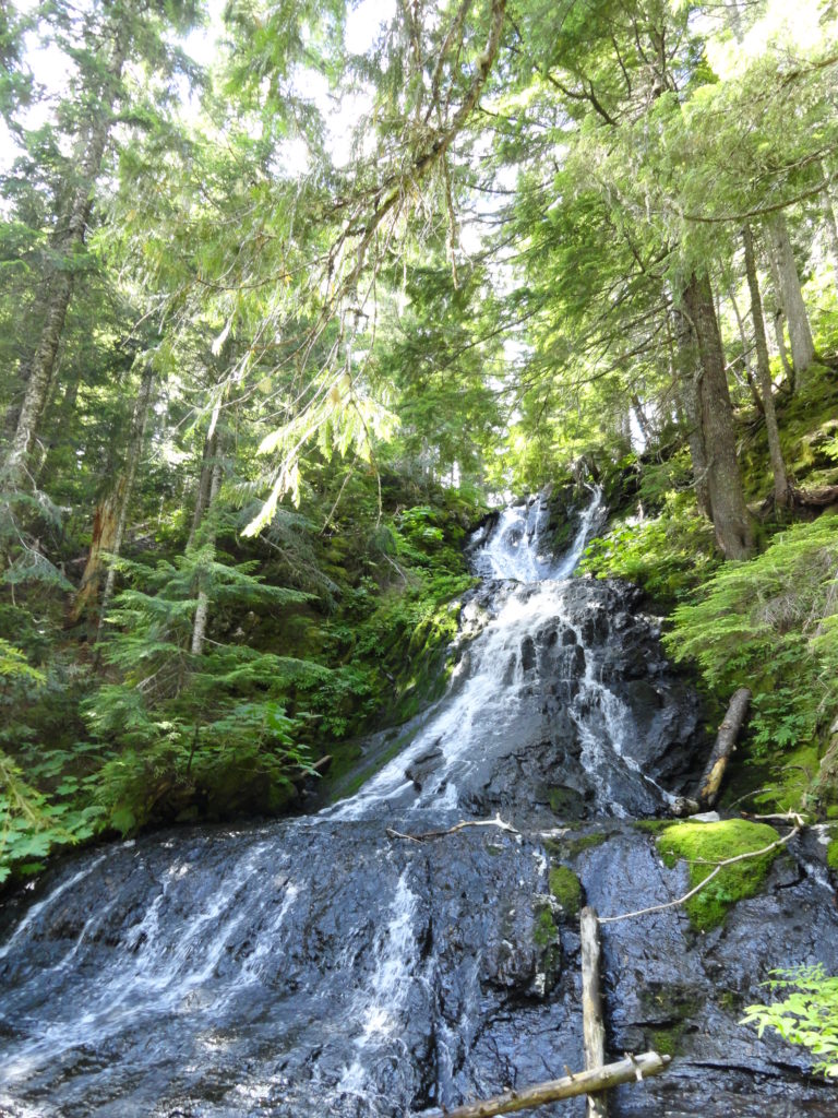
Read MoreDowney Creek — portal to famous Ptarmigan Traverse

Quick Facts: Location: Suiattle River Road Land Agency: Mount Baker-Snoqualmie National Forest Roundtrip: 13.6 miles Elevation gain: 1500 feet Green Trails Maps: Mountain Loop Highway Map 111SX Contact: Darrington Ranger District: Mount Baker-Snoqualmie National Forest Notes: Northwest Forest Pass or interagency pass required Access: From Darrington travel north on SR 530 for 7.5 miles turning…
Read MoreMount Muller Loop– Stunning ridgeline hike above the Sol Duc Valley
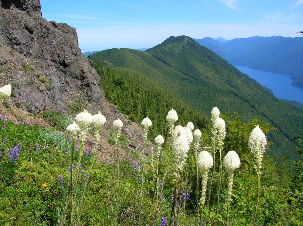
Quick Facts: Location: North Olympic Peninsula Land Agency: Olympic National Forest Roundtrip: 12.7 miles Elevation gain: 3350 feet Contact: Olympic National Forest, Pacific Ranger District, Forks, Green Trails Map: Green Trails Lake Crescent No. 101 Notes: Northwest Forest Pass or Interagency Pass required Access: From Port Angeles, follow US 101 west for 32 miles to…
Read MoreCora Lake– Emerald lake cradled beneath craggy High Rock
Quick Facts: Location: Nisqually River Valley Land Agency: National Forest Service Roundtrip: 1.4 miles Elevation Gain: 400 feet Contact: Gifford Pinchot National Forest Green Trails Map: Randle, WA no. 301 Notes: no pass needed; creek crossing might be challenging early in the season; trail is open to mountain and motor bikes Access: From Elbe, follow SR 706 east…
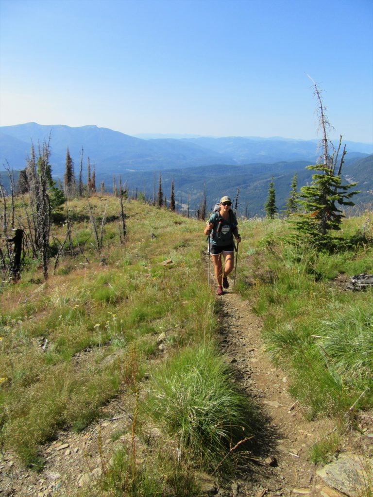
Read MoreDriveway Butte– Give your calves a workout hiking this steep old cattle drive
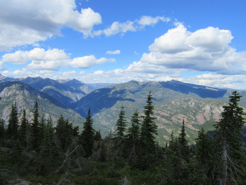
Quick Facts: Location: Methow Valley Land Agency: Okanogan-Wenatchee National Forest Round Trip: 8.6 miles Elevation Gain: 3000 feet Contact: Okanogan-Wenatchee National Forest Green Trails Map: Green Trails Washington Pass No. 50 Recommended Guidebook: Day Hiking North Cascades 2nd Edition Notes: Northwest Forest Pass or Interagency Pass required Access: From Marblemount follow State Route 20 east…
Read More