Black Mountain
Savor sweeping views from mountain to sound to city
Quick Facts:
Location: North Shore Mountains, West Vancouver, BC
Distance: 9 km (5.6 miles) roundtrip
Elevation Gain: 550 m (1800 feet)
Contact: Cypress Provincial Park
Recommended Guidebook: Urban Trails Vancouver, BC (Mountaineers Books)
Notes: Notegate closure times at Cypress Bowl Ski Area so not to be locked in. Parking is also available before gate. Trails are accessible and snow free generally from late June through October.
Trailhead directions: From Vancouver follow Trans Canada 1/BC 99 to exit 8. Turn right onto Cypress Bowl Road and drive 15.7 km (9.8 miles) to trailhead at Cypress Ski Area.
Good to Know: kid-friendly, summer wildflowers, exceptional views, old-growth
Hike a section of the infamous Baden-Powell Trail to Eagle Bluff on Black Mountain. From those cliffs high above Howe Sound and Black’s summit enjoy fine views of the Salish Sea and Howe Crest. And savor breathtaking views too of the Vancouver skyline.
From the Cypress Mountain (named for Alaskan yellow cedars) Ski Area parking area walk past the Cypress Creek Lodge and pick up the Baden-Powell (B-P) Trail. The B-P Trail runs for 50 km (30 miles ) across the North Shore Mountain with some of its most challenging and scenic terrain here in Cypress Provincial Park.
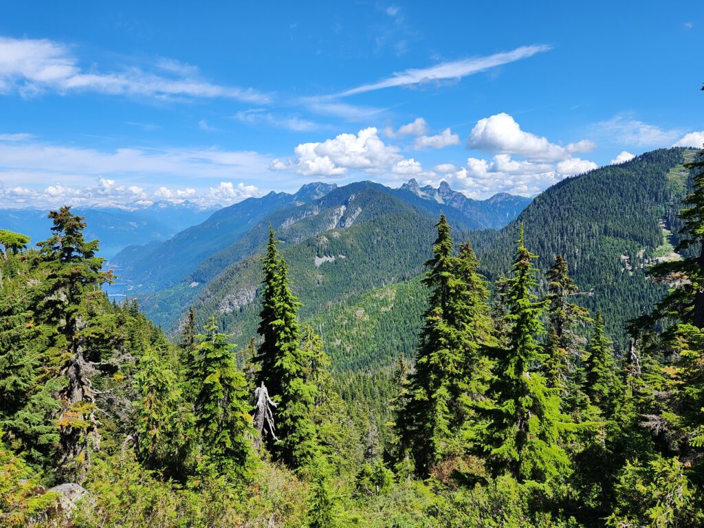
Pass the Yew Lake Trail (an excellent side trip through stunning old-growth. dogs prohibited) and then begin steeply climbing, skirting the edge of ski slopes. At 1.9 km (1.2 miles) reach a junction. You’ll be returning on the B-P Trail left so head east on the Black Mountain Loop reaching Cabin Lake and a junction. Head right to Black Mountain’s 1224-meter (4016-foot) northern and highest summit and enjoy a good view to the Lions (Twin Sister) and other Howe Sound Crest peaks as well as Howe Sound..
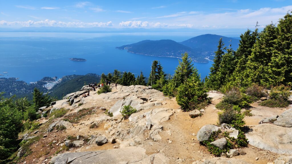
Return to the junction and keep hiking straight over the rocky 1218 m (3996-foot) south summit. Then enter a thick hemlock forest and steeply descend coming to a junction with the B-P Trail. You’ll return left so head right passing Owen Lake and enjoying fairly hiking across Black’s high plateau. Traverse pocket meadows, primeval forest and with the help of boardwalks, bogs. After passing the small Cougar Lakes begin descending reaching the wide open ledges of Eagle Bluff at 4.5 km (2.8 miles)
Savor spectacular views including straight down to Horseshoe Bay, Howe Sound and Bowen Island. Admire too the view out over the Strait of George to Vancouver Island. And marvel at the view south to Burrard Inlet with its flotilla of ocean liners, the Grey Peninsula behind it, and Mount Baker and the shimmering Vancouver skyline to the southeast.
Then retrace your steps back to the Black Mountain Loop Trail junction and keep right on the B-P Trail coming to Sam and Theagill Lake. Bear left at two junction with trails leading to ski slopes and start a short and steep climb coming to the first Black Mountain loop junction. Then head right on a deep descent returning to your start at 9 km (5.6 miles).
For more details on this hike and 54 others in the Metro Vancouver Regional District, pick up a copy of my NEW Urban Trails Vancouver, BC (Mountaineers Books).