Mount Seymour — See more of the BC Lower Mainland from this classic peak
Quick Facts:
Location: North Shore Mountains, North Vancouver, BC
Distance: 8.4 km (5.2 miles) roundtrip
Elevation Gain: 540 m (1772 feet)
Contact: Mount Seymour Provincial Park
Recommended Guidebook: Urban Trails Vancouver, BC (Mountaineers Books)
Notes: Trail to Mount Seymour is snow free from July through October. Other trails in park outside of ski area are open in winter for snow showing and cross country skiing and require a Free Day Use vehicle pass (to control crowding) in winter months (check park website for dates and details). Always check avalanche warnings and park notices and closures.
Trailhead directions: From Vancouver follow Trans-Canada Highway 1 to Exit 22B in District of North Vancouver. Then bear right on the Mount Seymour Parkway for 4.4 km (2.7 miles) and turn left on the Mount Seymour Road. Drive 13.3 km (8.3 miles) to last parking lot at the ski area. Alternative parking on lower lots.
Good to Know: kid-friendly (use caution with young children), exceptional views, old-growth
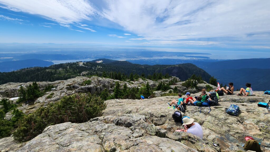
One of the most popular hikes in the BC Lower Mainland, don’t expect to be alone on Mount Seymour. Best to avoid on weekends and try to get an early start. The views are sweeping—from Mount Baker to Mount Garibaldi, the San Juan and Gulf Islands, and the entire Vancouver metropolitan area spread out directly below on Burrard Inlet and the Fraser River Delta. The hike is fairly short, but the trail is rocky with lots of ups and downs.
Mount Seymour is one of the more prominent peaks rising above the Vancouver metropolitan area. Its three summits are the centerpiece to a 3509 ha (8671 acre) provincial park. The park was established in 1936. Two years later skiing operations began on the mountain. But just beyond the ski lifts and communications towers is a rugged wilderness. The trail to Mount Seymour begins at an elevation of 1020 m (3350 feet) at the north end of Parking Lot 4. Head north on the wide trail skirting a ski run and the Mystery Peak Express Chairlift. Ignore trails leading left to Dog Mountain, Dinkey Peak, and First Lake and continue steadily climbing. After briefly following along a ski run, the way bends left on single track descending to a small pond. It then steadily climbs reaching Brockton Point with its stunning views of Mount Baker above the Fraser River Valley.
Cross a couple of small creeks and stay left at a junction with the Elsay Lake Trail. The way now gets steeper and rockier emerging on open ridge just below the summit block of Pump Peak (First Summit), named by an early climber for a summit tree resembling a water pump). It’s a short scramble best approached from the west. The trail continues north slightly descending before climbing onto a shoulder of Tim Jones Peak (Second Summit). A short spur leads right to the summit with its excellent views of Mount Seymour before you. This is a good spot too for hikers with young children to turn around.
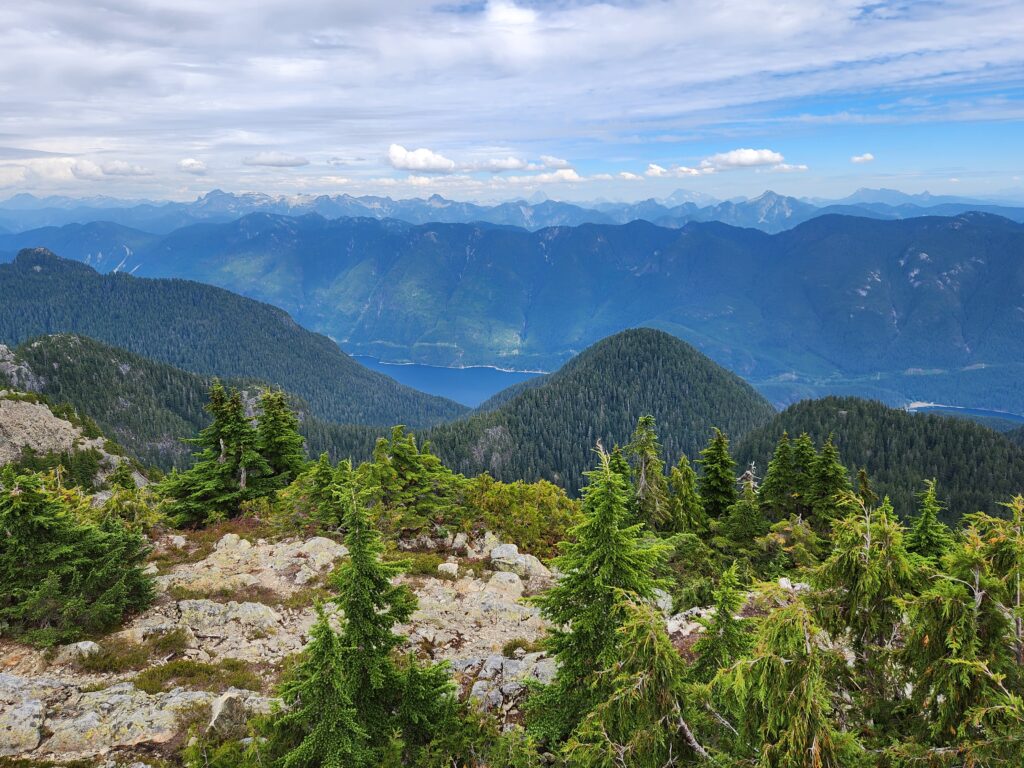
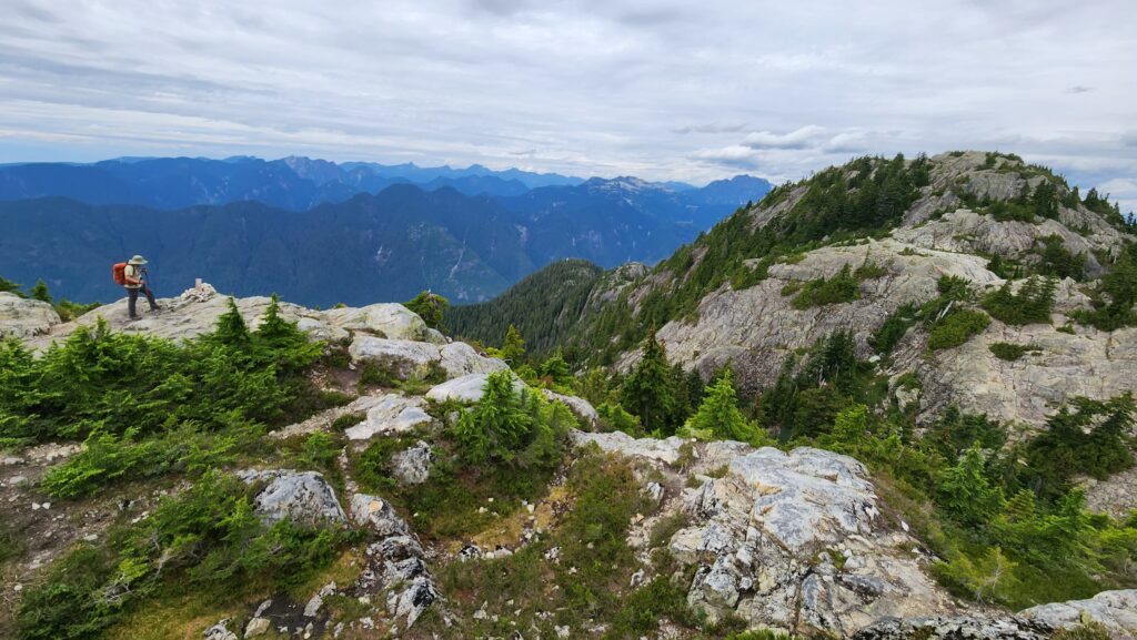
The Mount Seymour Trail now descends traversing a steep rocky slope. Reach a tight col and resume climbing, now on exposed ledge and rock reaching the wide open first summit of 1449-meter (4,754-foot) of Mount Seymour. The views are spectacular. Indian Arm straight below. Impressive Mounts Judge Howay, Robie Reid, Baker, Shuksan, and Garibaldi Peak; as well as the Howe Crest, Strait of Georgia, Vancouver Island and a whole lot of shimmering Vancouver, Burnaby, New Westminster and Surrey skyscrapers.
For more details on this hike and 54 others in the Metro Vancouver Regional District, pick up a copy of my NEW Urban Trails Vancouver, BC (Mountaineers Books).