Grouse Grind
Quick Facts:
Location: North Vancouver, BC
Land Agency: Grouse Mountain Regional Park
Distance: 1.6 miles (2.5 km) one way
Elevation Gain: 2625 feet (800 meters)
Contact: Metro Vancouver Regional Parks
Detailed Information: Urban Trails Vancouver BC (Mountaineers Books)
Notes: Dogs prohibited. Trail generally opened May through October (check hours) and subject to closure during inclement weather. Grouse Grind is one way up only. Return via BCMC Route or take the Grouse Mountain Skyride (Tram) down (fee). Purchase ticket online or at the Alpine Guest Services in the Peak Chalet at adjacent Grouse Mountain Resort. Trailhead parking $2 for three hours, $4 all day. Limited free street parking.
Access: Map to “Grouse Mountain Parking Lot D,” 6400 Nancy Greene Way, North Vancouver, BC V7R 4W1, Canada
Via Transit: Translink bus lines 232, 236, 247
Good to Know: One way only
Famous among trail runners for its daunting statistics, the Grouse Grind is a grueling grunt involving 2830 steps up the steep western face of Grouse Mountain. It’s extremely popular attracting more than 100,000 folks annually. Summit views are rewarding and there’s lots to check out at trail’s end including a grizzly bear enclosure. Then take a tram back to your start or return on the not quite as steep but still steep BCMC Route.
Be sure to heed all of the signs at the start warning of risks, proper preparations, and trail rules—no dogs and no audible music among them. The Grind was originally built in the 1980s by a couple of local climbers as a rough winter conditioning route. It has since been reconstructed and is now part of the MVRD park system.
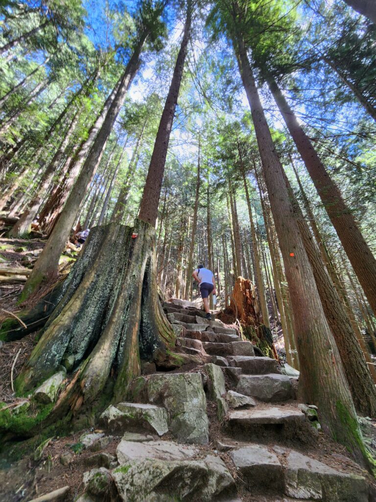
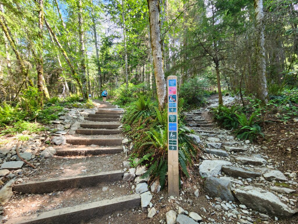
Pass a scanner (which reads Grind Timer Cards which you can purchase from the ski area to record your name and time). Most folks take around two hours. The FKT is 23:48 for men and 29:10 for women. Now veer left at a junction where the Baden-Powel (BP) trail heads right. Then start grinding through a mature second growth conifer forest coming to a junction. The BCMC Route heads straight. Head left under an arch and begin ascending steeply at a grade averaging 30%. The well-built wooden and stone steps are relentless. Trail markers give distance in 40ths (i.e. GG 5/40). Larger signs state elevation progress in quarters. At the ¼th mark assess your condition and turnaround if desired. Otherwise continue (you’re committed now) on a much narrower, steeper and uphill only route.
Ski netting along steeper stretches prevents a slip turning into a tumble. Ropes holding the netting in place make for nice hoisting assists. Window views through the tree reveal Capilano Lake straight below. At 1.6 miles (2.5 km) reach the Grind’s terminus at the Peak Chalet (ski lodge). Relish in your accomplishment, snap your selfies and enjoy the excellent view west over West Vancouver, Burrard Inlet and Point Gray.
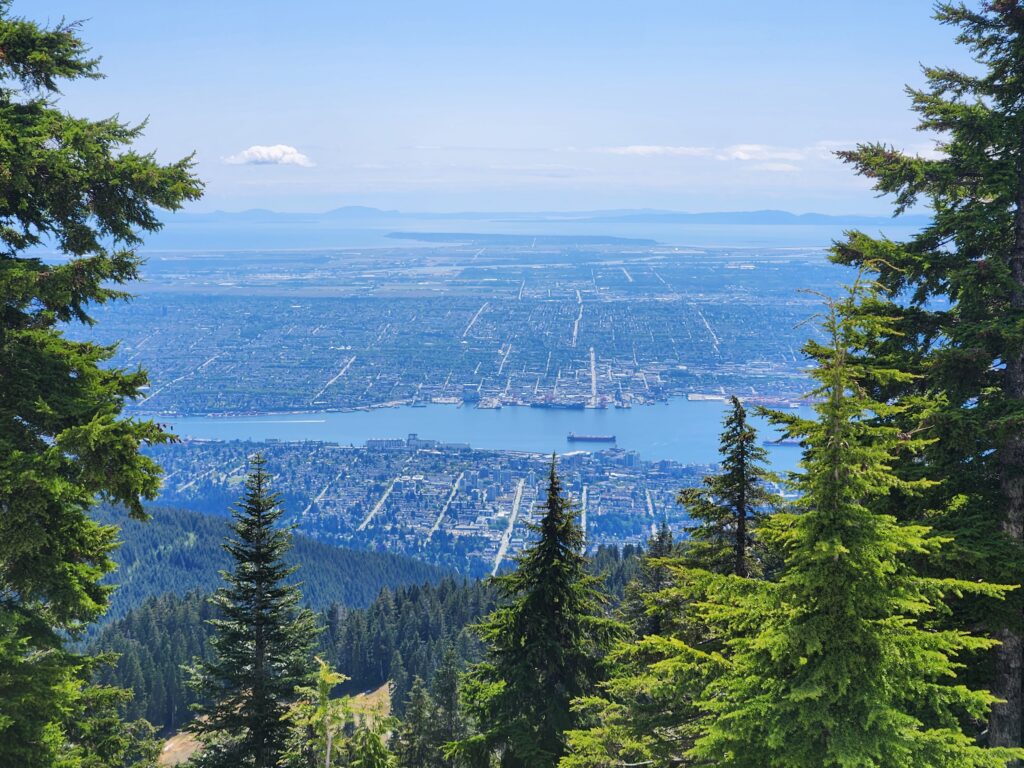
Now either catch a downhill tram or stay awhile. Grab lunch or coffee at the lodge. Check out the two resident grizzly bears (no worries they live within a large enclosure). Watch a bird or lumberjack show. Ride a zip line (for a fee). You can hike to the Eye of the Wind Turbine (fee to enter) at the top of 4,100-foot (1250 m) Grouse Mountain and enjoy widespread views of adjacent North Shore Mountain, the entire Greater Vancouver Metro area, Vancouver Island, the Gulf Islands; and Washington’s San Juan Islands, Mount Baker and North Cascades.
If you want to hike back to your start, follow the BCMC Route (trekking poles advised) down the mountain returning to the Grind near a big gully 0.2 mile (0.3 km) from the trailhead. It’s slightly longer, and slightly less steep trail than the Grouse Grind mainly on good steps with a few rough and rocky stretches.
For more details on this hike and 54 others in the Metro Vancouver Regional District, pick up a copy of my NEW Urban Trails Vancouver, BC (Mountaineers Books).