Mount Ellinor– brutally steep ascent to breathtakingly beautiful panoramic views!
Quick Facts:
Location: Olympic National Forest
Land Agency: National Forest Service
Distance: 6.6 miles roundtrip
Elevation Gain: 3270 feet
Contact: Olympic National Forest, Hood Canal Ranger District, Quilcene, http://www.fs.usda.gov/olympic
Detailed Information: Day Hiking Olympic Peninsula 3rd edition (Mountaineers Books)
Notes: NW Forest Pass or Interagency Pass required for upper trailhead; Trail. Especially from upper trailhead is extremely popular and can be crowded on weekends. Consider a midweek hike. Trail dangerous when snow covered.
Access: From Shelton, travel north on US Highway 101 for 15 miles to Hoodsport. Turn left onto State Route 119 and proceed 9.3 miles. Then turn right onto graveled FR 24, drive 1.6 miles, and turn left onto FR 2419. After 4.6 miles, come to the lower trailhead. (For the upper trailhead, continue on FR 2419 for another 1.6 miles. Then turn left on rough and rocky FR Spur 014 and follow it 1 mile to the trailhead.)
Good to Know: exceptional wildflowers, exceptional alpine views, busy on weekends
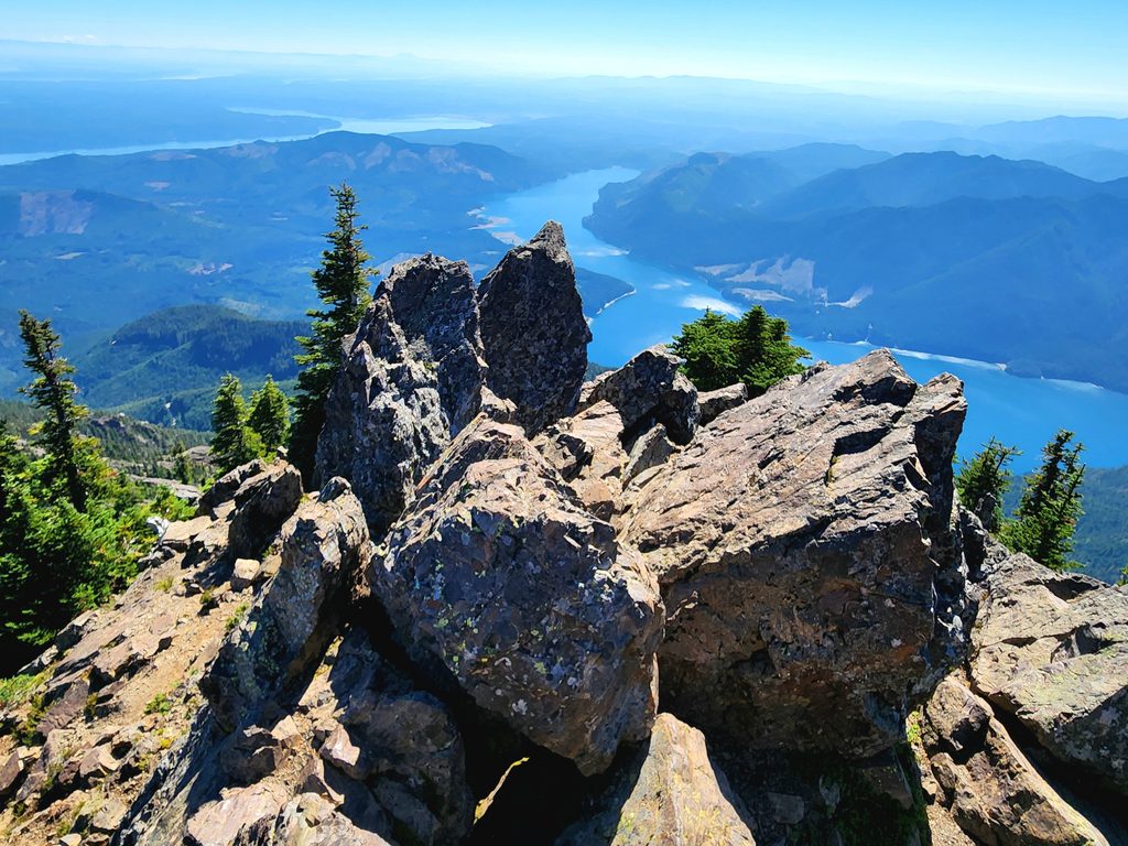
Mount Ellinor is an Olympic Mountains classic! From its jagged summit, peer deep into the heart of the Olympic wilderness and out across Lake Cushman and Puget Sound to the Cascades spanning the eastern horizon. However these views require a steep price—the hike is arduous and demanding utilizing hundreds of steps straight up a steep face. And don’t expect to be alone on this hike.
If you’re intent on getting to the views as fast as possible, head to the upper trailhead. Otherwise, take the longer route from the lower trailhead and get a chance to warm up, enjoy fine old-growth forest, and perhaps find a little solitude. Begin by immediately entering a cool forest of old-growth hemlocks and Douglas-firs with a rhododendron understory. Pass a junction with the Mount Ellinor Connector Trail which heads downhill 1.4 miles to the Big Creek loop utilizing part of the original route to Ellinor from Lake Cushman.
Steadily ascend a heavily forested ridge passing a teaser view point and coming to a junction at 1.6 miles. The trail right leads to the upper trailhead. Stay left, soon coming to another junction. The trail right—the most popular portal to Ellinor, descends 0.3 mile to the upper trailhead.
Now head left joining plenty of other hikers on well-trodden tread and steeply climb. Bear left where the winter route leads right. Trees soon yield to meadows and rocky gardens. The Mount Rose Trail Crew carved into the steep mountain face a manageable ascent route. However it’s still extremely dangerous when snow covered.
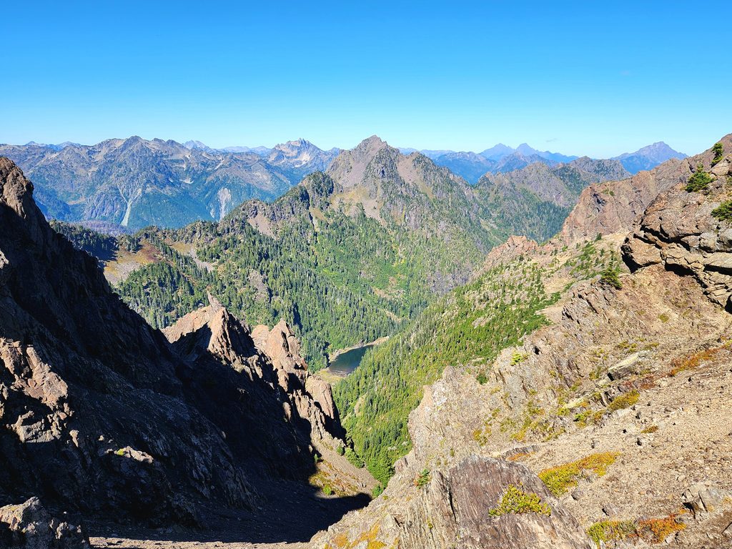
Huff and puff sometimes on steps, ascending an incredibly steep slope. Pause to admire an amazing view unfurling before you. Traverse beneath the summit block, and then bend left and clamber up a rocky ridge to Ellinor’s 5944-foot summit. Minding the precipitous drop-offs, savor the stunning views. Nearly one vertical mile below is shimmering Lake Cushman. Just beyond, Hood Canal and Puget Sound sparkle against a Cascades backdrop dominated by Mount Rainier and Mount Saint Helens.
Turn your attention north and west to a diorama of jagged Olympic peaks; Washington, Pershing, Stone, Lincoln, Cruiser, Gladys, and Copper prominent among them. Icy Olympus lingers in the distance. Gaze straight down into vertigo-inducing Jefferson Creek valley and its isolated pond—which likely has seen very few human visitors.
Mount Ellinor is one of 136 hikes in my new and expanded Day Hiking Olympic Peninsula 3rd edition (Mountaineers Books), Pick up your copy today for detailed trusted information on trails from the Long Beach Peninsula to the Strait of Juan de Fuca! No crowd sourced slop or AI garbage-just boots on the ground trusted research from one of the most prolific trail writers in the Northwest!