Archives
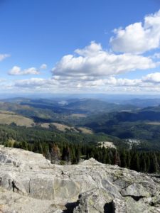
Location: Mount Spokane State Park Land Agency: Washington State Parks Roundtrip: 6.0 miles High Point: 5,883 feet Elevation gain: 1,000 feet Difficulty: moderate Map: Mount Spokane State Park (Dharma Maps) Contact: Washington State Parks Note: Discover Pass Required; dogs permitted on leash Access: From Spokane, follow US 2 north 10…

Quick Facts: Location: Goat Rocks Wilderness Land Agency: National Forest Service Roundtrip: 15.7 miles Elevation Gain: 2,625 feet Contact: Naches Ranger District, Okanogan-Wenatchee National Forest Green Trails Map: Goat Rocks William O Douglas Wilderness No. 303S Notes: Northwest Trail Pass or interagency pass required; Wilderness permit required, free, self-issued at trailhead; wilderness rules…
Quick Facts: Location: Badger Creek Wilderness Land Agency: National Forest Service Roundtrip: 2.5 miles Elevation Gain: 550 feet Contact: Barlow Ranger District Mount Hood National Forest Notes: Northwest Trail Pass or interagency pass required Green Trails Map: Mount Hood Climbing / Timberline Trail no. 462SX Access: From Portland: Follow I-84 east to Exit…

Quick Facts: Location: Glacier View Wilderness Land Agency: Gifford Pinchot National Forest Roundtrip: 8.4 miles Elevation gain: 1,600 feet Green Trails Map: Mount Rainier West, WA no. 269 Contact: Cowlitz Valley Ranger Station (Randle), Gifford Pinchot National Forest Notes: FR 59 is rough in spots but is passable for passenger…
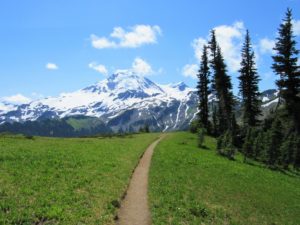
Quick Facts: Location: Mount Baker Highway, North Cascades Land Agency: National Forest Service Roundtrip: 9.0 miles Elevation gain: 2500 feet Difficulty: moderate Green Trails Map: Mount Baker Wilderness 13S Contact: Mount Baker Ranger District: Mount Baker -Snoqualmie National Forest Access: From Bellingham follow SR 542 (Mount Baker Highway) east for…

Quick Facts: Location:…
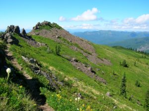
Quick Facts: Location: Silver Star Scenic Area Land Agency: Gifford Pinchot National Forest Roundtrip: 5.0 miles High Point: 4,390 feet Elevation gain: 1,440 feet Difficulty: moderately difficult Green Trails Map: Lookout Mtn No. 396, Bridal Veil No. 428 Contact: Gifford Pinchot National Forest Mount Adams Ranger District, Note: FR 4109 is…
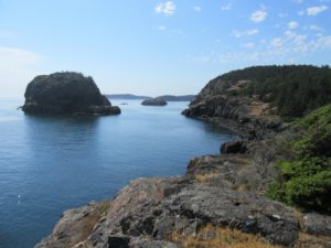
Quick Facts: Location: Lopez Island Land Agency: San Juan Islands National Monument Roundtrip: 2.2 miles Elevation Gain: 180 feet Contact: Bureau of Land Management Detailed Information: Day Hiking The San Juans and Gulf Islands (Mountaineers Books) Notes: Dogs permitted on leash; coastal cliffs—keep children nearby Access: From Anacortes, take Washington State Ferry to…

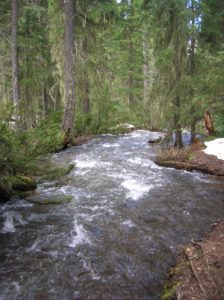
Quick Facts: Location: Ohanapecosh Land Agency: Mount Rainier National Park Roundtrip: 2.7 miles Elevation Gain: 350 feet Contact: Mount Rainier National Park Detailed Information: Day Hiking Mount Rainier (Mountaineers Books) Green Trails Map: Mount Rainier National Park 269S Notes: National Park Entrance Fee or Interagency Pass required; dog prohibited Access: From Packwood, follow…
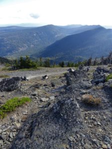
Quick Facts: Location: Blue Mountains Land Agency: Umatilla National Forest Roundtrip: 8.0 miles Elevation Gain: 500 feet Contact: Umatilla National Forest, Pomeroy Ranger District Detailed Information: Day Hiking Eastern Washington (Mountaineers Books) Notes: Northwest Forest Pass or Interagency Pass required Access: From Dayton, head east on Patit Road for 14 miles turning left…