100 Classic Hike Washington
Catherine Creek Rock Arch–A touch of Utah in the Northwest!
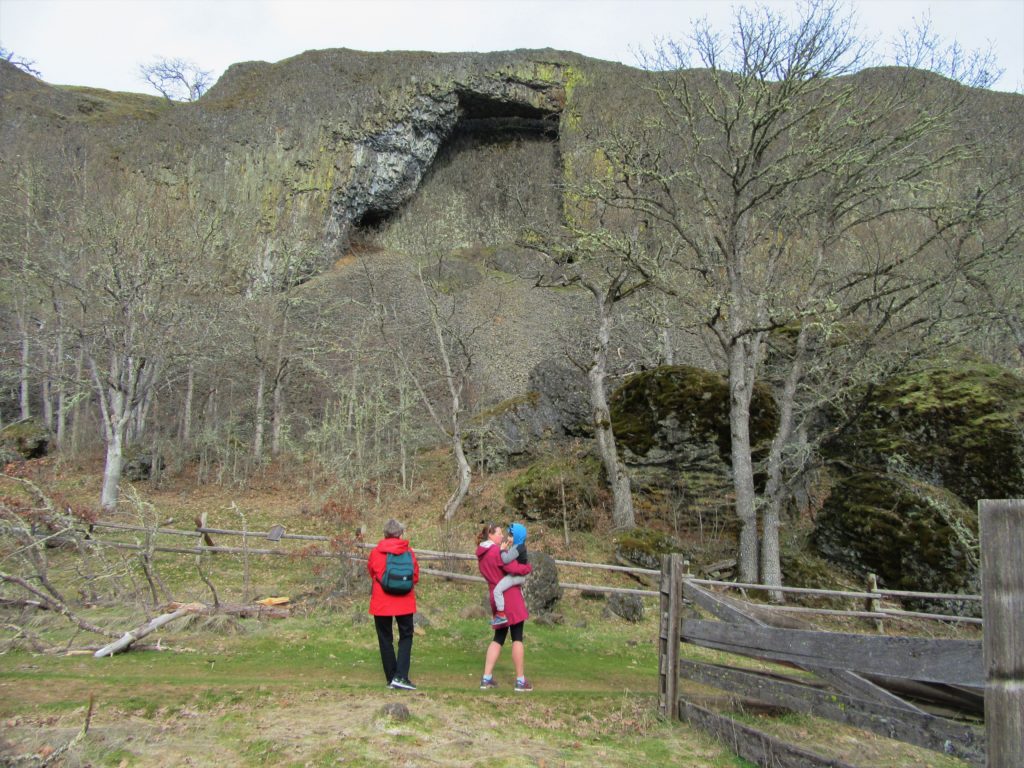
Location: Columbia River Gorge National Scenic Area Land Agency: Columbia Gorge National Scenic Area Roundtrip: 2.3 miles Elevation gain: 370 feet Difficulty: Easy Contact: Columbia Gorge National Scenic Area Notes: Dogs permitted on leash. Be aware or ticks and poison oak. Green Trails Map: Columbia River Gorge East No. 432S Good to Know: kid-friendly, dog-friendly…
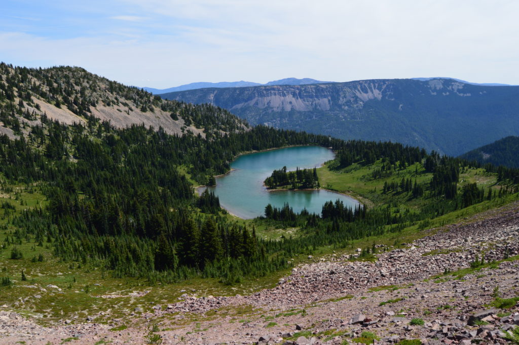
Read MoreThirteenmile Canyon– Wander one of wildest wilderness canyons in Eastern Washington
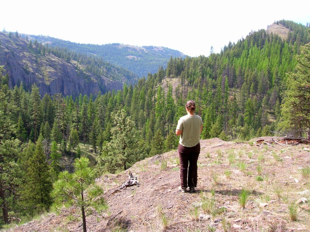
Location: Colville National Forest, Ferry County, Wa Land Agency: National Forest Service Roundtrip: 9.0 miles Elevation gain: 1,700 feet Contact: Colville National Forest, Republic Ranger District Notes: beware of rattlesnakes Access: From Republic follow SR 21 south 12.3 miles to trailhead located just within the Colville Indian Reservation Boundary. If coming from Wilbur, follow SR…
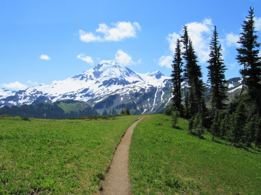
Read MoreMount Dickerman–arduous climb to sweeping alpine views
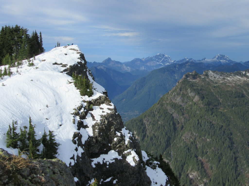
Quick Facts: Location: Mountain Loop Highway near Granite Falls Land Agency: Mount Baker-Snoqualmie National Forest Roundtrip: 8.6 miles High Point: 5,723 feet Elevation gain: 3,900 feet Difficulty: difficult Green Trails Map: Mountain Loop Highway No. 111SX Contact: Darrington Ranger District: Mount Baker Snoqualmie National Forest Notes: Northwest Forest Pass required Access: From Granite Falls follow…
Read MoreMount Spokane–Savor spectacular views from this prominent peak above Washington’s second city
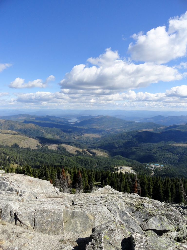
Location: Mount Spokane State Park Land Agency: Washington State Parks Roundtrip: 6.0 miles High Point: 5,883 feet Elevation gain: 1,000 feet Difficulty: moderate Map: Mount Spokane State Park (Dharma Maps) Contact: Washington State Parks Note: Discover Pass Required; dogs permitted on leash Access: From Spokane, follow US 2 north 10 miles to Mead. Turn right…
Read MoreShoe Lake — A great hike good for your soul!
Quick Facts: Location: Goat Rocks Wilderness Land Agency: National Forest Service Roundtrip: 15.7 miles Elevation Gain: 2,625 feet Contact: Naches Ranger District, Okanogan-Wenatchee National Forest Green Trails Map: Goat Rocks William O Douglas Wilderness No. 303S Notes: Northwest Trail Pass or interagency pass required; Wilderness permit required, free, self-issued at trailhead; wilderness rules apply Access: From Packwood, follow…
Read MoreSkyline Divide — A mile high carpet of wildflowers
Quick Facts: Location: Mount Baker Highway, North Cascades Land Agency: National Forest Service Roundtrip: 9.0 miles Elevation gain: 2500 feet Difficulty: moderate Green Trails Map: Mount Baker Wilderness 13S Contact: Mount Baker Ranger District: Mount Baker -Snoqualmie National Forest Access: From Bellingham follow SR 542 (Mount Baker Highway) east for 35 miles turning right onto…
Read MoreSilver Star Mountain via Ed’s Trail–Stellar wildflowers and explosive volcanic views
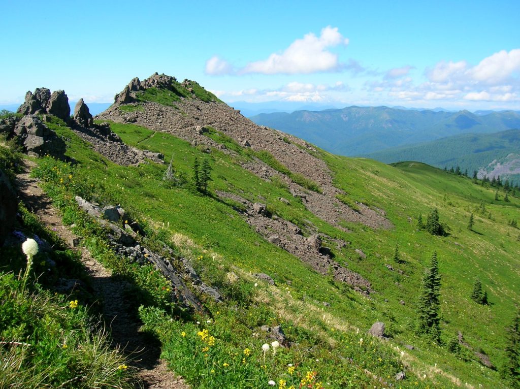
Quick Facts: Location: Silver Star Scenic Area Land Agency: Gifford Pinchot National Forest Roundtrip: 5.0 miles High Point: 4,390 feet Elevation gain: 1,440 feet Difficulty: moderately difficult Green Trails Map: Lookout Mtn No. 396, Bridal Veil No. 428 Contact: Gifford Pinchot National Forest Mount Adams Ranger District, Note: FR 4109 is rough and recommended for high…
Read More