Archive
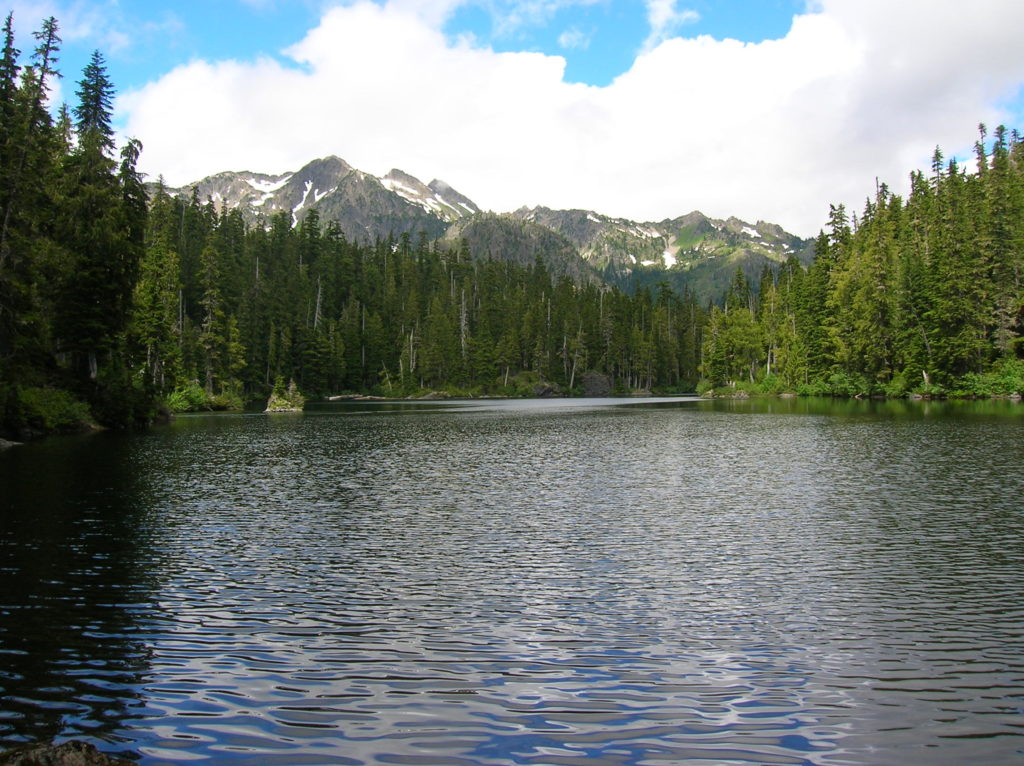
Round Lake — Find solitude on Lost Creek Ridge

Quick Facts: Location: Mountain Loop Highway near Darrington Land Agency: Mount Baker-Snoqualmie National Forest Roundtrip: 9.8 miles Elevation gain: 4300 feet Difficulty: strenuous Green Trails Map: Mountain Loop Highway 111SX Contact: Darrington Ranger District; Mount Baker-Snoqualmie National Forest Access: From Darrington follow the Mountain Loop Highway for 16 miles to a junction with Forest Road 49. Turn…
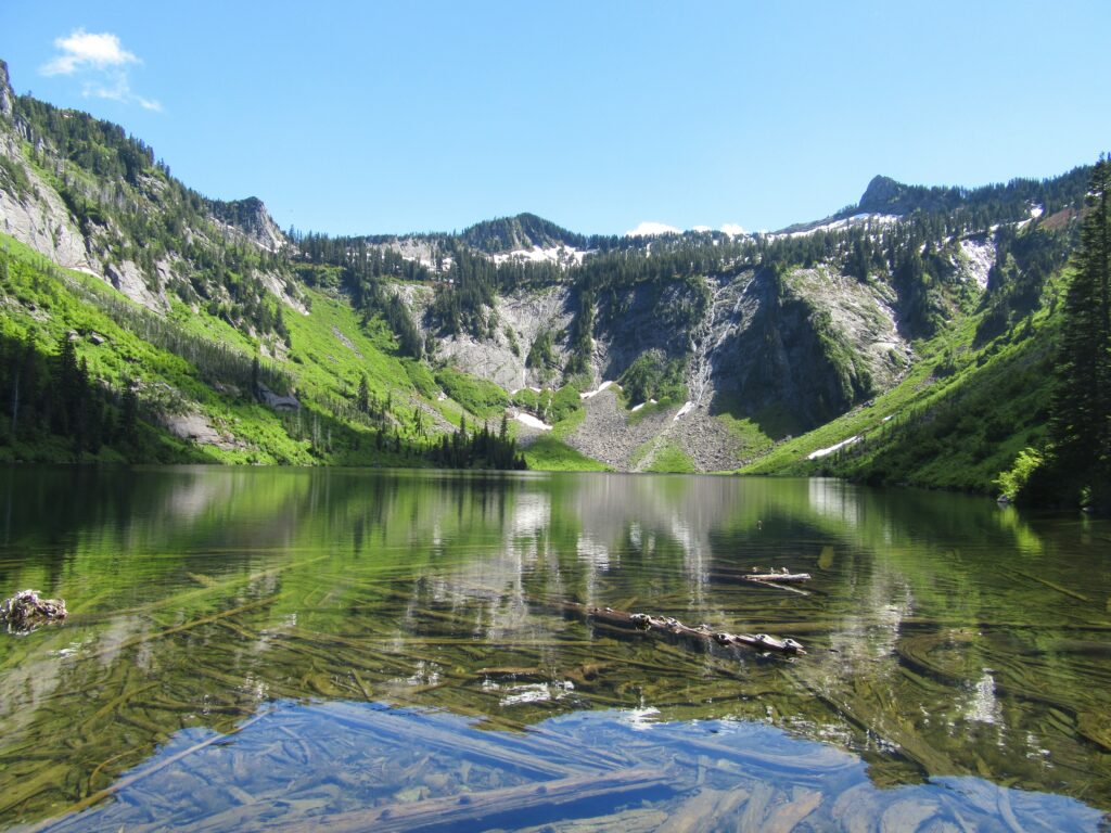
Read MoreMildred Lakes — Brutal trail to a placid trio of backcountry lakes
Quick Facts: Location: Mount Skokomish Wilderness Land Agency: Olympic National Forest Roundtrip: 9.0 miles Elevation Gain: 2925 feet Contact: Olympic National Forest, Hood Canal Ranger District, Green Trails Map: Olympic Mountains East 168SX Notes: Northwest Forest Pass or Interagency Pass required Access: From Hoodsport travel north on US 101 north for 13.7 miles turning left onto FR 25…
Read MoreDeception Creek—Big trees, wilderness valley, no crowds—and that’s the truth!
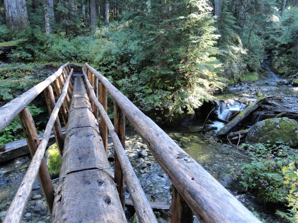
Quick Facts: Location: Skykomish River Valley Land Agency: Mount Baker-Snoqualmie National Forest Roundtrip: 10.5 miles Elevation Gain: 1,350 feet Notes: Northwest Forest Pass required; Dogs permitted on leash. Contact: Skykomish Ranger District: Mount Baker-Snoqualmie National Forest Green Trails Map: Alpine Lakes-Stevens Pass-No. 176S Access: From Everett drive US 2 east to Skykomish. Then continue for another…
Read MoreIndian Henry’s Hunting Ground via Kautz Lake — Head to a fabled land of wildflowers!
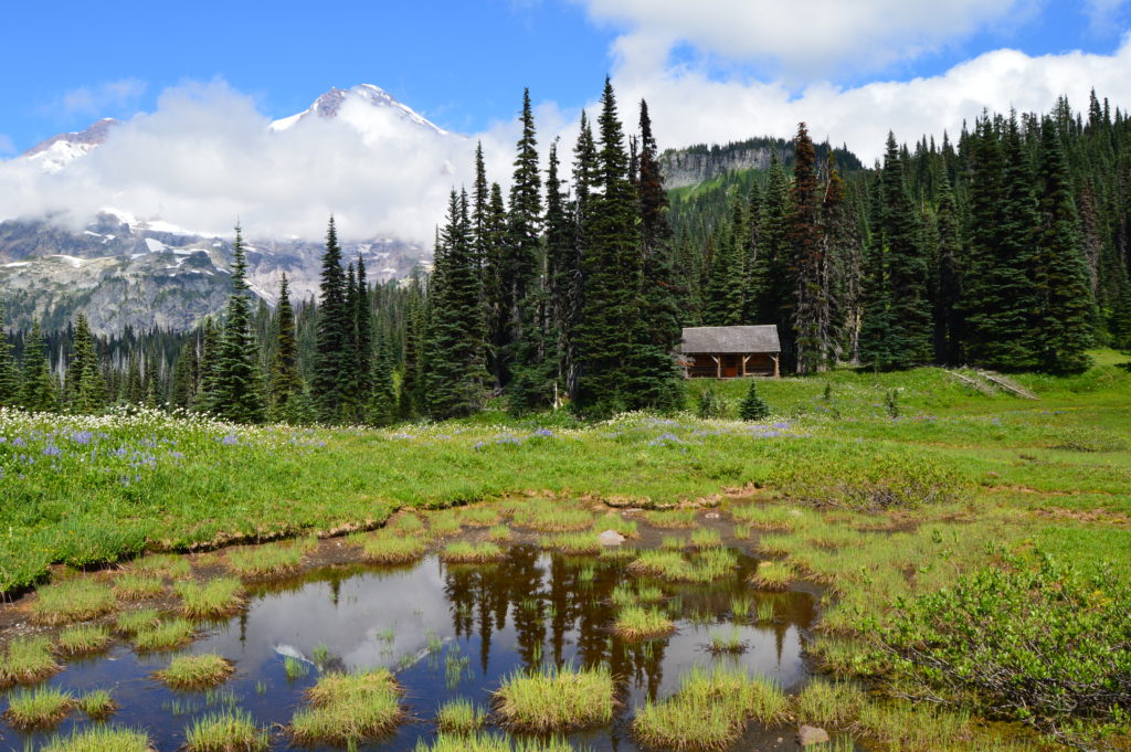
Quick Facts: Location: Nisqually Valley, Mount Rainier National Park Land Agency: National Park Service Roundtrip: 11.6 miles Elevation Gain: 3200 feet Contact: Mount Rainier National Park Green Trails Map: Mount Rainier National Park 269S Notes: National Park Entrance Fee or Interagency Pass required; Dog prohibited Timed entry pass required for entrance into Mount Rainier National Park (Longmire and Sunrise…
Read MoreParadise Glacier Trail — The ice caves are no more, but the views are still incredible

Quick Facts: Location: Mount Rainier National Park Land Agency: National Park Service Roundtrip: 5.6 miles Elevation Gain: 1,000 feet Contact: Mount Rainier National Park Green Trails Map: Green Trails Mount Rainier National Park 269SX Notes: National Park entrance fee; Dogs Prohibited; Practice Leave No Trace Principles; Timed entry pass required for entrance into Mount Rainier National…
Read MoreGlacier Basin─Strike it rich with great views on this tough hike
Quick Facts: Location: Mountain Loop Highway near Barlow Pass Land Agency: Mount Baker-Snoqualmie National Forest Roundtrip: 12.4 miles Elevation Gain: 2,300 feet Green Trails Map: Mountain Loop Highway 111SX Access: From Granite Falls follow the Mountain Loop Highway east for 30 miles to Barlow Pass. Hike begins by walking up gated Monte Cristo Road. Note: Northwest Forest…
Read MoreTubal Cain Mine and Buckhorn Lake — Take a “rhody trip” to an historic mine
Quick Facts: Location: Buckhorn Wilderness, Olympic National Forest Land Agency: National Forest Service Roundtrip: 12.4 miles Elevation Gain: 2,100 feet Contact: Olympic National Forest, Hood Canal Ranger District, Quilcene, Green Trails Map: Olympic Mountains East 168SX Notes: Wilderness regulations apply Access: From Discovery Bay (Jct SR 20 and US 101), drive no US 101 north and turn left…
Read MoreGreider Lakes — shimmering subalpine lakes in the Sultan Basin
Quick Facts: Location: Sultan Basin Land Agency: Washington Department of Natural Resources Roundtrip: 9.6 miles Elevation gain: 1,600 feet Green Trails Map: Mountain Loop Highway 111SX Contact: Snohomish County Public Utility District Notes: Register (no fee) at entrance to watershed. Dogs must be on leash. Access: From Everett follow US 2 east to Sultan. At…
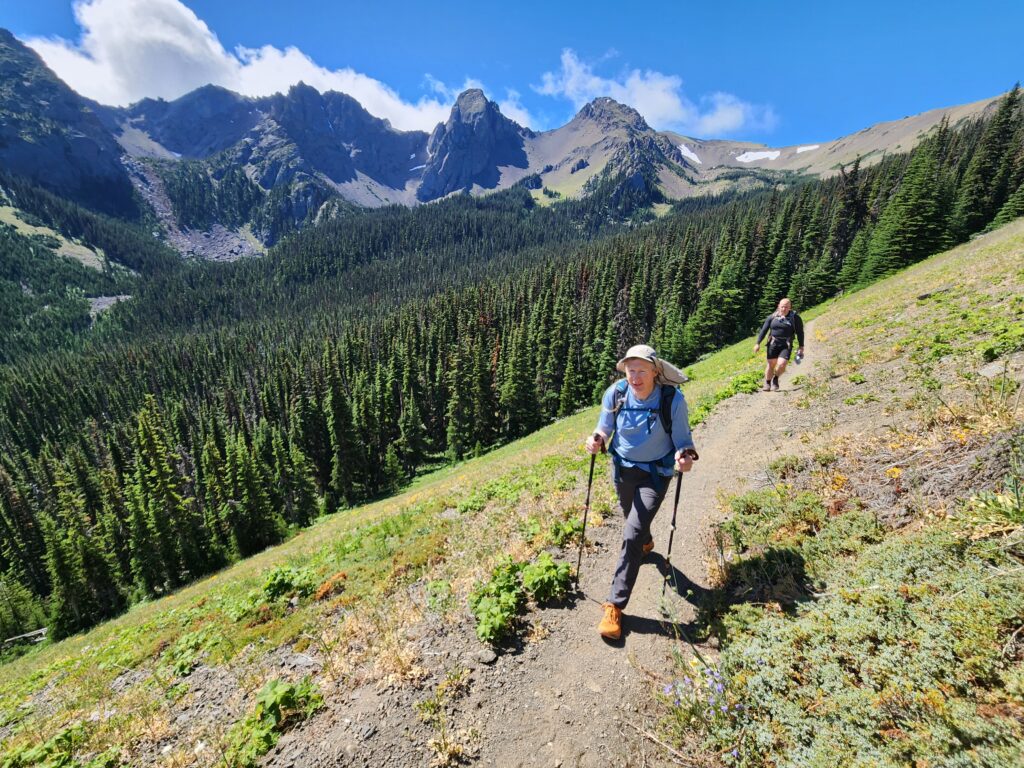
Read MoreGrand Ridge─Horizon-spanning views from the loftiest trail in the Olympics
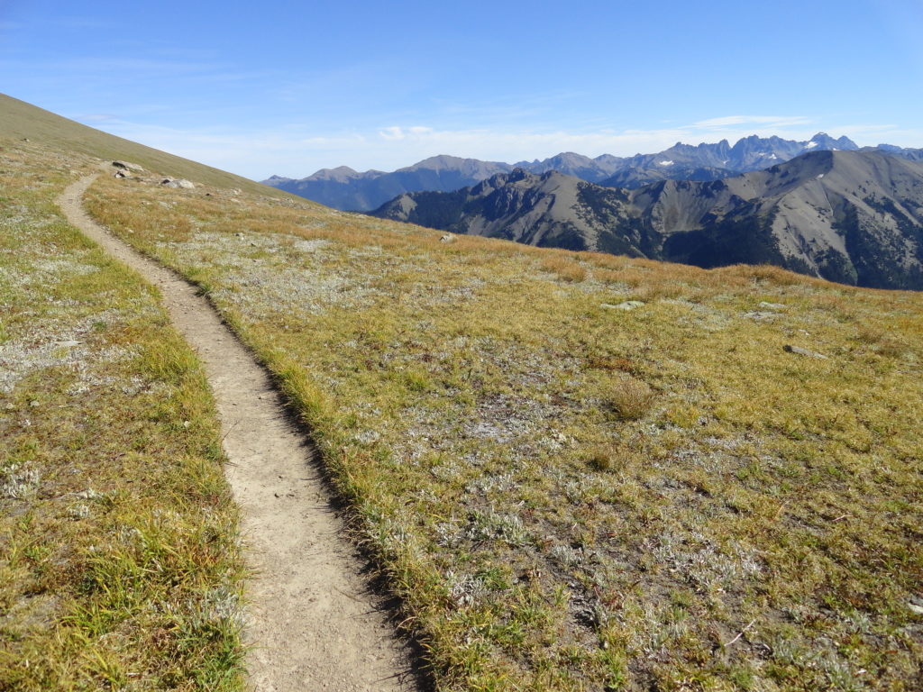
Quick Facts: Location: Deer Park-Obstruction Point, Olympic National Park Land Agency: National Park Service Roundtrip: 15.4 miles. To Maiden Peak: 7.0 miles Elevation Gain: 3,400 feet. To Maiden Peak: 1,600 feet Green Trails Map: Olympics Mountain East 168S Contact: Olympic National Park Notes: Park entry fee; Pavement on Deer Park Road ends at National Park Boundary…
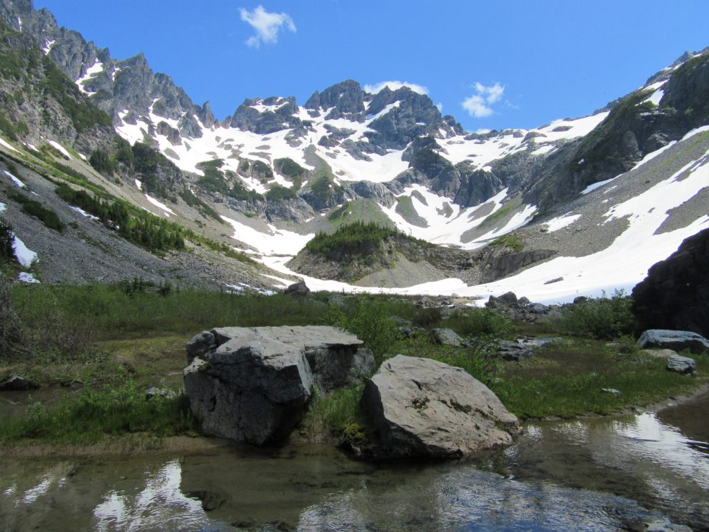
Read MoreFourth of July Creek—Celebrate Independence Day with these explosive views!
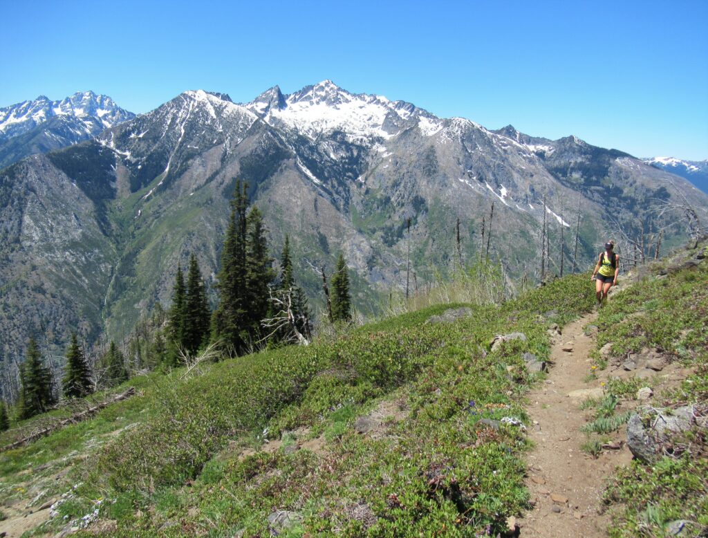
Quick Facts: Location: Central Cascades Land Agency: Okanogan-Wenatchee National Forest Roundtrip: 11.2 miles Elevation Gain: 4,700 feet Notes: rattlesnakes are common along lower portions of trail. Green Trails Map: Alpine Lakes East Stuart Range 208SX Contact: Wenatchee River Ranger District (Leavenworth) More information: Day Hiking Central Cascades 2nd edition (The Mountaineers Books) Access: From Leavenworth follow the…
Read More