Best Spring Hikes
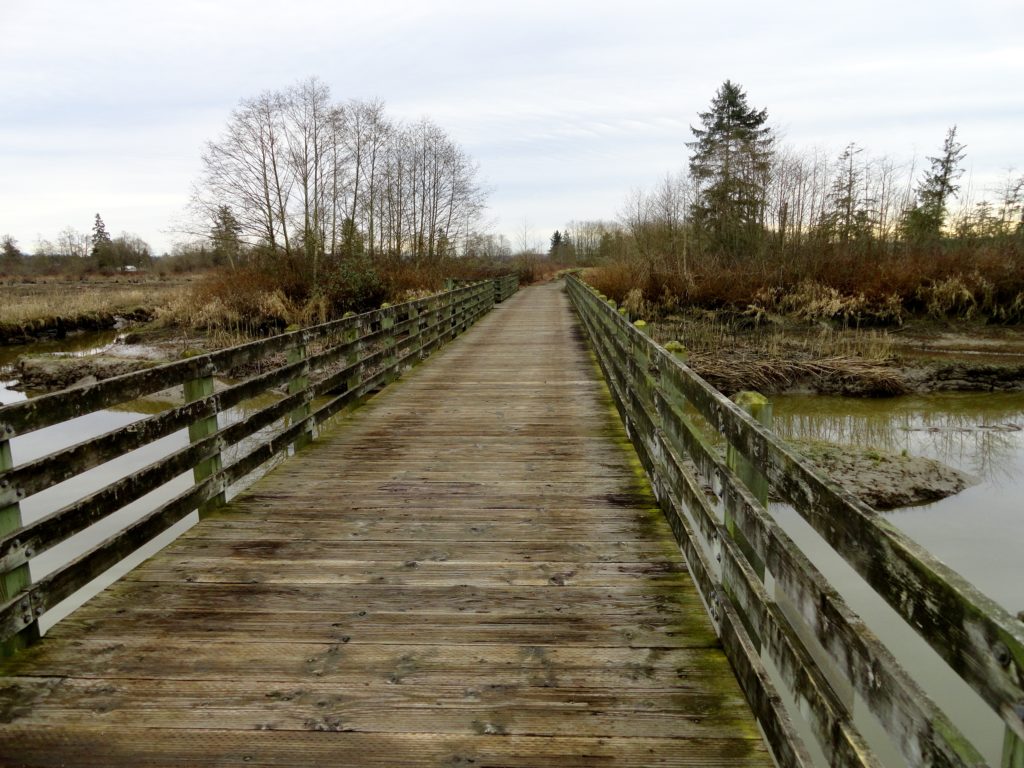
La Center Bottoms─Wintering bird haven on the East Fork of the Lewis River
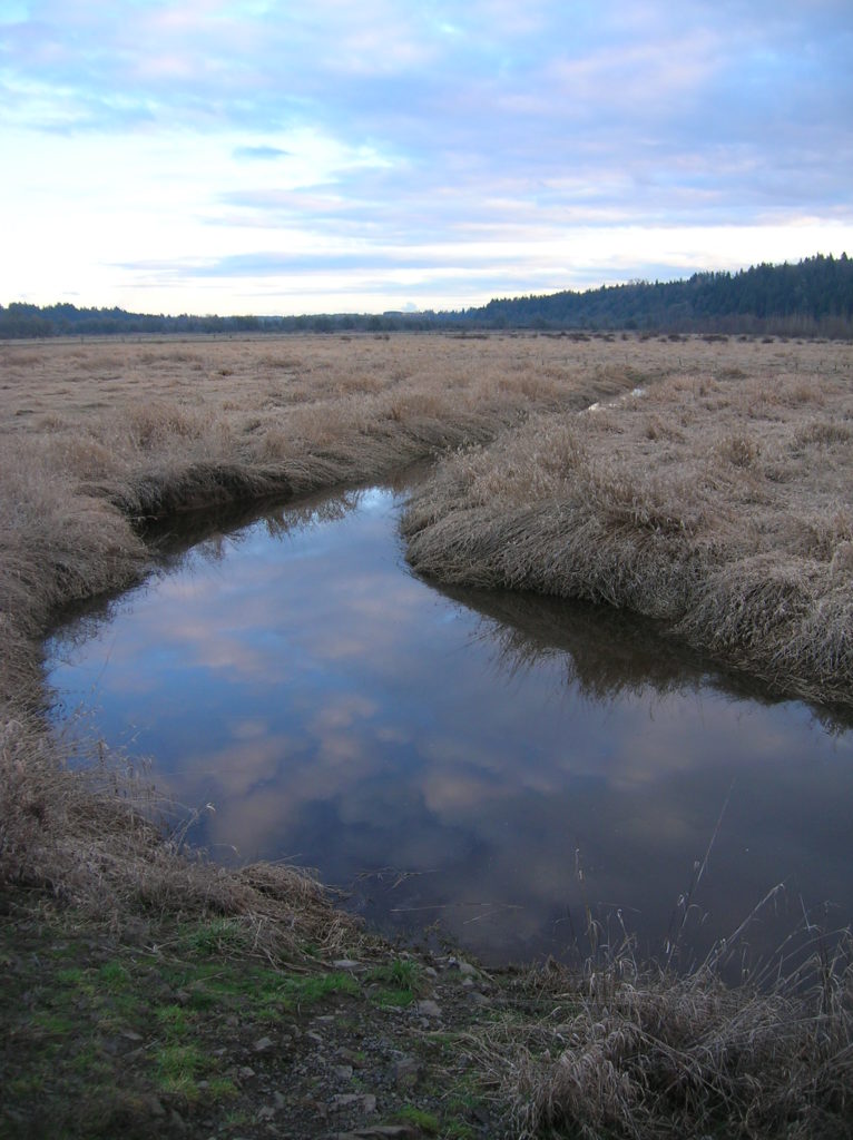
Quick Facts: Location: La Center, Clark County Wash. Land Agency: Clark County Parks Roundtrip: 2.0 miles Elevation Gain: 30 feet Special Note: Dogs permitted on leash. Access: From Vancouver, head north on I-5 to Exit 16. Turn right onto La Center Road and proceed for 1.6 miles to the bridge over the East Fork Lewis River.…
Read MoreLime Kiln Trail─Hop onboard for an historic hike along the Stillaguamish River

Quick Facts: Location: Stillaguamish River Valley, Granite Falls Land Agency: Snohomish County Parks Roundtrip: 7.0 miles Elevation Gain: 600 feet Contact: Snohomish County Parks Green Trails Map: Mountain Loop Highway 111SX Notes: Dogs must be on leash; park open dawn to dusk. Access: Follow SR 92 east to Granite Falls. Turn right onto Granite Ave. Continue…
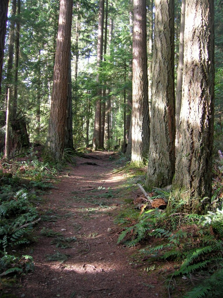
Read MoreLewis and Clark State Park─Discover beautiful Old Growth Forest along the old highway ninety-nine
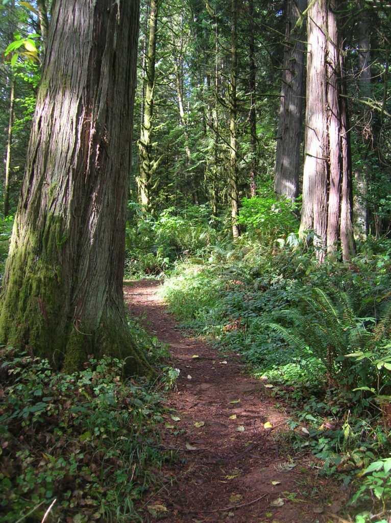
Quick Facts: Location: Chehalis River Valley Land Agency: Washington State Parks Roundtrip: 2.0 miles Elevation Gain: 125 feet Note: Discover Pass required; dogs permitted on leash. Access: From Exit 68 on I-5, proceed 2.5 miles east on US 12 to Mary’s Corner. Turn right onto Jackson Highway entering state park in .7 mile. Continue another…
Read MoreTracy Hill — Wild turkeys and sublime views
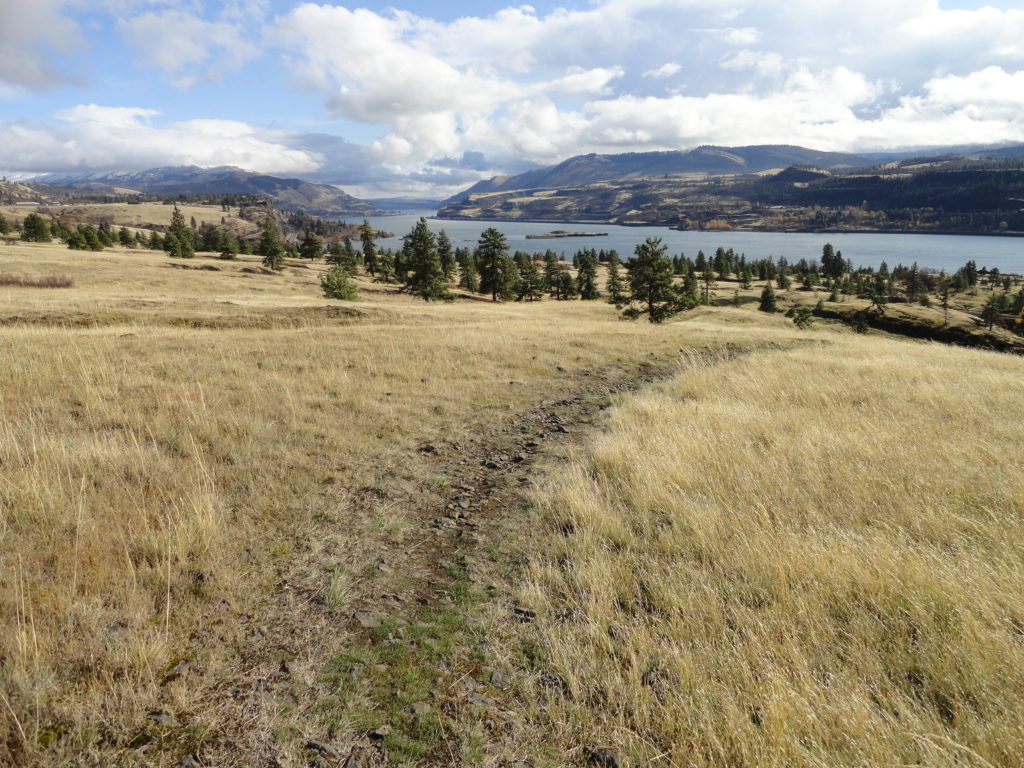
Quick Facts: Location: Columbia River Gorge National Scenic Area Land Agency: Columbia Gorge National Scenic Area Roundtrip: 5.0 miles Elevation gain: 1150 feet Difficulty: Moderate Contact: Columbia Gorge National Scenic Area Notes: Dogs permitted on leash. Be aware of ticks and poison oak. Green Trails Map: Columbia River Gorge East No. 432S Good to Know:…
Read MoreColdwater Lake– Saunter through a healing landscape exploding with wildflowers!
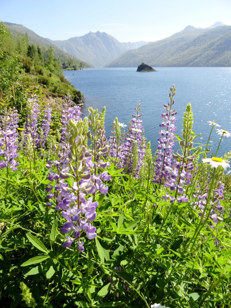
Quick Facts: Location: Mount St. Helens National Volcanic Monument Land Agency: US Forest Service Roundtrip: 9.0 miles Elevation Gain: 550 feet Contact: Mount St Helens National Volcanic Monument Green Trails Map: Green Trails Mount St Helens 332S Notes: Northwest Forest Pass (or interagency pass) required; No dogs; Trail open to bikes: Off trail travel prohibited Access: From Castle Rock…
Read MorePatterson Mountain — Bitterroot and Balsamroot and a bevy of other blossoms
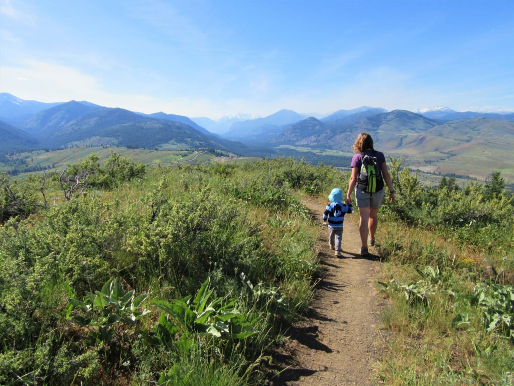
Quick Facts: Location: Methow Valley Land Agency: WA Department of Natural Resources Roundtrip: 3.7 miles Elevation Gain: 1,100 feet Contact: WA Department of Natural Resources Green Trails Map: Sun Mountain, WA- No.83S Notes: Discover Pass Required Access: From Winthrop head east on SR 20 for .6 mile immediately turning right onto Twin lakes Road. Follow for 3.0 miles turning right…
Read MoreCloverdale Farm -Explore this future park on the Stilly
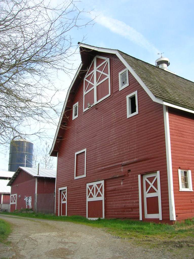
Quick Facts: Location: North Fork Stillaguamish River Valley near Arlington Land Agency: Snohomish County Parks Roundtrip: 4.5 miles Elevation gain: 50 feet Difficulty: easy Contact: Snohomish County Parks Notes: Dogs permitted on leash. All farm buildings are closed to public. Access: From Exit 208 on I-5 head east on SR 530 for 4.0 miles to Arlington. Continue east on SR 530 for…
Read MoreLowell Riverfront Trail—Out of industrial ashes a riverside trail and park are born
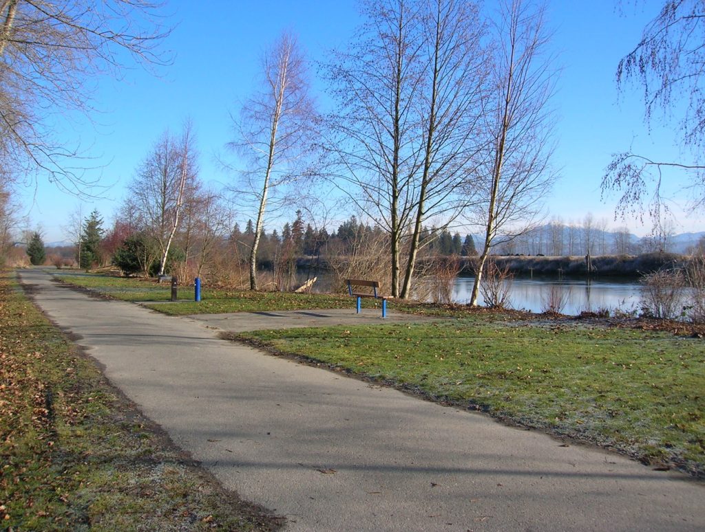
Quick Facts: Location: Lowell neighborhood, city of Everett Land Agency: Everett Parks and Recreation Contact: Everett Parks and Recreation Department Roundtrip: 4.0 miles Elevation Gain: None Access: From Exit 192 on I-5 in Everett head east on 41st Street. Turn right (south) onto 3rd Ave and proceed for 1.2 miles to four-way stop. Turn left onto…
Read MoreTemple Pond—Make a hiking pilgrimage to the Temple of Lord Hill
Quick Facts: Location: Snohomish County near Monroe and Snohomish Land Agency: Snohomish County Parks Roundtrip: 3.7 miles Elevation Gain: 150 feet Access: From the city of Snohomish, exit SR 9 onto 2nd Street. Proceed east for a one mile; then turn right onto Lincoln Ave which becomes the Old Snohomish-Monroe Highway. After 2.7 miles turn…
Read MoreSpencer Island — Wildlife refuge in the heart of the Snohomish River Delta
Quick Facts: Location: Snohomish River Delta, Everett Land Agency: Snohomish County Parks Roundtrip: 3.0 miles Elevation gain: none Contact: Snohomish County Parks Notes: Dogs prohibited; Washington Dept of Fish and Wildlife manages northern half of island which is open seasonally to hunting. Good to Know: Practice Leave No Trace, kid-friendly, snow free winter hike, exceptional bird…
Read More