Best Spring Hikes
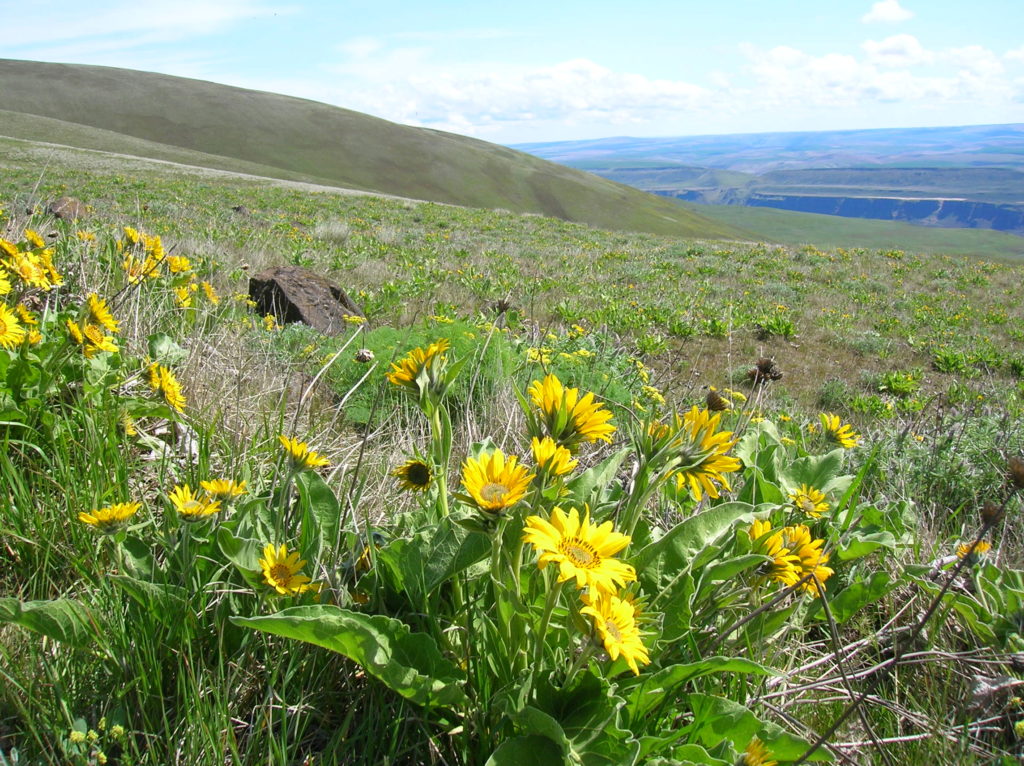
Tom McCall Point─Legendary Columbia River Gorge Wildflower Display
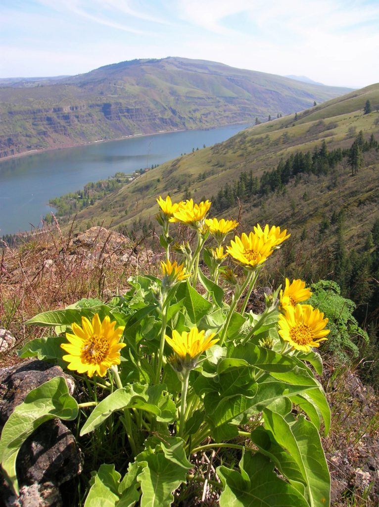
Quick Facts: Location: Columbia River Gorge National Scenic Area Land Agency: Oregon Nature Conservancy and Mayer State Roundtrip: 3.2 miles Elevation Gain: 1,000 feet Notes: Dogs prohibited; Trail closed from Nov 1 through Apr 30 to limit tread damage. Practice Leave No Trace Principles Green Trails Map: Columbia River Gorge East No. 432S Contact: Oregon…
Read MoreTucannon River– Riverside trail will have you singing the Blues

Quick Facts: Location: Blue Mountains Land Agency: Umatilla National Forest Roundtrip: 8.0 miles Elevation Gain: 500 feet Contact: Umatilla National Forest, Pomeroy Ranger District Detailed Information: Day Hiking Eastern Washington (Mountaineers Books) Notes: Northwest Forest Pass or Interagency Pass required Access: From Dayton, head east on Patit Road for 14 miles turning left onto Hartsuck Grade following 4.0…
Read MoreCowiche Mountain– Explore Snow Mountain Ranch’s flowery mountain
Quick Facts: Location: Snow Mountain Ranch, Yakima County, WA Land Agency: Cowiche Canyon Conservancy Roundtrip: 6.2 miles Elevation Gain: 1,250 feet Contact: Cowiche Canyon Conservancy Notes: Dog must be leashed Access: Follow I-90 east to I-82. Continue east on I-82 and take Exit 31A onto US 12. Then head west and take the exit for N 40th Ave.…
Read MoreDosewallips State Park Loop — Hike back in time through a quiet forest
Quick Facts: Location: Olympic Peninsula Land Agency: Washington State Parks Roundtrip: 3.6 miles Elevation Gain: 550 feet Contact: Dosewallips State Park Green Trails Map: Olympic Mountains East 168SX Detailed Information: Day Hiking Olympic Peninsula (Mountaineers Books) Notes: Discover Pass required; Dog must be leashed Recommended Resource: Day Hiking Olympic Peninsula Access: From Quilcene drive US 101 south for 12…
Read MoreTumwater Pipeline Trail—Hike along “strong water” watching rafters and rapids
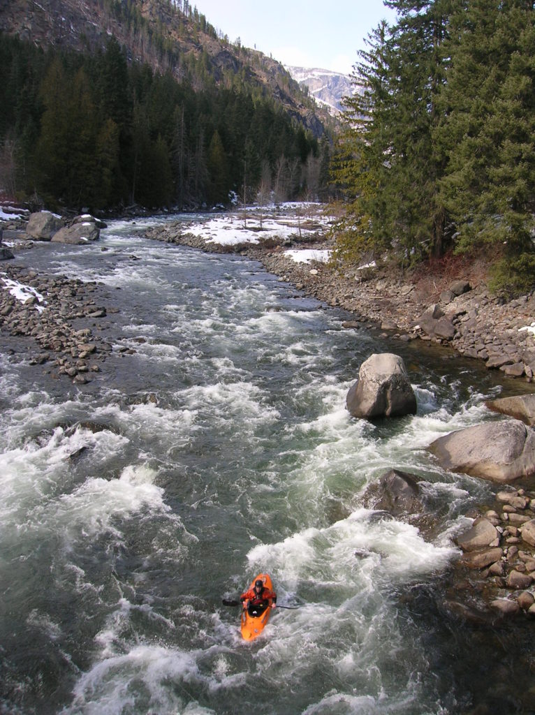
Quick Facts: Location: Wenatchee River Valley Land Agency: Okanogan-Wenatchee National Forest Roundtrip: 2.4 miles Elevation Gain: 100 feet Green trails Map: Leavenworth- No. 178 Access: From Everett head east on US 2 passing Stevens Pass to Coles Corner. Continue east on US 2 for 12.7 miles to trailhead located on your right (between Mileposts 97…
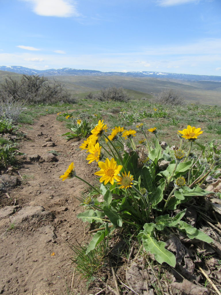
Read MoreStacker Butte─Blossoming Queen of the Columbia River Gorge
Quick Facts: Location: Columbia River Gorge National Scenic Area Land Agency: Washington Department of Natural Resources Roundtrip: 5.0 miles Elevation Gain: 1,150 feet Contact: Washington DNR Southeast Region Notes: Discover Pass required; Dogs prohibited; Practice Leave No Trace Principles Recommended Resource: Day Hiking Columbia River Gorge Green trails Map: Columbia River Gorge West No. 432S Good…
Read MoreFrenchman Coulee — This Canyon above the Columbia River C’est magnifique!
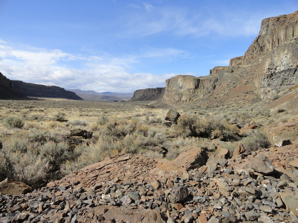
Quick Facts: Location: Columbia River Basin Land Agency: Washington Department of Fish and Wildlife Roundtrip: 4.0 miles Elevation gain: 100 feet Contact: Washington Department of Fish and Wildlife, Columbia Basin Wildlife Area (Moses Lake) Notes: Discover Pass required Detailed Source: Day Hiking Eastern Washington (Mountaineers Books) Access: Follow I-90 to Exit 143 and head north…
Read MoreCrab Creek: Columbia National Wildlife Refuge–Come join the sandhill cranes for their festival!
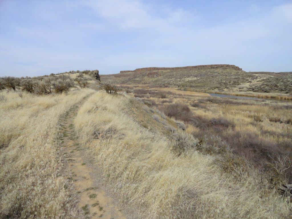
Quick Facts: Location: Columbia National Wildlife Refuge near Othello Land Agency: US Fish and Wildlife Service Roundtrip: 2.6 miles Elevation gain: 40 feet Contact: Columbia National Wildlife Refuge Notes: Dogs permitted on leash. Access: From Ellensburg take I-90 east to Exit 137. Then follow SR 26 for 25 miles east turning left onto SR 262.…
Read MoreQuinault Rainforest Loop — Easily accessible trail system through an Olympic Rainforest
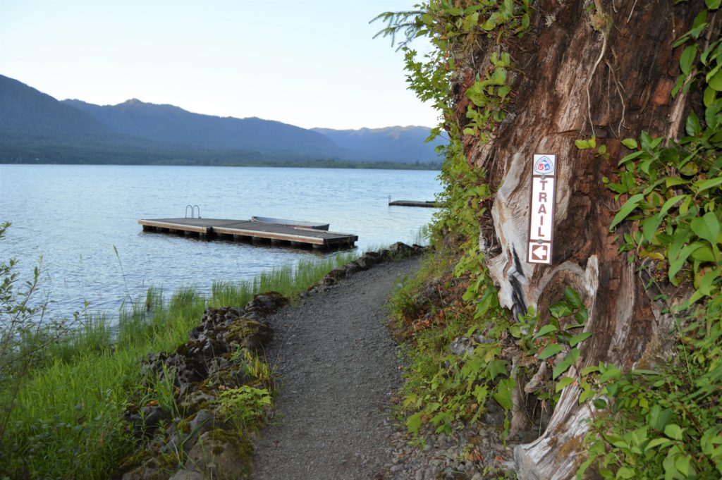
Quick Facts: Location: Lake Quinault Land Agency: Olympic National Forest Roundtrip: 3.9 miles Elevation Gain: 500 feet Contact: Olympic National Forest, Pacific Ranger District, Quinault Detailed Information: Day Hiking Olympic Peninsula 2nd Edition (Mountaineers Books) Notes: Northwest Forest Pass or Interagency Pass required; dogs should on leash Access: From Hoquiam travel north on US 101 for 35 miles.…
Read MoreHeart Lake– A perfect destination for a St. Valentine’s Day hike

Quick Facts: Location: Fidalgo Island Land Agency: Anacortes Parks Department Roundtrip: 3.0 miles Green Trails Map: Deception Pass/Anacortes Community Forest Lands No. 41S Elevation gain: 160 feet Contact: City of Anacortes Parks and Recreation; Friends of the Forest Notes: Dogs must be leashed; some trails open to bicycles, horses. Access: From Exit 230 on…
Read More