Best Spring Hikes
Moss Lake Natural Area
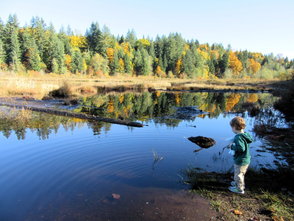
Extensive peat bog teem with flora and fauna Quick Facts: Location: Snoqualmie Valley Distance: 3.0 miles of trails Elevation Gain: minimal Contact: King County Parks Recommended Guidebook: Urban Trails Eastside (Mountaineers Books) Notes: dogs welcome on leash Trailhead directions: Use your phone App to map to Moss Lake Natural Area 35646 NE Moss Lake Rd,…
Read MoreDiablo Lake– Hell of a lake, but not a devil of a hike
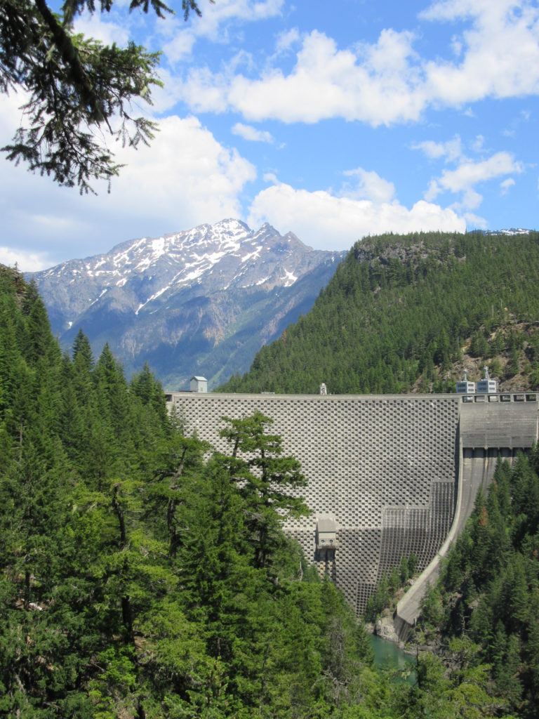
Quick Facts: Location: North Cascades Highway Land Agency: Ross Lake National Recreation Area Roundtrip: 7.6 miles Elevation Gain: 1400 feet Contact: North Cascades National Park Detailed Information: Day Hiking North Cascades 2nd edition (Mountaineers Books) Notes: Dogs must be leashed. Access road gated at 4:15 pm during winter Access: From Marblemount follow SR 20 east for 21.5 miles.…
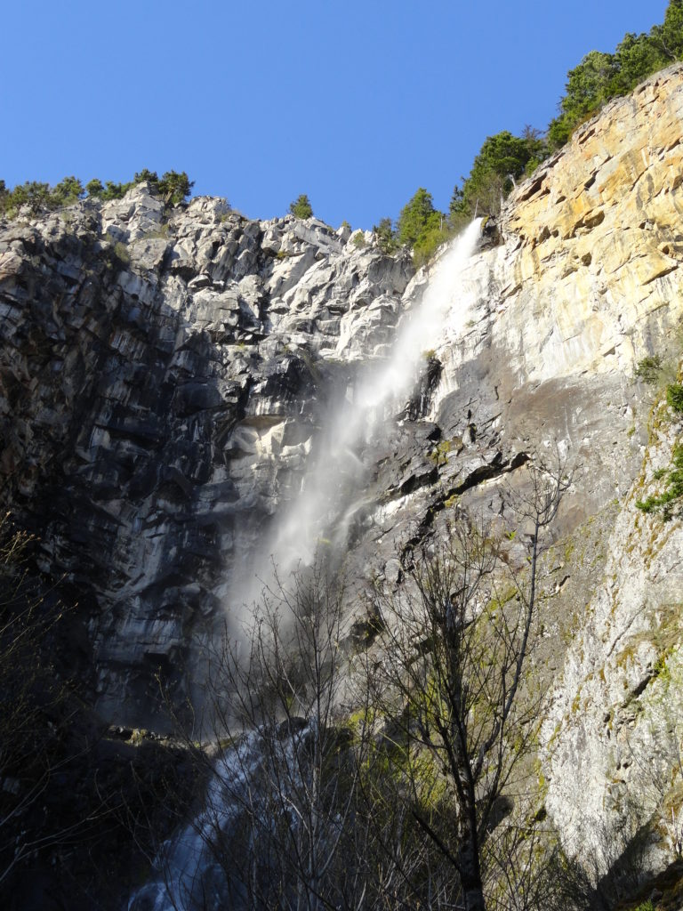
Read MoreBoulder River- waterfalls among old-growth forest

Quick Facts: Location: Boulder River Wilderness, near Darrington Land Agency: National Forest Service Round trip: 8.6 miles Elevation Gain: 750 feet Green Trails Maps: Mountain Loop Highway 111SX Access: From Arlington follow SR 530 for 20 miles. Just beyond Milepost 41 near a subdivision turn right onto FR 2010 and continue for 3.7 miles to trailhead. Contact:…
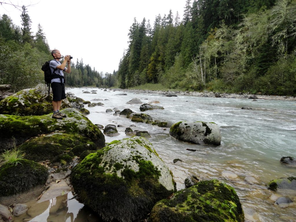
Read MoreLower Big Quilcene River─Lowland hike teems with primeval beauty
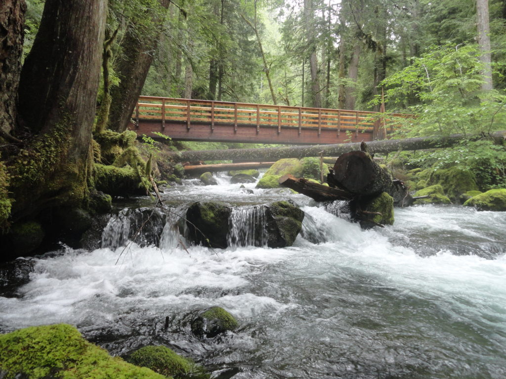
Quick Facts: Location: Olympic National Forest, Hood Canal District Land Agency: National Forest Service Roundtrip: To Camp Jolly 10.2 miles Green Trails Map: Olympic Mountains East 168SX Elevation Gain: 800 feet Contact: Hood Canal District, Quilcene Good to Know: kid-friendly, dog-friendly, open to mountain bikes, backpacking opportunities, old-growth, exceptional rhodies, Practice Leave No Trace Principles Access: From…
Read MoreOzette Triangle–Classic Olympic Coast Hike packed with surprises
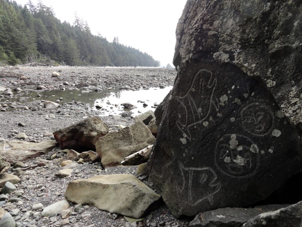
Quick Facts: Location: Olympic Coast Land Agency: Olympic National Park Roundtrip: 9.4 miles Elevation Gain: 400 feet Notes: National Park entry fee; dogs prohibited; coastal section can be difficult during high tides. Green Trails Map: Olympic Coast 99S Contact: Olympic National Park Access: From Port Angeles, follow US 101 west for 5 miles to SR 112. Continue on…
Read MoreSnoquera Falls — A touch of the Yosemite Valley in Washington
Quick Facts: Location: White River Valley Land Agency: Mount Baker-Snoqualmie National Forest Roundtrip: 4.2 miles Elevation Gain: 750 feet Contact: Snoqualmie Ranger District, Enumclaw office Green Trails Map: Greenwater no. 238 Notes: Northwest Forest Pass or Interagency Pass required; Dogs permitted on leash Access: From Enumclaw, follow SR 410 east for 28 miles. Turn left onto Camp Sheppard…
Read MoreOld Sauk River Trail– Stroll along a Wild and Scenic River
Quick Facts: Location: Mountain Loop Highway near Darrington, Land Agency: Mount Baker -Snoqualmie National Forest Roundtrip: 6.0 miles Elevation gain: 150 feet Green Trails Maps: Mountain Loop Highway 111SX Contact: Darrington Ranger District: Mount Baker -Snoqualmie National Forest Notes: Northwest Forest or Interagency Pass required Access: Take Exit 208 off of I-5 following SR 530…
Read MoreJay Lake — Solitude and camping at Wallace Falls State Park

Quick Facts: Location: Skykomish River Valley, US 2 Land Agency: Washington State Parks Roundtrip: 11.5 miles Elevation gain: 1,575 feet Green Trails Map: Contact: Wallace Falls State Park Notes: Discover Pass required; Dogs must be leashed; Camping requires a permit-attain from park prior to trip. Access: From Everett, follow US 2 for 28 miles east…
Read MorePeshastin Pinnacles — Hike though a magical kingdom of rocky spires

Quick Facts: Location: Wenatchee River Valley near Leavenworth Land Agency: Washington State Parks Roundtrip: 1.5 miles Elevation gain: 400 feet Green Trails Maps: Wenatchee Mission Ridge no. 211S Contact: Peshastin Pinnacles State Park Notes: Discover Pass required; dogs must be leashed. Access: From Leavenworth follow US 2 east for 9 miles turning left onto North…
Read MoreGuillemot Cove─Quiet nature retreat on Hood Canal
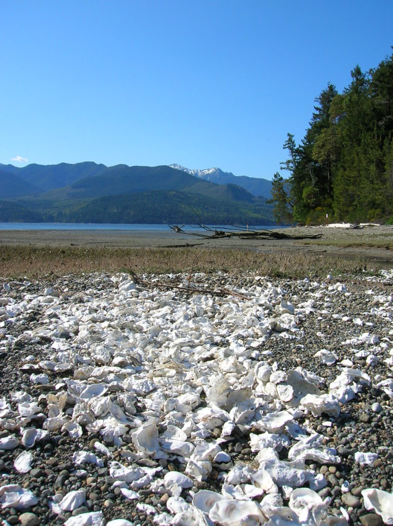
Quick Facts: Location: Kitsap Peninsula Land Agency: Kitsap County Parks Roundtrip: 2.5 miles Elevation Gain: 350 feet Contact: Kitsap County Parks Notes: Dogs prohibited. Access: From Bremerton, follow SR 3 North to Newberry Hill Road Exit. Then head west for 3.0 miles turning right onto Seabeck Highway. Continue for 5.0 miles to Seabeck turning right…
Read More