Best Spring Hikes
Mount Erie
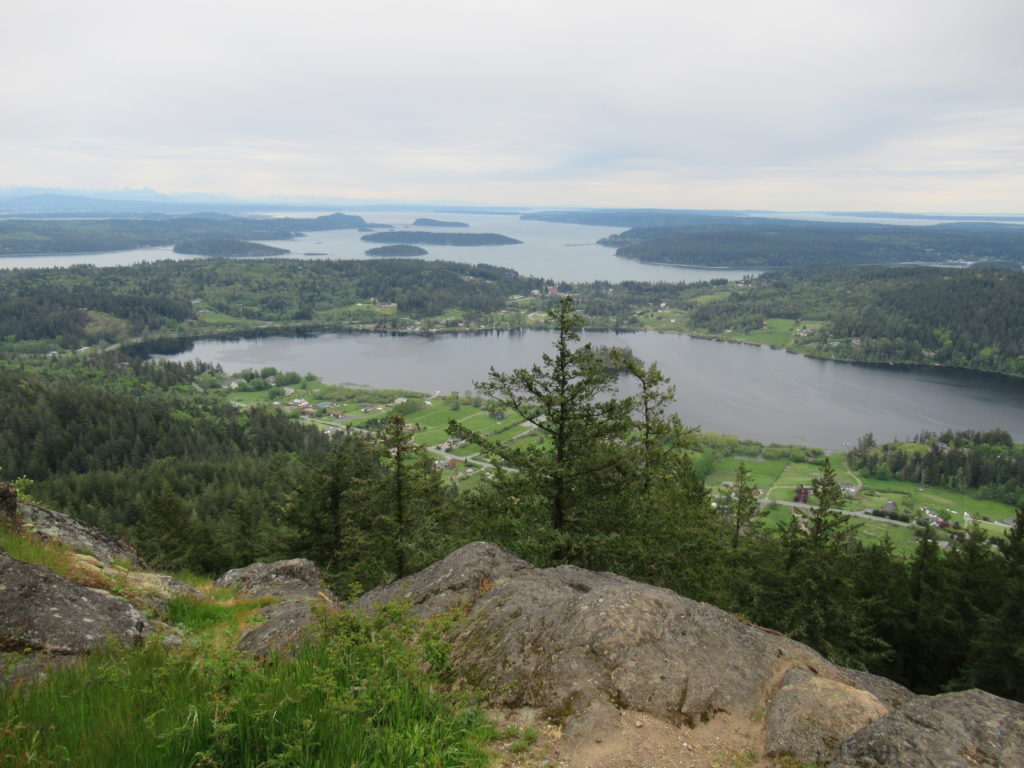
Fidalgo Island highpoint grants sweeping views Quick Facts: Location: Fidalgo Island Land Agency: Anacortes Community Forest Lands (ACFL) Round Trip: 5.2 miles Elevation Gain: 910 feet Contact: Anacortes Parks and Recreation Detailed Information: Day Hiking San Juans and Gulf Islands (Mountaineers Books) Map: online Notes: Dogs permitted on leash. Some trails open to bicycles, horses…
Read MoreLatourell Falls─First in a long line of stunning Columbia River Gorge waterfalls
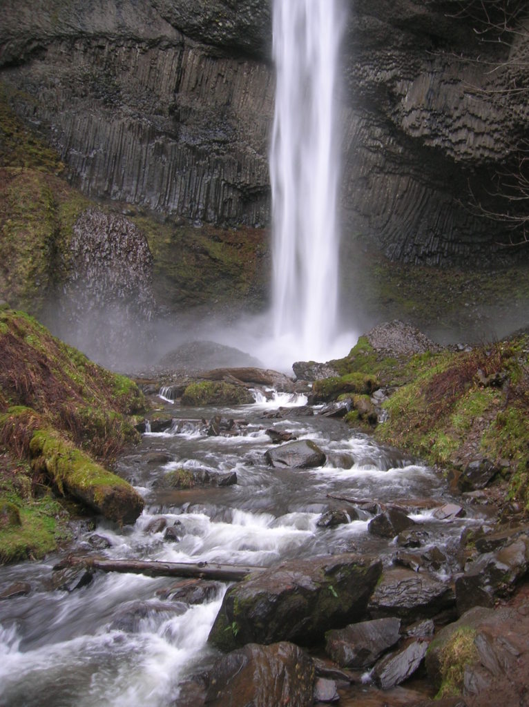
Quick Facts: Location: Columbia River Gorge National Scenic Area Land Agency: Oregon State Parks Roundtrip: 2.3 miles Elevation Gain: 650 feet Green Trails Map: Columbia River Gorge- West no. 428S Contact: Guy Talbot State Park Access: From Portland follow I-84 east to Exit 28. Then follow the Historic Columbia Highway west 2.6 miles to trailhead.…
Read MorePenrose Point State Park
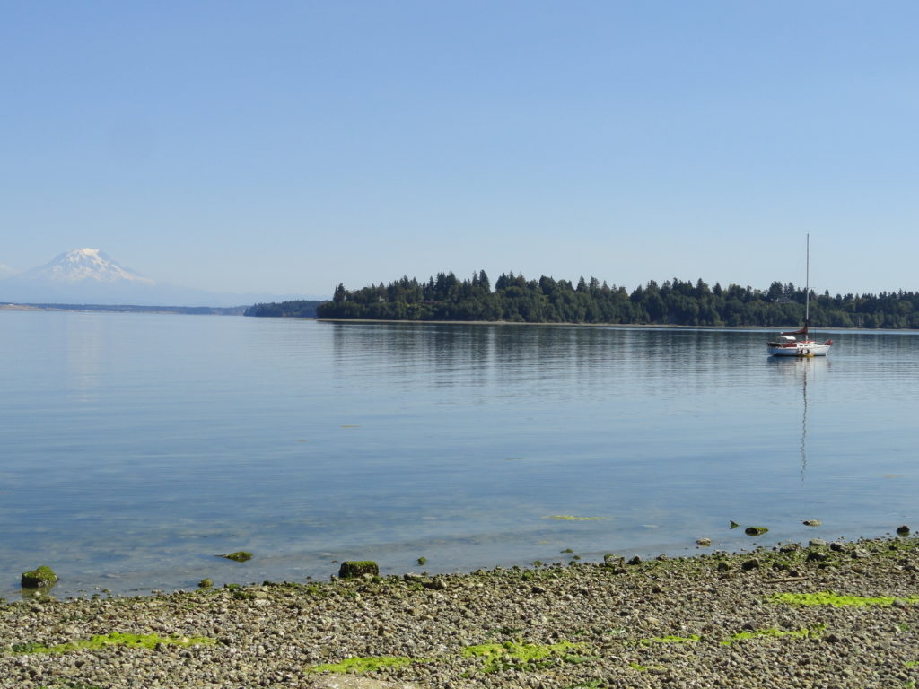
Madronas, big maples and sweeping views of Mount Rainier Quick Facts: Location: Key Peninsula Land Agency: Washington State Parks Round Trip: 2.5 miles of trails Elevation Gain: 200 feet Contact: Penrose Point State Park Detailed Information: Urban Trails Kitsap (Mountaineers Books) Notes: Discover Pass required, Dogs permitted on leash Access: From Purdy (just north of…
Read MoreMcLane Creek– Wetland wonderland within minutes from downtown Olympia
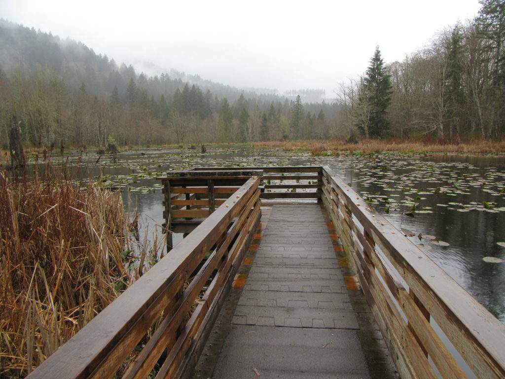
Quick Facts: Location: Capitol State Forest Land Agency: Washington Department of Natural Resources (DNR) Roundtrip: 1.5 miles Elevation Gain: minimal Contact: Washington Department of Natural Resources (DNR); South Puget Sound Region Office Notes: Discover Pass required; dogs permitted on leash Access: From Exit 104 on I-5 in Olympia, head west on US 101 taking the Black…
Read MoreWarrior Rock Lighthouse─A scenic and historic hike on Oregon’s largest island
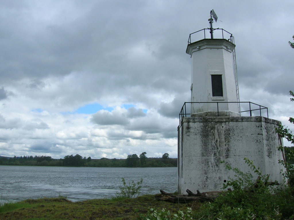
Quick Facts: Location: Sauvie Island (Portland, Oregon) Land Agency: Oregon Department of Fish and Wildlife Roundtrip: 6.5 miles Elevation Gain: 10 feet Access: From downtown Portland, follow US 30 west for just shy of 11 miles turning right onto the Sauvie Island Bridge. Follow Sauvie Island Road passing Cracker Barrel Grocery in .3 mile (where…
Read MoreBells Mountain Trail
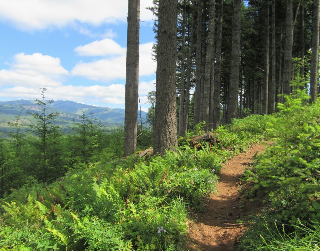
Yacolt Burn Forest Trail rings out to be explored Quick Facts: Location: Clark County Land Agency: Washington Department of Natural Resources Distance: 9.5 miles one way Elevation Gain: up to 2200 Contact: Pacific Cascade Region, Washington Department of Natural Resources Detailed Information: Urban Trails Vancouver WA (Mountaineers Books) Notes: Discover Pass required at all trailheads…
Read MoreEvans Creek Preserve
A glimpse of the Eastside pre-Microsoft Quick Facts: Location: Sammamish Land Agency: Sammamish Parks and Recreation Distance: 3.5 miles of trails Elevation Gain: up to 475 feet Contact: Sammamish Parks and Recreation Detailed Information: Urban Trails Eastside (Mountaineers Books) Notes: Dogs permitted on leash Access: From Redmond Head east on SR 202 for 4.0 miles…
Read MoreOld Kettle Falls Trail
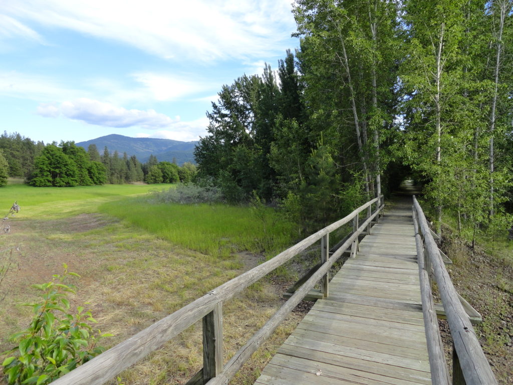
Hike through an old town site along a tamed river Quick Facts: Location: Lake Roosevelt, Stevens County, WA Land Agency: National Park Service Roundtrip: 2.6 miles Elevation Gain: minimal Contact: Lake Roosevelt National Recreation Area Detailed Information: Day Hiking Eastern Washington (Mountaineers Books) Notes: Dogs permitted on leash Access: From Kettle Falls head west on SR 20-US 395…
Read MoreLimekiln Point and Preserve

Orcas, old quarries, and a beautiful lighthouse Quick Facts: Location: San Juan Island Land Agency: Washington State Parks and San Juan County Conservation Land Bank Roundtrip: 2.2 miles Elevation Gain: 265 feet Contact: Lime Kiln State Park or San Juan County Conservation Land Bank Detailed Information: Day Hiking the San Juans and Gulf Islands (Mountaineers Books) Notes: Discover…
Read MoreEagle Creek — Classic Hike overflows with stunning waterfalls
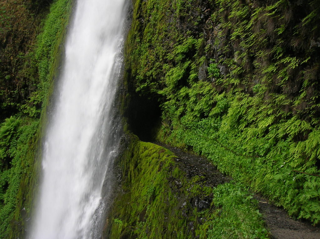
Quick Facts: Location: Columbia River Gorge near Cascades Locks, Oregon Land Agency: National Forest Service Roundtrip: 12 miles High Point: 1,100 feet Elevation gain: 1,600 feet Difficulty: moderate Green Trails Maps: Columbia Gorge West no. 428S Contact: Columbia Gorge National Scenic Area Notes: Northwest Forest Pass or Interagency Pass required; Dogs permitted (but not recommended) on leash; steep drop offs and exposure—keep children near.…
Read More