Best Spring Hikes
The Hummocks — Hike through the former heart of Mount St. Helens
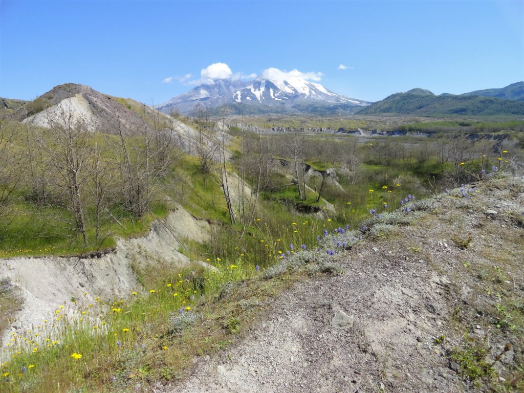
Quick Facts: Location: Spirit Lake Highway, Mount St Helens National Volcanic Monument Land Agency: National Forest Service Roundtrip: 2.5 miles Elevation Gain: 250 feet Contact: Mount St Helens National Volcanic Monument Green Trails Map: Mount St Helens 332S Notes: Northwest Forest Pass (or interagency pass) required; dogs permitted on leash; off trail travel prohibited. Practice Leave…
Read MoreSpider Lake─Best “web site” on the Olympic Peninsula
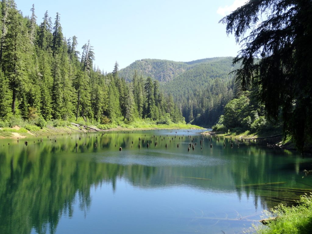
Quick Facts: Location: Olympic National Forest, Hood Canal District Land Agency: National Forest Service Roundtrip: 2.0 miles Green Trails Map: Mount Tebo, WA No. 199 Elevation Gain: 200 feet Contact: Hood Canal District, Quilcene Good to know: Dog-friendly, Kid-friendly, snow free winter hike Access: From Shelton, head north on US 101 for 7 miles turning…
Read MoreSaddle Rock—Iconic landmark of the Wenatchee Foothills
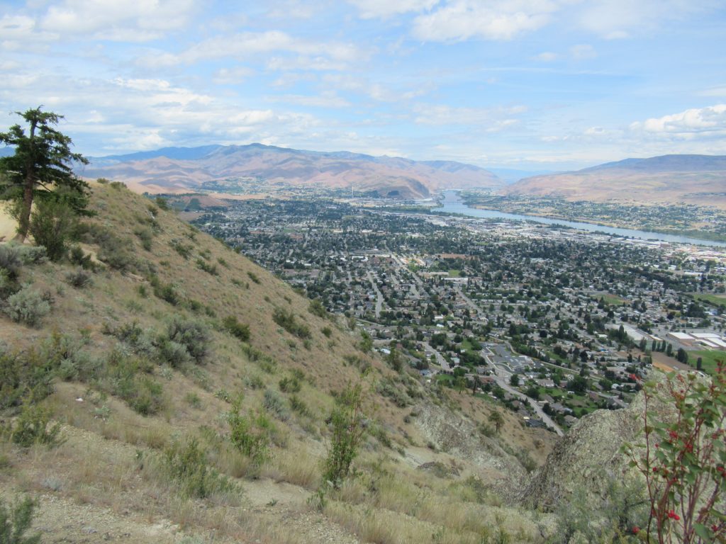
Quick Facts: Location: Wenatchee, Washington Land Agency: WA DNR and Chelan-Douglas Land Trust Roundtrip: 3.0 miles Elevation Gain: 1000 feet Contact: WA DNR and Chelan-Douglas Land Trust Notes: Dogs must be leashed; be alert for rattlesnakes Green Trails Map: Wenatchee/ Mission Ridge No. 211S Access: From US 2 in Wenatchee head south onto State Route…
Read MoreHappy Panther Trail–Take a joyful catwalk in the North Cascades
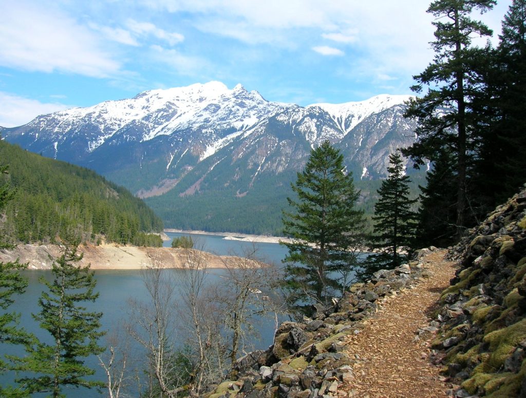
Quick Facts: Location: North Cascades Scenic Highway Land Agency: Ross Lake National Recreation Area, National Park Service Roundtrip: 11.8 miles Elevation gain: 1200 feet Green Trails Maps: Green Trails, North Cascades Ross Lake No. 16SX Contact: North Cascades National Park complex Notes: Dogs must be leashed Access: From Burlington follow SR 20 east to Marblemount. Then…
Read MoreTheler Wetlands─Enjoy the sounds and smells of spring at Hood Canal
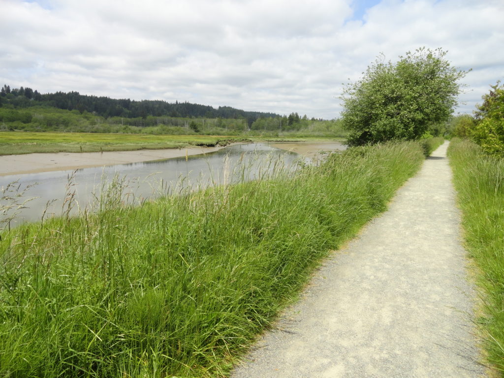
Quick Facts: Location: Kitsap Peninsula Land Agency: City of Belfair, Washington Distance: 3.0 miles of trails Elevation Gain: 40 feet Recommended Resource: Urban Trails Kitsap Notes: Trail open dawn to dusk. Dogs are prohibited. Access: From Bremerton head west on SR 3 to Belfair. Proceed one mile beyond the junction with SR 300 to the…
Read MoreDuckabush River — Every day is Hump Day on this wilderness trail!

Quick Facts: Location: The Brothers Wilderness, east Olympic Peninsula Land Agency: Olympic National Forest Roundtrip: 10.6 miles Elevation gain: 2,300 feet Contact: Hood Canal Ranger District, Quilcene ; Olympic National Forest Green Trails Map: Olympics East no. 168SX Notes: Trail crosses a recent burn area, beware of falling snags especially during windy days Good to Know:…
Read MoreNorth Head Lighthouse–Hike to a headland at the mouth of the Columbia River
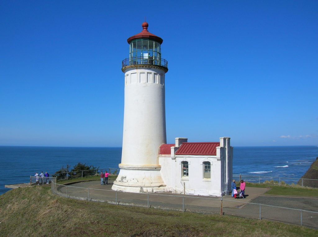
Location: Cape Disappointment State Park, Long Beach Peninsula Land Agency: Washington State Parks Roundtrip: 4.2 miles Elevation gain: 300 feet Contact: Cape Disappointment State Park Notes: Discover Pass required; Dogs must be leashed Good to Know: kid-friendly, snow free winter hike, historic Access: From Kelso follow SR 4 west to Naselle. Turn left onto SR…
Read MoreWhispering Firs Trail– While away a winter day on this Paradise Valley trail

Location: Maltby Land Agency: Snohomish County Parks Roundtrip: 0.6 mile Elevation gain: minimal Contact: Snohomish County Parks; map available on line Notes: Dogs must be on a leash Access: From SR 522 in Maltby (5.0 miles east of Woodinville; 8.0 miles west of Monroe) head east on Paradise Lake Road for 1.7 miles to trailhead.…
Read MoreOyster Dome─The Pearl of the Chuckanut Mountains
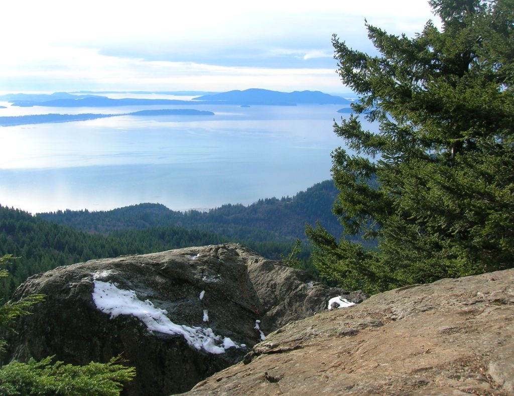
Quick Facts: Location: Chuckanut Mountains Land Agency: Washington Department of Natural Resources Roundtrip: 6.5 miles Elevation Gain: 1,900 feet Special Note: Oyster Dome can be hazardous in icy and wet conditions. Trail can be extremely popular, opt for a weekday visit. Contact: Washington DNR, Northwest Region; www.dnr.wa.gov Access: Trailhead is located just past milepost 10…
Read MoreJacobs Point Park
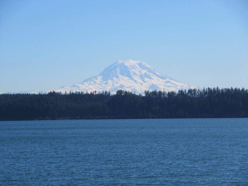
Park rich with views, history, and wildlife on Oro Bay Quick Facts: Location: Anderson Island Land Agency: Anderson Island Park and Recreation Department Round Trip: 2.5 mile loop Elevation Gain: minimal Contact: Anderson Island Park and Recreation Department Detailed Information: Urban Trails Tacoma (Mountaineers Books) Notes: Dogs prohibited Access: From Steilacoom–Anderson Island Ferry terminal take…
Read More