Best Spring Hikes
Fort Flagler Loop─Old defense post now protects undeveloped Puget Sound coastline
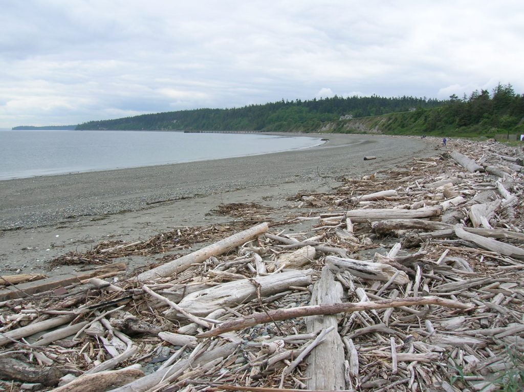
Quick Facts: Location: Marrowstone Island Land Agency: Washington State Parks Contact: Fort Flagler State Park Roundtrip: 5.6 miles Elevation Gain: 200 feet Access: From Kingston Ferry Terminal, follow SR 104 west for 15 miles turning right onto SR 19. Continue north for 9 miles to Chimicum turning right onto Irondale Road and proceeding 1.6 miles…
Read MoreWhistler Canyon-big on bighorn sheep and Okanogan River views
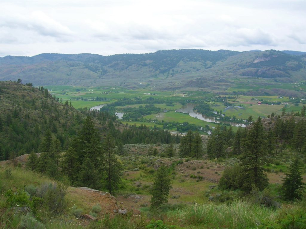
Location: Okanogan Valley near Oroville Land Agency: Okanogan-Wenatchee National Forest Roundtrip: 5.0 miles High Point: 1,950 feet Elevation gain: 1,250 feet Difficulty: moderate Contact: Pacific Northwest Trail Association Note: Dogs should be under strict control as to not disturb the bighorn sheep. Access: From Tonasket, follow US 97 north for 14.5 miles to trailhead turnoff…
Read MoreRainbow Falls State Park
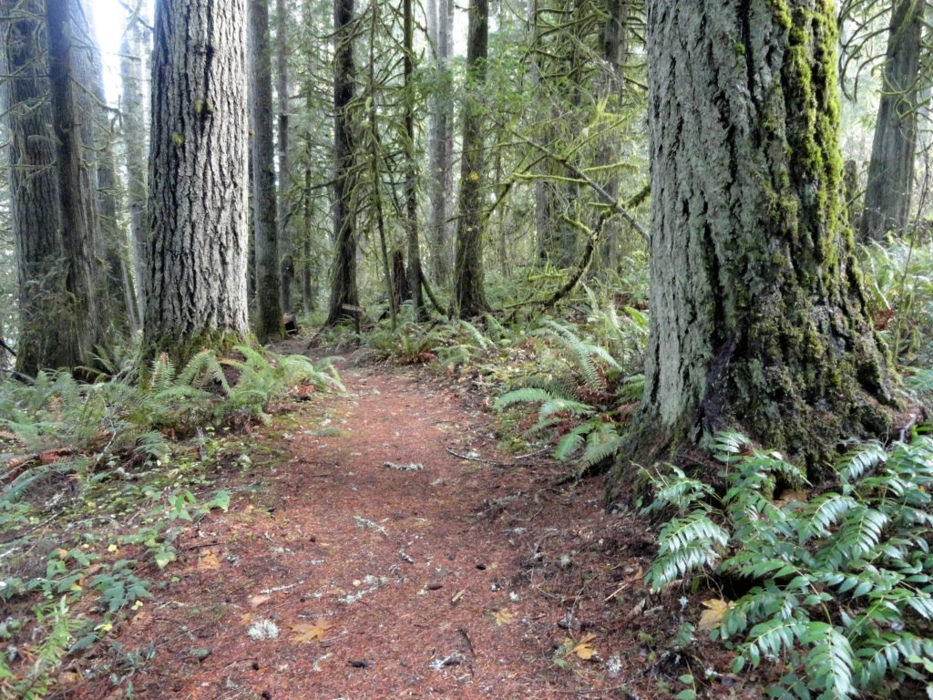
Stroll through groves of Old-growth above the Chehalis River Quick Facts: Location: Chehalis River Valley Land Agency: Washington State Parks Roundtrip: up to 3.0 miles Elevation gain: 300 feet Contact: Rainbow Falls State Park Notes: Discover Pass required; dogs must be leashed Access: From Chehalis (exit 77 on I-5) follow SR 6 west for 16…
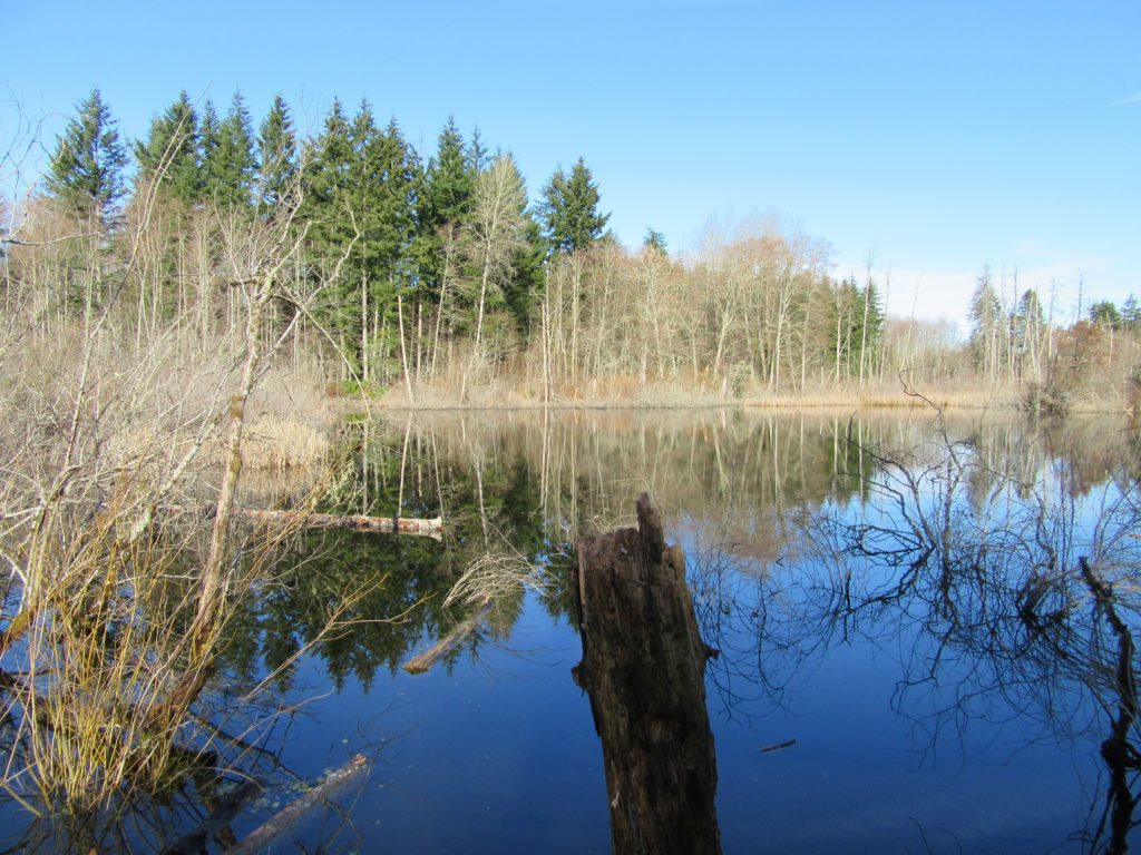
Read MoreBob Heirman Wildlife Preserve at Thomas’ Eddy – Swans, steelhead, and serenity on the Snohomish River

Quick Facts: Location: Snohomish River, south of Snohomish Land Agency: Snohomish County Parks Roundtrip: 1.5 miles Elevation Gain: 50 feet Contact: Snohomish County Parks and Recreation Special Note: Dogs prohibited. Trails can flood during rainy period. Expect wet and muddy trails. Access: From the city of Snohomish, travel south on SR 9 for 2.6 miles…
Read MoreCapitol Peak
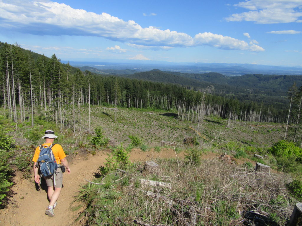
The views rule from this prominent peak near Olympia Quick Facts: Location: Capitol State Forest Land Agency: Washington Department of Natural Resources (DNR) Distance: 17.0 mile loop Elevation Gain: 2300 feet Contact: Washington Department of Natural Resources (DNR); South Puget Sound Region Office Notes: dogs permitted on leash; Trails also open to mountain bikes and…
Read MoreIsland Center Forest
Explore an excellent trail system in the heart of Vashon Island Quick Facts: Location: Vashon Island Land Agency: King County Parks and Vashon Maury Island Land Trust Distance: more than 10 miles of trails Elevation Gain: up to 200 feet Contact: King County Parks Notes: dogs permitted on leash: Trails also open to mountain bikes…
Read MoreTolmie State Park
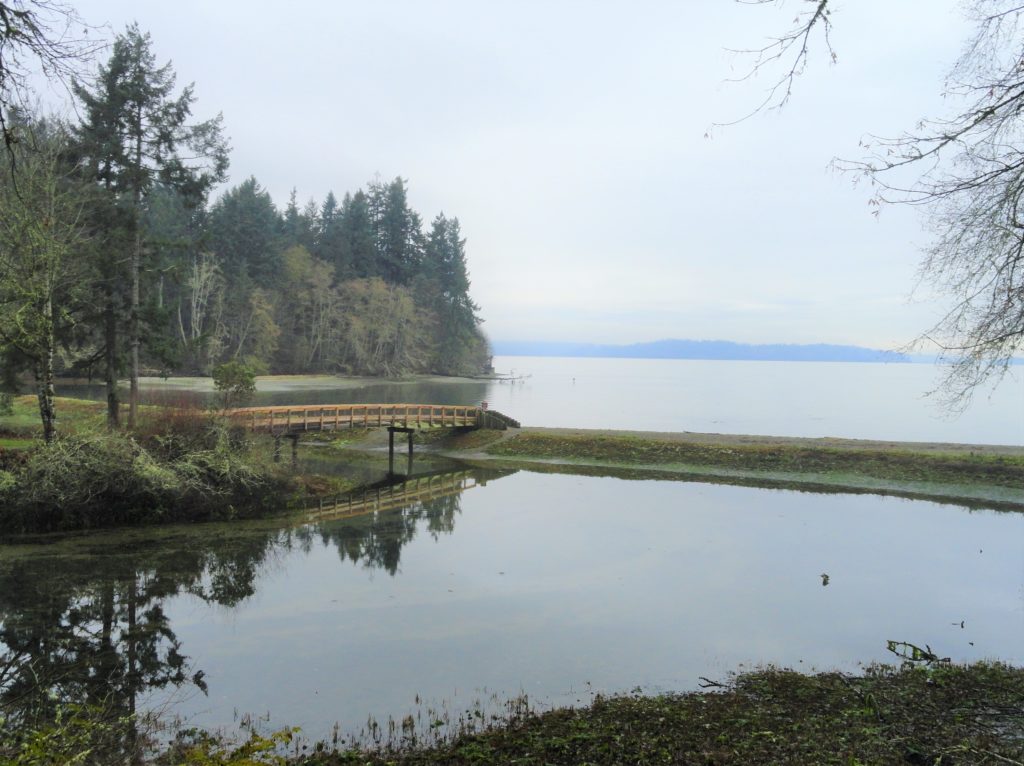
Explore a small trail network on the Nisqually Reach Quick Facts: Location: Lacey Land Agency: Washington State Parks Distance: 3.0 miles of trails Elevation Gain: up to 225 feet Contact: Tolmie State Park Notes: Discover Pass required; dogs permitted on leash: Hours: April 20-September 20: 8 a.m to dusk September 21-April 19, Wed—Sunday 9 a.m.-dusk…
Read MoreMercer Slough Nature Park
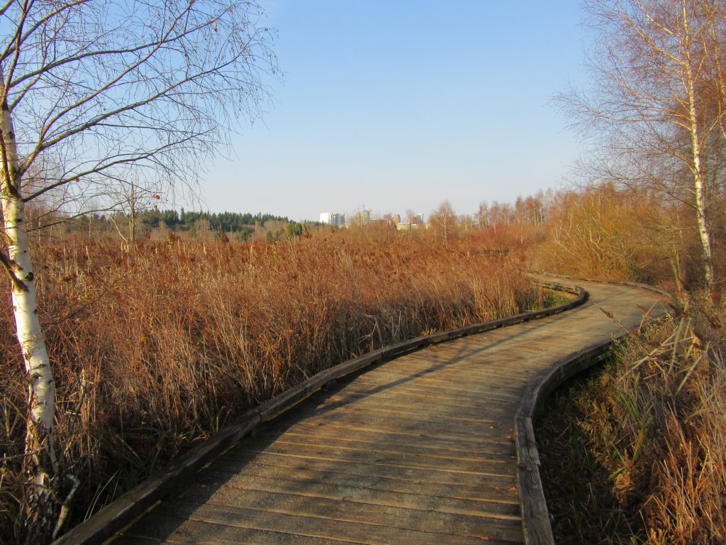
Hike a slew of trails near the heart of Bellevue Quick Facts: Location: Bellevue Land Agency: City of Bellevue Parks and Recreation Distance: more than 7.0 miles of trails Elevation Gain: minimal Contact: City of Bellevue Parks and Recreation Notes: dogs permitted on leash, Recommended Guidebook: Urban Trails Eastside (Mountaineers Book) Access: Take Exit 12…
Read MoreBig Gulch─ Explore Mukilteo’s deep ravines

Quick Facts: Location: Mukilteo Land Agency: Mukilteo Parks and Recreation Contact: Mukilteo Recreation Department Roundtrip: 4.0 miles Elevation Gain: 350 feet Access: From Everett follow SR 526 to SR 525. Turn left (south) on SR 525 and drive .5 mile to 92nd Street. Turn right and then immediately turn left into the 92nd Street Park parking area.…
Read MoreLake Sylvia─A great place to log some hiking miles
Quick Facts: Location: Montesano, Olympic Peninsula Land Agency: Washington State Parks Roundtrip: 4.9 miles Elevation Gain: 220 feet Access: From US 12 in Montesano, head north on Main Street past the county courthouse. Turn left onto Spruce Avenue proceeding three blocks. Then turn right on 3rd Street which becomes Sylvia Lake Road for 1.2 miles to…
Read More