British Columbia
Cheam Lake Wetlands–Birding hotspot where the North Cascades meet the Fraser River
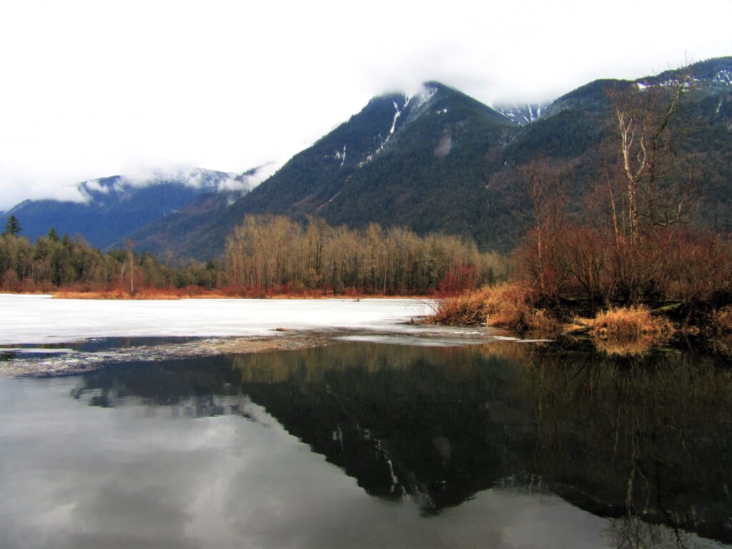
Quick Facts: Location: Popkum, Fraser Valley Regional District, BC Land Agency: Fraser Valley Regional Parks Round Trip: 2.5 miles (4.0 km) roundtrip Elevation Gain: minimal Contact: Fraser Valley Regional Parks Notes: Dogs prohibited Access: From Vancouver, BC follow Trans-Canada Highway 1 east to Exit 138 (12 miles /20 kilometers east of Chilliwack). Turn left and…
Read MoreBright Walk (White Rock Promenade)– Festive hike on Semiahmoo Bay

Quick Facts: Location: White Rock BC Distance: 4.4 km (2.7 miles) round trip Elevation Gain: minimal Contact: City of White Rock Recreation and Culture Recommended Guidebook: Urban Trails Vancouver, BC (Mountaineers Books) Notes: Bright Walk runs from late November until mid-January. Check city website for exact dates. Promenade open year round but note dogs prohibited…
Read MoreBoundary Bay Dyke Trail

Bountiful birds and beautiful views of Mount Baker Quick Facts: Location: Surrey and Delta, BC Distance: 16.9 km (10.5 miles) one way Elevation Gain: minimal Contact: Metro Vancouver Regional Parks, Surrey Parks and Recreation Recommended Guidebook: Urban Trails Vancouver, BC (Mountaineers Books) Notes: Dogs permitted on leash; but dogs not allowed on shoreline trail in…
Read MoreMount Seymour — See more of the BC Lower Mainland from this classic peak
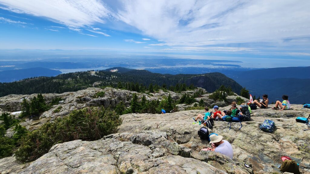
Quick Facts: Location: North Shore Mountains, North Vancouver, BC Distance: 8.4 km (5.2 miles) roundtrip Elevation Gain: 540 m (1772 feet) Contact: Mount Seymour Provincial Park Recommended Guidebook: Urban Trails Vancouver, BC (Mountaineers Books) Notes: Trail to Mount Seymour is snow free from July through October. Other trails in park outside of ski area are…
Read MoreBlack Mountain
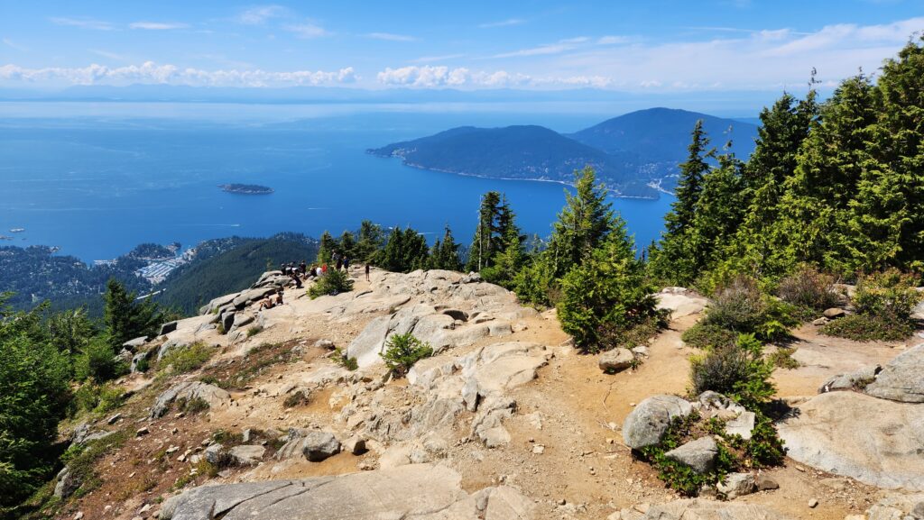
Savor sweeping views from mountain to sound to city Quick Facts: Location: North Shore Mountains, West Vancouver, BC Distance: 9 km (5.6 miles) roundtrip Elevation Gain: 550 m (1800 feet) Contact: Cypress Provincial Park Recommended Guidebook: Urban Trails Vancouver, BC (Mountaineers Books) Notes: Notegate closure times at Cypress Bowl Ski Area so not to be…
Read MoreMount Wells– Victoria area summit gushes with flowers and views

Quick Facts: Location: Victoria—Langford, BC Land Agency: Capital Regional District Parks Roundtrip: 2.0 miles/ 3.2 km Elevation gain: 865 feet/ 264 m Maps: CRDP site Contact: Capital Regional District Parks Notes: dogs permitted on leash; please stay on trail to protect rare plants Access: From Victoria, follow Trans-Canada Highway 10.5 for miles (17 km) exiting…
Read MoreSwan Lake and Christmas Hill –A very merry hike minutes from downtown Victoria

Quick Facts: Location: Saanich Peninsula, Vancouver Island Land Agency: Swan Lake Christmas Hill Sanctuary Roundtrip: 3.5 miles/ 5.6 kilometers Elevation gain: 325 feet/ 100 meters Contact: Swan Lake Christmas Hill Sanctuary Notes: dogs prohibited Access: From Victoria or Sidney, follow BC 17 (Patricia Bay Highway) exiting onto McKenzie Ave. Proceed east turning right onto Rainbow…
Read MoreBoundary Bay Dyke Trail– Bundles of bald eagles, owls and shorebirds and breathtaking views of Mount Baker

Quick Facts: Location: BC Lower Mainland, Land Agency: Boundary Bay Wildlife Management Area One Way: 10.4 miles (16.7 kilometers) Elevation Gain: minimal Contact: Boundary Bay Wildlife Management Area Notes: trail also open to stock and bikes: dogs permitted on leash but note dogs not allowed on shoreline trail in Mud Bay Park from Oct 15-Apr…
Read MoreFrosty Mountain–Cool views and alpine larches, too!
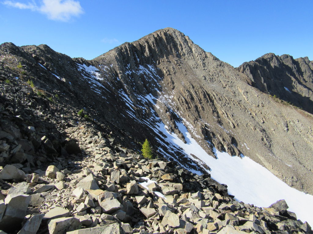
Quick Facts: Location: North Cascades, E.C. Manning Provincial Park Land Agency: BC Parks Roundtrip: 13.2 miles Elevation Gain: 3820 feet Contact: E.C. Manning Provincial Park Notes: Dogs permitted on leash. Practice Leave No Trace principles. Access: From Vancouver BC follow Trans-Canada Highway 1 east to Hope. Then continue east on BC 3 (Crowsnest Highway) for 37.5 miles and…
Read More