Columbia River Gorge Hikes
Catherine Creek Rock Arch–A touch of Utah in the Northwest!
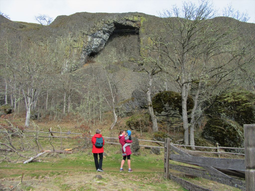
Location: Columbia River Gorge National Scenic Area Land Agency: Columbia Gorge National Scenic Area Roundtrip: 2.3 miles Elevation gain: 370 feet Difficulty: Easy Contact: Columbia Gorge National Scenic Area Notes: Dogs permitted on leash. Be aware or ticks and poison oak. Green Trails Map: Columbia River Gorge East No. 432S Good to Know: kid-friendly, dog-friendly…
Read MoreSilver Star Mountain via Ed’s Trail–Stellar wildflowers and explosive volcanic views
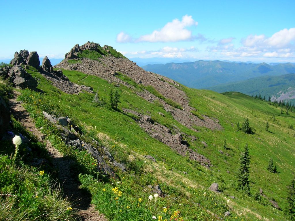
Quick Facts: Location: Silver Star Scenic Area Land Agency: Gifford Pinchot National Forest Roundtrip: 5.0 miles High Point: 4,390 feet Elevation gain: 1,440 feet Difficulty: moderately difficult Green Trails Map: Lookout Mtn No. 396, Bridal Veil No. 428 Contact: Gifford Pinchot National Forest Mount Adams Ranger District, Note: FR 4109 is rough and recommended for high…
Read MoreTom McCall Point─Legendary Columbia River Gorge Wildflower Display
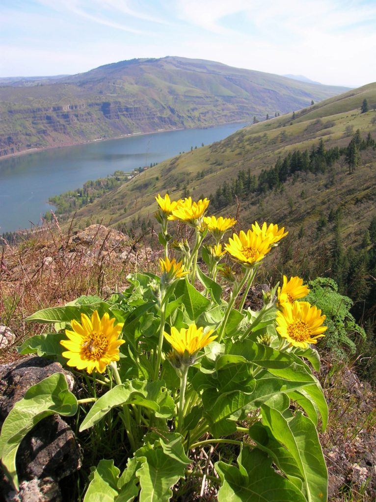
Quick Facts: Location: Columbia River Gorge National Scenic Area Land Agency: Oregon Nature Conservancy and Mayer State Roundtrip: 3.2 miles Elevation Gain: 1,000 feet Notes: Dogs prohibited; Trail closed from Nov 1 through Apr 30 to limit tread damage. Practice Leave No Trace Principles Green Trails Map: Columbia River Gorge East No. 432S Contact: Oregon…
Read MoreStacker Butte─Blossoming Queen of the Columbia River Gorge
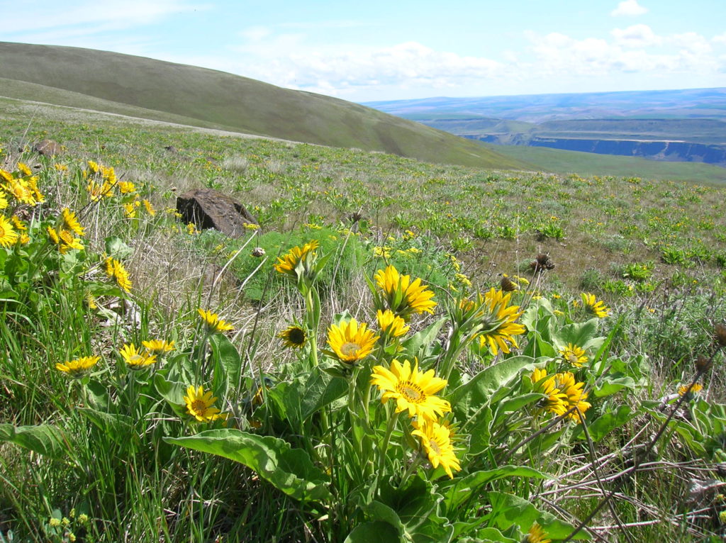
Quick Facts: Location: Columbia River Gorge National Scenic Area Land Agency: Washington Department of Natural Resources Roundtrip: 5.0 miles Elevation Gain: 1,150 feet Contact: Washington DNR Southeast Region Notes: Discover Pass required; Dogs prohibited; Practice Leave No Trace Principles Recommended Resource: Day Hiking Columbia River Gorge Green trails Map: Columbia River Gorge West No. 432S Good…
Read MoreSteigerwald Lake National Wildlife Refuge─Gorge on some excellent bird watching

Quick Facts Location: Columbia River Gorge National Scenic Area Land Agency: US Fish and Wildlife Roundtrip: 2.8 miles Elevation Gain: none Contact: www.fws.gov/ridgefieldrefuges/steigerwaldlake Green Trails Map: Columbia River Gorge West No. 428S Notes: Dogs prohibited; section of trail closed from Oct 1—Apr 30 for wildlife protection. Access: From Vancouver head east on SR 14 for…
Read More