Fire Lookouts
Lookout Tree Trail — Snag a glimpse into the past
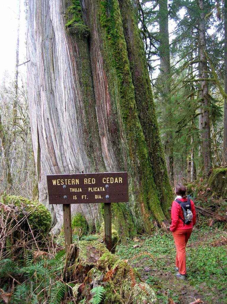
Quick Facts: Location: Mountain Loop Highway Land Agency: Mount Baker-Snoqualmie National Forest Roundtrip: 1.5 mile Elevation gain: 200 feet Green Trails Map: Mountain Loop Highway 111SX Contact: Darrington Ranger District: Mount Baker Snoqualmie National Forest Notes: No passes needed Access: From Darrington, follow Mountain Loop Highway for 11.3 miles to unmarked trailhead located on your…
Read MoreHidden Lake Lookout
Savor stunning views from an historic fire lookout teetering on a lofty precipitous knoll Quick Facts: Location: Cascade River Road Land Agency: Mount Baker-Snoqualmie National Forest Roundtrip: 9.0 miles Elevation Gain: 3,340 feet Green Trails Maps: Diablo, WA-No. 48; Cascade Pass, WA-No. 80 Access: From Marblemount, head east on the Cascade River Road for 9.7…
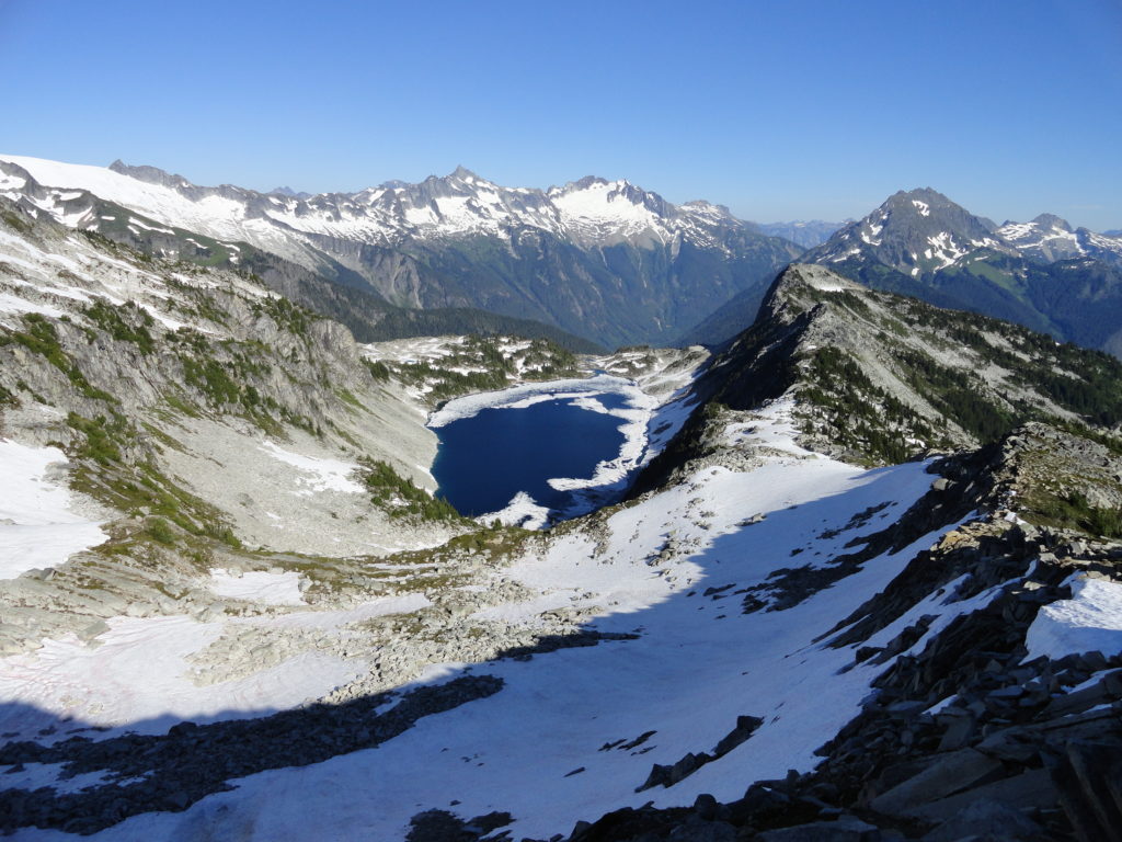
Read MoreGreen Mountain –Banal is thy name—Breathtakingly beautiful is thy game
Quick Facts: Location: Glacier Peak Wilderness, Suiattle River Road Land Agency: Mount Baker-Snoqualmie National Forest Roundtrip: 8.0 miles Elevation gain: 3,100 feet Green Trails Maps: North Cascades Ross Lake 16SX Contact: Darrington Ranger District: Mount Baker-Snoqualmie National Forest Notes: wilderness rules apply Access: From Darrington, travel north on SR 530 for 7.5 miles turning right…
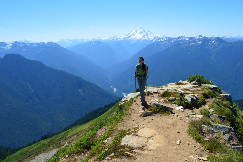
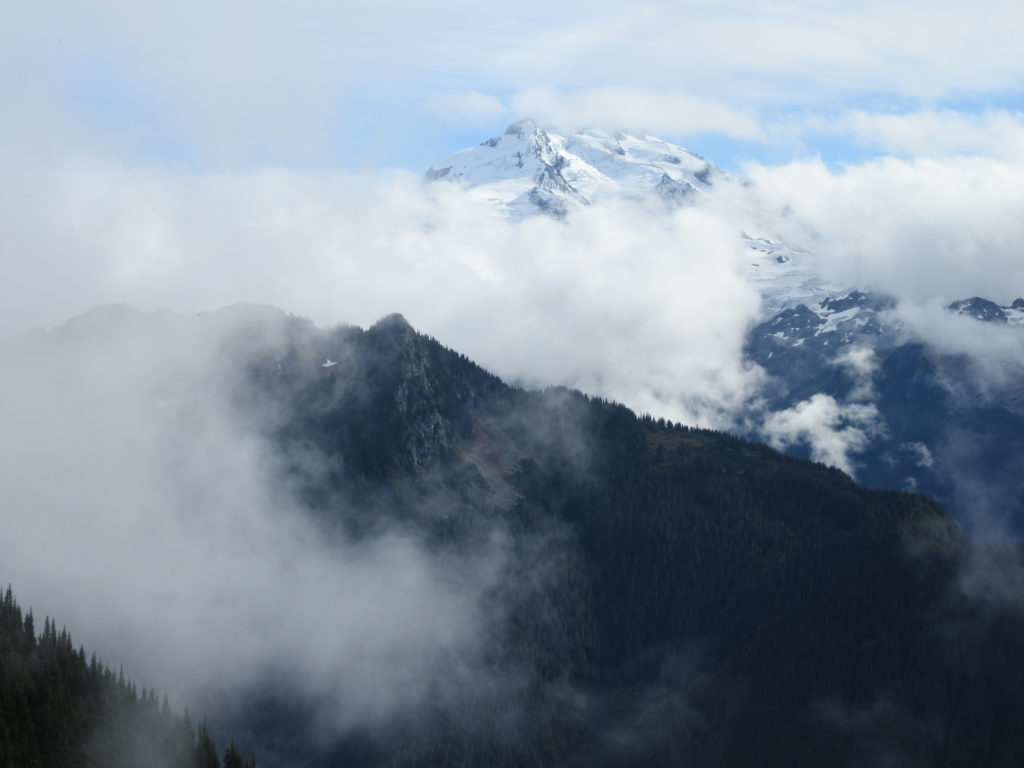
Read MoreHigh Rock– The view of Rainier simply rocks from this precipitous peak!
Quick Facts: Location: Sawtooth Ridge near Ashford and Packwood, WA Land Agency: Gifford Pinchot National Forest Roundtrip: 3.2 miles Elevation gain: 1,350 feet Green Trails Maps: Randle, WA no. 301 Contact: Cowlitz Valley Ranger Station (Randle); Gifford Pinchot National Forest Notes: Dogs are allowed, but should be on leash because of steep and dangerous drop offs.…
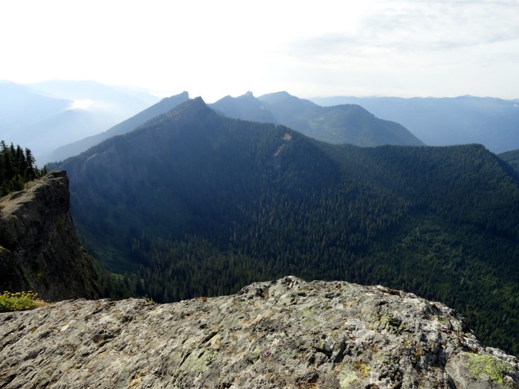
Read MoreCrystal Peak
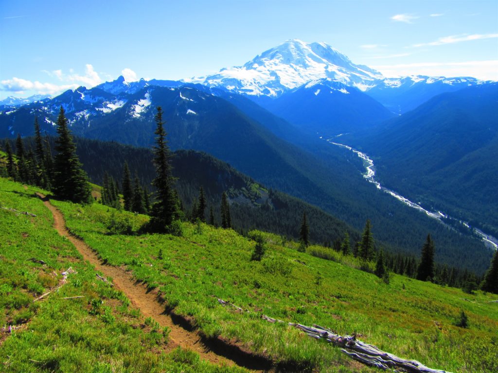
Old fire lookout site grants some of the best views in Mount Rainier NP Quick Facts: Location: Mount Rainier National Park Land Agency: National Park Service Distance: 7.8 miles Elevation Gain: 3,400 feet Contact: Mount Rainier National Park Map: Green Trails Mount Rainier National Park 269SX Notes: National Park Entrance Fee or Interagency Pass, Dogs-prohibited…
Read MoreSun Top — snowshoe to a historic lookout in the shadows of Mount Rainier
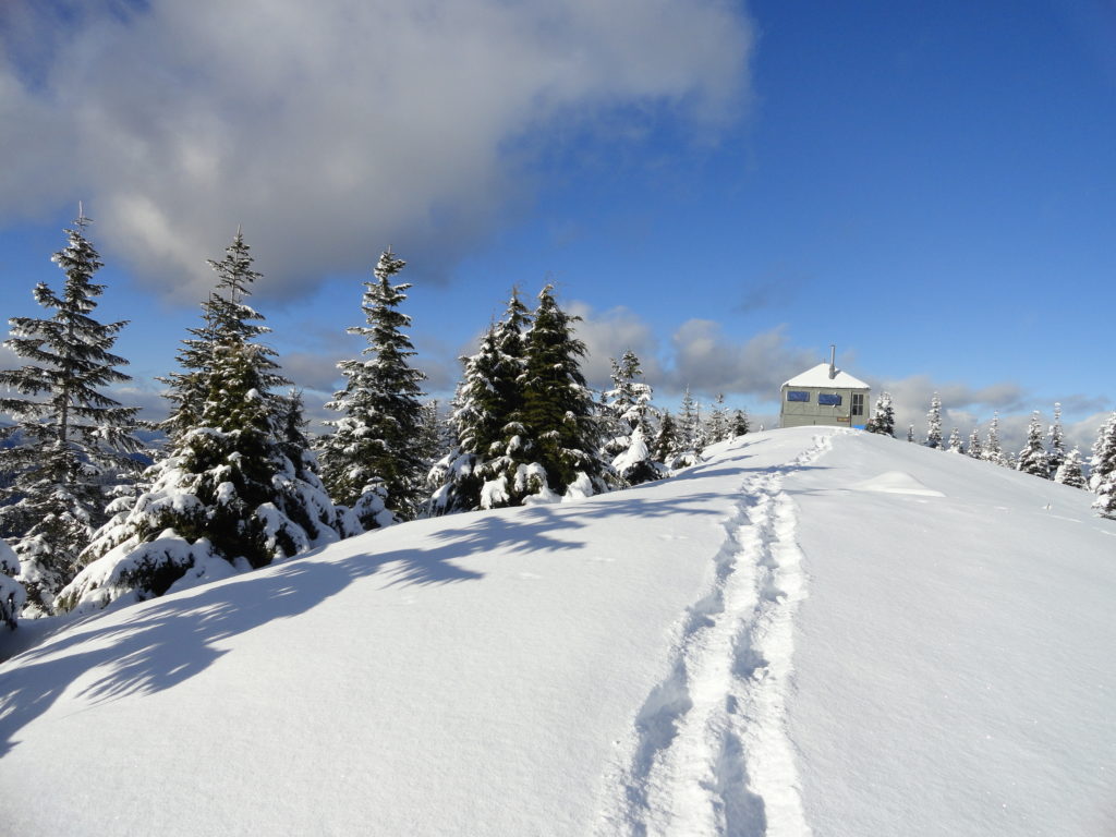
Quick Facts: Location: White River Valley Land Agency: Mount Baker-Snoqualmie National Forest Roundtrip: 11.0 miles Elevation gain: 3,050 feet Contact: Mount Baker-Snoqualmie National Forest Green Trails Map: Green Trails Maps – Greenwater no. 238 Notes: Sno-park Pass required. Route is non-groomed and shared with skiers (do not snowshoe on groomed ski trail). Beyond the upper…
Read MoreThorp Mountain–Historic Lookout on Kachess Ridge
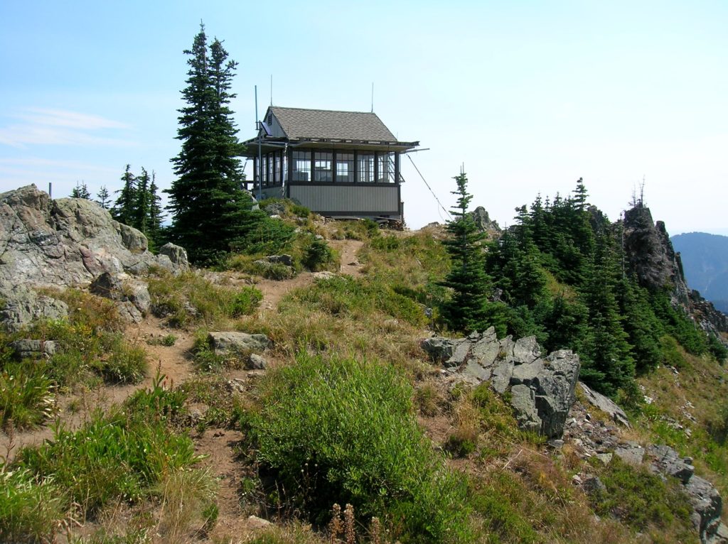
Location: Cle Elum River Valley near Salmon La Sac Land Agency: Okanogan-Wenatchee National Forest Roundtrip: 5.0 miles High Point: 5,854 feet Elevation gain: 1,700 feet Difficulty: moderate Green Trails Map: Kachess Lake – No. 208 Contact: Cle Elum Ranger District: Okanogan-Wenatchee National Forest (509) 852-1100 Note: FR 4308-120 is rough and brushy in spots. High…
Read MoreKloshe Nanitch
Stand watch over the Sol Duc Valley Quick Facts: Location: North Olympic Peninsula-Sol Duc Valley; Land Agency: Olympic National Forest; Roundtrip: 6.4 miles; Elevation gain: 2,400 feet; Contact: Olympic National Forest, Pacific District North, Forks; Notes: Discover Pass Required; Recommended Guidebook: Day Hiking Olympic Peninsula (2nd edition) Good to Know: Dog-friendly, Trail Less Traveled, Historic…
Read MoreBlue Lake and Johnson Mountain–divine ridge walking

Quick Facts: Location: Mountain Loop Highway near Darrington Land Agency: Mount Baker-Snoqualmie National Forest Roundtrip: 28.3 miles Elevation Gain: 6,725 feet Green Trails Maps: Mountain Loop Highway 111SX Recommended Guidebook: Backpacking Washington (Romano; Mountaineers Books) Access: From Darrington, head south on the Mountain Loop Highway 16.0 miles turning left onto FR 49. Follow for 6.4 miles bearing…
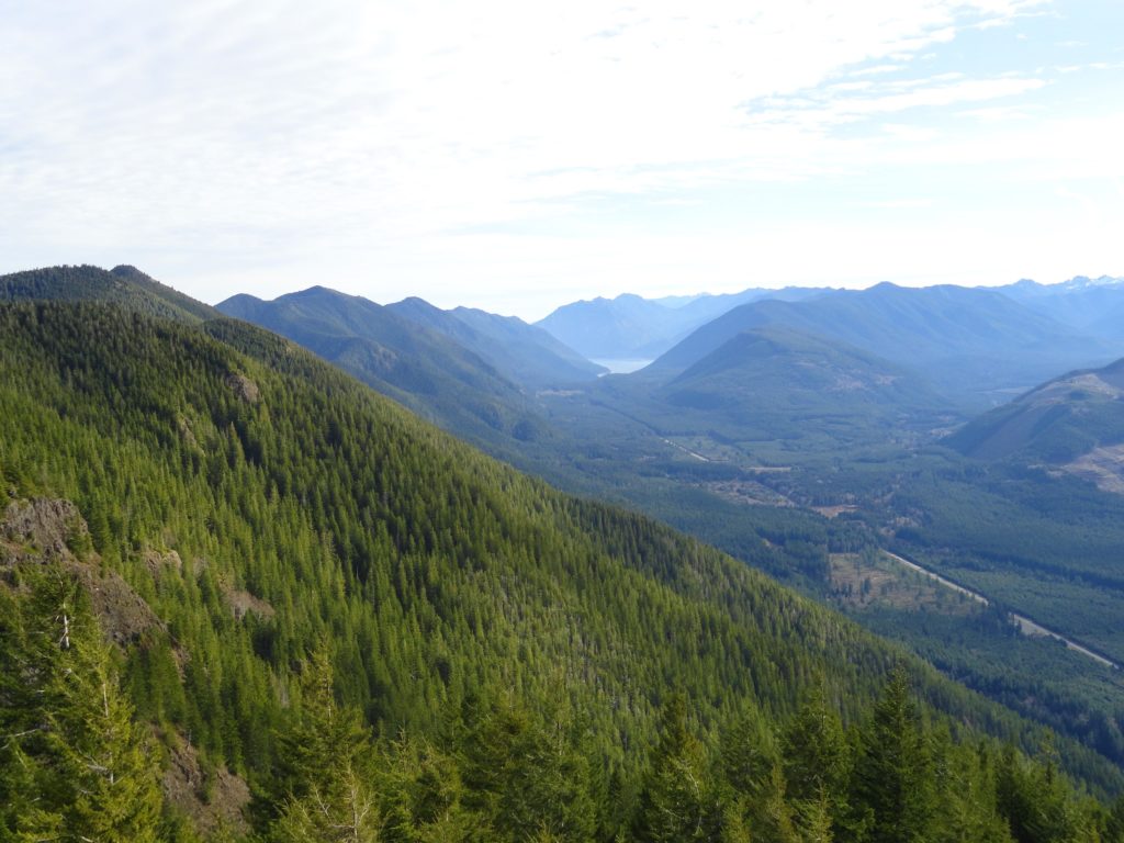
Read MoreSulphur Mountain –Savor Sweet Suiattle Valley Views
Quick Facts: Location: Suiattle River Road Land Agency: Mount Baker-Snoqualmie National Forest Roundtrip: 10.0 miles Elevation gain: 4,600 feet Green Trails Maps: Mountain Loop Highway Map 111SX Contact: Darrington Ranger District: Mount Baker-Snoqualmie National Forest Notes: Northwest Forest Pass or interagency pass required Access: From Darrington, travel north on SR 530 for 7.5 miles turning…
Read More