Fire Lookouts
Mount Walker–excellent views at the eastern edge of the Olympic Mountains
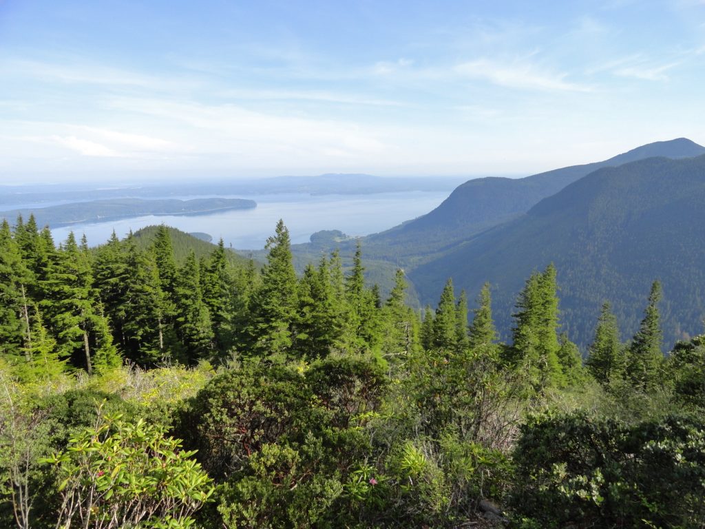
Quick Facts: Location: Northeast Olympic Peninsula Land Agency: Olympic National Forest Roundtrip: 5.0 miles Elevation gain: 2050 feet Contact: Hood Canal Ranger District Green Trails Map: Olympics East no. 168S Notes: In winter the road is gated. Park away from gate and walk .3 mile to trailhead. Recommended Guidebook: Day Hiking Olympic Peninsula 2nd edition (Mountaineers…
Read MoreLookout Mountain — Look out to Mount Hood and beyond
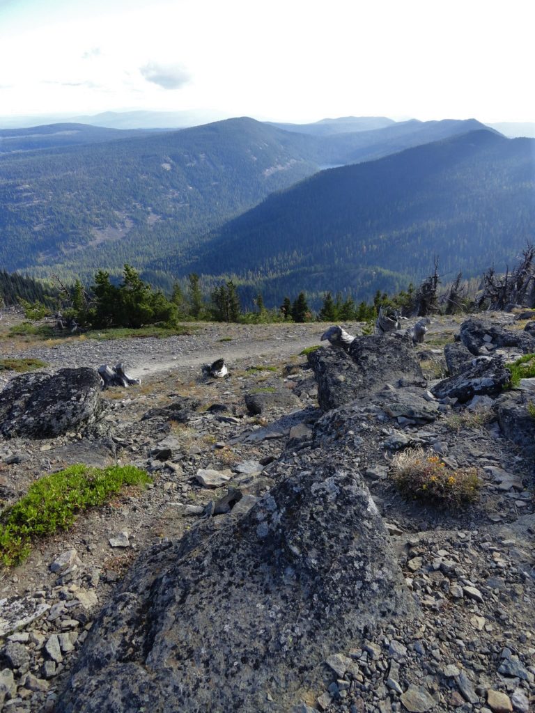
Quick Facts: Location: Badger Creek Wilderness Land Agency: National Forest Service Roundtrip: 2.5 miles Elevation Gain: 550 feet Contact: Barlow Ranger District Mount Hood National Forest Notes: Northwest Trail Pass or interagency pass required Green Trails Map: Mount Hood Climbing / Timberline Trail no. 462SX Access: From Portland: Follow I-84 east to Exit 64 in Hood River. Then…
Read MoreMount Fremont–Lookout among herds of mountain goats
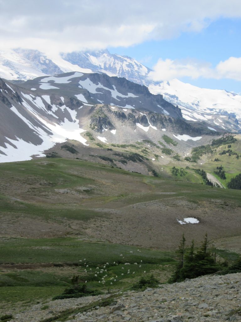
Quick Facts: Location: Mount Rainier National Park Land Agency: National Park Service Round Trip: 5.4 miles Elevation Gain: 900 feet Contact: Mount Rainier National Park Green Trails Maps: Mount Rainier National Park 269S Notes: National Park Entrance Fee or Interagency Pass; Dogs-prohibited Access: From Enumclaw follow SR 410 east for 37.5 miles to Mount Rainier National…
Read MoreSourdough Mountain Lookout–Trail is 5.5 miles long and one mile straight up!
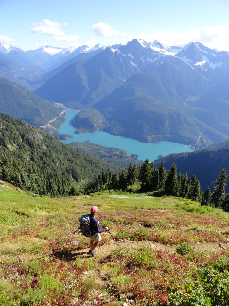
Quick Facts: Location: North Cascades Highway Land Agency: North Cascades National Park Roundtrip: 11.0 miles Elevation Gain: 5,100 feet Green Trails Maps: Diablo, WA-No. 48 Access: From Marblemount, follow the North Cascades Highway (SR 20) east for 20 miles. Turn left onto Diablo Road and proceed 0.7 mile crossing an iron bridge spanning Stetattle Creek. Bear right reaching the trailhead in…
Read More