Hike of the Week
Windy Pass
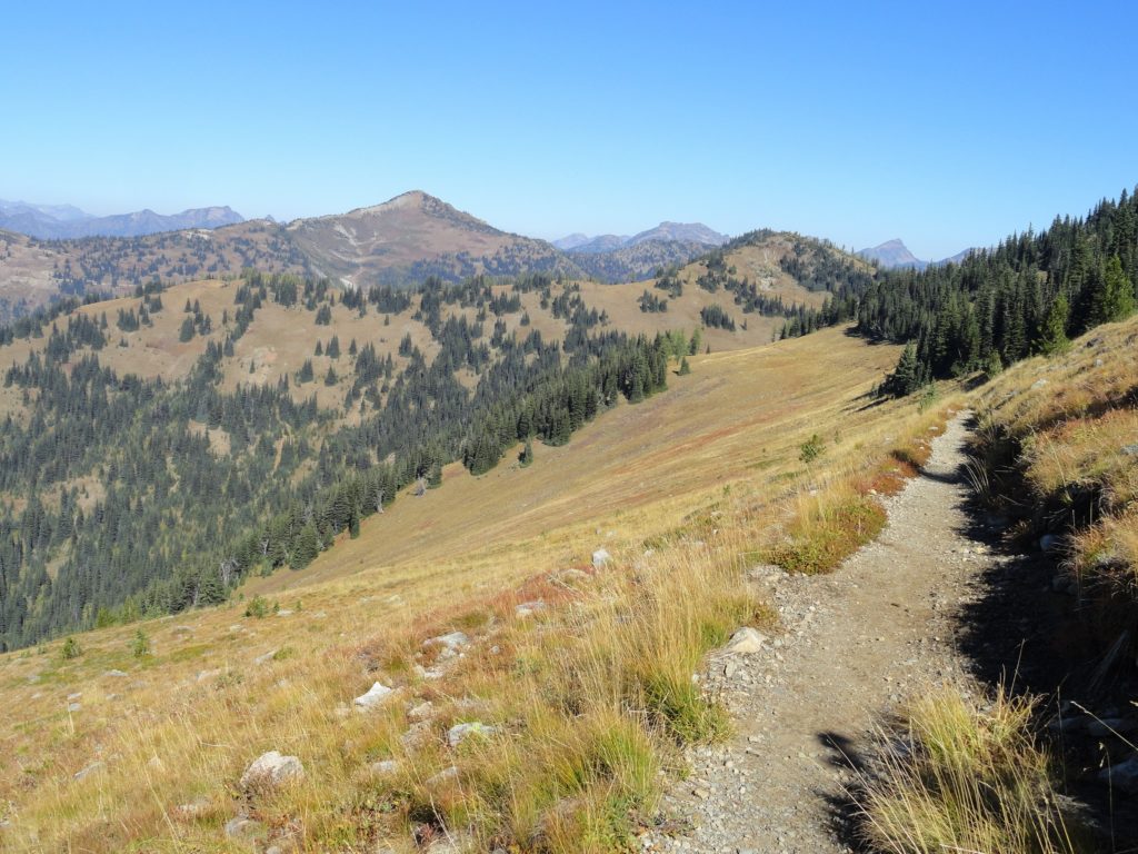
Easy wanderings high on the Pacific Crest Trail Quick Facts: Location: Harts Pass area Land Agency: National Forest Service Distance: 7.6 miles Elevation Gain: 900 feet Contact: Okanogan-Wenatchee National Forest, Methow Valley Ranger District Map: Green Trails Methow Valley Pasayten Wilderness 51SX Notes: Northwest Trail Pass or Interagency pass required Access: From Winthrop, drive State…
Read MoreCrystal Peak
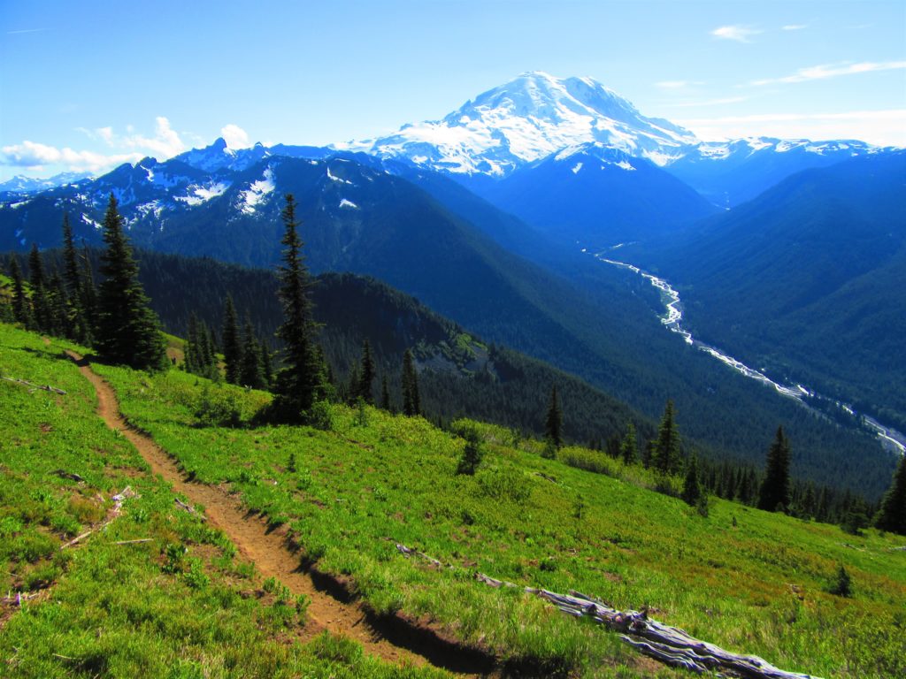
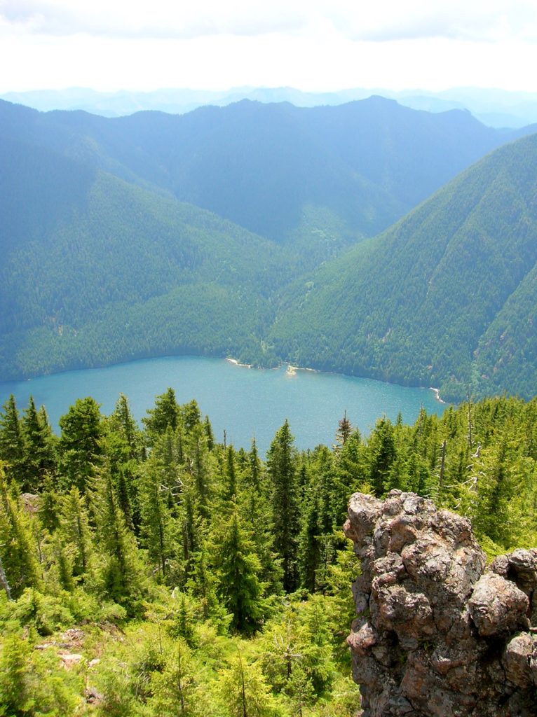
Old fire lookout site grants some of the best views in Mount Rainier NP Quick Facts: Location: Mount Rainier National Park Land Agency: National Park Service Distance: 7.8 miles Elevation Gain: 3,400 feet Contact: Mount Rainier National Park Map: Green Trails Mount Rainier National Park 269SX Notes: National Park Entrance Fee or Interagency Pass, Dogs-prohibited…
Read MoreScott Paul Trail
Loop on high slopes on Mount Baker Quick Facts: Location: Mount Baker National Recreation Area Land Agency: National Forest Service Distance: 8.0 mile loop Elevation Gain: 2000 feet Contact: Mount Baker–Snoqualmie National Forest, Mount Baker Ranger District Map: Green Trails Mount Baker Wilderness no. 13S Notes: Northwest Trail Pass or interagency pass required May 1-Oct…
Read MoreTwin Lakes—The fishing is good, but only if you’re an osprey!
Quick Facts: Location: Lake Wenatchee Area Land Agency: Okanogan-Wenatchee National Forest Roundtrip: 6.8 miles Elevation Gain: 1,200 feet Green Trails Map: Wenatchee Lake- No. 145 Contact: Wenatchee River Ranger District (Leavenworth) Notes: Northwest Forest Pass or Interagency Pass required; wilderness rules apply Access: From Everett head east on US 2 to Coles Corner. Turn left (north)…
Read MoreMount Rose–How sweet are thy views!
Quick Facts: Location:Mount Skokomish Wilderness, Southeast Olympic Peninsula Land Agency: Olympic National Forest Roundtrip: 6.7 miles Elevation gain: 3,500 feet Green Trails Maps: Olympic Mountains East No. 168SX Contact: Hood Canal District, Quilcene Notes: Wilderness regulations apply Access: From Shelton, travel north on US 101 for 15 miles to Hoodsport. Turn left onto SR 119…
Read MoreMarten Creek─Overlooked trail off the Mountain Loop Highway offers plenty of solitude
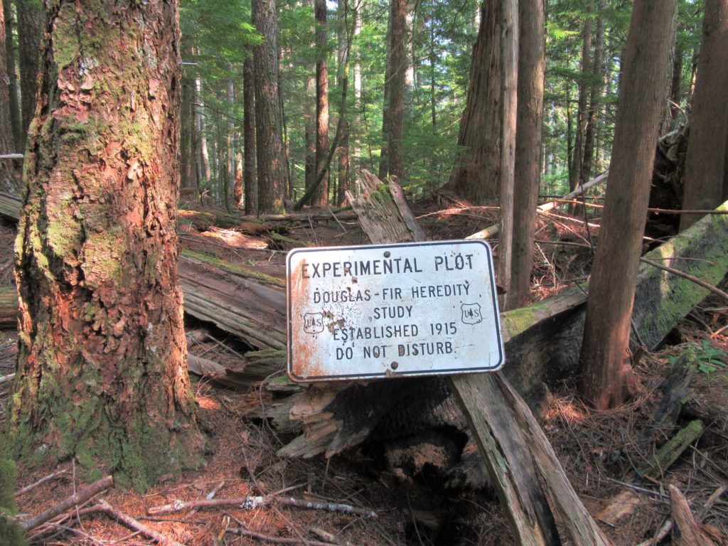
Quick Facts Location: Boulder River Wilderness, Mountain Loop Highway near Granite Falls Land Agency: Mount Baker-Snoqualmie National Forest Roundtrip: 5.2 miles Elevation Gain: 1,300 feet Green Trails Map: Mountain Loop Highway WA- No. 111SX Recommended Guidebook: Day Hiking North Cascades 2nd edition (Mountaineers Books) Access: From Granite Falls follow the Mountain Loop Highway east for…
Read MoreLookout Mountain
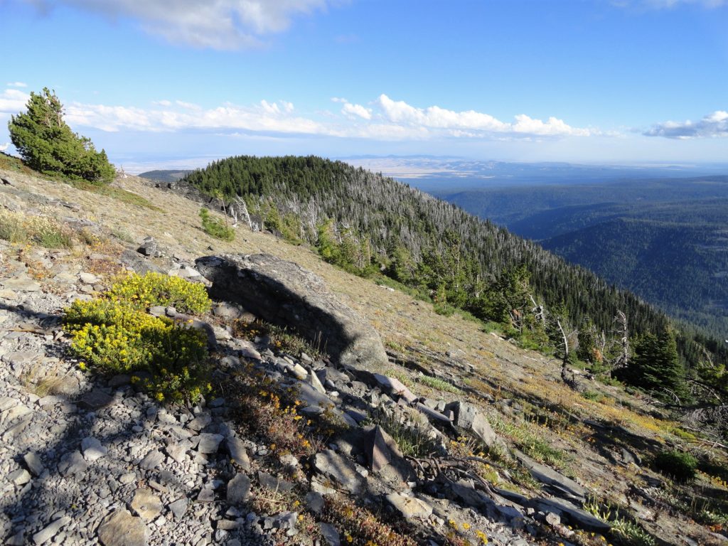
Flowers and sweeping views from highest point in the Badger Creek Wilderness Quick Facts: Location: Badger Creek Wilderness Land Agency: Mount Hood National Forest Distance: 2.5 miles roundtrip Elevation Gain: 550 feet Contact: Barlow Ranger District, Mount Hood National Forest Map: Green Trails Mount Hood Wilderness 462SX Notes: Northwest Trail Pass or interagency pass required…
Read MoreSlab Camp Trail
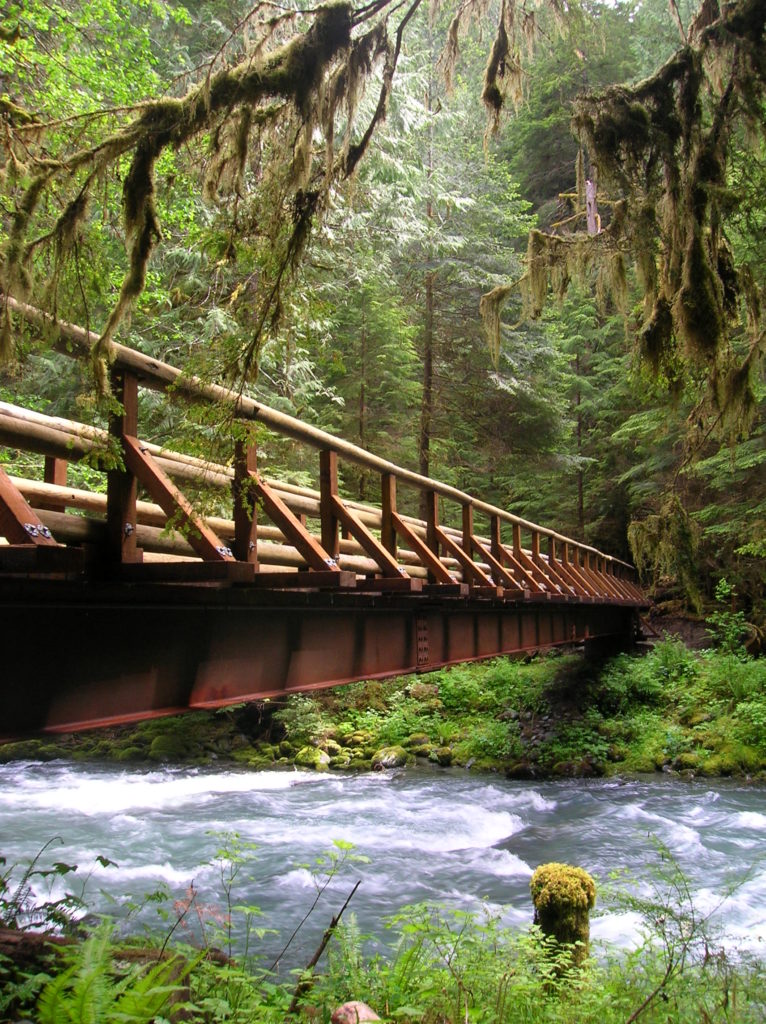
Quick Facts: Location: Buckhorn Wilderness Land Agency: Olympic National Forest Roundtrip: 5.6 miles Elevation Gain: 1,100 feet Green Trails Map: Olympic Mountains East 168SX Recommended Guidebook: Day Hiking Olympic Peninsula 2nd edition (Mountaineers Books) Contact: Hood Canal District, Quilcene Olympic National Forest Access: From Sequim, head west 2.5 miles on US 101 turning left onto…
Read MoreBells Mountain Trail
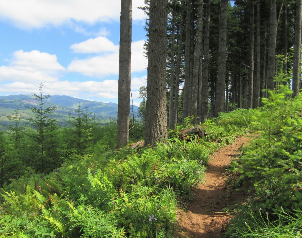
Yacolt Burn Forest Trail rings out to be explored Quick Facts: Location: Clark County Land Agency: Washington Department of Natural Resources Distance: 9.5 miles one way Elevation Gain: up to 2200 Contact: Pacific Cascade Region, Washington Department of Natural Resources Detailed Information: Urban Trails Vancouver WA (Mountaineers Books) Notes: Discover Pass required at all trailheads…
Read MoreEvans Creek Preserve
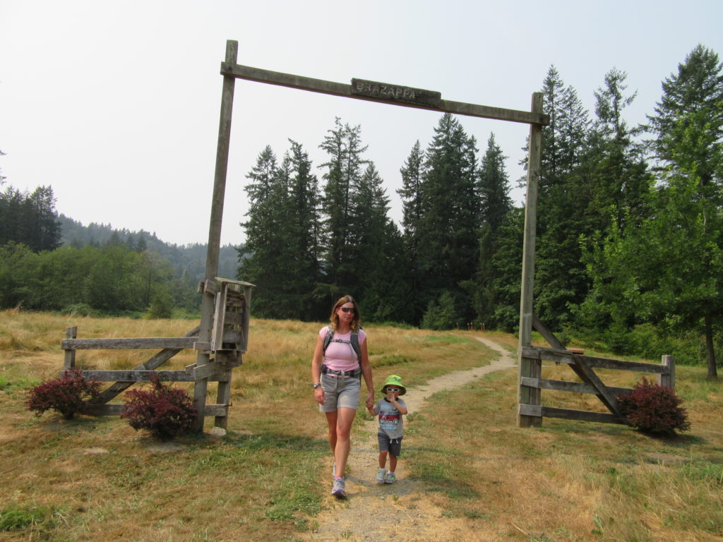
A glimpse of the Eastside pre-Microsoft Quick Facts: Location: Sammamish Land Agency: Sammamish Parks and Recreation Distance: 3.5 miles of trails Elevation Gain: up to 475 feet Contact: Sammamish Parks and Recreation Detailed Information: Urban Trails Eastside (Mountaineers Books) Notes: Dogs permitted on leash Access: From Redmond Head east on SR 202 for 4.0 miles…
Read More