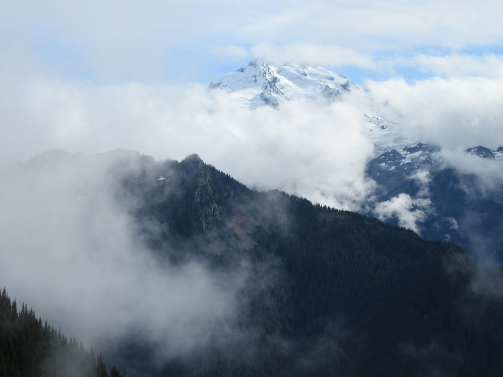
North Cascades
Blue Lake and Johnson Mountain–divine ridge walking

Quick Facts: Location: Mountain Loop Highway near Darrington Land Agency: Mount Baker-Snoqualmie National Forest Roundtrip: 28.3 miles Elevation Gain: 6,725 feet Green Trails Maps: Mountain Loop Highway 111SX Recommended Guidebook: Backpacking Washington (Romano; Mountaineers Books) Access: From Darrington, head south on the Mountain Loop Highway 16.0 miles turning left onto FR 49. Follow for 6.4 miles bearing…
Read MoreSulphur Mountain –Savor Sweet Suiattle Valley Views
Quick Facts: Location: Suiattle River Road Land Agency: Mount Baker-Snoqualmie National Forest Roundtrip: 10.0 miles Elevation gain: 4,600 feet Green Trails Maps: Mountain Loop Highway Map 111SX Contact: Darrington Ranger District: Mount Baker-Snoqualmie National Forest Notes: Northwest Forest Pass or interagency pass required Access: From Darrington, travel north on SR 530 for 7.5 miles turning…
Read MoreMeadow Lake- serene subalpine lake above the Suiattle and White Chuck rivers
Quick Facts: Location: White Chuck River Valley, Mountain Loop Highway Land Agency: Mount Baker-Snoqualmie National Forest Service Roundtrip: 16.0 miles Elevation Gain: 2,900 feet Green Trails Map: Mountain Loop Highway 111SX Access: Take Exit 208 off of I-5 following SR 530 east for 32 miles to Darrington. Then head south on the Mountain Loop Highway proceeding 9.0…
Read MoreTiffany Mountain — Enjoy horizon-spanning views at the edge of the North Cascades

Quick Facts: Location: Northeastern Cascades Land Agency: Okanogan-Wenatchee National Forest Roundtrip: 5.0 miles Elevation Gain: 1,700 feet Green Trails Map: Green Trails, Tiffany Mountain, WA- No. 53 Contact: Tonasket Ranger District, Okanogan-Wenatchee National ForestAccess: From Burlington follow SR 20 east to Winthrop. Then continue north on East Chewuch River Road for 6.5 miles and turn right onto FR…
Read MoreDowney Creek — portal to famous Ptarmigan Traverse

Quick Facts: Location: Suiattle River Road Land Agency: Mount Baker-Snoqualmie National Forest Roundtrip: 13.6 miles Elevation gain: 1500 feet Green Trails Maps: Mountain Loop Highway Map 111SX Contact: Darrington Ranger District: Mount Baker-Snoqualmie National Forest Notes: Northwest Forest Pass or interagency pass required Access: From Darrington travel north on SR 530 for 7.5 miles turning…
Read MoreDriveway Butte– Give your calves a workout hiking this steep old cattle drive
Quick Facts: Location: Methow Valley Land Agency: Okanogan-Wenatchee National Forest Round Trip: 8.6 miles Elevation Gain: 3000 feet Contact: Okanogan-Wenatchee National Forest Green Trails Map: Green Trails Washington Pass No. 50 Recommended Guidebook: Day Hiking North Cascades 2nd Edition Notes: Northwest Forest Pass or Interagency Pass required Access: From Marblemount follow State Route 20 east…
Read MorePatterson Mountain — Bitterroot and Balsamroot and a bevy of other blossoms
Quick Facts: Location: Methow Valley Land Agency: WA Department of Natural Resources Roundtrip: 3.7 miles Elevation Gain: 1,100 feet Contact: WA Department of Natural Resources Green Trails Map: Sun Mountain, WA- No.83S Notes: Discover Pass Required Access: From Winthrop head east on SR 20 for .6 mile immediately turning right onto Twin lakes Road. Follow for 3.0 miles turning right…
Read MoreKelcema Lake-Satisfying snowshoe trip to ancient forest flanked subalpine lake
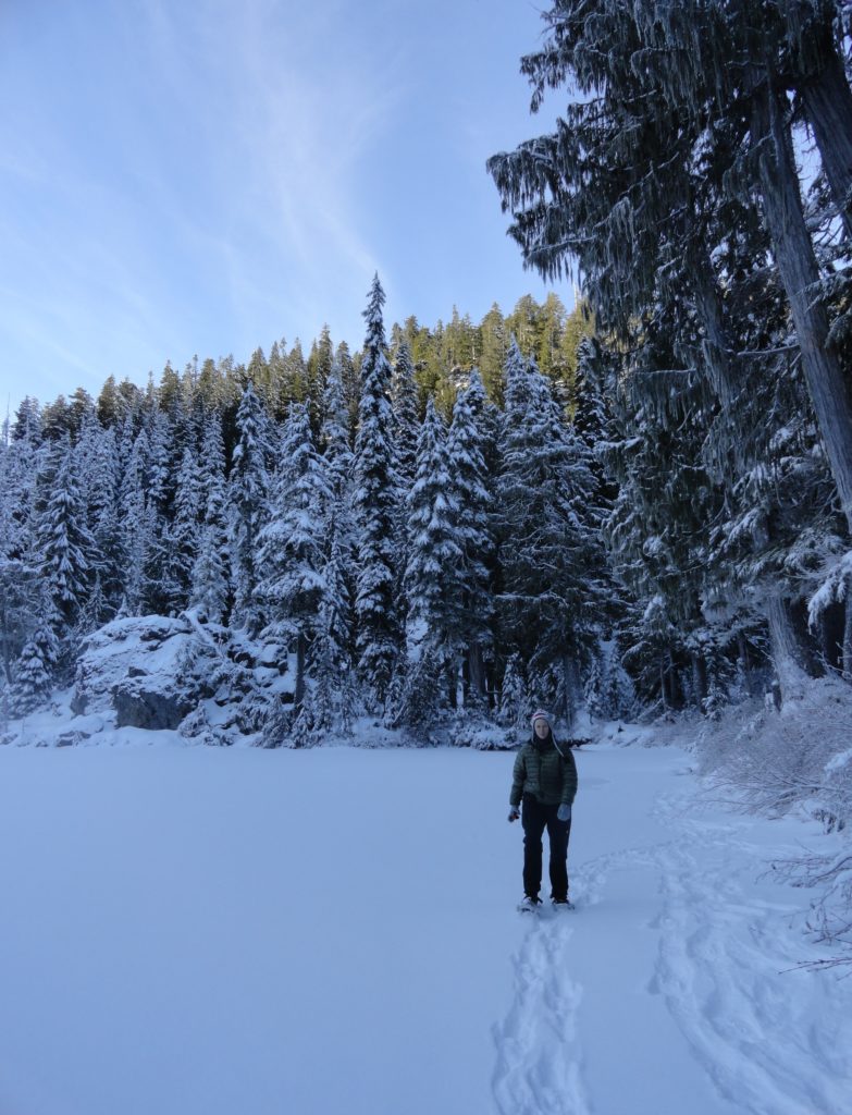
Quick Facts: Location: Mountain Loop Highway near Granite Falls Land Agency: Mount Baker-Snoqualmie National Forest Roundtrip: 9.6 miles Elevation gain: 1,600 feet Green Trails Map: Mountain Loop Highway 111SX Contact: Darrington Ranger District: Mount Baker Snoqualmie National Forest Access: From Granite Falls, follow the Mountain Loop Highway east for 23.5 miles to Deer Creek Parking…
Read MoreCutthroat Lakes– Hike to a set of beautiful tarns beneath Bald Mountain
Quick Facts: Location: Mountain Loop Highway Land Agency: Mount Baker-Snoqualmie National Forest; Washington Department of Natural Resources Roundtrip: 6.0 miles Elevation gain: 1,700 feet Green Trails Maps: Mountain Loop Highway 111SX Recommended Resource: Day Hiking North Cascades (Romano; Mountaineers Books) Contact: Darrington Ranger District: Mount Baker-Snoqualmie National Forest Notes: access road is narrow and parking is limited.…
Read MoreSunrise Lake─Golden larches brighten the shores of this alpine lake
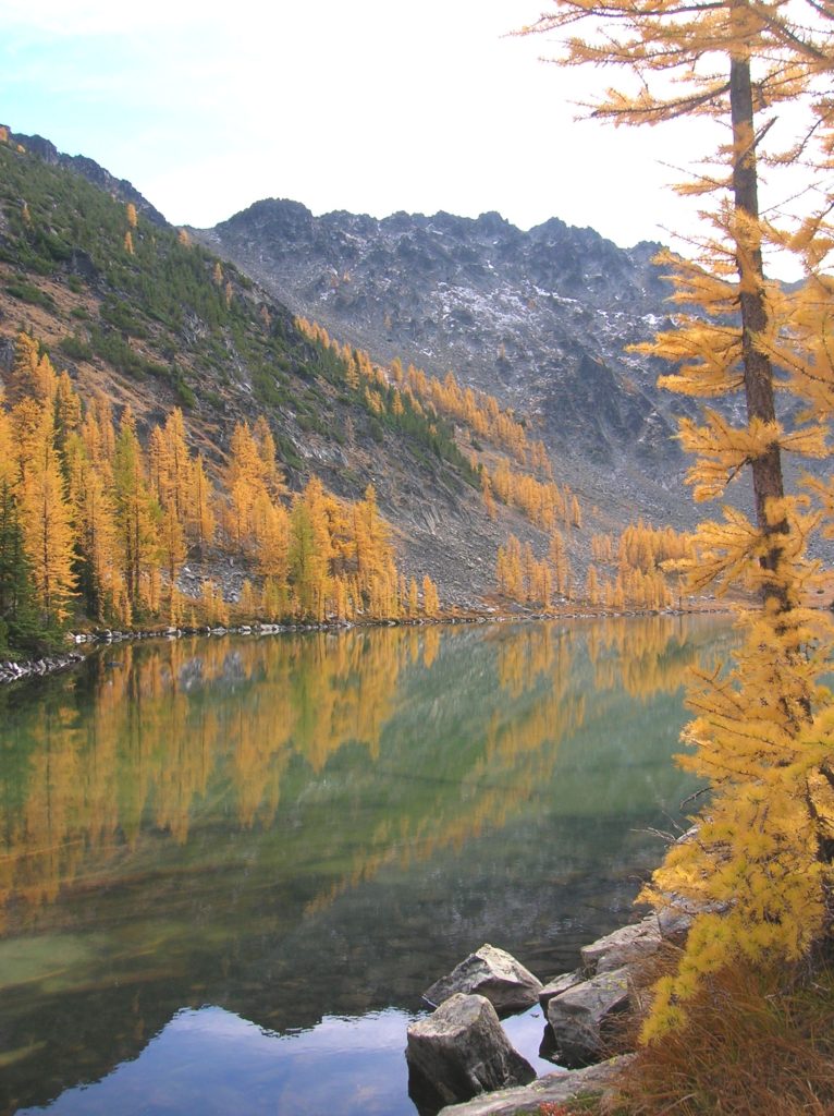
Quick Facts: Location: North Cascades – Sawtooth Ridge Land Agency: U.S. Forest Service Roundtrip: 13.0 miles Elevation Gain: 3,730 feet Green Trails Map: Prince Creek, WA- No. 115 Recommended Resource: Day Hiking North Cascades (Romano; Mountaineers Books) Access: From Twisp drive SR 20 east for 2.0 miles. Continue south on SR 153 for 12.0 miles turning right…
Read More