North Cascades
Frosty Mountain–Cool views and alpine larches, too!
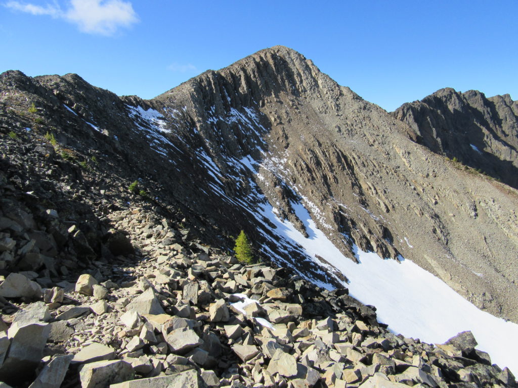
Quick Facts: Location: North Cascades, E.C. Manning Provincial Park Land Agency: BC Parks Roundtrip: 13.2 miles Elevation Gain: 3820 feet Contact: E.C. Manning Provincial Park Notes: Dogs permitted on leash. Practice Leave No Trace principles. Access: From Vancouver BC follow Trans-Canada Highway 1 east to Hope. Then continue east on BC 3 (Crowsnest Highway) for 37.5 miles and…
Read MoreMount Dickerman–arduous climb to sweeping alpine views
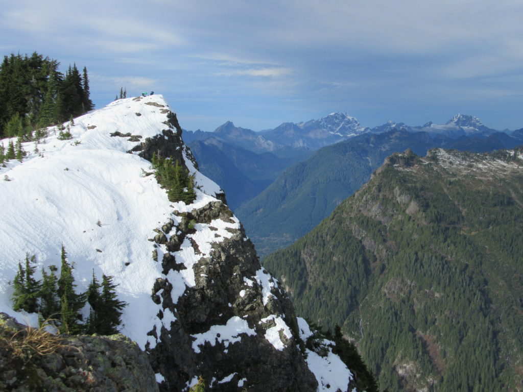
Quick Facts: Location: Mountain Loop Highway near Granite Falls Land Agency: Mount Baker-Snoqualmie National Forest Roundtrip: 8.6 miles High Point: 5,723 feet Elevation gain: 3,900 feet Difficulty: difficult Green Trails Map: Mountain Loop Highway No. 111SX Contact: Darrington Ranger District: Mount Baker Snoqualmie National Forest Notes: Northwest Forest Pass required Access: From Granite Falls follow…
Read MoreSkyline Divide — A mile high carpet of wildflowers
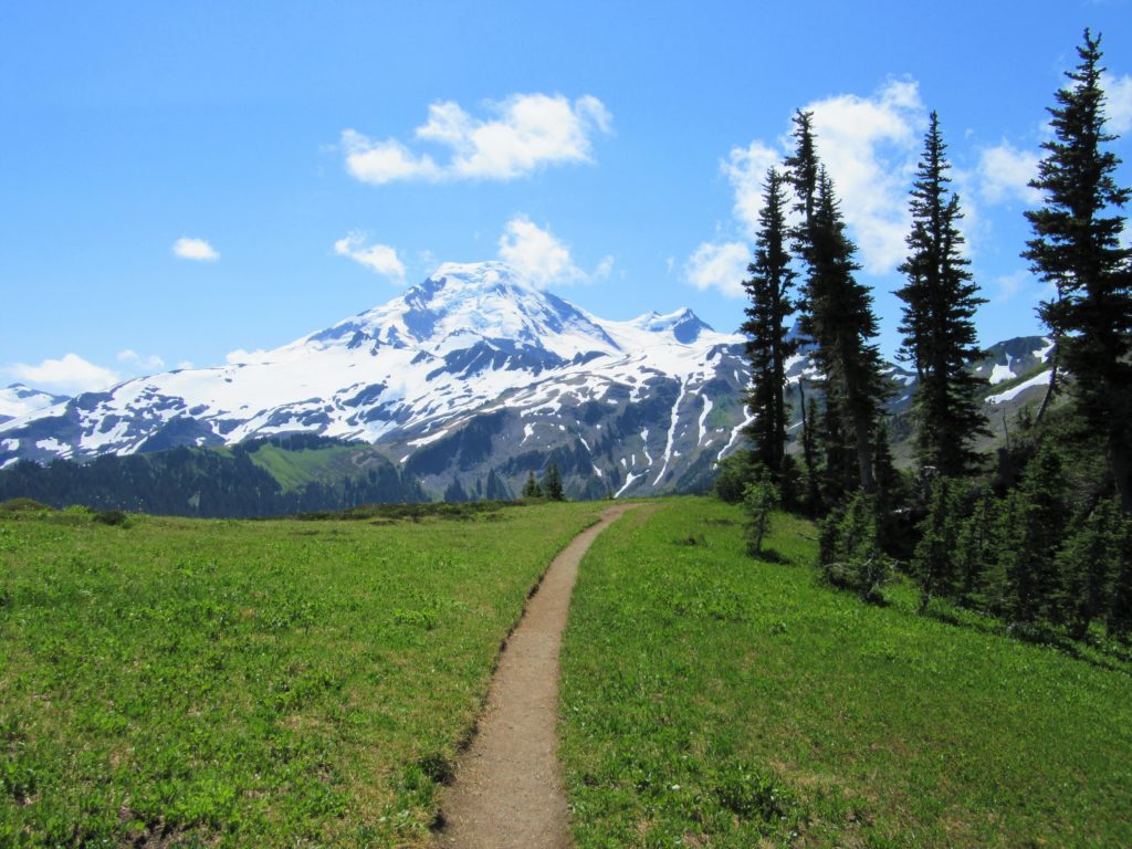
Quick Facts: Location: Mount Baker Highway, North Cascades Land Agency: National Forest Service Roundtrip: 9.0 miles Elevation gain: 2500 feet Difficulty: moderate Green Trails Map: Mount Baker Wilderness 13S Contact: Mount Baker Ranger District: Mount Baker -Snoqualmie National Forest Access: From Bellingham follow SR 542 (Mount Baker Highway) east for 35 miles turning right onto…
Read MorePinnacle Lake — Pretty little lake perched on a shoulder of Mount Pilchuck
Quick Facts: Location: Mountain Loop Highway, near Granite Falls Land Agency: Mount Baker-Snoqualmie National Forest; Washington State Parks Roundtrip: 4.2 miles Elevation gain: 1,100 feet Green Trails Maps: Mountain Loop Highway 111SX Contact: Darrington Ranger District: Mount Baker-Snoqualmie National Forest Notes: access road is rough, high clearance vehicles recommended. Access: From Granite Falls follow the…
Read MoreTwin Lakes (Monte Cristo) — Follow a rugged old miner’s path to a remote basin
Quick Facts: Location: Mountain Loop Highway near Barlow Pass Land Agency: Mount Baker-Snoqualmie National Forest Roundtrip: 17.0 miles Elevation gain: 3,900 feet Green Trails Map: Mountain Loop Highway no. 111SX Contact: Darrington Ranger District: Mount Baker Snoqualmie National Forest Notes: Northwest Forest Pass or Interagency Pass required; A washout at the Twin Bridges requires…
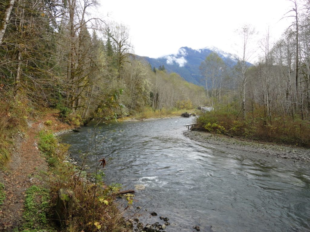
Read MoreBedal Basin–Lonesome and beautiful basin beneath awe-inspiring Sloan Peak
Location: Mountain Loop Highway Land Agency: Mount Baker-Snoqualmie National Forest Roundtrip: 5.2 miles High Point: 4,650 feet Elevation gain: 1,900 feet Difficulty: challenging Green Trails Maps: Mountain Loop Highway No. 111SX Contact: Darrington Ranger District: Mount Baker Snoqualmie National Forest Access: Take Exit 208 off of I-5 following SR 530 east for 32 miles to Darrington.…
Read MoreChokwich Trail─Chock full of solitude
Quick Facts: Location: Mountain Loop Highway near Darrington Land Agency: Mount Baker-Snoqualmie National Forest Roundtrip: 7.0 miles Elevation Gain: 900 feet Green Trails Map: Mountain Loop Highway no.111SX Note: NW Forest Pass required Access: From Granite Falls follow the Mountain Loop Highway east for 31 miles to Barlow Pass and end of pavement. Continue for 3.5 miles turning…
Read MoreLake Evan and Boardman Lake–Enjoy an easy hike to two family friendly lakes
Quick Facts: Location: Mountain Loop Highway near Granite Falls Land Agency: Mount Baker-Snoqualmie National Forest Roundtrip: 2.0 miles Elevation gain: 300 feet Difficulty: easy (with some rough footing) Green Trails Map: Mountain Loop Highway 111SX Contact: Darrington Ranger District: Mount Baker-Snoqualmie National Forest Access: From Granite Falls, follow the Mountain Loop Highway east to the Verlot…
Read MoreBeaver Lake — Trail holds a “slough” of surprises
Quick Facts: Location: Mountain Loop Highway Land Agency: Mount Baker-Snoqualmie National Forest Roundtrip: 3.8 miles Elevation gain: 100 feet Green Trails Map: Mountain Loop Highway 111SX Contact: Darrington Ranger District: Mount Baker Snoqualmie National Forest Notes: Northwest Forest Pass or Interagency Pass required Access: From Darrington, follow Mountain Loop Highway for 9.0 miles to trailhead…
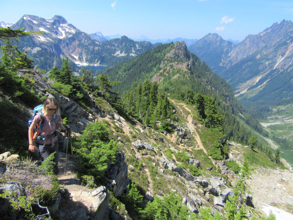
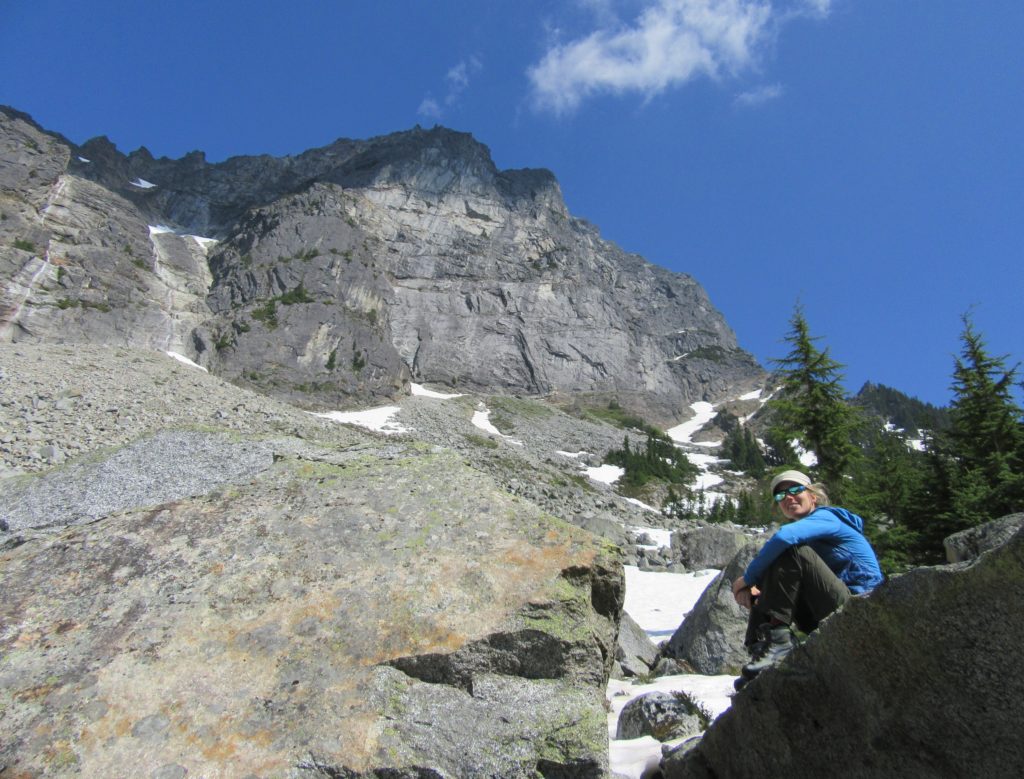
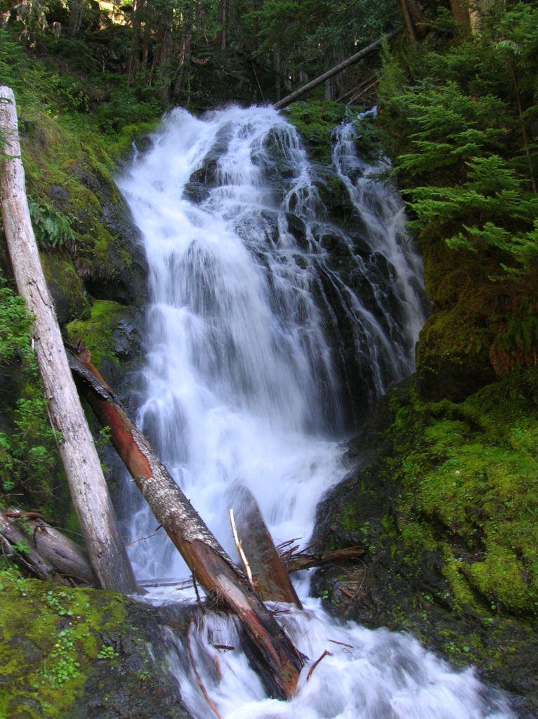
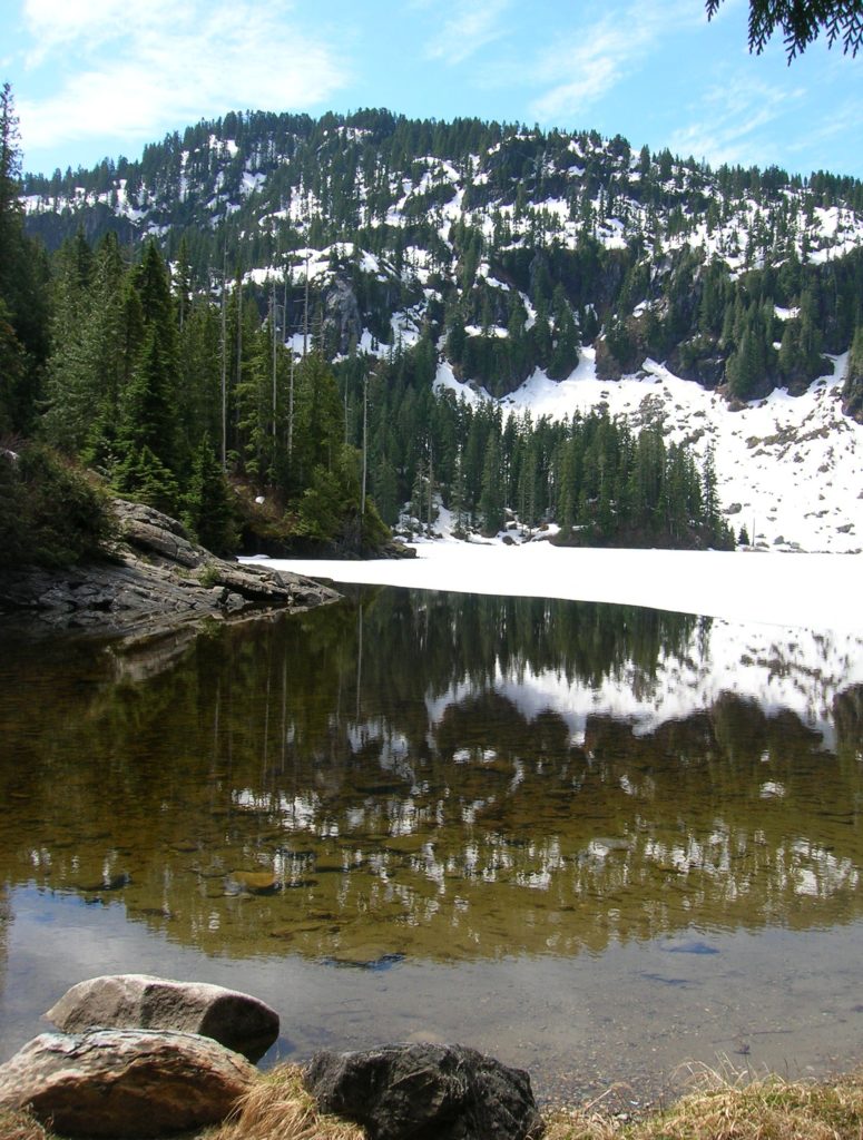
Read MoreScatter Lake — Golden larch lake high on 8,321-foot Abernathy Peak
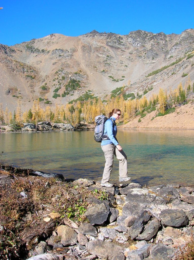
Quick Facts: Location: Twisp River Valley Land Agency: Okanogan-Wenatchee National Forest Roundtrip: 8.5 miles Elevation gain: 3,800 feet Green Trails Map: Stehekin, WA – No 82 Contact: Methow Valley Ranger District: Okanogan-Wenatchee National Forest Notes: NW Forest Pass or Interagency Pass required Access: From Twisp, follow Twisp River Road west for 21.8 miles to…
Read More