Puget Sound – Islands & Lowlands
Osprey Trails — Saunter through wildlife habitat along the Sultan River
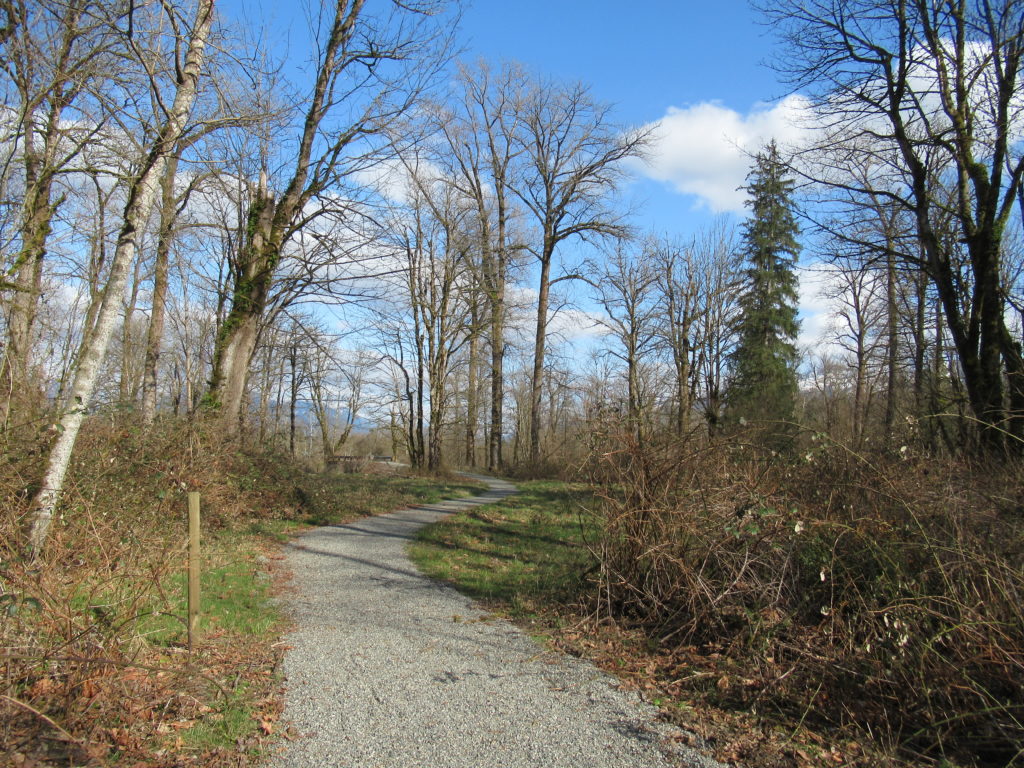
Quick Facts: Location: Sultan, Snohomish County Land Agency: City of Sultan Roundtrip: 2.0 miles Elevation Gain: level Access: From Everett, follow US 2 east to Sultan. Turn left onto 3rd Street and drive 0.6 mile north. Then turn left onto High Street and continue 0.1 mile to Osprey Park. Contact: City of Sultan Notes: Dogs permitted on leash Good to…
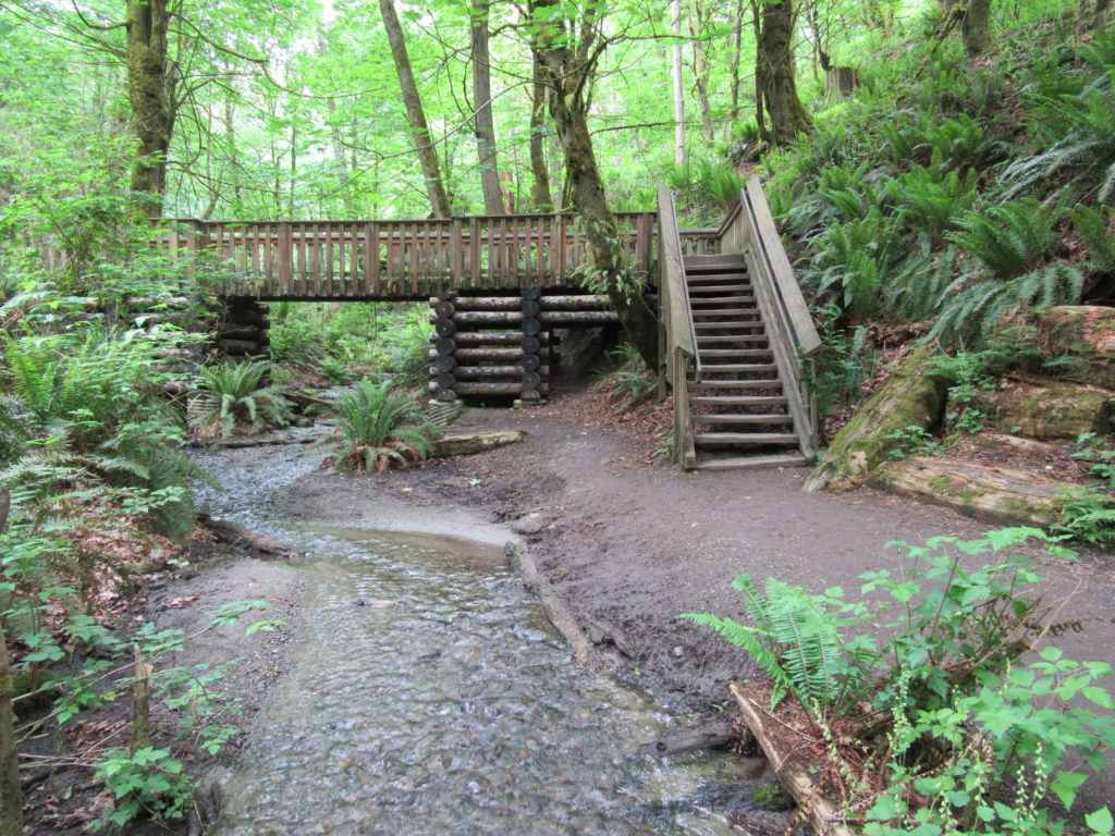
Read MoreCougar Mountain Wilderness Peak Loop
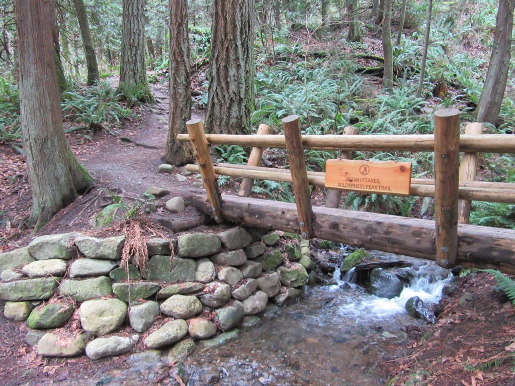
No views, but lots of big trees and pretty cascades Quick Facts: Location: Cougar Mountain Regional Wildland Park. Land Agency: King County Parks. Distance: 3.9 mile lollipop loop. Elevation Gain: 1200 feet. Contact: King County Parks. Green Trails Map: Cougar Mtn/ Squak Mtn No. 203S. Notes: dogs permitted on leash, Warning: car break-ins frequently occur…
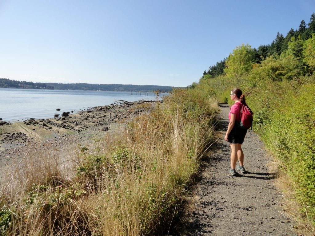
Read MoreFort Flagler Loop─Old defense post now protects undeveloped Puget Sound coastline
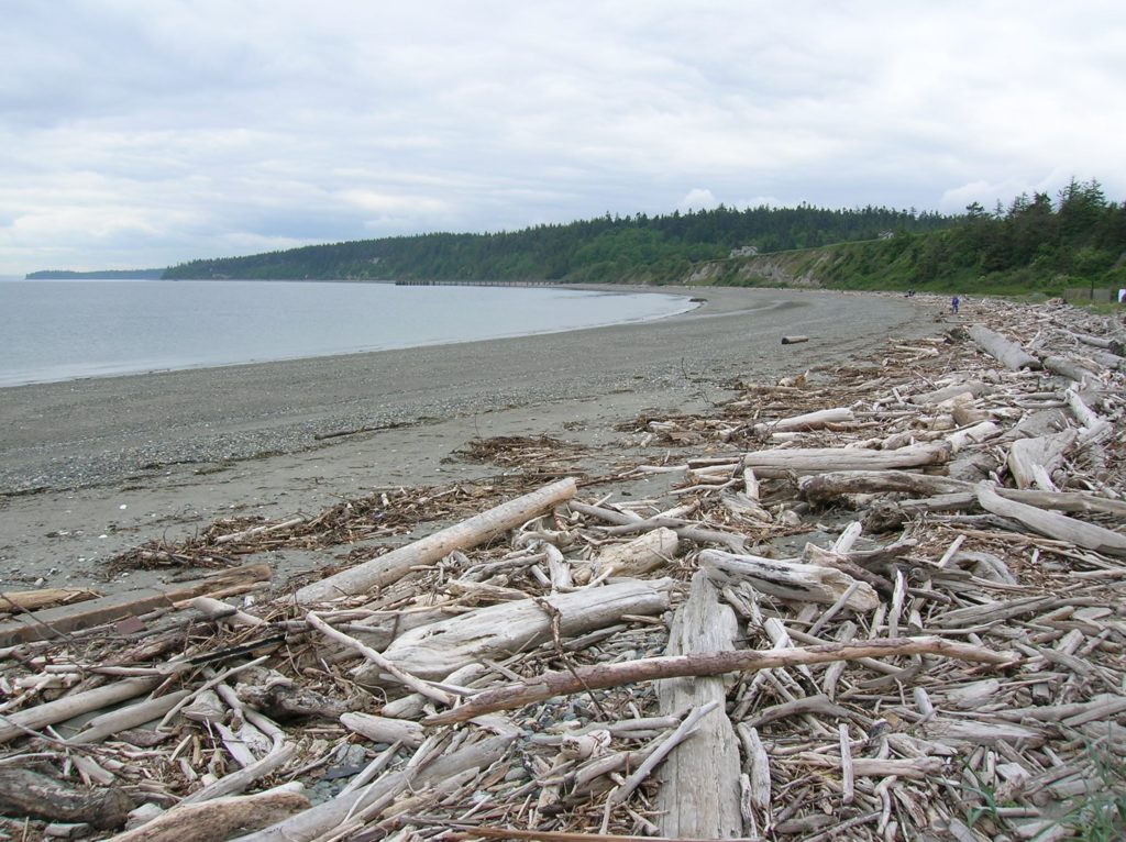
Quick Facts: Location: Marrowstone Island Land Agency: Washington State Parks Contact: Fort Flagler State Park Roundtrip: 5.6 miles Elevation Gain: 200 feet Access: From Kingston Ferry Terminal, follow SR 104 west for 15 miles turning right onto SR 19. Continue north for 9 miles to Chimicum turning right onto Irondale Road and proceeding 1.6 miles…
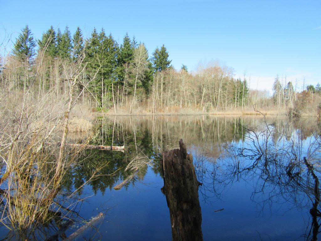
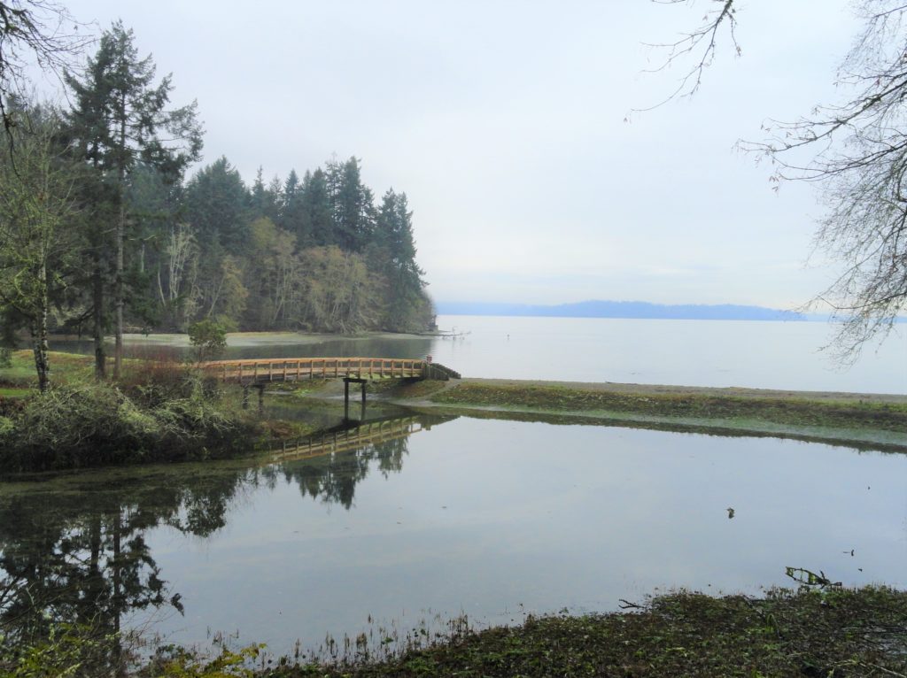
Read MoreBob Heirman Wildlife Preserve at Thomas’ Eddy – Swans, steelhead, and serenity on the Snohomish River

Quick Facts: Location: Snohomish River, south of Snohomish Land Agency: Snohomish County Parks Roundtrip: 1.5 miles Elevation Gain: 50 feet Contact: Snohomish County Parks and Recreation Special Note: Dogs prohibited. Trails can flood during rainy period. Expect wet and muddy trails. Access: From the city of Snohomish, travel south on SR 9 for 2.6 miles…
Read MoreIsland Center Forest
Explore an excellent trail system in the heart of Vashon Island Quick Facts: Location: Vashon Island Land Agency: King County Parks and Vashon Maury Island Land Trust Distance: more than 10 miles of trails Elevation Gain: up to 200 feet Contact: King County Parks Notes: dogs permitted on leash: Trails also open to mountain bikes…
Read MoreTolmie State Park
Explore a small trail network on the Nisqually Reach Quick Facts: Location: Lacey Land Agency: Washington State Parks Distance: 3.0 miles of trails Elevation Gain: up to 225 feet Contact: Tolmie State Park Notes: Discover Pass required; dogs permitted on leash: Hours: April 20-September 20: 8 a.m to dusk September 21-April 19, Wed—Sunday 9 a.m.-dusk…
Read MoreDash Point State Park
Make a dash for more than 10 miles of trails! Quick Facts: Location: Federal Way Land Agency: Washington State Parks Distance: more than 10 miles of trails Elevation Gain: up to 475 feet Contact: Dash Point State Park Notes: Discover Pass required; dogs permitted on leash, Recommended Guidebook: Urban Trails Tacoma (Mountaineers Book) Access: From…
Read MoreFort Ward Park
Enjoy rich views across Rich Passage Quick Facts:Location: Bainbridge IslandLand Agency: Bainbridge Island Metro Park and Recreation DistrictRound Trip: 2.0 milesElevation Gain: 140 feetContact: Bainbridge Island Metro Park and Recreation DistrictRecommended Guidebook: Urban Trails Kitsap (Mountaineers Book) Access: From Bainbridge Island Ferry follow SR 305 north for one mile turning left onto High School Road.…
Read MoreBig Gulch─ Explore Mukilteo’s deep ravines

Quick Facts: Location: Mukilteo Land Agency: Mukilteo Parks and Recreation Contact: Mukilteo Recreation Department Roundtrip: 4.0 miles Elevation Gain: 350 feet Access: From Everett follow SR 526 to SR 525. Turn left (south) on SR 525 and drive .5 mile to 92nd Street. Turn right and then immediately turn left into the 92nd Street Park parking area.…
Read MoreRiverview Wildlife Refuge –Quiet bird sanctuary on the Snohomish River

Quick Facts Location: City of Snohomish Land Agency: Snohomish Department of Parks and Volunteer Programs Roundtrip: 2.2 miles Elevation gain: minimal Difficulty: Easy Contact: City of Snohomish and Pilchuck Audubon Society Notes: Dogs must be on a leash. Access: From Everett head east on US 2 to SR 9. Then follow SR 9 south exiting…
Read More