Wildflowers
Hall Mountain via Noisy Creek –steep climb to stunning views and wildflowers
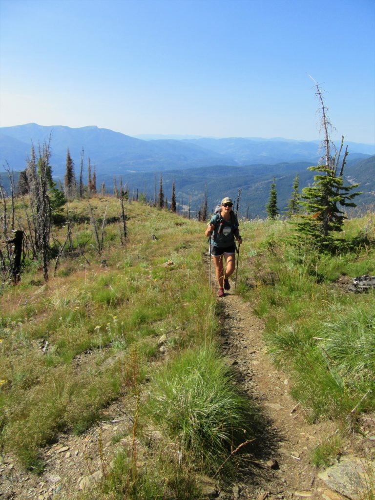
Quick Facts: Location: Selkirk Mountains Land Agency: Colville National Forest Round Trip: 14.0 miles Elevation Gain: 4,000 feet Contact: Sullivan Lake Ranger District, Colville National Forest Recommended Guidebook: Day Hiking Eastern Washington by Craig Romano and Rich Landers (Mountaineers Books) Notes: trail passes through a recent fire zone—be aware of hazards such as falling snags.…
Read MoreMount Muller Loop– Stunning ridgeline hike above the Sol Duc Valley
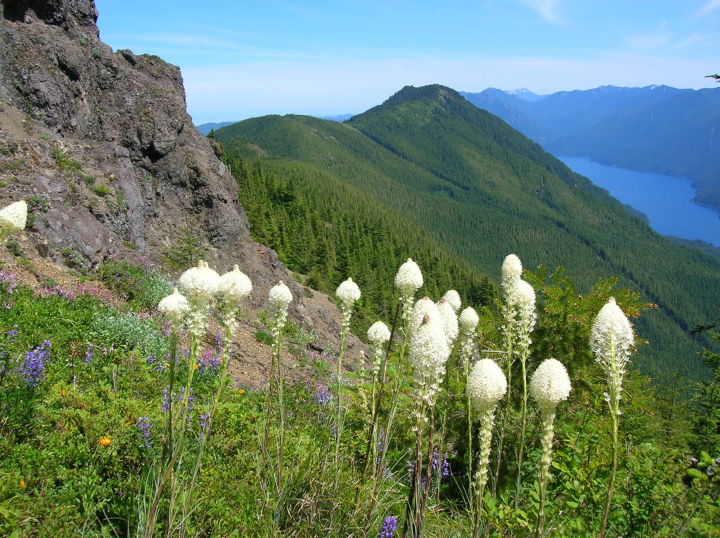
Quick Facts: Location: North Olympic Peninsula Land Agency: Olympic National Forest Roundtrip: 12.7 miles Elevation gain: 3350 feet Contact: Olympic National Forest, Pacific Ranger District, Forks, Green Trails Map: Green Trails Lake Crescent No. 101 Notes: Northwest Forest Pass or Interagency Pass required Access: From Port Angeles, follow US 101 west for 32 miles to…
Read MoreJohnson Ridge–Ridgeline hike in the Wild Sky Wilderness
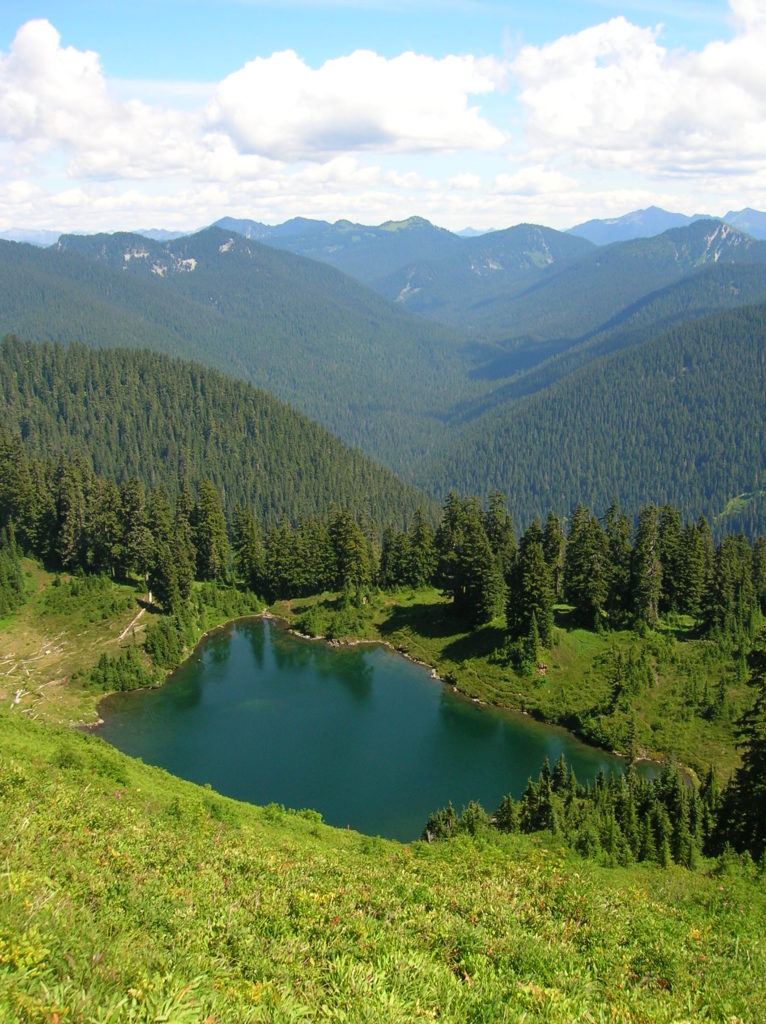
Location: Beckler River near Skykomish Land Agency: Mount Baker-Snoqualmie National Forest Roundtrip: 9.0 miles High Point: 5,540 feet Elevation gain: 2,650 feet Difficulty: difficult Green Trails Maps: Alpine Lakes West Stevens Pass No. 176S Contact: Skykomish Ranger District: Mount Baker-Snoqualmie National Forest Access: From Everett head east on US 2 for 50 miles turning left onto…
Read MoreJohnston Ridge via the Boundary Trail — Shun the road to this historic and magnificent site
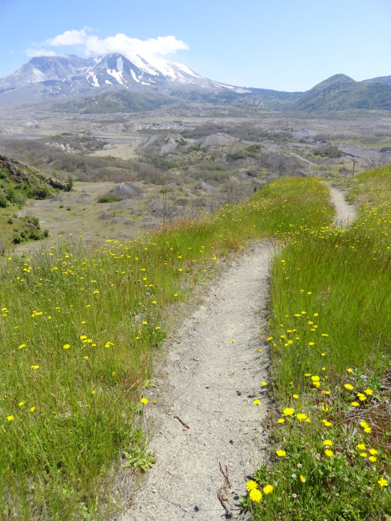
Quick Facts: Location: Mount St Helens Land Agency: Mount St Helens National Volcanic Monument Round Trip: 9.0miles Elevation Gain: 1875 feet Contact: Mount St Helens National Volcanic Monument Green Trails Map: Mount St Helens 332S Recommended Guidebook: Day Hiking Mount St. Helens by Craig Romano and Aaron Theisen (Mountaineers Books) Notes: dogs prohibited; off trail…
Read MoreDriveway Butte– Give your calves a workout hiking this steep old cattle drive
Quick Facts: Location: Methow Valley Land Agency: Okanogan-Wenatchee National Forest Round Trip: 8.6 miles Elevation Gain: 3000 feet Contact: Okanogan-Wenatchee National Forest Green Trails Map: Green Trails Washington Pass No. 50 Recommended Guidebook: Day Hiking North Cascades 2nd Edition Notes: Northwest Forest Pass or Interagency Pass required Access: From Marblemount follow State Route 20 east…
Read MoreColdwater Lake– Saunter through a healing landscape exploding with wildflowers!
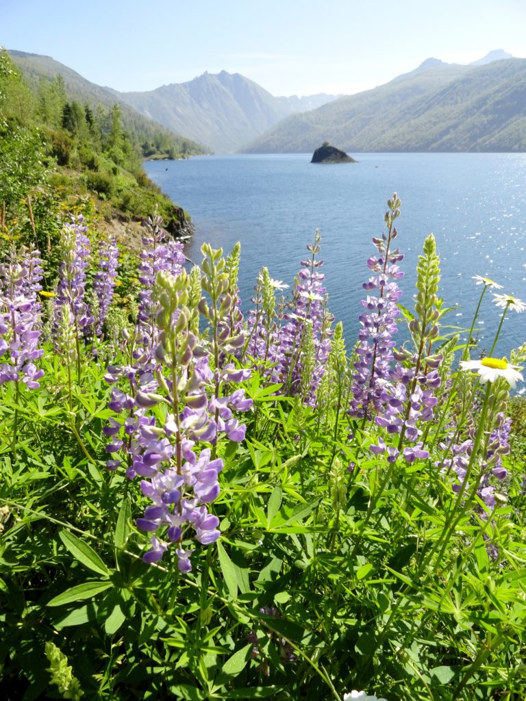
Quick Facts: Location: Mount St. Helens National Volcanic Monument Land Agency: US Forest Service Roundtrip: 9.0 miles Elevation Gain: 550 feet Contact: Mount St Helens National Volcanic Monument Green Trails Map: Green Trails Mount St Helens 332S Notes: Northwest Forest Pass (or interagency pass) required; No dogs; Trail open to bikes: Off trail travel prohibited Access: From Castle Rock…
Read MoreDirty Face Ridge– Make a clean break from Mount Townsend’s crowds

Quick Facts: Location: Buckhorn Wilderness, Northeast Olympic Peninsula Land Agency: Olympic National Forest Roundtrip: 7.8 miles Elevation gain: 3,000 feet Green Trails Maps: Olympic Mountains East No. 168SX Recommended Guidebook: Day Hiking Olympic Peninsula 2nd edition (Mountaineers Books) by Craig Romano Contact: Hood Canal District, Olympic National Forest Quilcene Access: Take US 101 to Louella…
Read MorePatterson Mountain — Bitterroot and Balsamroot and a bevy of other blossoms
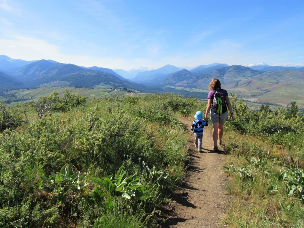
Quick Facts: Location: Methow Valley Land Agency: WA Department of Natural Resources Roundtrip: 3.7 miles Elevation Gain: 1,100 feet Contact: WA Department of Natural Resources Green Trails Map: Sun Mountain, WA- No.83S Notes: Discover Pass Required Access: From Winthrop head east on SR 20 for .6 mile immediately turning right onto Twin lakes Road. Follow for 3.0 miles turning right…
Read MoreCatherine Creek Rock Arch–A touch of Utah in the Northwest!
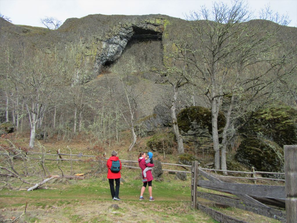
Location: Columbia River Gorge National Scenic Area Land Agency: Columbia Gorge National Scenic Area Roundtrip: 2.3 miles Elevation gain: 370 feet Difficulty: Easy Contact: Columbia Gorge National Scenic Area Notes: Dogs permitted on leash. Be aware or ticks and poison oak. Green Trails Map: Columbia River Gorge East No. 432S Good to Know: kid-friendly, dog-friendly…
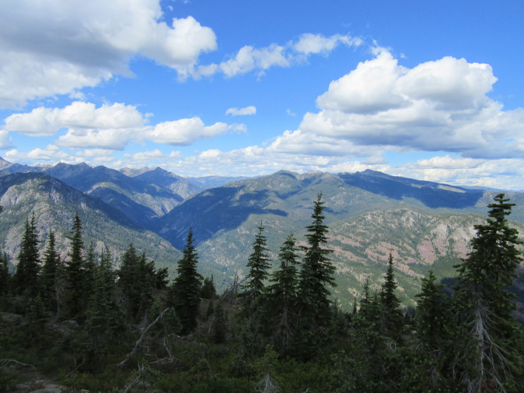
Read MoreThirteenmile Canyon– Wander one of wildest wilderness canyons in Eastern Washington
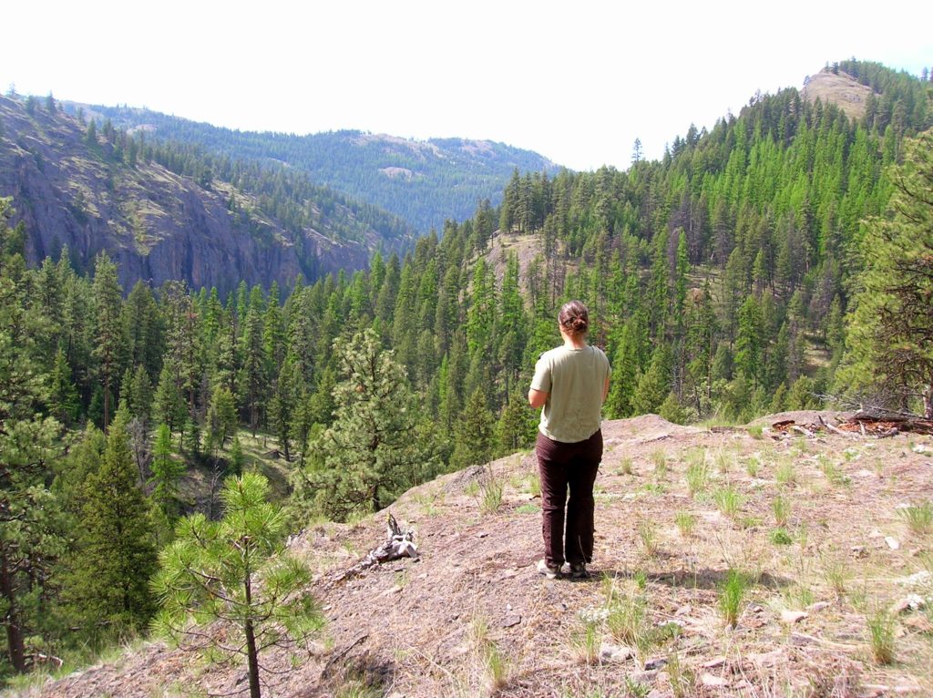
Location: Colville National Forest, Ferry County, Wa Land Agency: National Forest Service Roundtrip: 9.0 miles Elevation gain: 1,700 feet Contact: Colville National Forest, Republic Ranger District Notes: beware of rattlesnakes Access: From Republic follow SR 21 south 12.3 miles to trailhead located just within the Colville Indian Reservation Boundary. If coming from Wilbur, follow SR…
Read More