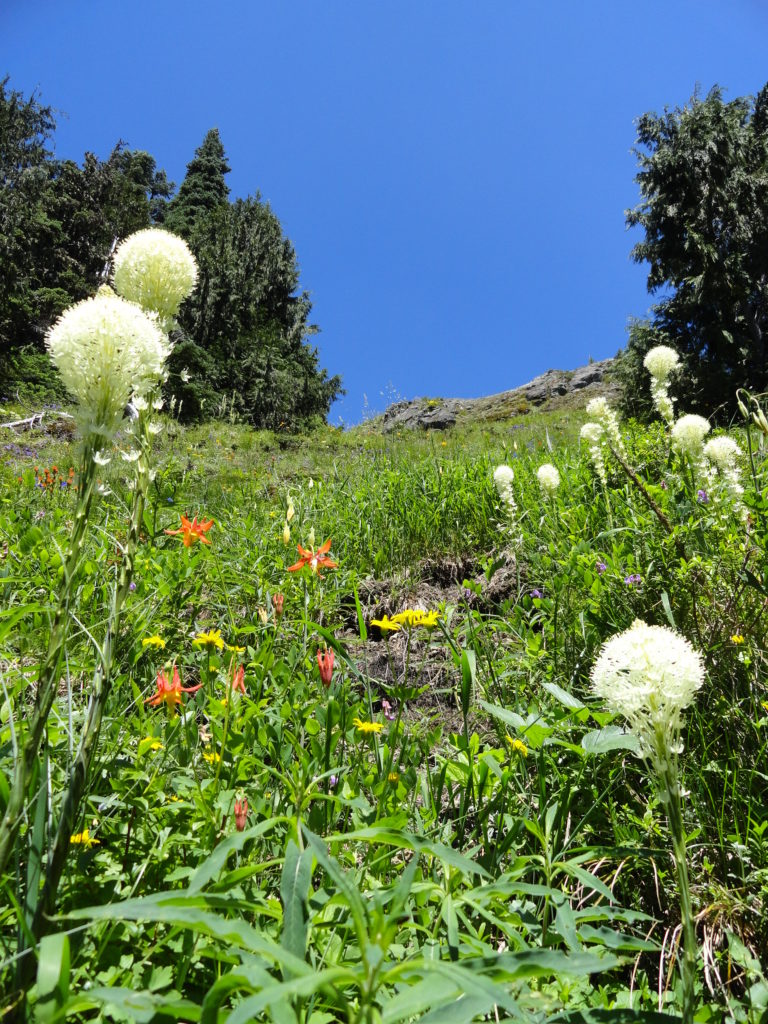
Wildflowers
Sunrise Lake─Golden larches brighten the shores of this alpine lake
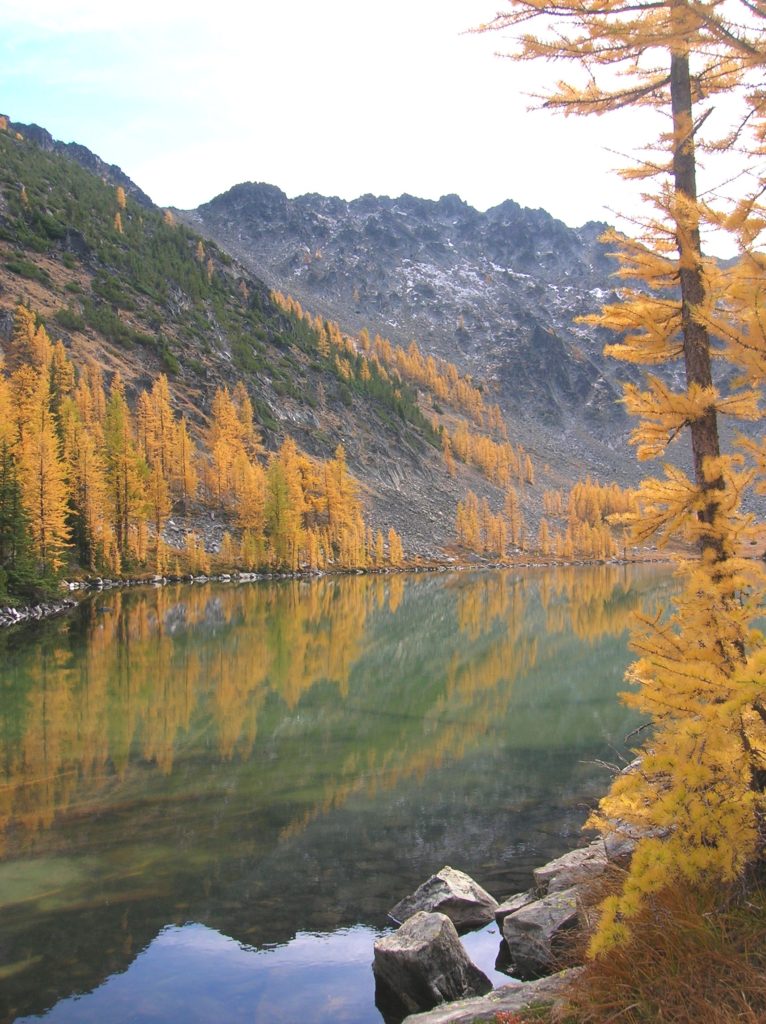
Quick Facts: Location: North Cascades – Sawtooth Ridge Land Agency: U.S. Forest Service Roundtrip: 13.0 miles Elevation Gain: 3,730 feet Green Trails Map: Prince Creek, WA- No. 115 Recommended Resource: Day Hiking North Cascades (Romano; Mountaineers Books) Access: From Twisp drive SR 20 east for 2.0 miles. Continue south on SR 153 for 12.0 miles turning right…
Read MoreApe Canyon–Hike through old-growth forest above a swath of destruction
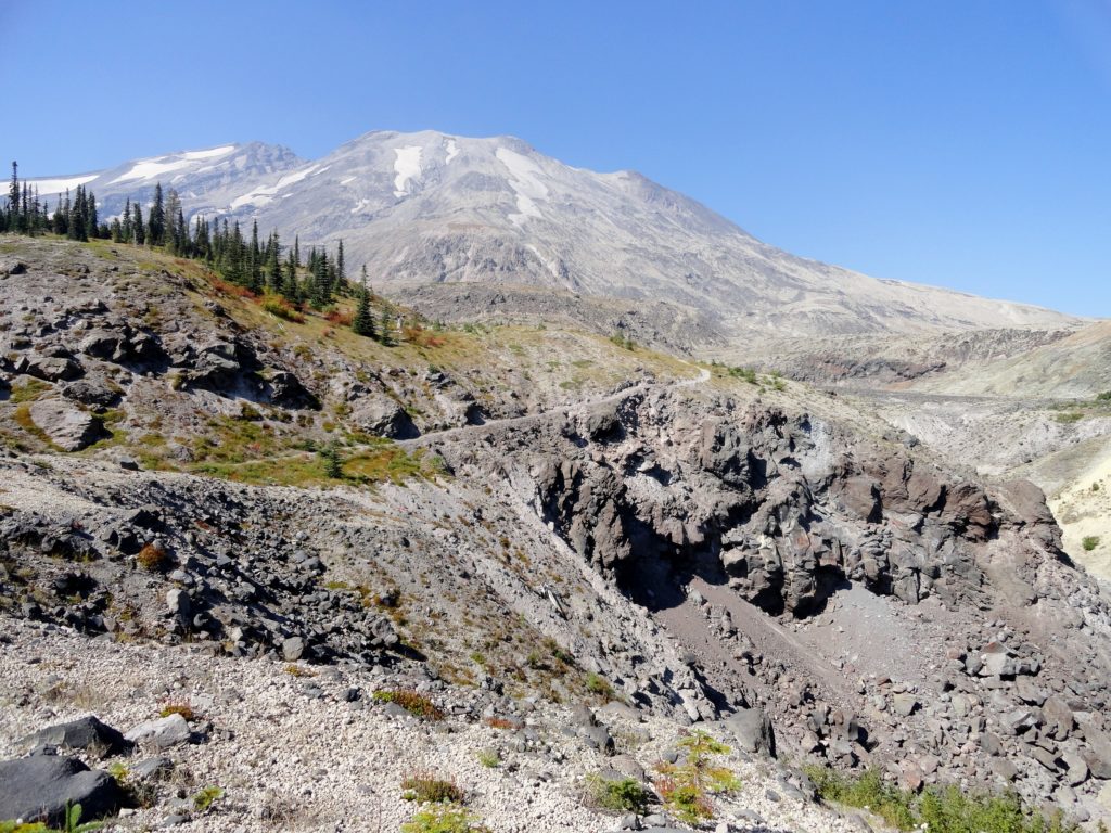
Quick Facts: Location: Mount St. Helens National Volcanic Monument Land Agency: National Forest Service Roundtrip: 9.4 miles Elevation Gain: 1,550 feet Contact: Mount St. Helens National Volcanic Monument Green Trails Map: Mount St Helens 332 Recommended Resource: Day Hiking Mount St Helens (Mountaineers Books) Notes: Northwest Forest Pass or Interagency Pass required. Trail is also open to mountain…
Read MoreFrosty Mountain–Cool views and alpine larches, too!
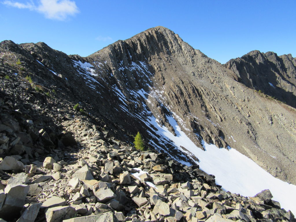
Quick Facts: Location: North Cascades, E.C. Manning Provincial Park Land Agency: BC Parks Roundtrip: 13.2 miles Elevation Gain: 3820 feet Contact: E.C. Manning Provincial Park Notes: Dogs permitted on leash. Practice Leave No Trace principles. Access: From Vancouver BC follow Trans-Canada Highway 1 east to Hope. Then continue east on BC 3 (Crowsnest Highway) for 37.5 miles and…
Read MoreHall Mountain via Noisy Creek– It’s a haul to this old lookout site
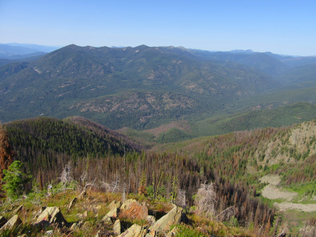
Quick Facts: Location: Selkirk Mountains, Eastern Washington Land Agency: National Forest Service Roundtrip: 14 miles Elevation Gain: 4130 feet Contact: Sullivan Lake District, Colville National Forest Notes: Practice Leave No Trace principles; grizzly habitat, trail passes recent burn zone–use caution Access: From Newport, Washington follow SR 20 north (west) 47 miles to the junction with SR 31 in…
Read MoreSkyscraper Mountain–Enjoy sweeping views of Rainier from this towering summit
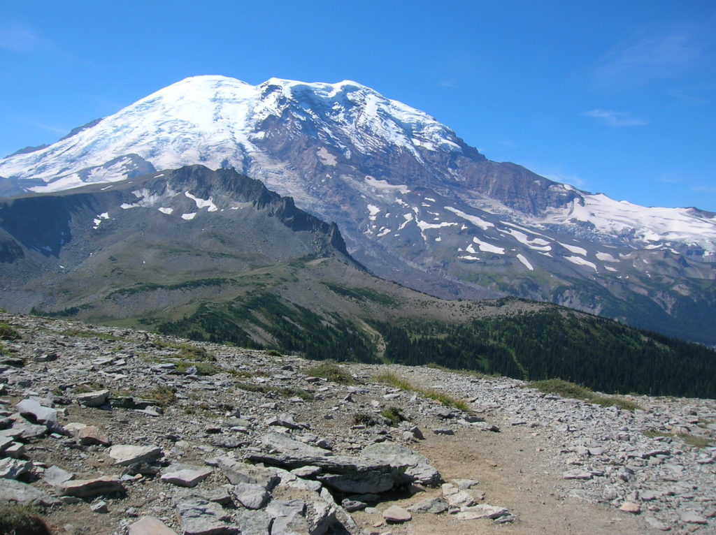
Location: Mount Rainier National Park Land Agency: National Park Service Roundtrip: 7.0 miles High Point: 7,078 feet Elevation gain: 1,500 feet Difficulty: moderate Green Trails Map: Mount Rainier Wonderland Map 269S Contact: Mount Rainier National Park Note: Park entrance fee; dogs prohibited Access: From Enumclaw, follow SR 410 east to Sunrise Road. Turn right and…
Read MoreHeather Park─Steep climb to views that are “Tops”

Quick Facts: Location: Hurricane Ridge-Heart of the Hills Land Agency: Olympic National Park Roundtrip: 10 miles Elevation Gain: 3,940 feet Green Trails Map: Hurricane Ridge-Elwha North No. 134S Access: From Port Angeles, follow Race Street south 1.2 miles passing the Olympic National Park Visitors Center to the Hurricane Ridge Road (Heart O the Hills Parkway).…
Read MoreLake West and Lake Helen – Seldom visited lakes within the shadows of Mount Rainier
Quick Facts: Location: Glacier View Wilderness Land Agency: Gifford Pinchot National Forest Roundtrip: 8.4 miles Elevation gain: 1,600 feet Green Trails Map: Mount Rainier West, WA no. 269 Contact: Cowlitz Valley Ranger Station (Randle), Gifford Pinchot National Forest Notes: FR 59 is rough in spots but is passable for passenger cars. Wilderness regulations apply. Free…
Read MoreSkyline Divide — A mile high carpet of wildflowers
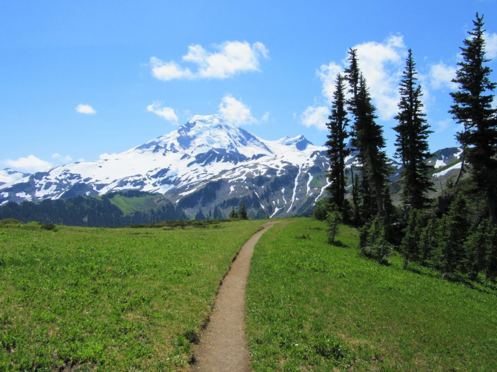
Quick Facts: Location: Mount Baker Highway, North Cascades Land Agency: National Forest Service Roundtrip: 9.0 miles Elevation gain: 2500 feet Difficulty: moderate Green Trails Map: Mount Baker Wilderness 13S Contact: Mount Baker Ranger District: Mount Baker -Snoqualmie National Forest Access: From Bellingham follow SR 542 (Mount Baker Highway) east for 35 miles turning right onto…
Read MoreSourdough Ridge — Enjoy sweet views of Mount Rainier from this easy ridge hike
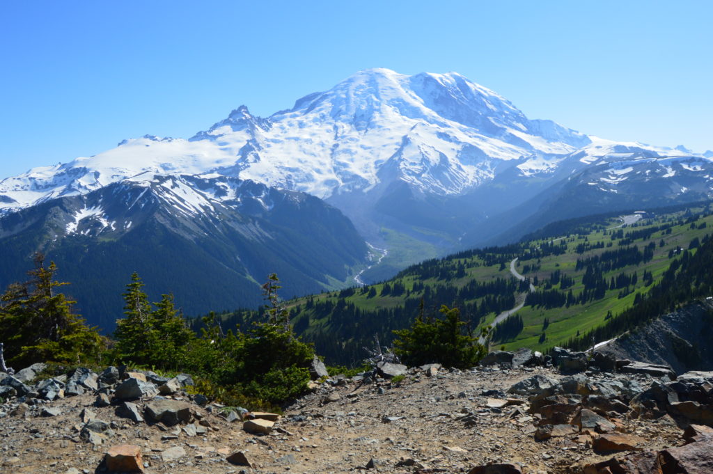
Quick Facts: Location: Sunrise, Mount Rainier National Park…
Read MoreSilver Star Mountain via Ed’s Trail–Stellar wildflowers and explosive volcanic views
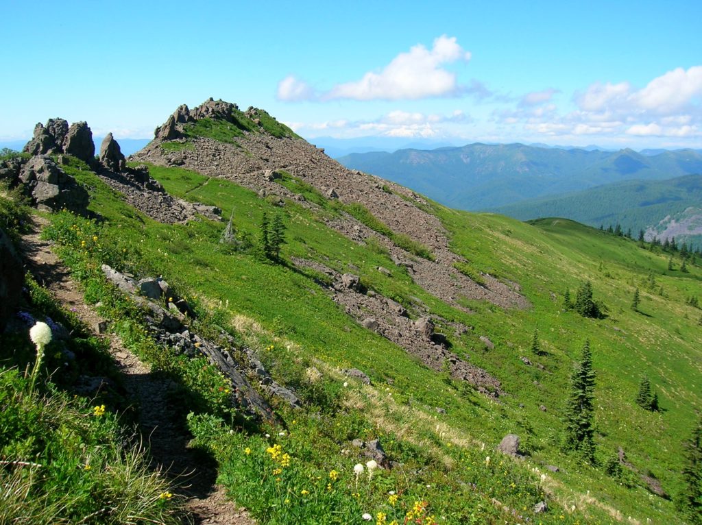
Quick Facts: Location: Silver Star Scenic Area Land Agency: Gifford Pinchot National Forest Roundtrip: 5.0 miles High Point: 4,390 feet Elevation gain: 1,440 feet Difficulty: moderately difficult Green Trails Map: Lookout Mtn No. 396, Bridal Veil No. 428 Contact: Gifford Pinchot National Forest Mount Adams Ranger District, Note: FR 4109 is rough and recommended for high…
Read More