Posts Tagged ‘100 Classic Hikes Washington’
Grand Valley–Aptly named valley has it all; lakes, meadows, and fantastic alpine scenery

Quick Facts: Location: Obstruction Point (Hurricane Ridge) Land Agency: National Park Service Roundtrip: 9.8 miles Elevation gain: 2,400 feet Contact: Olympic National Park Wilderness Information Center Green Trails Map: Elwha North/Hurricane Ridge-No. 134S Notes: Dogs prohibited; National Park Entry Fee required Access: From Port Angeles follow the Hurricane Ridge Road (Heart O the Hills Parkway)…
Read MoreImage Lake — jewel in the heart of the Glacier Peak Wilderness
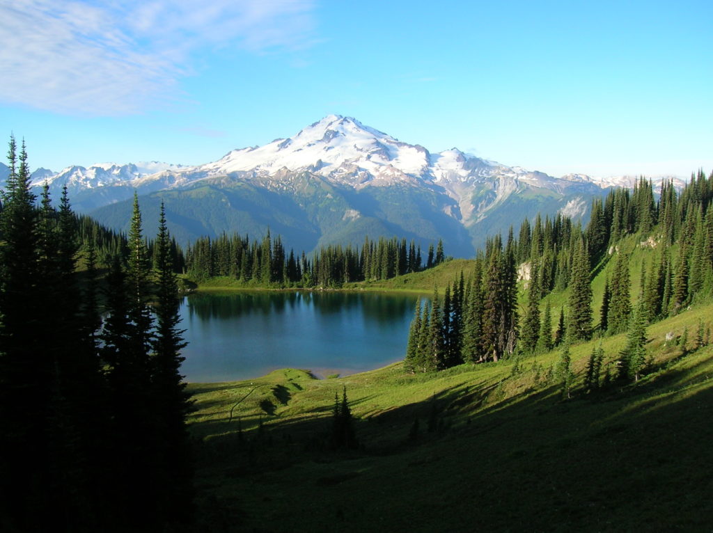
Quick Facts: Location: Glacier Peak Wilderness Land Agency: Mount Baker-Snoqualmie National Forest Roundtrip: 33.0 miles Elevation Gain: 4,700 feet Green Trails Map: Mountain Loop Highway 111SX Contact: Darrington Ranger District: Mount Baker Snoqualmie National Forest Notes: NW Forest or Interagency Pass required; No camping within ¼ mile of Image Lake—use established campsites; no fires at lake; respect re-vegetation…
Read MoreTurtlehead — It’s one shell of a view from this Turtleback Mountain summit
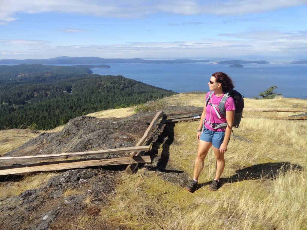
Quick Facts: Location: Orcas Island, San Juan Islands Land Agency: San Juan County Land Bank Roundtrip: 5.6 miles Elevation Gain: 1295 feet Contact: San Juan County Land Bank Notes: Dogs permitted on leash; trail (partial) open to bikes (even days) and horses (odd days) Access: Take Washington State Ferry from Anacortes to Orcas Island. Then head…
Read MoreGranite Mountain- classic fire lookout hike at Snoqualmie Pass
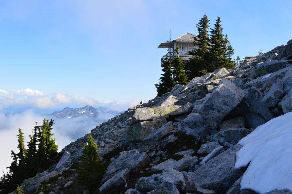
Quick Facts: Location: Snoqualmie Pass Region Land Agency: National Forest Service Round Trip: 9.0 miles Elevation Gain: 3700 feet Contact: Mount Baker-Snoqualmie National Forest, Snoqualmie Ranger District North Bend Green Trails Maps: Green Trails, Snoqualmie Pass Gateway no. 207SX Notes: Northwest Forest pass or Interagency Pass required; Alpine Lakes Wilderness use permit required May 15—Oct 31,…
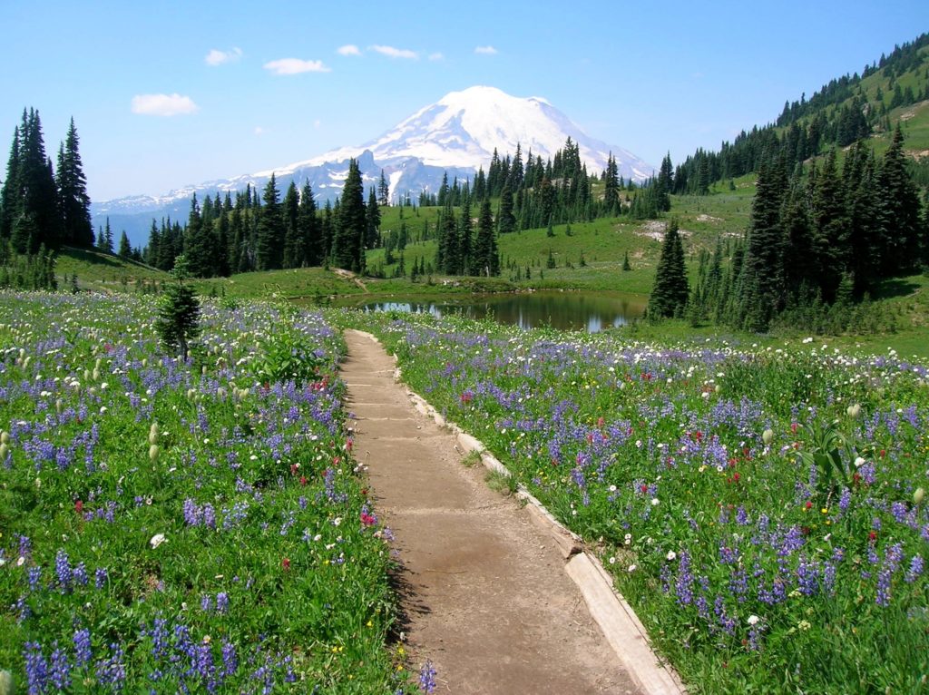
Read MoreIndian Henry’s Hunting Ground via Kautz Lake — Head to a fabled land of wildflowers!
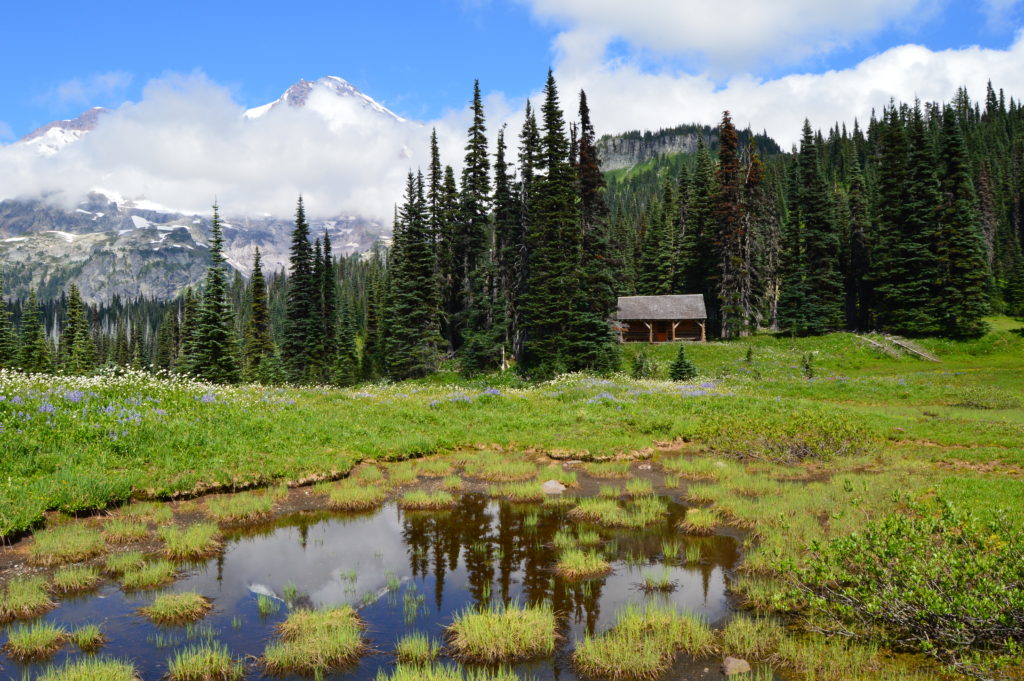
Quick Facts: Location: Nisqually Valley, Mount Rainier National Park Land Agency: National Park Service Roundtrip: 11.6 miles Elevation Gain: 3200 feet Contact: Mount Rainier National Park Green Trails Map: Mount Rainier National Park 269S Notes: National Park Entrance Fee or Interagency Pass required; Dog prohibited Timed entry pass required for entrance into Mount Rainier National Park (Longmire and Sunrise…
Read MoreGrand Ridge─Horizon-spanning views from the loftiest trail in the Olympics
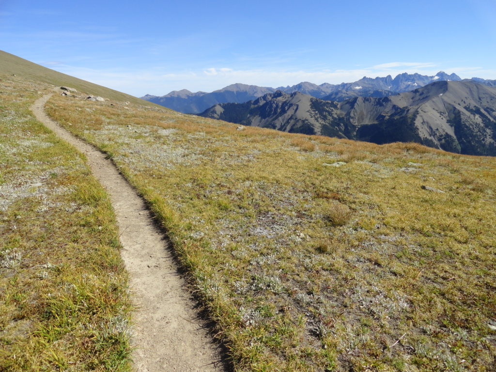
Quick Facts: Location: Deer Park-Obstruction Point, Olympic National Park Land Agency: National Park Service Roundtrip: 15.4 miles. To Maiden Peak: 7.0 miles Elevation Gain: 3,400 feet. To Maiden Peak: 1,600 feet Green Trails Map: Olympics Mountain East 168S Contact: Olympic National Park Notes: Park entry fee; Pavement on Deer Park Road ends at National Park Boundary…
Read MoreMaple Pass — Lofty North Cascades Loop lined with larches and long ranging vistas
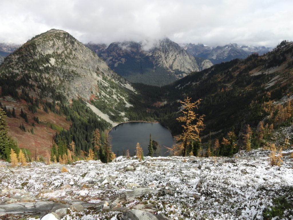
Quick Facts: Location: North Cascades Highway –Rainy Pass Land Agency: Okanogan-Wenatchee National Forest Roundtrip: 7.2 miles Difficulty: Moderate Elevation Gain: 2,000 feet Green Trails Maps: Ross Lake North Cascades 16SX Access: From I-5 north (Exit 230 ) in Burlington, head east on SR 20 (North Cascades Highway) for 98 miles to Rainy Pass near Milepost 158. Turn right into the…
Read MoreLake Ingalls
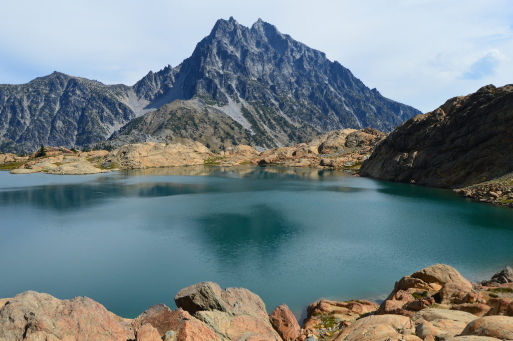
Capture breathtaking reflective views of Mount Stuart Quick Facts: Location: Alpine Lake Wilderness, Teanaway Country Round Trip: 9.2 miles Elevation Gain: 2600 feet Contact: Okanogan-Wenatchee National Forest, Cle Elum Ranger District, https://www.fs.usda.gov/okawen/Detailed Information: 100 Classic Hikes Washington (Mountaineers Books) Notes: Northwest Forest Pass required; dogs prohibited; wilderness rules apply; no camping at lake. Green Trails…
Read MoreBlanca Lake– A strikingly beautiful lake set beneath a formidable wall of jagged peaks
Quick Facts: Location: Wild Sky and Henry Jackson Wildernesses, North Fork Skykomish River Valley Land Agency: Mount Baker-Snoqualmie National Forest Roundtrip: 8.4 miles Elevation gain: 3,300 feet Green Trails Map: Monte Cristo, WA- No. 143 Contact: Skykomish Ranger District: Mount Baker Snoqualmie National Forest Notes: Northwest Forest Pass or Interagency Pass required. No fires allowed…
Read MoreNaches Peak–Big Scenic Payoff for little effort
Quick Facts: Location: Naches Pass, Mount Rainier National Park Land Agency: United States Park Service Roundtrip: 4.0 miles Elevation gain: 600 feet Green Trails Maps: Mount Rainier Wonderland Map 269SX Contact: Mount Rainier National Park Notes: Dogs prohibited Access: From Enumclaw follow SR 410 east to Tipsoo Lake parking area just before Chinook Pass. Good…
Read More