Posts Tagged ‘bird watching’
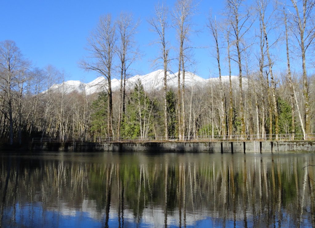
South Indian Island — Enjoy peaceful shoreline strolling along a line of defense
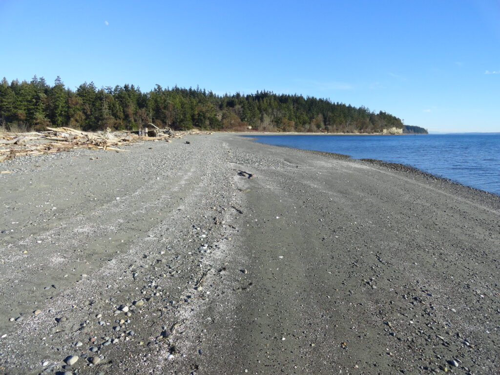
Quick Facts: Location: Indian Island near Port Hadlock Land Agency: Jefferson County Parks Roundtrip: 4.0 miles Elevation Gain: 70 feet Notes: Detailed information can be found in Day Hiking Olympic Peninsula (Mountaineers Books) Contact: Jefferson County Parks Access: From Kingston, drive State Route 104 turning right onto SR 19. Then continue north for 9 miles turning right onto…
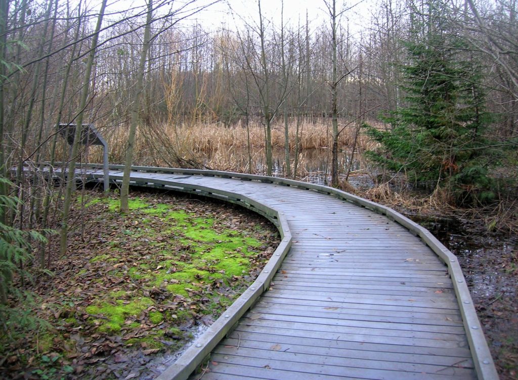
Read MorePadilla Bay Dike Trail–shore fine hike in the Skagit Valley
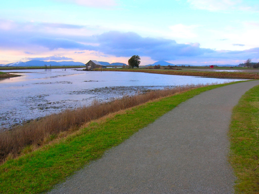
Quick Facts: Location: Skagit County Land Agency: Padilla Bay National Estuarine Research Reserve Roundtrip: 4.8 miles Elevation Gain: 30 feet Contact: Padilla Bay NERR Access: From Burlington (exit 231 on I-5) proceed through roundabouts and head west on Josh Wilson Road for 6.4 miles. Upon entering the village of Bay View turn left onto 2nd Street…
Read MoreGuillemot Cove─Quiet nature retreat on Hood Canal
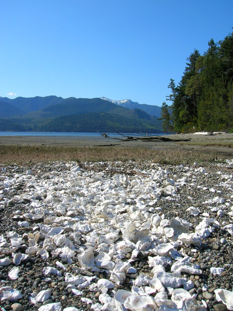
Quick Facts: Location: Kitsap Peninsula Land Agency: Kitsap County Parks Roundtrip: 2.5 miles Elevation Gain: 350 feet Contact: Kitsap County Parks Notes: Dogs prohibited. Access: From Bremerton, follow SR 3 North to Newberry Hill Road Exit. Then head west for 3.0 miles turning right onto Seabeck Highway. Continue for 5.0 miles to Seabeck turning right…
Read MoreBilly Frank Jr. Nisqually National Wildlife Refuge– Delightful hiking on the delta
Quick Facts: Location: Nisqually River Delta Land Agency: United States Fish and Wildlife Service Roundtrip: 4.2 miles Elevation Gain: minimal Contact: Billy Frank Jr. Nisqually National Wildlife Refuge Map: Refuge Map Notes: $3.00 per four adults entrance fee; or Interagency Passes accepted; dogs prohibited; Northern end of the Nisqually Estuary Trail is closed from October to…
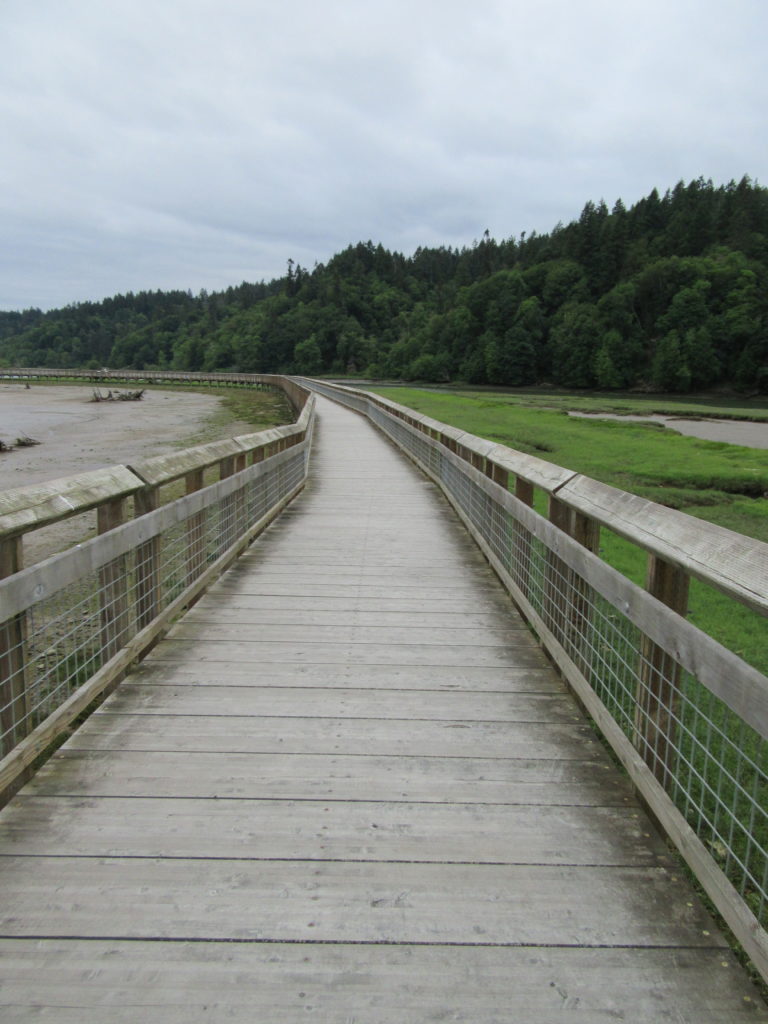
Read MoreFortson Ponds –An old mill site on an emerging long distance trail
Quick Facts: Location: Darrington Land Agency: Snohomish County Parks Roundtrip: 2.0 miles Elevation gain: none Difficulty: Easy Contact: Snohomish County Parks Green Trails Map: Mountain Loop Highway 111SX Notes: Dogs allowed on leash Access: From Exit 208 on I-5 (Arlington) travel east on SR 530 for 25.2 miles turning left onto Fortson Mill Road (near…
Read MoreOaks to Wetlands Trail─ A slough of birds and delights along the Columbia River
Quick Facts: Location: Ridgefield National Wildlife Refuge, Clark County Land Agency: U.S. Fish and Wildlife Roundtrip: 2.0 miles Elevation Gain: 75 feet Contact: Ridgefield National Wildlife Refuge Notes: Dogs prohibited. Recommended Guidebook: Urban Trails Vancouver WA (Mountaineers Books) Access: From Exit 14 on I-5 head west 3.0 miles on SR 501 (Pioneer Street) to its…
Read MoreSecond Beach– Home to First Rate Scenery
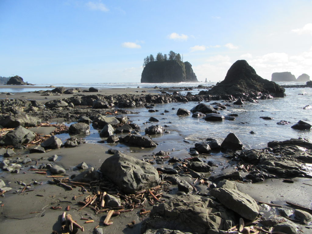
Quick Facts: Location: Olympic National Park Land Agency: Quileute Nation and National Park Service Roundtrip: 4.0 miles Elevation Gain: 310 feet Contact: Olympic National Park, Wilderness Information Center Green Trails Map: 99S Olympic Coast Beaches Notes: Dogs prohibited Access: From Forks follow US 101 north for 1.5 miles turning left onto State Route 110 (signed “Mora–La Push”). Continue…
Read MoreSwan Lake and Christmas Hill –A very merry hike minutes from downtown Victoria

Quick Facts: Location: Saanich Peninsula, Vancouver Island Land Agency: Swan Lake Christmas Hill Sanctuary Roundtrip: 3.5 miles/ 5.6 kilometers Elevation gain: 325 feet/ 100 meters Contact: Swan Lake Christmas Hill Sanctuary Notes: dogs prohibited Access: From Victoria or Sidney, follow BC 17 (Patricia Bay Highway) exiting onto McKenzie Ave. Proceed east turning right onto Rainbow…
Read MoreNarbeck Wetland Sanctuary–Bird bursting, frog hopping wildlife habitat beside Boeing
Quick Facts: Location: Everett Land Agency: Snohomish County Roundtrip: 1.8 miles Elevation gain: none Difficulty: Easy Contact: Friends of Narbeck Wetland Sanctuary Notes: Dogs must be leashed; open 7 a.m. to dusk Access: From Everett follow SR 526 west 2.5 miles exiting onto Seaway Boulevard. Proceed for 1.0 mile north. Entrance is on right, across…
Read MoreCrescent Lake─Swan stop at the confluence of the Skykomish and Snoqualmie Rivers
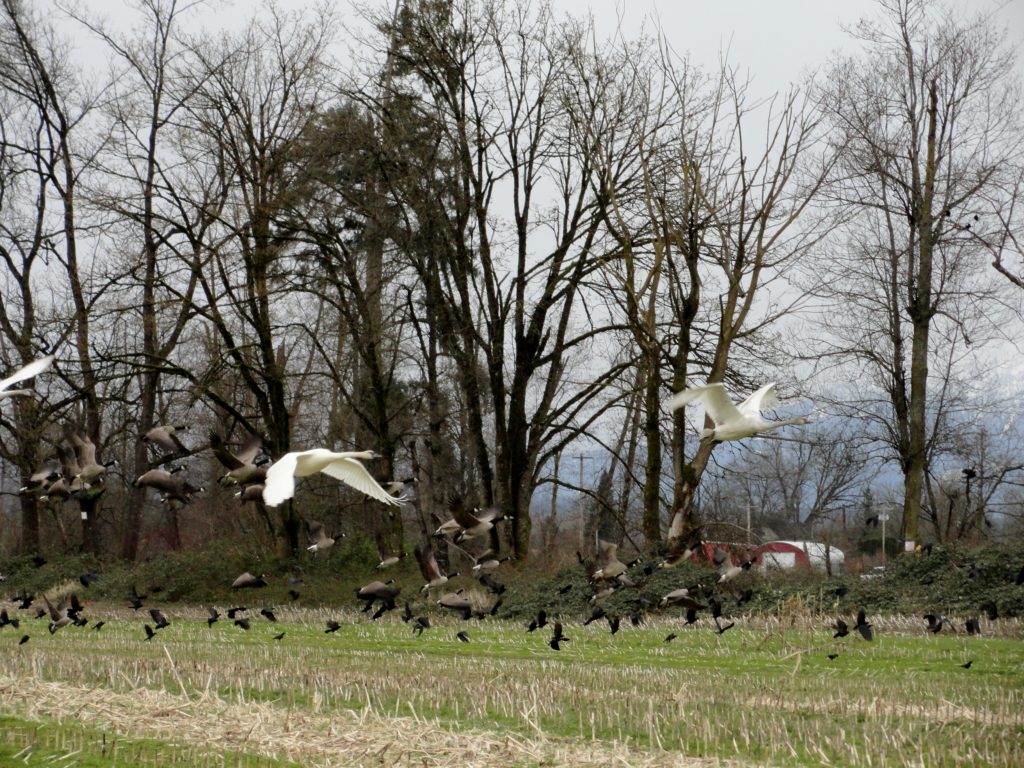
Quick Facts: Location: Snoqualmie Valley south of Monroe Land Agency: Washington Department of Fish and Wildlife (WDFW) Roundtrip: 2.2 miles Elevation Gain: None Notes: Discover Pass required; Crescent Lake is an active hunting area, so be aware of hunting seasons. Access: From Everett follow US 2 east to Monroe. Turn right onto SR 203 and follow for 3.8 miles turning right onto…
Read More