Posts Tagged ‘Day hiking North Cascades’
Willapa Hills Trail─ Follow the Chehalis River back into time

Quick Facts: Location: Western Lewis County Land Agency: Washington State Parks Roundtrip: 10.0 miles Elevation Gain: 100 feet Access: From Chehalis (exit 77 on I-5) follow SR 6 west for 23 miles to the town of Pe Ell. At blinking red light turn left onto 6th Ave and proceed 0.1 mile to Trailhead at old…
Read MoreHeadlee Pass and Lake Elon─An old mining trail is a terrible thing to waste!
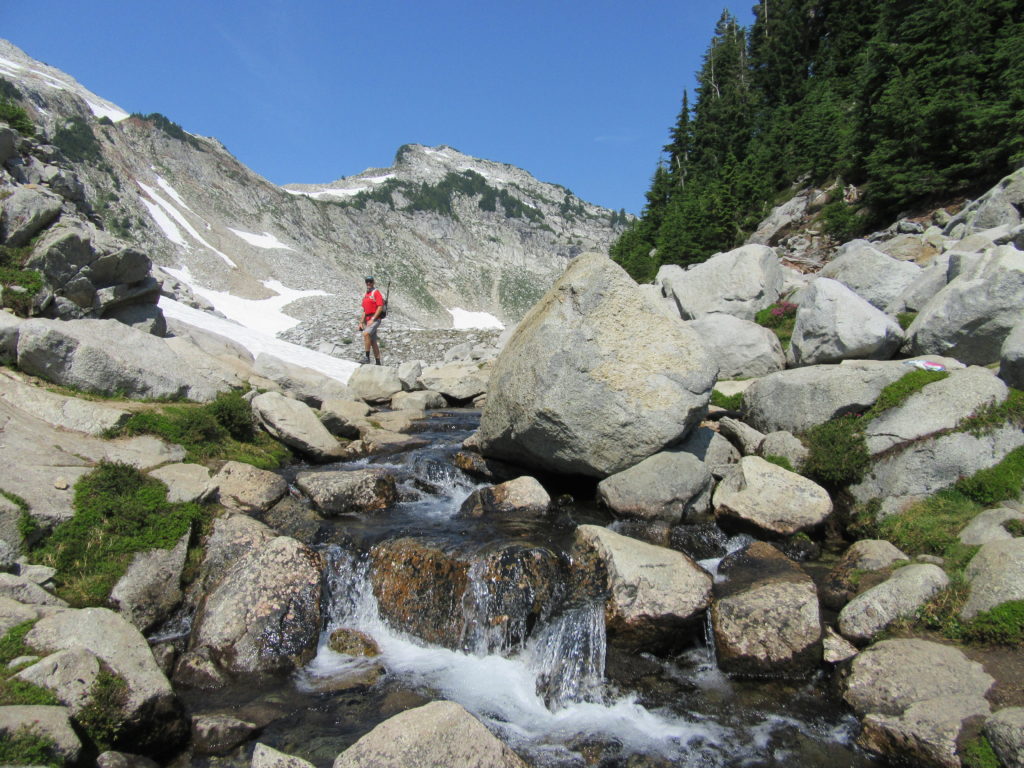
Quick Facts: Location: Mountain Loop Highway Land Agency: Mount Baker-Snoqualmie National Forest Roundtrip: 7.0 miles Elevation Gain: 2,650 feet Contact: Darrington Ranger District: Mount Baker -Snoqualmie National Forest Green Trails Map: Mountain Loop Highway 111SX Recommended Guidebook: Day Hiking North Cascades 2nd edition (Mountaineers Books) Special Note: Northwest Trail Pass or Interagency Pass required. Access:…
Read MoreGoat Lake─A family friendly hike for old goats and kids alike!
Quick Facts: Location: Mountain Loop Highway near Darrington Land Agency: Mount Baker-Snoqualmie National Forest Roundtrip: 10.4 miles Elevation Gain: 1,400 feet Green trails Map: Mountain Loop Highway-No. 111SX Access: From Granite Falls, follow the Mountain Loop Highway east for 31 miles to Barlow Pass and end of pavement. Continue for 3.5 miles turning right onto FR…
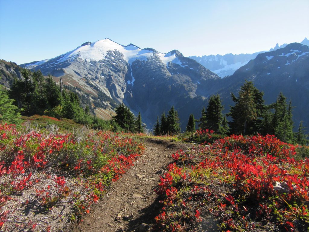
Read MoreHidden Lake Lookout
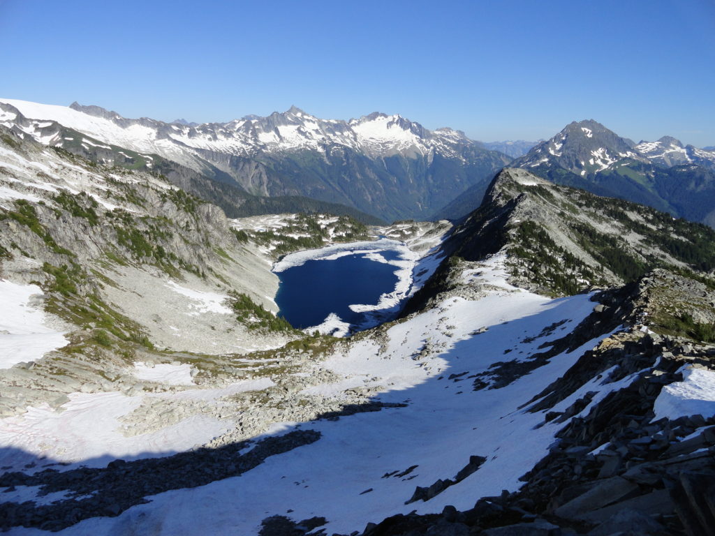
Savor stunning views from an historic fire lookout teetering on a lofty precipitous knoll Quick Facts: Location: Cascade River Road Land Agency: Mount Baker-Snoqualmie National Forest Roundtrip: 9.0 miles Elevation Gain: 3,340 feet Green Trails Maps: Diablo, WA-No. 48; Cascade Pass, WA-No. 80 Access: From Marblemount, head east on the Cascade River Road for 9.7…
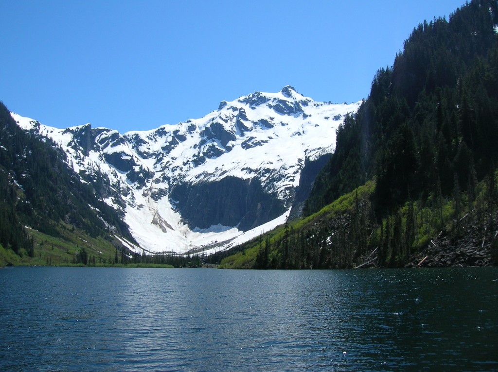
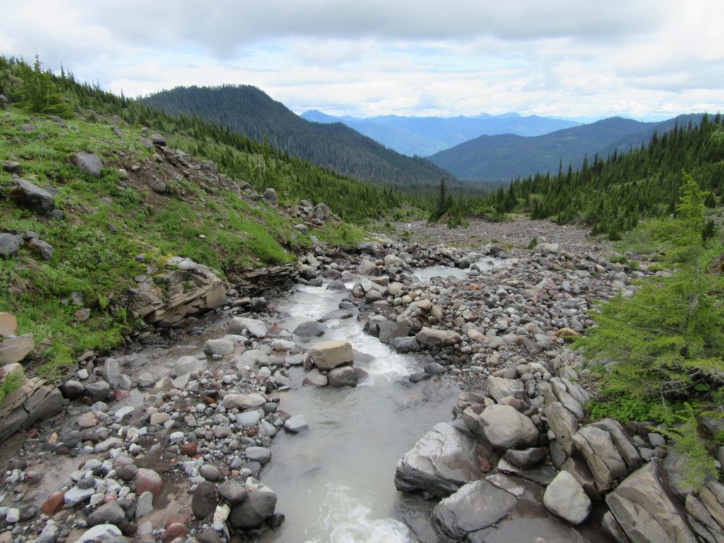
Read MoreGreen Mountain –Banal is thy name—Breathtakingly beautiful is thy game
Quick Facts: Location: Glacier Peak Wilderness, Suiattle River Road Land Agency: Mount Baker-Snoqualmie National Forest Roundtrip: 8.0 miles Elevation gain: 3,100 feet Green Trails Maps: North Cascades Ross Lake 16SX Contact: Darrington Ranger District: Mount Baker-Snoqualmie National Forest Notes: wilderness rules apply Access: From Darrington, travel north on SR 530 for 7.5 miles turning right…
Read MoreWindy Pass
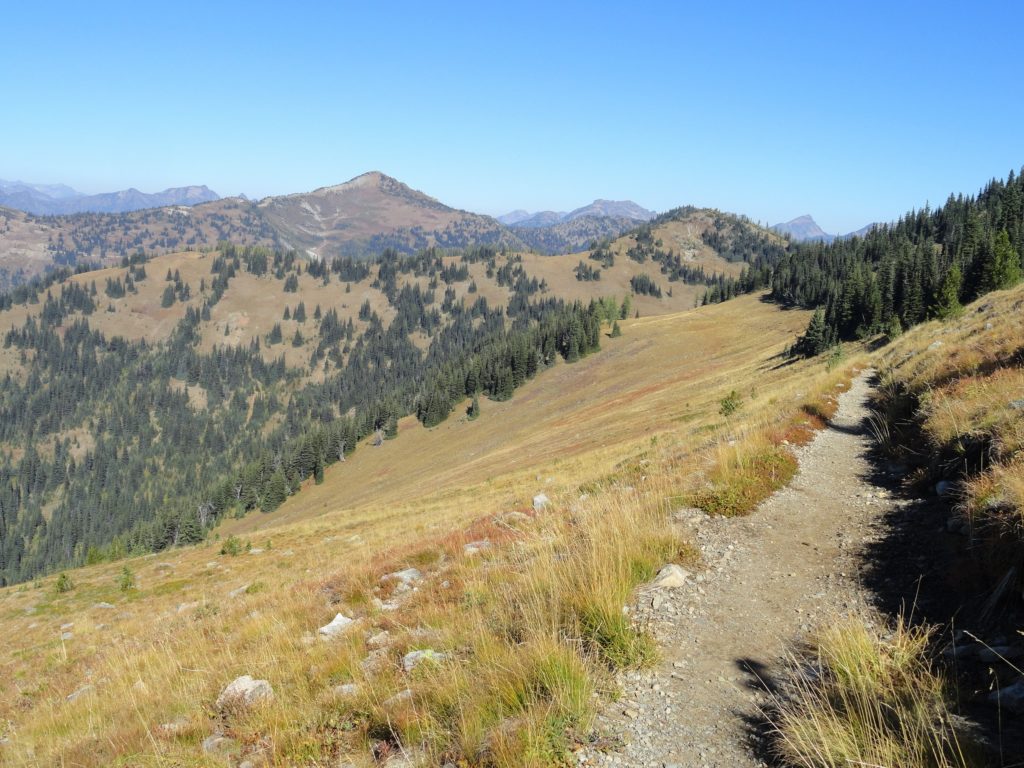
Easy wanderings high on the Pacific Crest Trail Quick Facts: Location: Harts Pass area Land Agency: National Forest Service Distance: 7.6 miles Elevation Gain: 900 feet Contact: Okanogan-Wenatchee National Forest, Methow Valley Ranger District Map: Green Trails Methow Valley Pasayten Wilderness 51SX Notes: Northwest Trail Pass or Interagency pass required Access: From Winthrop, drive State…
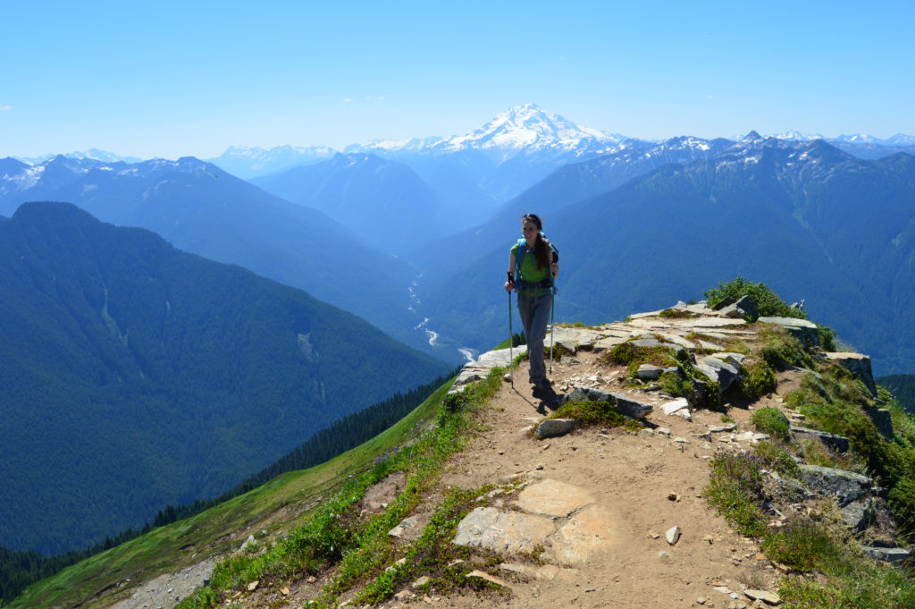
Read MoreScott Paul Trail
Loop on high slopes on Mount Baker Quick Facts: Location: Mount Baker National Recreation Area Land Agency: National Forest Service Distance: 8.0 mile loop Elevation Gain: 2000 feet Contact: Mount Baker–Snoqualmie National Forest, Mount Baker Ranger District Map: Green Trails Mount Baker Wilderness no. 13S Notes: Northwest Trail Pass or interagency pass required May 1-Oct…
Read MoreMarten Creek─Overlooked trail off the Mountain Loop Highway offers plenty of solitude
Quick Facts Location: Boulder River Wilderness, Mountain Loop Highway near Granite Falls Land Agency: Mount Baker-Snoqualmie National Forest Roundtrip: 5.2 miles Elevation Gain: 1,300 feet Green Trails Map: Mountain Loop Highway WA- No. 111SX Recommended Guidebook: Day Hiking North Cascades 2nd edition (Mountaineers Books) Access: From Granite Falls follow the Mountain Loop Highway east for…
Read MoreHappy Panther Trail–Take a joyful catwalk in the North Cascades
Quick Facts: Location: North Cascades Scenic Highway Land Agency: Ross Lake National Recreation Area, National Park Service Roundtrip: 11.8 miles Elevation gain: 1200 feet Green Trails Maps: Green Trails, North Cascades Ross Lake No. 16SX Contact: North Cascades National Park complex Notes: Dogs must be leashed Access: From Burlington follow SR 20 east to Marblemount. Then…
Read MoreHannegan Peak– Supreme views of snow and ice—and that’s the truth, Ruth!
Quick Facts: Location: North Cascades Mount Baker Wilderness Land Agency: Mount Baker-Snoqualmie National Forest Roundtrip: 10.4 miles Elevation gain: 3,100 feet Green Trails Map: Mount Baker Wilderness 13SX Contact: Glacier Public Service Center or Mount Baker Ranger District: Mount Baker-Snoqualmie National Forest Notes: Northwest Trail Pass or Interagency Pass required; Wilderness rules apply Access: From…
Read More