Posts Tagged ‘Day hiking Olympic Peninsula’
Hurricane Hill─Storm this summit on snowshoes or skis
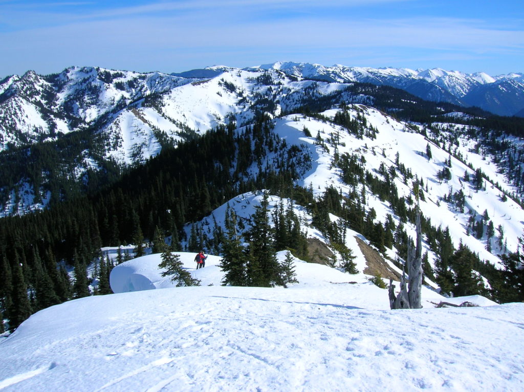
Quick Facts: Location: Hurricane Ridge, Olympic National Park Land Agency: National Park Service Roundtrip: 6.0 miles Elevation Gain: 900 feet Contact: Olympic National Park Green Trails Map: Elwha North Hurricane Ridge, No 134S Notes: Dogs are prohibited. National Park Entry Fee Required. Dec–Mar the road is open Fri–Sun and Holiday Mondays only weather permitting. All…
Read MoreSecond Beach– Home to First Rate Scenery
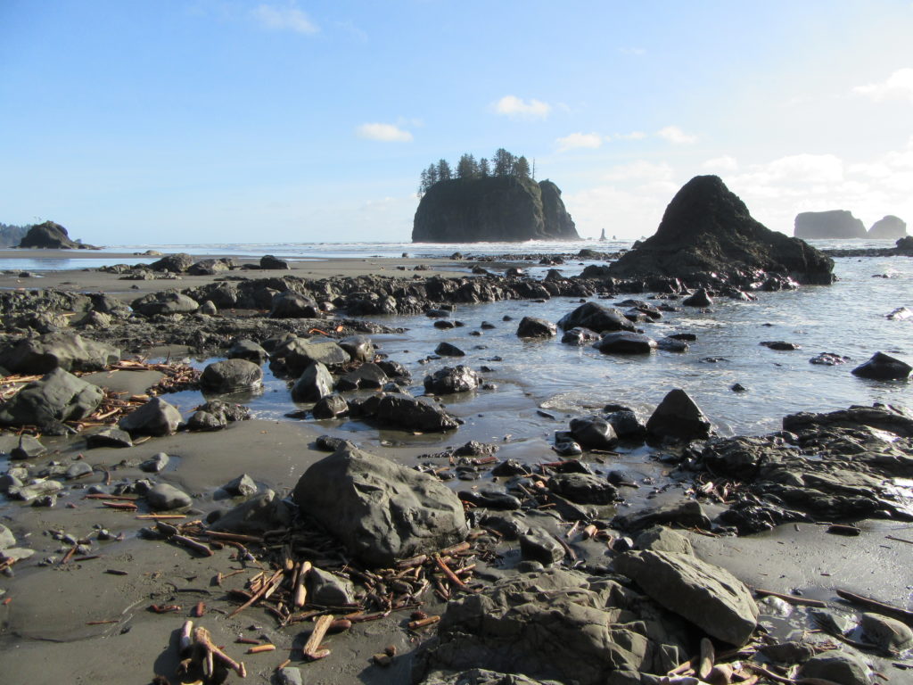
Quick Facts: Location: Olympic National Park Land Agency: Quileute Nation and National Park Service Roundtrip: 4.0 miles Elevation Gain: 310 feet Contact: Olympic National Park, Wilderness Information Center Green Trails Map: 99S Olympic Coast Beaches Notes: Dogs prohibited Access: From Forks follow US 101 north for 1.5 miles turning left onto State Route 110 (signed “Mora–La Push”). Continue…
Read MoreClallam Bay Spit — Explore Washington’s deserted and spectacular North Coast
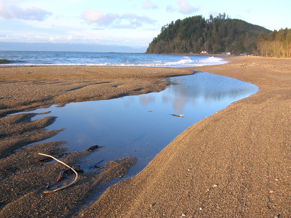
Quick Facts: Location: Strait of Juan de Fuca, North Olympic Peninsula Land Agency: Clallam County Parks and Washington State Parks Roundtrip: 2.1 miles Elevation Gain: minimal Contact: Clallam County Parks Notes: Dogs permitted on leash Access: From Port Angeles follow US 101 west for 5.4 miles to SR 112. Continue west for 44 miles on SR 112 to the community…
Read MoreSunrise Ridge─What a setting!
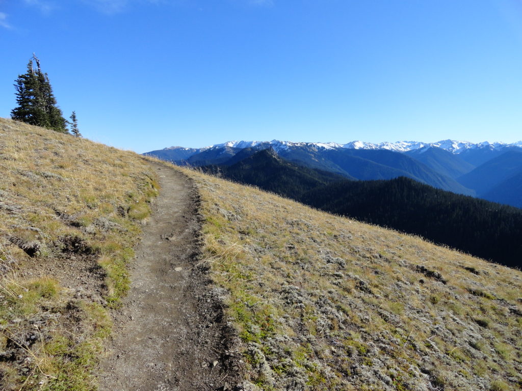
Quick Facts: Location: Olympic National Park – Hurricane Ridge Road Land Agency: National Park Service Roundtrip: 5.2 miles Elevation Gain: 1,100 feet Green Trails Map: Elwha North-Hurricane Ridge No. 134S Contact: Olympic National Park Access: From Port Angeles, follow Race Street south to Mount Angeles Ave to the Heart O’ the Hills Parkway (Hurricane Ridge…
Read MoreLake of the Angels─Hell of a hike to heavenly destination
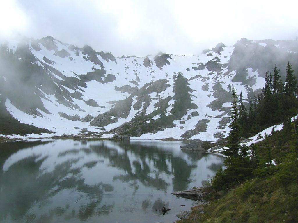
Quick Facts: Location: Hamma Hamma River Valley Land Agency: Olympic National Forest and Park Roundtrip: 7.2 miles Elevation Gain: 3,400 feet Green Trails Map: Olympic Mountains East 168SX Recommended Guidebook: Day Hiking Olympic Peninsula 2nd edition (Mountaineers Books) Access: From Hoodsport, follow US 101 north for 14 miles. Turn left at Milepost 318 onto the…
Read MoreFlapjack Lakes — Served with a healthy dose of scenery
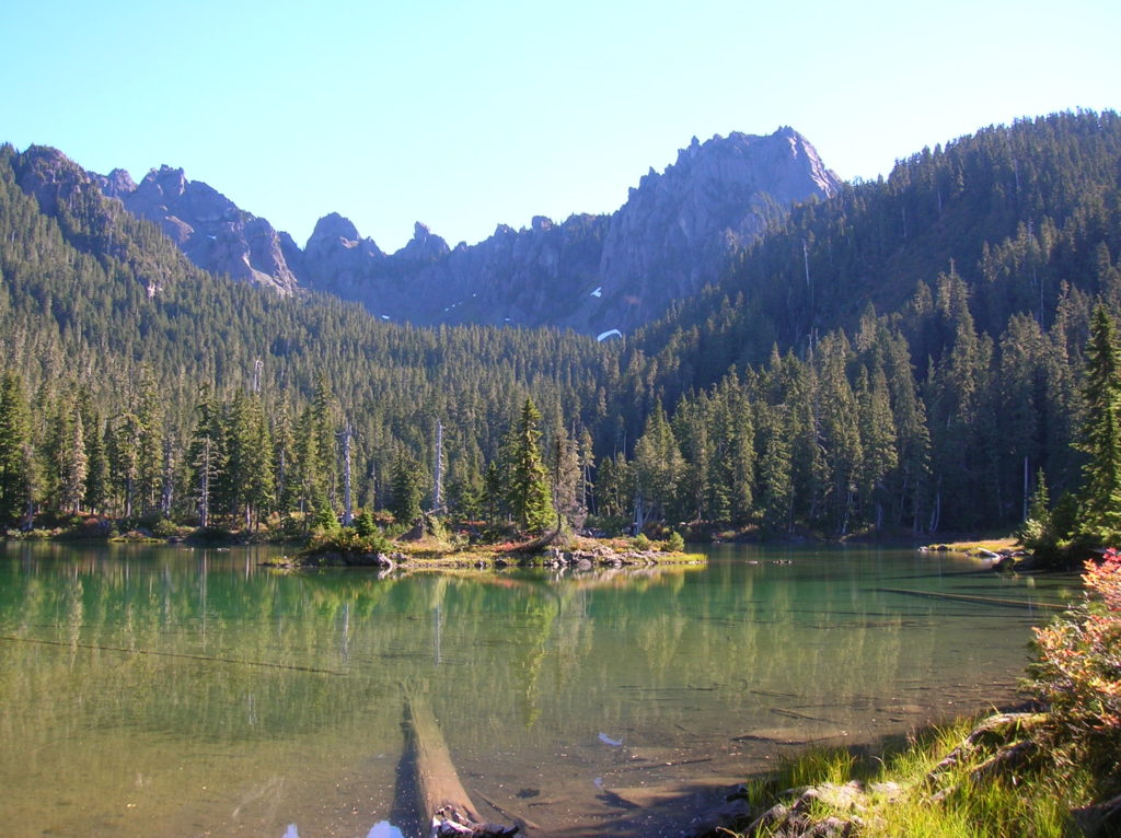
Quick Facts: Location: Staircase, Olympic National Park Land Agency: National Park Service Roundtrip: 15.4 miles Elevation gain: 3,050 feet Contact: Olympic National Park Wilderness Information Center (360) 565-3100 Green Trails Map: Olympic Mountains East 168S Notes: Dogs prohibited; National Park entry fee; Backcountry camping permit required for overnight trips; Practice Leave No Trace Principles Access: From…
Read MoreRuby Beach─Easily accessible but still wild
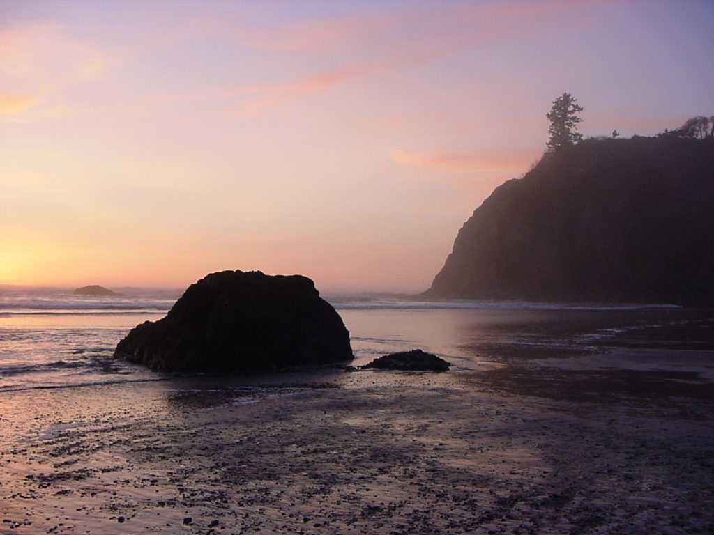
Quick Facts: Location: Olympic Coast Land Agency: National Park Service Roundtrip: To Ruby Beach: 0.5 mile; To Hoh River: 6.0 miles Elevation Gain: 80 feet Green Trails Map: Olympic Coast 99S Notes: Dogs permitted but must be on a leash. Access: From Forks, head south on US 101 for 27 miles to Ruby Beach trailhead.…
Read MoreCape Flattery─Hike to the northwestern most point in Washington State

Quick Facts: Location: Olympic Peninsula Coast Land Agency: Makah Nation Reservation Roundtrip: 1.5 miles Elevation Gain: 300 feet Contact: Makah Indian Nation Green Trails Map: Cape Flattery, WA- No 98S Notes: Dogs allowed on leash, Makah Recreation Pass required ($20, available at Washburn’s General Store ,the Makah Museum and several other locations in Neah Bay).…
Read MoreDeer Ridge–Enjoy dear views of the Gray Wolf River Valley
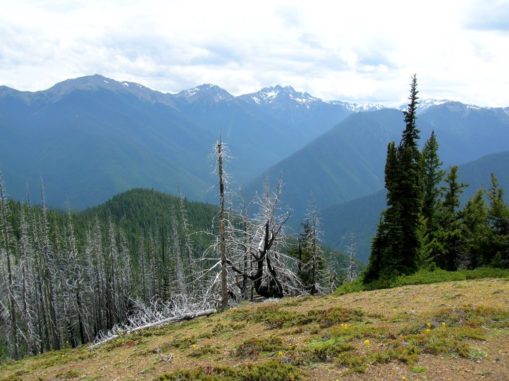
Quick Facts: Location: Northeast Olympic Peninsula Land Agency: Olympic National Forest and Olympic National Park Roundtrip: 10.0 miles Elevation gain: 2800 feet Contact: Hood Canal Ranger District, Olympic National Forest; and Olympic National Park Green Trails Map: Olympics East no. 168SX Notes: Dogs are prohibited on trail in the national park Good to Know: dog-friendly…
Read MoreMount Rose–How sweet are thy views!
Quick Facts: Location:Mount Skokomish Wilderness, Southeast Olympic Peninsula Land Agency: Olympic National Forest Roundtrip: 6.7 miles Elevation gain: 3,500 feet Green Trails Maps: Olympic Mountains East No. 168SX Contact: Hood Canal District, Quilcene Notes: Wilderness regulations apply Access: From Shelton, travel north on US 101 for 15 miles to Hoodsport. Turn left onto SR 119…
Read More