Posts Tagged ‘dog-friendly hike’
Vancouver Lake Regional Park
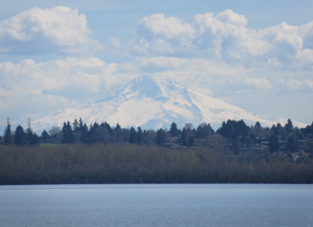
Volcano views and excellent birdwatching just west of downtown Vancouver, WA Quick Facts: Location: Vancouver, WA Land Agency: Clark County Parks Round Trip: 3.0 miles of trails Elevation Gain: minmal Contact: Vancouver Lake Regional Park Detailed Information: Urban Trails Vancouver WA (Mountaineers Books) Notes: year round parking fee of $5.00; Dogs permitted on-leash and prohibited…
Read MoreTwo Trees Trail─Two big pines and plenty of other trees, too!
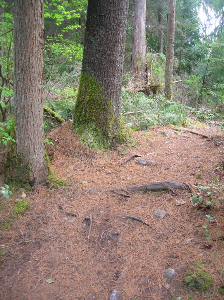
Quick Facts: Location: Maltby Land Agency: Snohomish County Parks Roundtrip: 3.8 miles Elevation Gain: 75 feet Special Note: Dogs must be leashed. Contact: Snohomish County Parks Access: From SR 522 in Maltby (5.0 miles east of Woodinville; 8.0 miles west of Monroe) head east on Paradise Lake Road for 1.7 miles to trailhead. Snohomish County…
Read MoreLake Twentytwo─waterfalls, big cedars and a beautiful lake beneath Mount Pilchuck
Quick Facts Location: Mountain Loop Highway near Granite Falls Land Agency: Mount Baker-Snoqualmie National Forest Roundtrip: 5.4 miles Elevation Gain: 1,350 feet Green Trails Map: Mountain Loop Highway 111SX Notes: NW Forest Pass required; dogs permitted on leash; trail can get busy, practice Leave No Trace ethics and consider visiting on a weekday. Access: From…
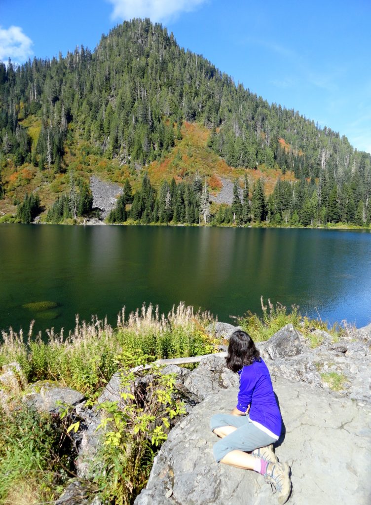
Read MoreMelakwa Lake–The buzz is out on this great Snoqualmie Pass hike
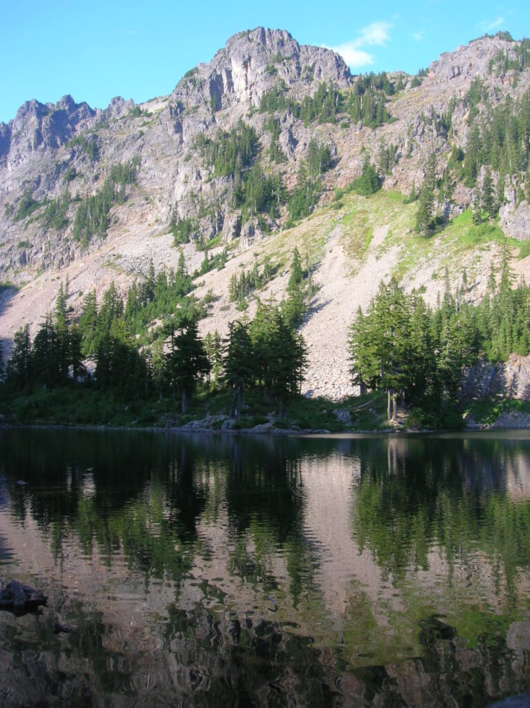
Location: Snoqualmie Pass region Land Agency: Mount Baker-Snoqualmie National Forest Roundtrip: 9.0 miles High Point: 4,600 feet Elevation gain: 2,400 feet Difficulty: difficult Green Trails Map: Snoqualmie Pass Gateway, WA- No 207SX Contact: North Bend Ranger District: Mount Baker Snoqualmie National Forest Notes: NW Forest Pass or Interagency Pass required; dogs must be on a…
Read MoreCooney Lake–larches at the edge of the North Cascades
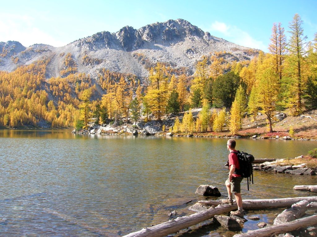
Location: Sawtooth Ridge Roadless Area Land Agency: Okanogan-Wenatchee National Forest Roundtrip: 16 miles High Point: 7,300 feet Elevation gain: 3,800 feet Difficulty: moderate Green Trails Maps: Prince Creek, WA- No. 115 Contact: Methow Valley Ranger District: Okanogan-Wenatchee National Forest Notes: Northwest Forest Pass or Interagency Pass required Access: From Twisp follow SR 153 south turning…
Read MoreImage Lake — jewel in the heart of the Glacier Peak Wilderness
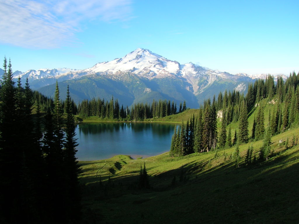
Quick Facts: Location: Glacier Peak Wilderness Land Agency: Mount Baker-Snoqualmie National Forest Roundtrip: 33.0 miles Elevation Gain: 4,700 feet Green Trails Map: Mountain Loop Highway 111SX Contact: Darrington Ranger District: Mount Baker Snoqualmie National Forest Notes: NW Forest or Interagency Pass required; No camping within ¼ mile of Image Lake—use established campsites; no fires at lake; respect re-vegetation…
Read MoreJay Lake — Solitude and camping at Wallace Falls State Park

Quick Facts: Location: Skykomish River Valley, US 2 Land Agency: Washington State Parks Roundtrip: 11.5 miles Elevation gain: 1,575 feet Green Trails Map: Contact: Wallace Falls State Park Notes: Discover Pass required; Dogs must be leashed; Camping requires a permit-attain from park prior to trip. Access: From Everett, follow US 2 for 28 miles east…
Read MoreDeer Lake– Wilderness lake above White Pass
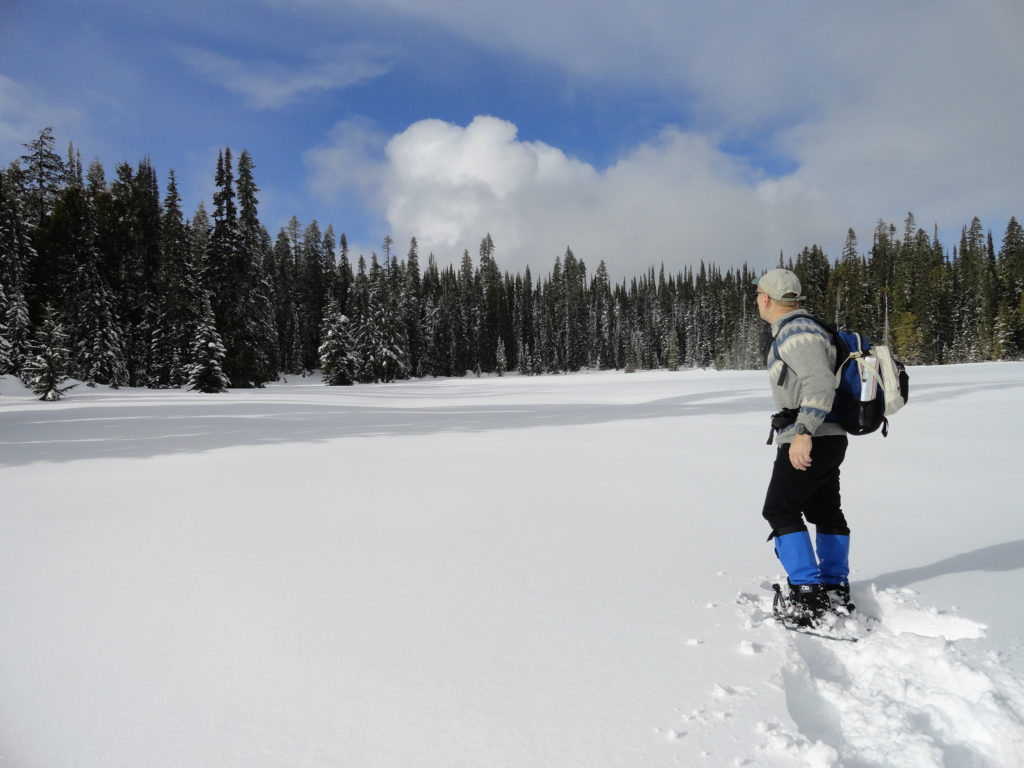
Location: William O. Douglas Wilderness, White Pass Land Agency: Okanogan-Wenatchee National Forest Roundtrip: 6.0 miles Elevation gain: 780 feet Green Trails Map: White Pass No. 303 Contact: White Pass Nordic Center Access: From Yakima or Morton follow US 12 to White Pass and proceed north to parking area near Yurt behind the Village Inn Condominiums.…
Read MoreFortson Ponds –An old mill site on an emerging long distance trail
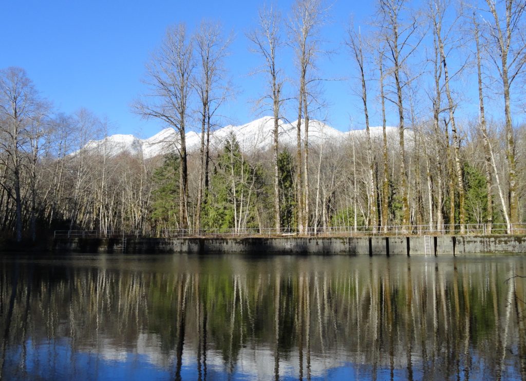
Quick Facts: Location: Darrington Land Agency: Snohomish County Parks Roundtrip: 2.0 miles Elevation gain: none Difficulty: Easy Contact: Snohomish County Parks Green Trails Map: Mountain Loop Highway 111SX Notes: Dogs allowed on leash Access: From Exit 208 on I-5 (Arlington) travel east on SR 530 for 25.2 miles turning left onto Fortson Mill Road (near…
Read MoreCedar Butte–Bad spelling on the summit and bad tidings at Christmas Lake below

Location: Snoqualmie Valley near North Bend Land Agency: Washington State Parks Roundtrip: 4.0 miles Elevation gain: 900 feet Green Trails Maps: Rattlesnake Mountain Upper Snoqualmie Valley No. 205S Contact: Washington State Parks (360) 902-8844 Notes: Discover Pass required; Dogs must be leashed Access: From Seattle take I-90 east to exit 32 in North Bend turning right (south)…
Read More