Posts Tagged ‘dog-friendly hike’
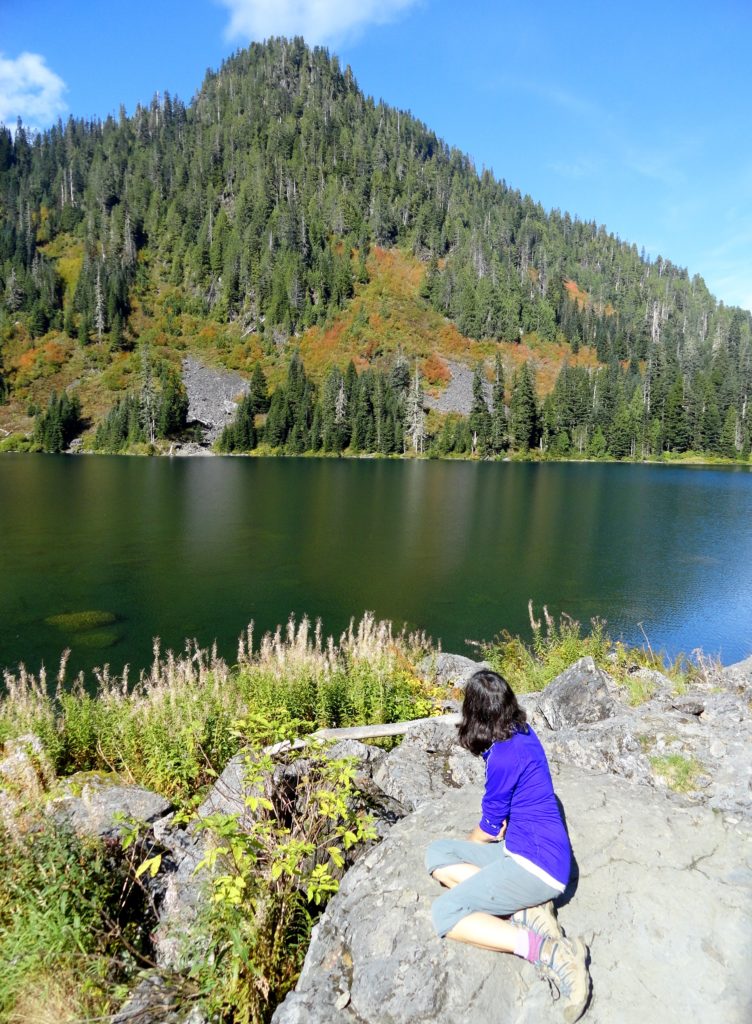
Pinnacle Lake — Pretty little lake perched on a shoulder of Mount Pilchuck
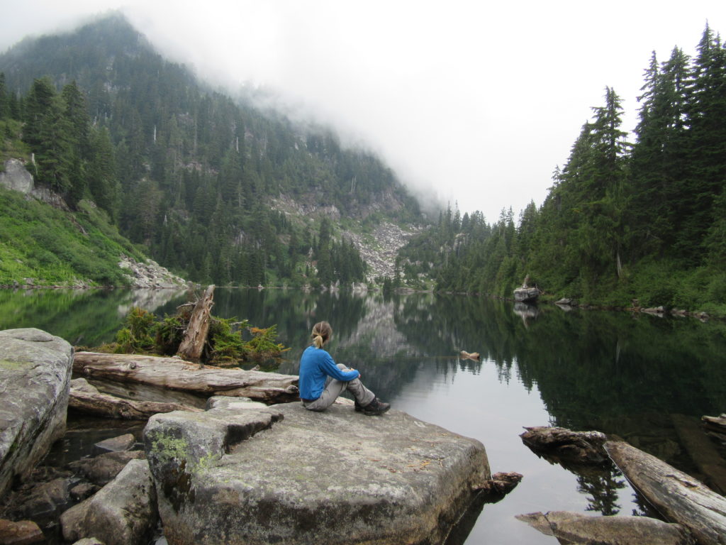
Quick Facts: Location: Mountain Loop Highway, near Granite Falls Land Agency: Mount Baker-Snoqualmie National Forest; Washington State Parks Roundtrip: 4.2 miles Elevation gain: 1,100 feet Green Trails Maps: Mountain Loop Highway 111SX Contact: Darrington Ranger District: Mount Baker-Snoqualmie National Forest Notes: access road is rough, high clearance vehicles recommended. Access: From Granite Falls follow the…
Read MoreBalch Creek–Dramatic Ravine a Forest Park highlight
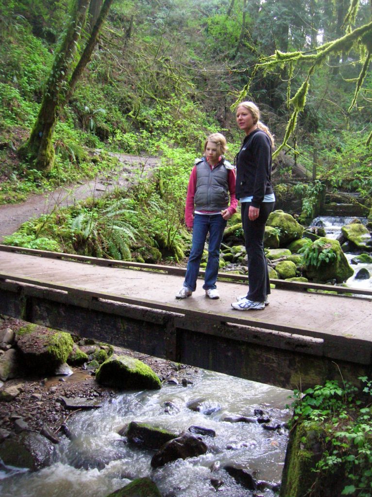
Location: Forest Park, Portland, Oregon Land Agency: Portland Parks and Recreation Roundtrip: 2.4 miles High Point: 425 feet Elevation gain: 300 feet Difficulty: easy Green Trails Map: Forest Park No 426S Contact: Contact/permits: Portland Parks and Recreation ; Forest Park Conservancy; Notes: dogs must be leashedAccess: From downtown Portland, follow NW Vaughn Street west turning…
Read MoreExplorer Falls–It's an easy search to find these falls

Quick Facts: Location: Near Lake Roesiger between Monroe and Granite Falls Land Agency: Washington DNR Roundtrip: 5.2 miles Elevation gain: 700 feet Contact: Washington DNR Notes: Discover Pass Required. Do not block gates, nor drive past it if open. Active logging area, be alert to trucks on roadway and yield right-of-way. Access: From Monroe, follow…
Read MoreVancouver Lake Regional Park
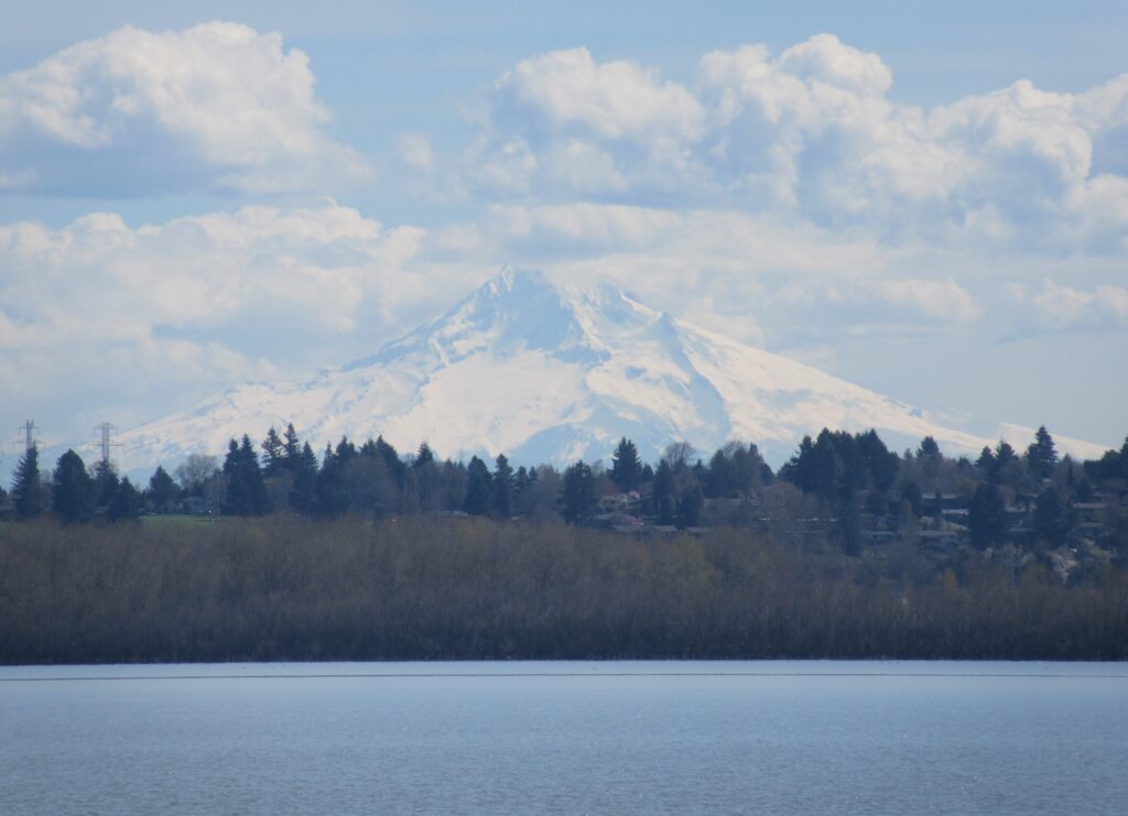
Volcano views and excellent birdwatching just west of downtown Vancouver, WA Quick Facts: Location: Vancouver, WA Land Agency: Clark County Parks Round Trip: 3.0 miles of trails Elevation Gain: minmal Contact: Vancouver Lake Regional Park Detailed Information: Urban Trails Vancouver WA (Mountaineers Books) Notes: year round parking fee of $5.00; Dogs permitted on-leash and prohibited…
Read MoreTwo Trees Trail─Two big pines and plenty of other trees, too!
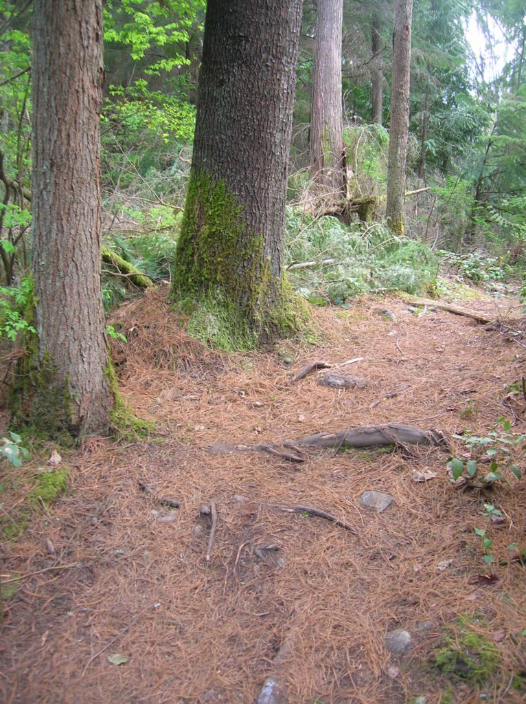
Quick Facts: Location: Maltby Land Agency: Snohomish County Parks Roundtrip: 3.8 miles Elevation Gain: 75 feet Special Note: Dogs must be leashed. Contact: Snohomish County Parks Access: From SR 522 in Maltby (5.0 miles east of Woodinville; 8.0 miles west of Monroe) head east on Paradise Lake Road for 1.7 miles to trailhead. Snohomish County…
Read MoreLake Twentytwo─waterfalls, big cedars and a beautiful lake beneath Mount Pilchuck
Quick Facts Location: Mountain Loop Highway near Granite Falls Land Agency: Mount Baker-Snoqualmie National Forest Roundtrip: 5.4 miles Elevation Gain: 1,350 feet Green Trails Map: Mountain Loop Highway 111SX Notes: NW Forest Pass required; dogs permitted on leash; trail can get busy, practice Leave No Trace ethics and consider visiting on a weekday. Access: From…
Read MoreMelakwa Lake–The buzz is out on this great Snoqualmie Pass hike
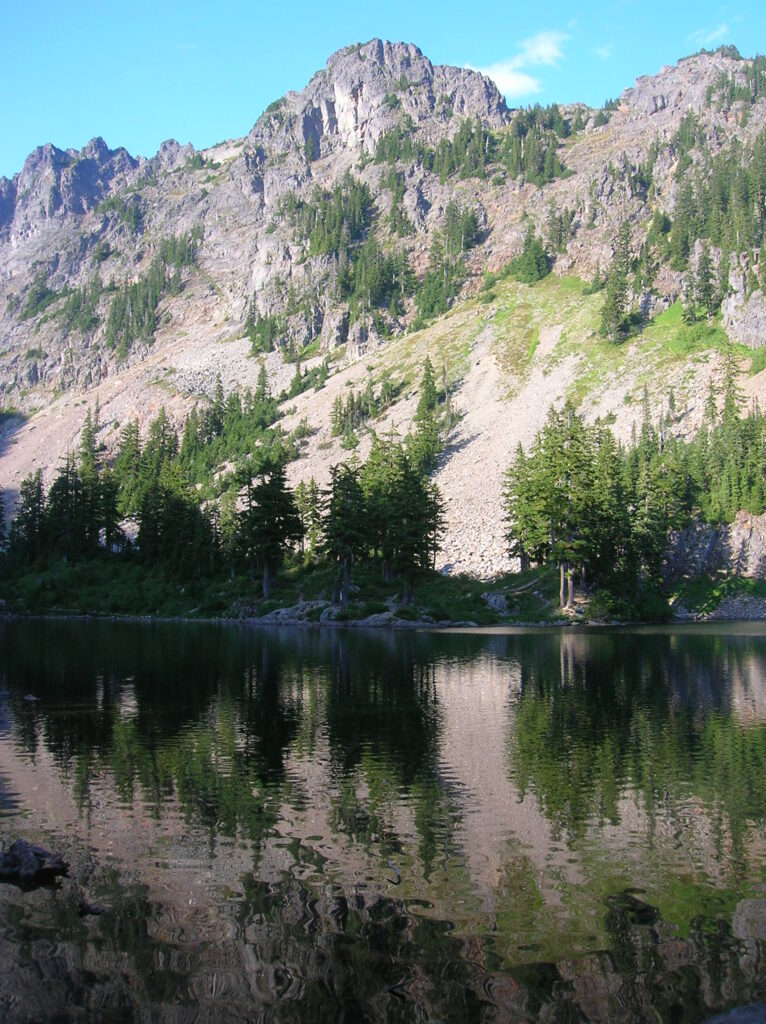
Location: Snoqualmie Pass region Land Agency: Mount Baker-Snoqualmie National Forest Roundtrip: 9.0 miles High Point: 4,600 feet Elevation gain: 2,400 feet Difficulty: difficult Green Trails Map: Snoqualmie Pass Gateway, WA- No 207SX Contact: North Bend Ranger District: Mount Baker Snoqualmie National Forest Notes: NW Forest Pass or Interagency Pass required; dogs must be on a…
Read MoreCooney Lake–larches at the edge of the North Cascades
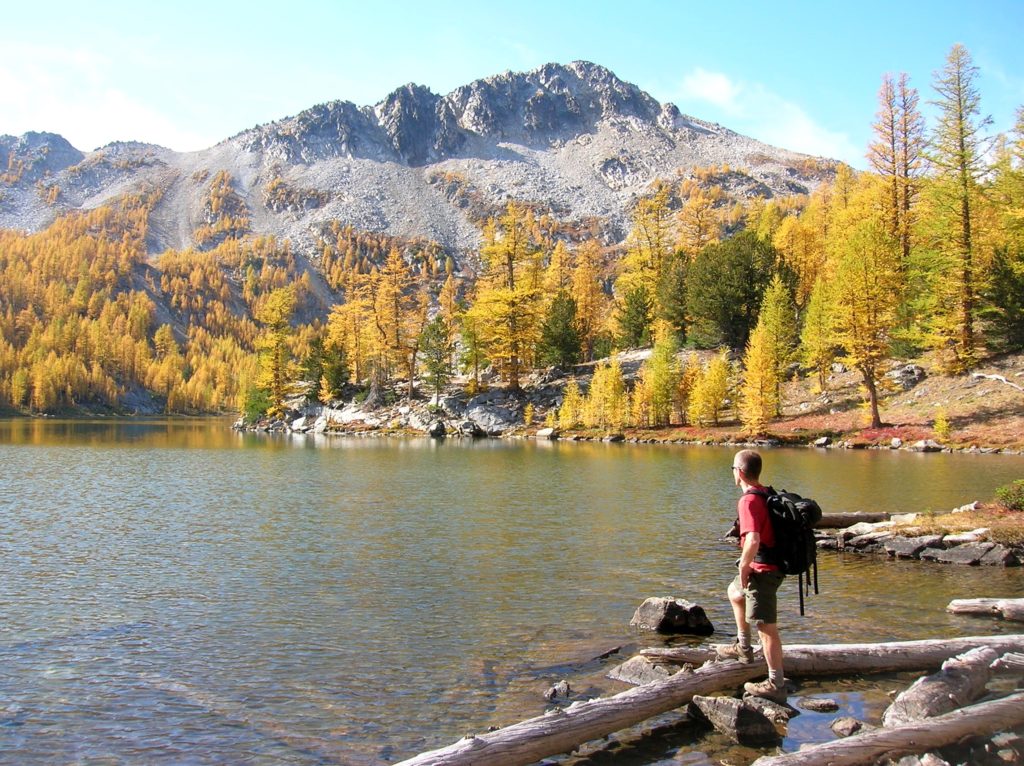
Location: Sawtooth Ridge Roadless Area Land Agency: Okanogan-Wenatchee National Forest Roundtrip: 16 miles High Point: 7,300 feet Elevation gain: 3,800 feet Difficulty: moderate Green Trails Maps: Prince Creek, WA- No. 115 Contact: Methow Valley Ranger District: Okanogan-Wenatchee National Forest Notes: Northwest Forest Pass or Interagency Pass required Access: From Twisp follow SR 153 south turning…
Read MoreImage Lake — jewel in the heart of the Glacier Peak Wilderness
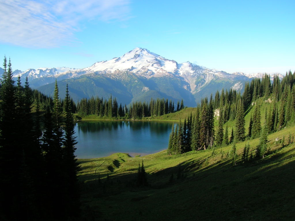
Quick Facts: Location: Glacier Peak Wilderness Land Agency: Mount Baker-Snoqualmie National Forest Roundtrip: 33.0 miles Elevation Gain: 4,700 feet Green Trails Map: Mountain Loop Highway 111SX Contact: Darrington Ranger District: Mount Baker Snoqualmie National Forest Notes: NW Forest or Interagency Pass required; No camping within ¼ mile of Image Lake—use established campsites; no fires at lake; respect re-vegetation…
Read MoreJay Lake — Solitude and camping at Wallace Falls State Park

Quick Facts: Location: Skykomish River Valley, US 2 Land Agency: Washington State Parks Roundtrip: 11.5 miles Elevation gain: 1,575 feet Green Trails Map: Contact: Wallace Falls State Park Notes: Discover Pass required; Dogs must be leashed; Camping requires a permit-attain from park prior to trip. Access: From Everett, follow US 2 for 28 miles east…
Read More