Posts Tagged ‘dog-friendly hike’
Arlington Airport Trail–Come Fly with Me on a walk around an historic airport
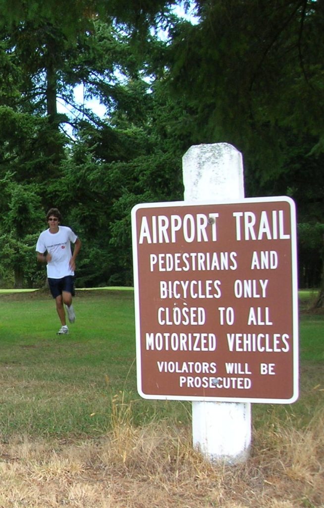
Quick Facts: Location: Arlington Land Agency: City of Arlington Roundtrip: 5.5 miles Elevation gain: 50 feet Difficulty: Easy Contact: Arlington Airport Commission Notes: Dogs must be on leash Access: From Everett, head north on I-5 to Exit 206. Continue east on SR 531 (172nd Street NE) for 1.4 miles. Turn left onto 59th Avenue NE and…
Read MoreSugarloaf — Savor Sweet Salish Sea Views
Quick Facts: Location: Anacortes, Fidalgo Island Land Agency: Anacortes Community Forest Lands Roundtrip: 2.5 miles Elevation gain: 650 feet Contact: Anacortes Parks and Recreation Notes: dogs permitted on leash; some trails open to bicycles, horses. Access: From Exit 230 on I-5 in Burlington, head west on SR 20 for 13.5 miles. Turn right onto…
Read MoreBrowns Point -Kalaloch–Kid and dog friendly hike on the wild Olympic Coast
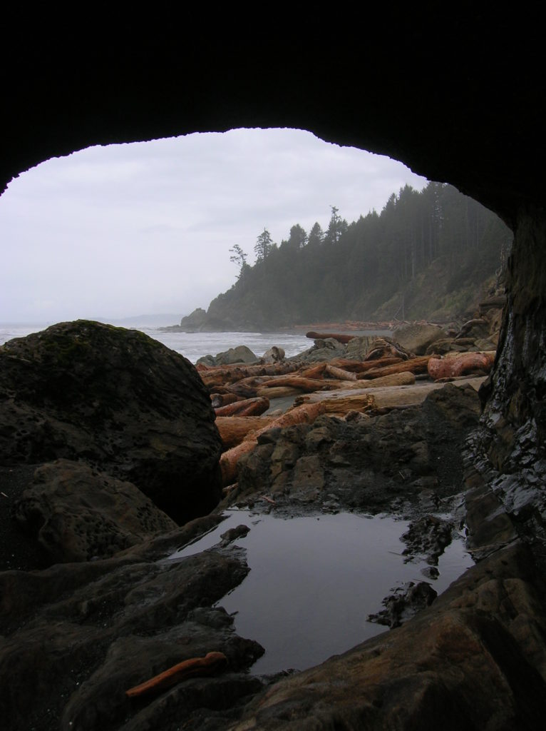
Location: Olympic National Park coast Land Agency: National Park Service Roundtrip: 4.0 miles Elevation gain: 50 feet Contact: Olympic National Park Wilderness Information Center Green Trails Map: Olympic Coast 99S Recommended Resource: Day Hiking Olympic Peninsula 2ed (Mountaineers Books) Notes: Dogs must be leashed; Browns Point can only be rounded during low tides; Practice Leave No…
Read MoreCatherine Creek Rock Arch–A touch of Utah in the Northwest!
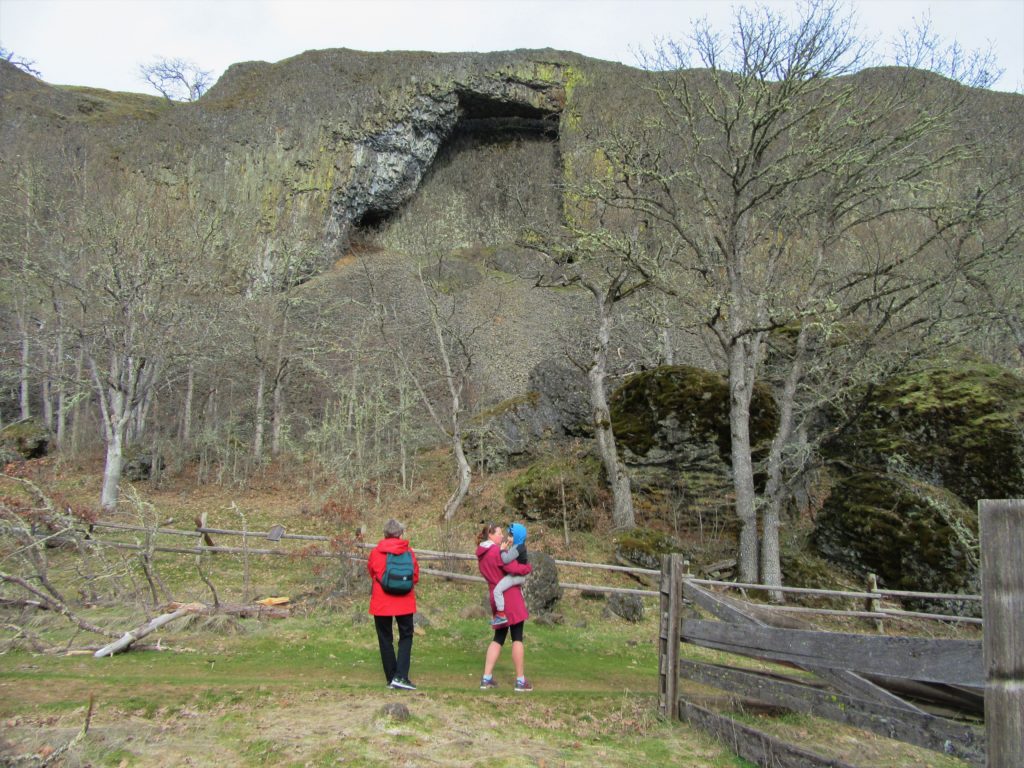
Location: Columbia River Gorge National Scenic Area Land Agency: Columbia Gorge National Scenic Area Roundtrip: 2.3 miles Elevation gain: 370 feet Difficulty: Easy Contact: Columbia Gorge National Scenic Area Notes: Dogs permitted on leash. Be aware or ticks and poison oak. Green Trails Map: Columbia River Gorge East No. 432S Good to Know: kid-friendly, dog-friendly…
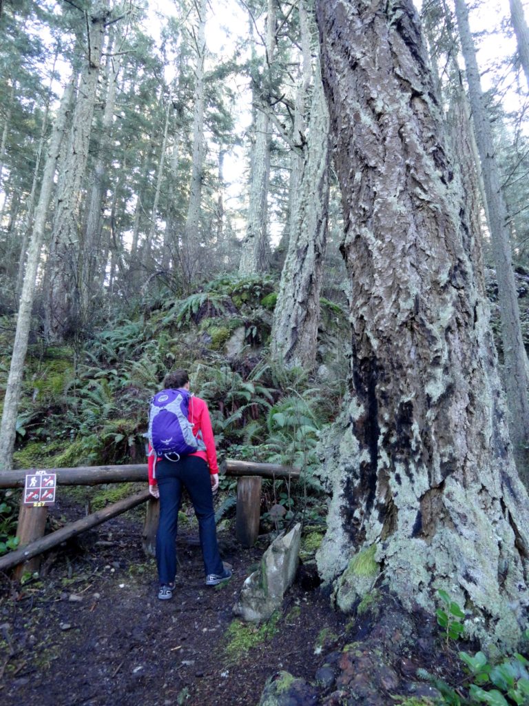
Read MoreGreenbank Farm–Plow through an array of family and dog friendly trails
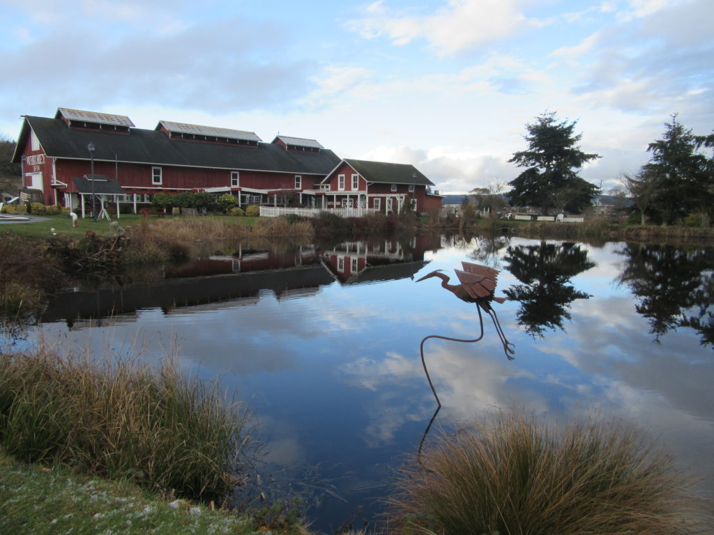
Quick Facts: Location: Whidbey Island Land Agency: Port of Coupeville Roundtrip: more than 4.0 miles of trails High Point: 300 feet Elevation gain: up to 280 feet Contact: Port of Coupeville Recommended Resource: Urban Trails Everett (Mountaineers Books) Notes: Some trails are open to equestrians; some trails are in an off-leash dog area Access: From Clinton Ferry Terminal on Whidbey…
Read MoreGreen River Natural Area–Explore this Sprawling Greenbelt between Auburn and Enumclaw
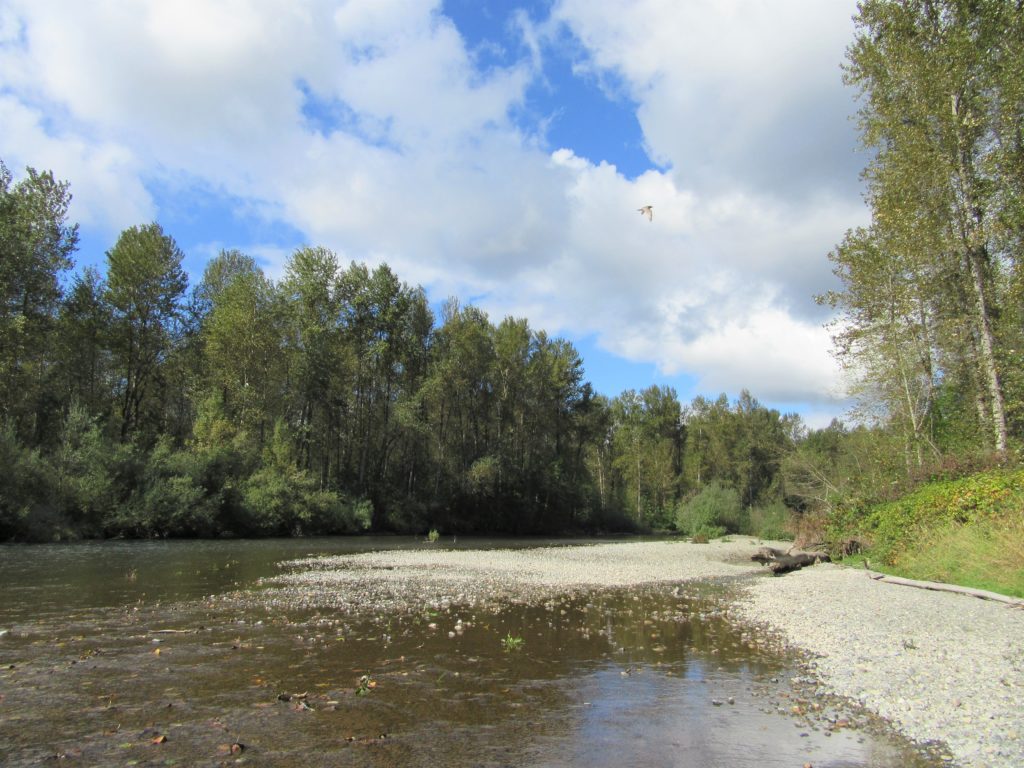
Quick Facts: Location: South King County Land Agency: King County Parks Round Trip: more than 7 miles of trails Elevation Gain: up to 650 feet Contact: King County Parks Recommended Resource: Urban Trails Tacoma (Mountaineers Books) Notes: Dogs allowed on leash Access: From SR 18 in Auburn the exit for SR 164 (Auburn Way S)…
Read MoreCutthroat Lakes– Hike to a set of beautiful tarns beneath Bald Mountain
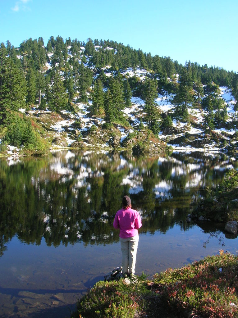
Quick Facts: Location: Mountain Loop Highway Land Agency: Mount Baker-Snoqualmie National Forest; Washington Department of Natural Resources Roundtrip: 6.0 miles Elevation gain: 1,700 feet Green Trails Maps: Mountain Loop Highway 111SX Recommended Resource: Day Hiking North Cascades (Romano; Mountaineers Books) Contact: Darrington Ranger District: Mount Baker-Snoqualmie National Forest Notes: access road is narrow and parking is limited.…
Read MoreHall Mountain via Noisy Creek– It’s a haul to this old lookout site
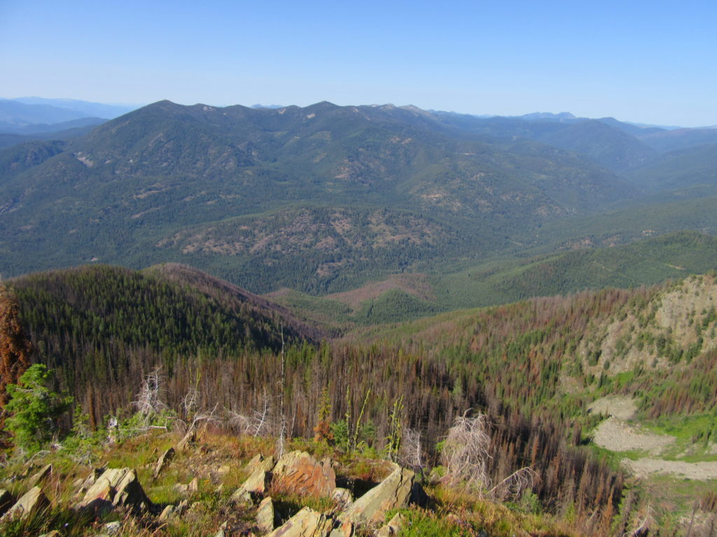
Quick Facts: Location: Selkirk Mountains, Eastern Washington Land Agency: National Forest Service Roundtrip: 14 miles Elevation Gain: 4130 feet Contact: Sullivan Lake District, Colville National Forest Notes: Practice Leave No Trace principles; grizzly habitat, trail passes recent burn zone–use caution Access: From Newport, Washington follow SR 20 north (west) 47 miles to the junction with SR 31 in…
Read MoreMount Dickerman–arduous climb to sweeping alpine views
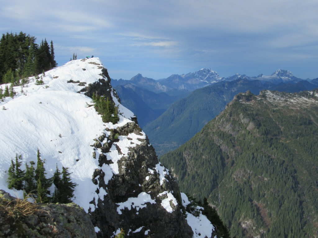
Quick Facts: Location: Mountain Loop Highway near Granite Falls Land Agency: Mount Baker-Snoqualmie National Forest Roundtrip: 8.6 miles High Point: 5,723 feet Elevation gain: 3,900 feet Difficulty: difficult Green Trails Map: Mountain Loop Highway No. 111SX Contact: Darrington Ranger District: Mount Baker Snoqualmie National Forest Notes: Northwest Forest Pass required Access: From Granite Falls follow…
Read MoreMount Spokane–Savor spectacular views from this prominent peak above Washington’s second city
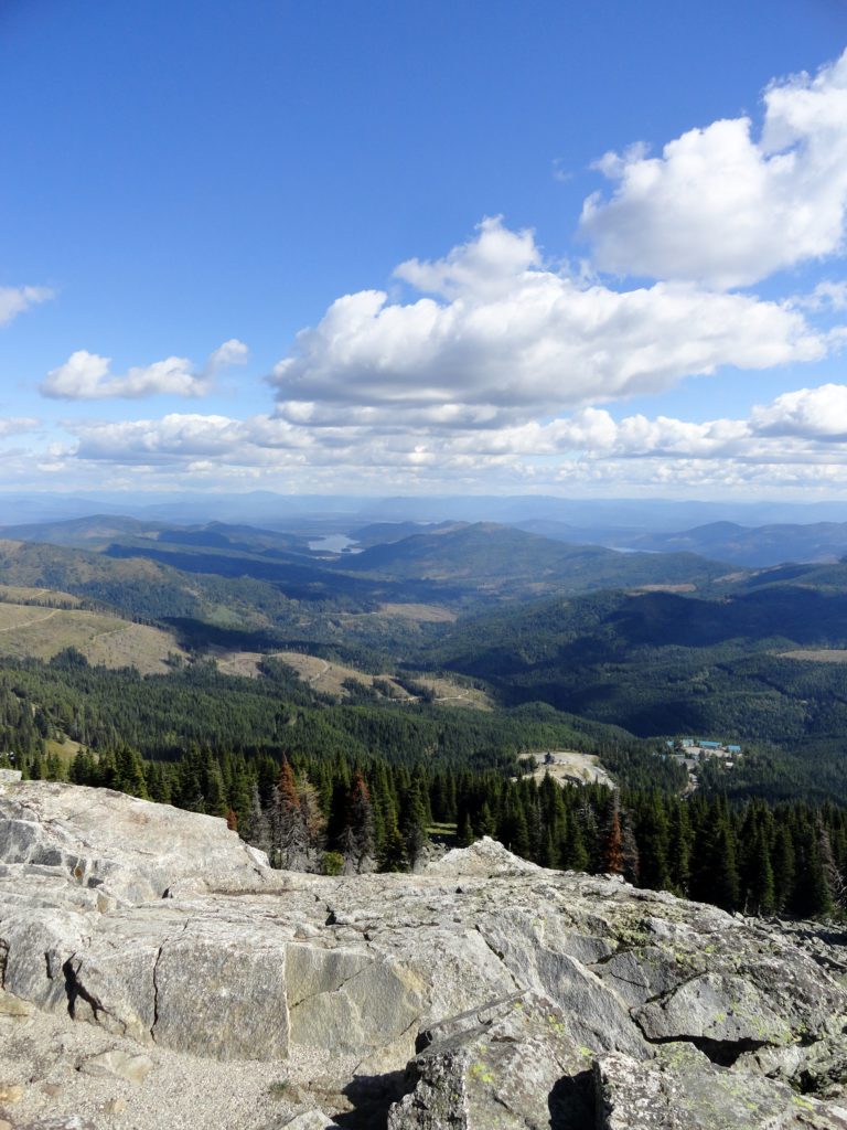
Location: Mount Spokane State Park Land Agency: Washington State Parks Roundtrip: 6.0 miles High Point: 5,883 feet Elevation gain: 1,000 feet Difficulty: moderate Map: Mount Spokane State Park (Dharma Maps) Contact: Washington State Parks Note: Discover Pass Required; dogs permitted on leash Access: From Spokane, follow US 2 north 10 miles to Mead. Turn right…
Read More