Posts Tagged ‘dog-friendly’
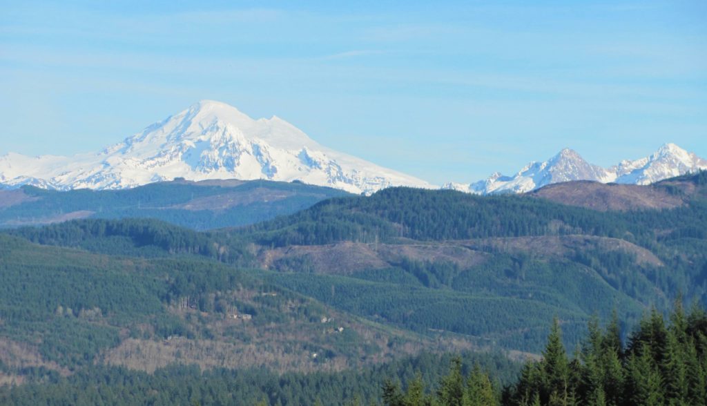
Boundary Bay Dyke Trail– Bundles of bald eagles, owls and shorebirds and breathtaking views of Mount Baker

Quick Facts: Location: BC Lower Mainland, Land Agency: Boundary Bay Wildlife Management Area One Way: 10.4 miles (16.7 kilometers) Elevation Gain: minimal Contact: Boundary Bay Wildlife Management Area Notes: trail also open to stock and bikes: dogs permitted on leash but note dogs not allowed on shoreline trail in Mud Bay Park from Oct 15-Apr…
Read MoreSquak Mountain East Ridge– discover the quiet Issaquah Alp
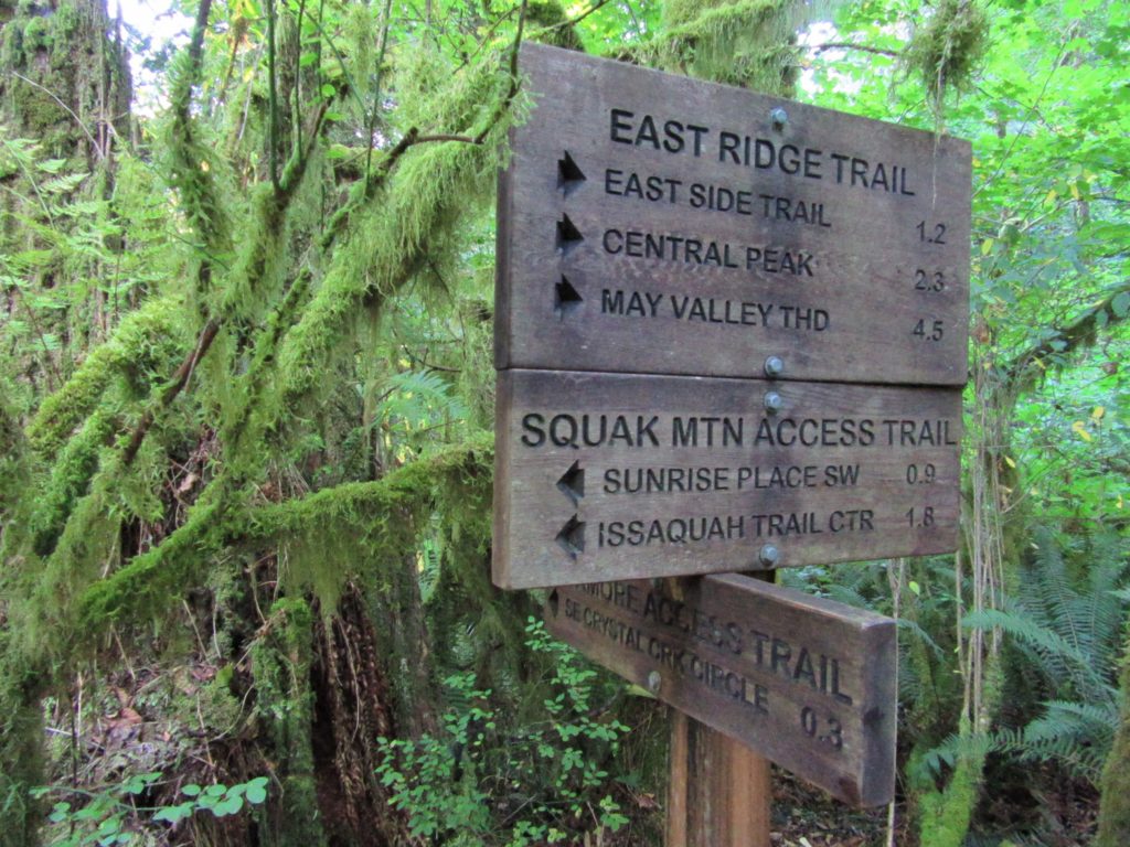
Quick Facts: Location: Issaquah Alps Land Agency: Washington State Parks Roundtrip: 8.0 miles Elevation Gain: 2000 feet Green Trails Map: Cougar Mountain/ Squak Mountain No. 203S Contact: Washington State Parks and Mountains to Sound Greenway Recommended Resource: Urban Trails Eastside Notes: Dogs must be leashed. Good to Know: snow-free winter hike, trail less taken, dog-friendly (on-leash), kid-friendly,…
Read MoreFort Casey Historical State Park — Frolic through a fort, to a lighthouse, and on a pretty beach
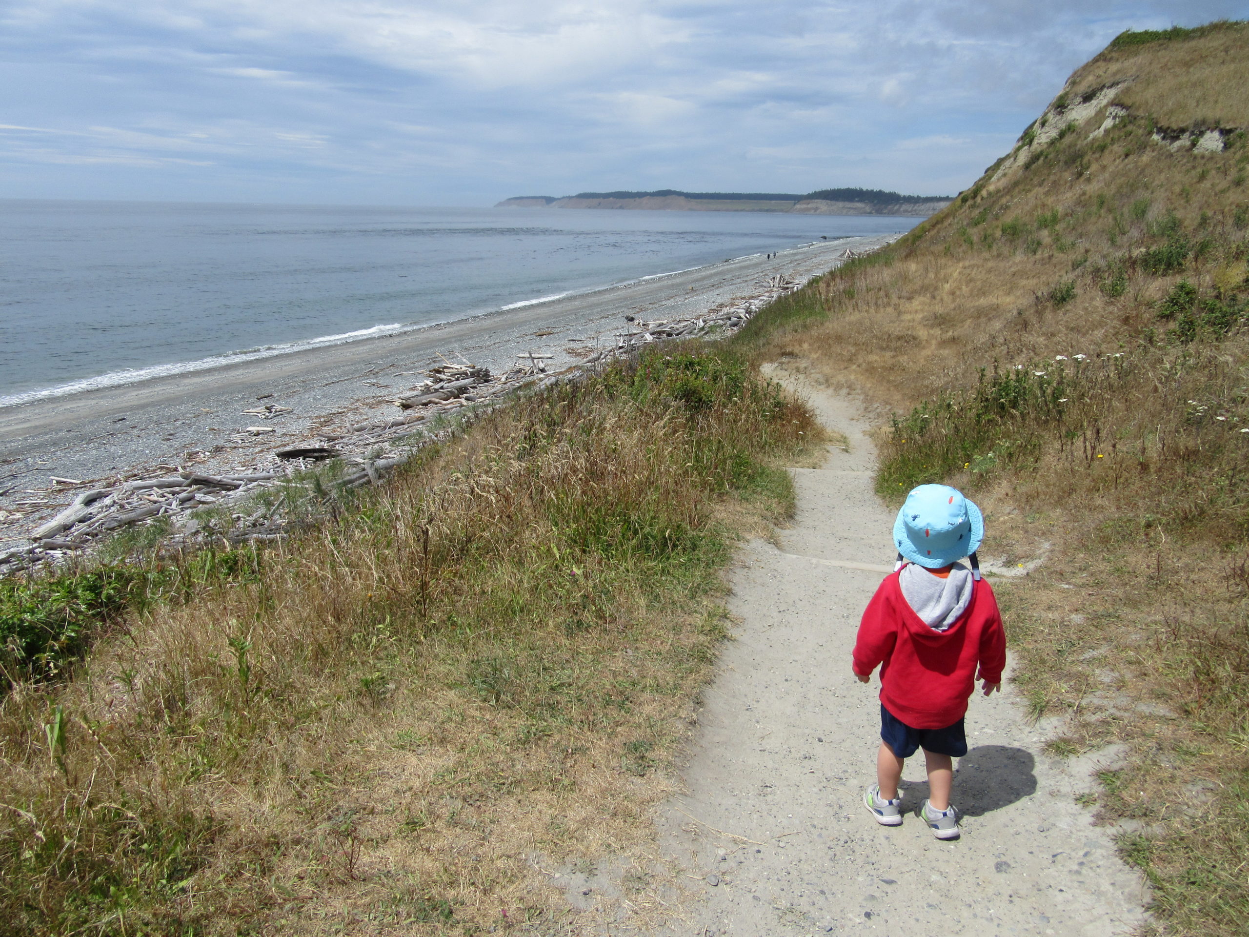
Quick Facts: Location: Whidbey Island Land Agency: Washington State Parks Round Trip: 1.8 miles of trails Elevation Gain: up to 90 feet Contact: Washington State Parks Recommended Resource: Urban Trails Everett (Mountaineers Books) Notes: Discover Pass required; Dogs allowed on leash Access: From Mukilteo take ferry to Clinton on Whidbey Island. Then continue north on…
Read MoreMillersylvania State Park─Amble among ancient trees just minutes from Olympia
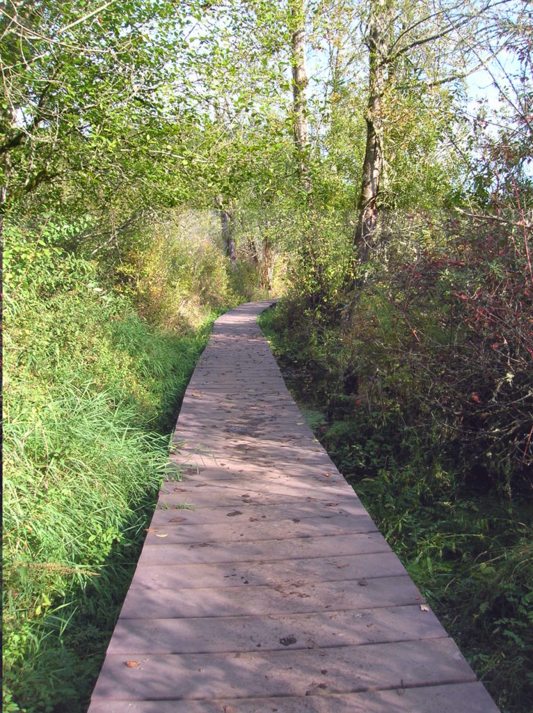
Quick Facts: Location: Thurston County Land Agency: Washington State Parks Roundtrip: 3.0 miles Elevation Gain: 75 feet Contact: Washington State Parks Recommended Resource: Urban Trails Olympia Notes: Discover Pass required; Dogs must be leashed. Access: From Olympia, head south on I-5 to Exit 99. Continue southeast on SR 121 for 4.2 miles. Turn right (west) into main…
Read MoreChuckanut Ridge — Follow a rough and tumble ridge to sweeping viewpoints
Quick Facts: Location: Chuckanut Mountains Land Agency: Whatcom County Parks and Washington State Parks Round Trip: 10.8 miles roundtrip Elevation Gain: 2000 feet Contact: Whatcom County Parks Recommended Resource: Urban Trails Bellingham (Mountaineers Books) Detailed map: Square One Maps Chuckanut Recreation Area Notes: Dogs allowed on leash Access: From Bellingham follow I-5 south to Fairhaven…
Read MoreThirteenmile Canyon– Wander one of wildest wilderness canyons in Eastern Washington
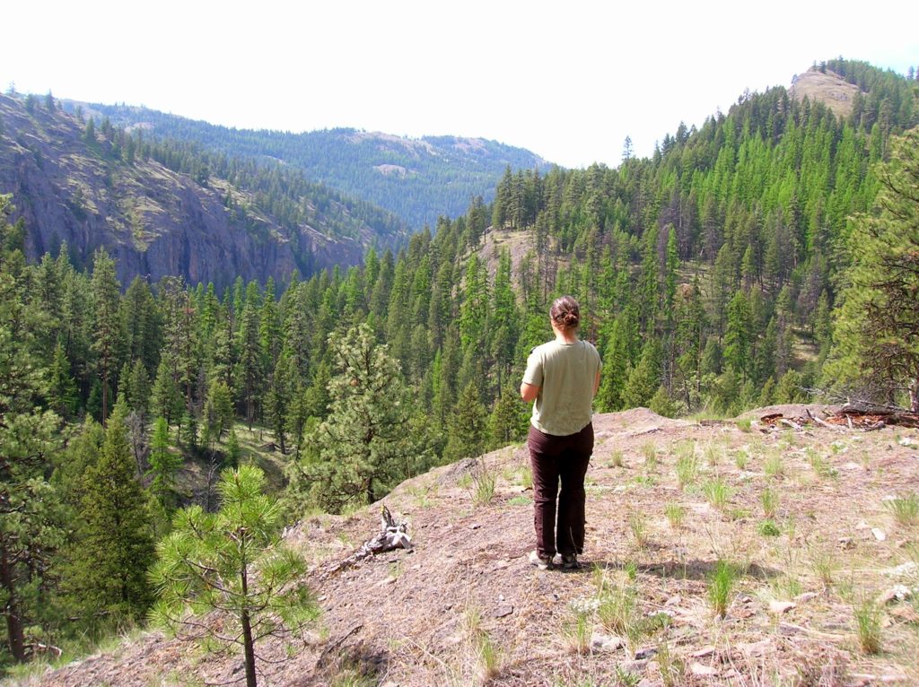
Location: Colville National Forest, Ferry County, Wa Land Agency: National Forest Service Roundtrip: 9.0 miles Elevation gain: 1,700 feet Contact: Colville National Forest, Republic Ranger District Notes: beware of rattlesnakes Access: From Republic follow SR 21 south 12.3 miles to trailhead located just within the Colville Indian Reservation Boundary. If coming from Wilbur, follow SR…
Read MoreSunrise Lake─Golden larches brighten the shores of this alpine lake
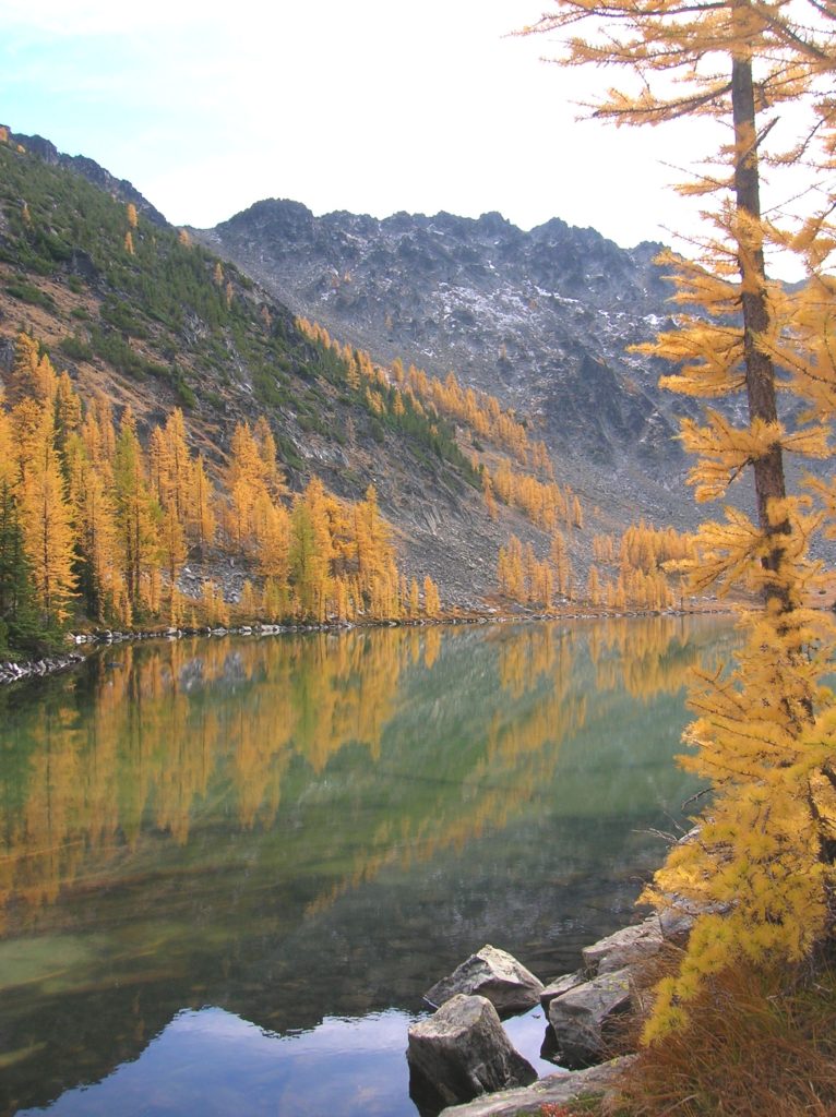
Quick Facts: Location: North Cascades – Sawtooth Ridge Land Agency: U.S. Forest Service Roundtrip: 13.0 miles Elevation Gain: 3,730 feet Green Trails Map: Prince Creek, WA- No. 115 Recommended Resource: Day Hiking North Cascades (Romano; Mountaineers Books) Access: From Twisp drive SR 20 east for 2.0 miles. Continue south on SR 153 for 12.0 miles turning right…
Read MoreApe Canyon–Hike through old-growth forest above a swath of destruction
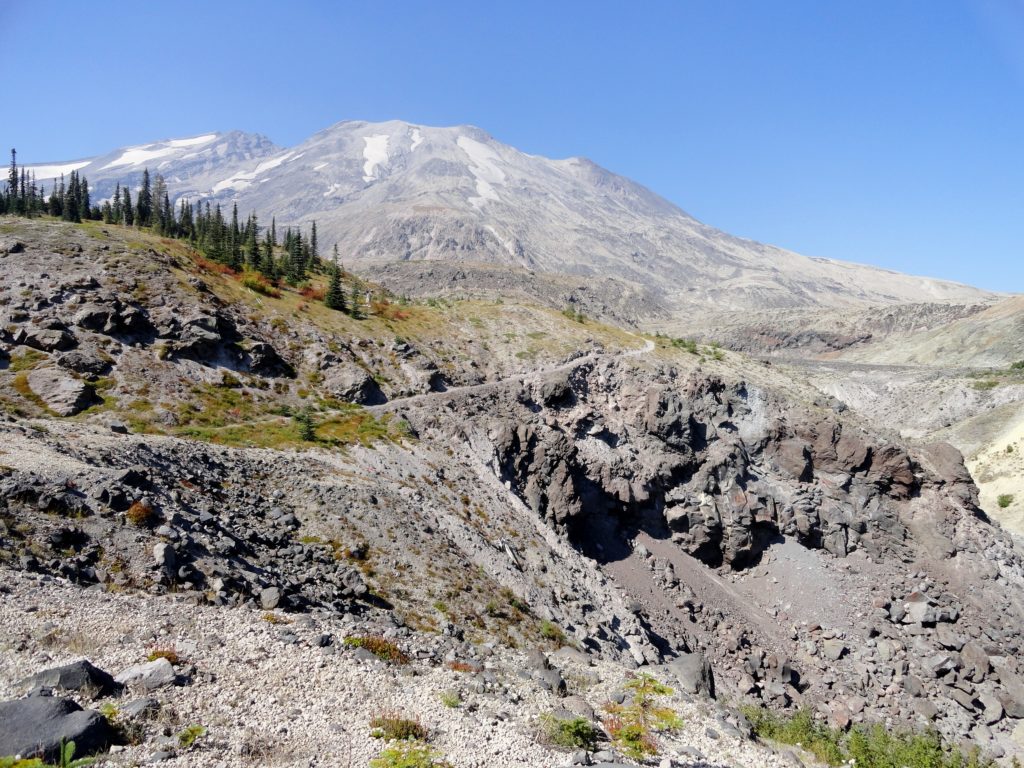
Quick Facts: Location: Mount St. Helens National Volcanic Monument Land Agency: National Forest Service Roundtrip: 9.4 miles Elevation Gain: 1,550 feet Contact: Mount St. Helens National Volcanic Monument Green Trails Map: Mount St Helens 332 Recommended Resource: Day Hiking Mount St Helens (Mountaineers Books) Notes: Northwest Forest Pass or Interagency Pass required. Trail is also open to mountain…
Read MoreRock Mountain via Snowy Creek—Big sky views and perhaps a goat or two
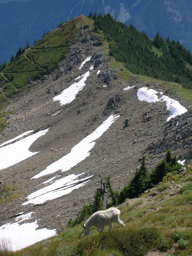
Quick Facts: Location: Nason Ridge near Stevens Pass Land Agency: Okanogan-Wenatchee National Forest Roundtrip: 9.8 miles Elevation Gain: 3,250 feet Green Trails Map: Alpine Lakes Stevens Pass Map 176S Access: From Everett head east on US 2. Four miles past Stevens Pass turn left onto Smith Brook Road (FR 6700). Follow for 6.0 miles turning…
Read MoreShoe Lake — A great hike good for your soul!
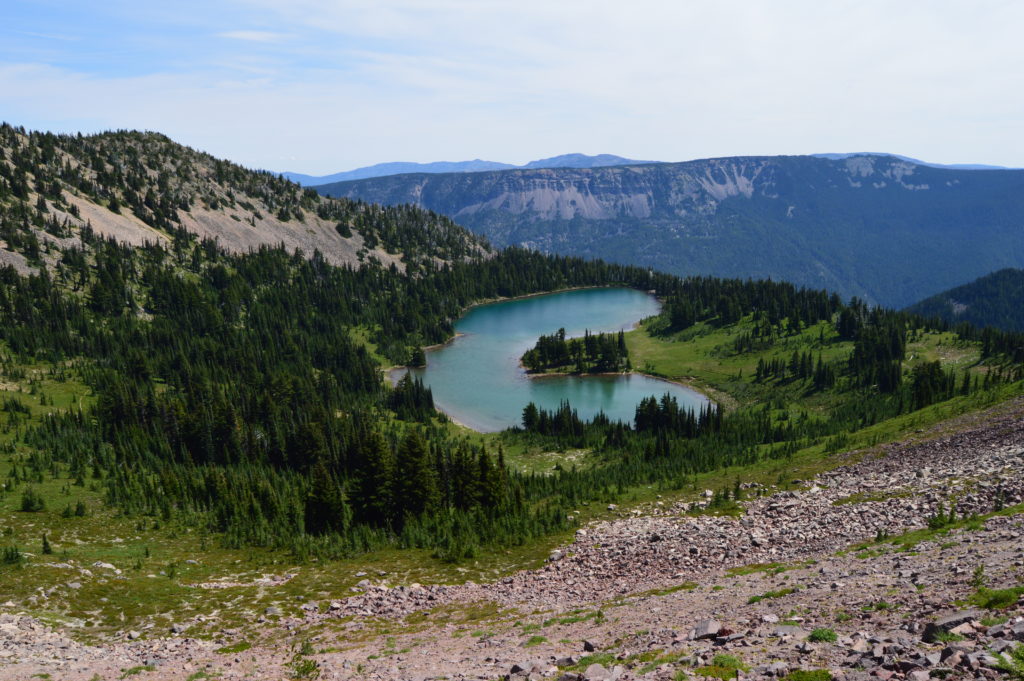
Quick Facts: Location: Goat Rocks Wilderness Land Agency: National Forest Service Roundtrip: 15.7 miles Elevation Gain: 2,625 feet Contact: Naches Ranger District, Okanogan-Wenatchee National Forest Green Trails Map: Goat Rocks William O Douglas Wilderness No. 303S Notes: Northwest Trail Pass or interagency pass required; Wilderness permit required, free, self-issued at trailhead; wilderness rules apply Access: From Packwood, follow…
Read More