Posts Tagged ‘dog-friendly’
Lanham Lake—Sublime snowshoeing above Stevens Pass
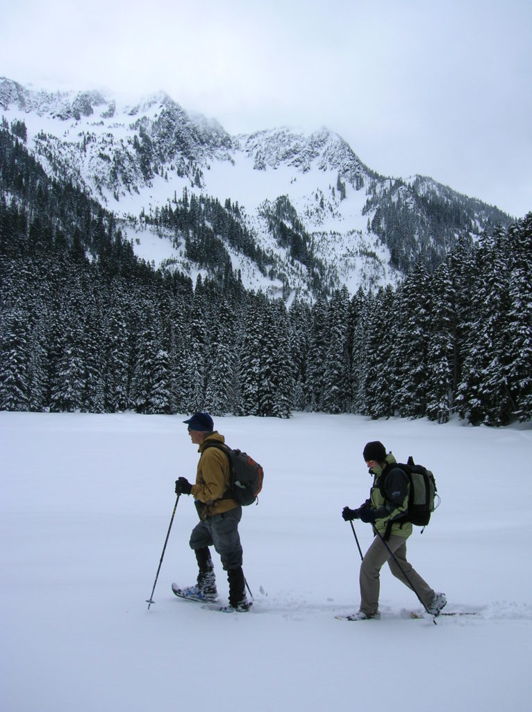
Quick Facts: Location: Stevens Pass Land Agency: Okanogan-Wenatchee National Forest Roundtrip: 3.2 miles Elevation Gain: 1,140 feet Green Trails Map: Alpine Lakes-Stevens Pass WA No. 176S Special Note: Slight avalanche concern. Contact: Okanogan-Wenatchee National Forest Access: From Everett head east on US 2 to Stevens Pass. Continue east for another 5.8 miles turning right into the…
Read MoreGreen to Cedar Rivers Trail
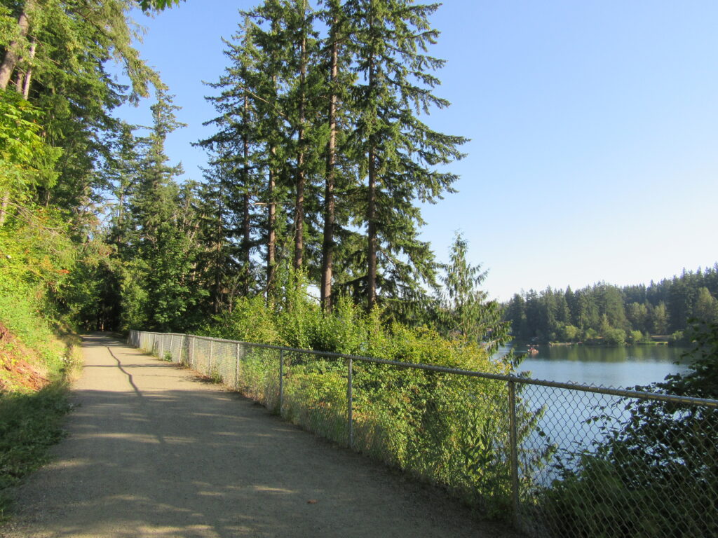
Walk across Maple Valley through a “wilderness” park Quick Facts: Location: Maple Valley, WA Distance: 3.3 miles one way Contact: King County Parks Elevation Gain: 250 feet Notes: Dogs permitted on leash Trailhead directions: From Seattle follow I-5 to I-405 and take Exit 4 in Renton. Then drive SR 169 south for 11.3 miles turning…
Read MoreMount Finlayson─This spoil of war now offers peaceful wandering
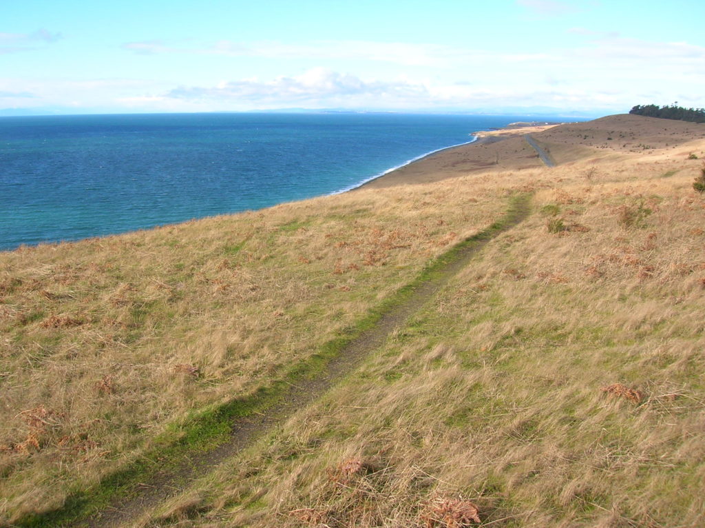
Quick Facts Location: San Juan Island Land Agency: National Park Service Roundtrip: 3.5 miles Elevation Gain: 290 feet Contact: San Juan Island National Historic Park Notes: Dogs must be leashed. Access: Take Washington State Ferry from Anacortes to Friday Harbor on San Juan Island. Follow Spring Street for .5 mile through town turning left onto…
Read MoreTollgate Farm
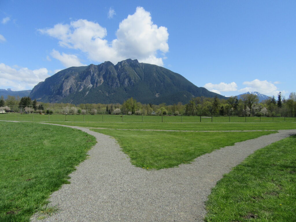
Historic prairie at the Forks of the Snoqualmie Quick Facts: Location: North Bend, WA Distance: 1.5 miles of trails Elevation Gain: minimal Contact: Si View Metropolitan District Green Trails Map: Mount Si NRCA no. 206S Notes: Dogs permitted on leash Trailhead directions: From Seattle follow I-90 east to Exit 27. Turn left onto Winery Road…
Read MoreLizard and Lily Lakes

Peaceful wandering near the Oyster Dome Quick Facts: Location: Blanchard State Forest Distance: 7.5 miles roundtrip Elevation Gain: 1,500 feet Contact: Washington Department of Natural Resources Map: Square One Maps Chuckanut Recreation Area Notes: Discover Pass required to park at trailheads Trailhead directions: From I-5 Exit 240 in Alger head north on Lake Samish Road…
Read MoreEdmonds Marsh─Over 225 species of birds on 23 acres of wetlands!
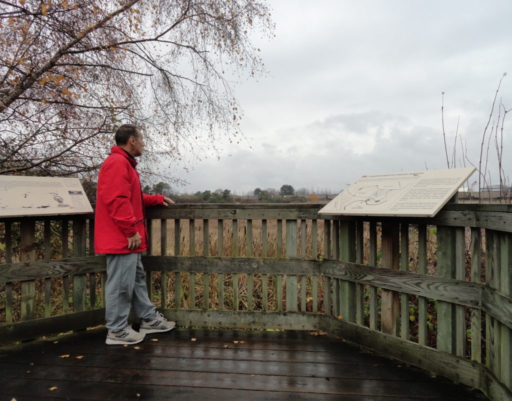
Quick Facts: Location: Edmonds Waterfront Land Agency: City of Edmonds Parks and Recreation Roundtrip: 1.8 miles Elevation Gain: Level Access: From I-5 follow SR 104 west towards the Edmonds-Kingston Ferry. One stoplight before the ferry terminal, turn left onto Dayton Street. Then continue for .1 mile to just before the railroad crossing. Turn left here…
Read MoreSnoqualmie Falls
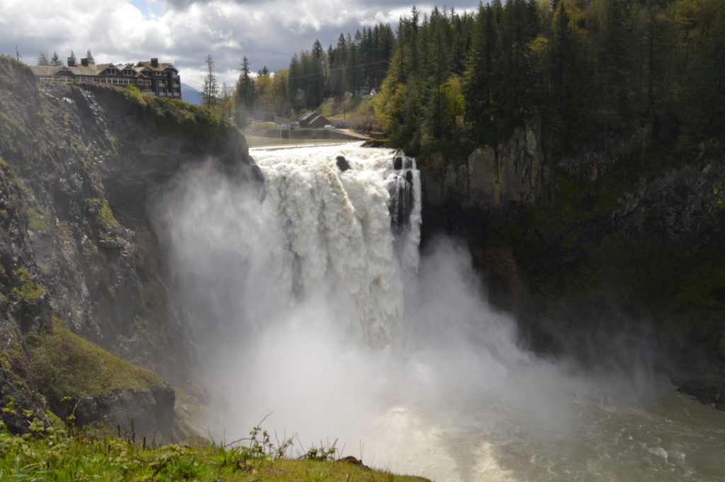
Hike to the base of the falls where heaven connects to earth Quick Facts: Location: Snoqualmie Valley Distance: 1.4 miles Elevation Gain: 280 feet Contact: Puget Sound EnergyDetailed Information: Urban Trails Eastside (Mountaineers Books) Green Trails Map: Rattlesnake Mountain/ Mountains to Sound Greenway No. 205S Notes: dogs permitted on leash. Parking lot on west side…
Read MoreNorthern State Recreation Area
Wander the former farm grounds of a state mental health hospital Quick Facts: Location: Skagit Valley Distance: more than 7.0 miles of trails Elevation Gain: up to 400 feet Contact: Skagit County ParksDetailed Information: Urban Trails Bellingham (Mountaineers Books) Notes: dogs permitted on leash; park open dawn to dusk. Access: From Exit 230 on I-5…
Read MoreClallam Bay Spit — Explore Washington’s deserted and spectacular North Coast
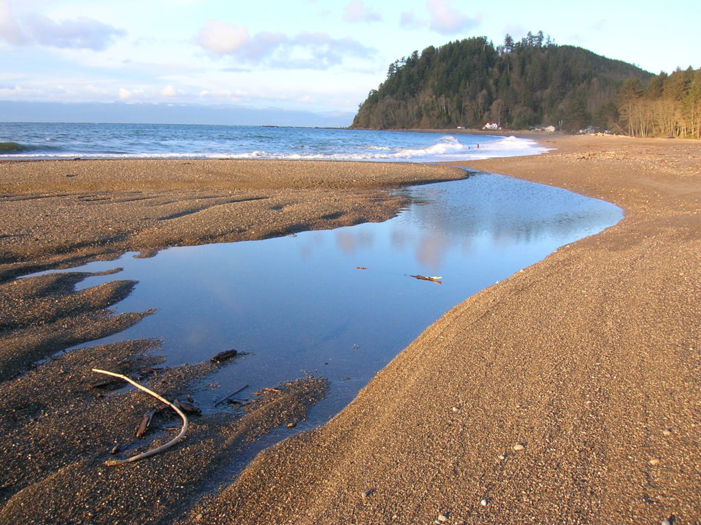
Quick Facts: Location: Strait of Juan de Fuca, North Olympic Peninsula Land Agency: Clallam County Parks and Washington State Parks Roundtrip: 2.1 miles Elevation Gain: minimal Contact: Clallam County Parks Notes: Dogs permitted on leash Access: From Port Angeles follow US 101 west for 5.4 miles to SR 112. Continue west for 44 miles on SR 112 to the community…
Read MoreClara and Marion Lakes
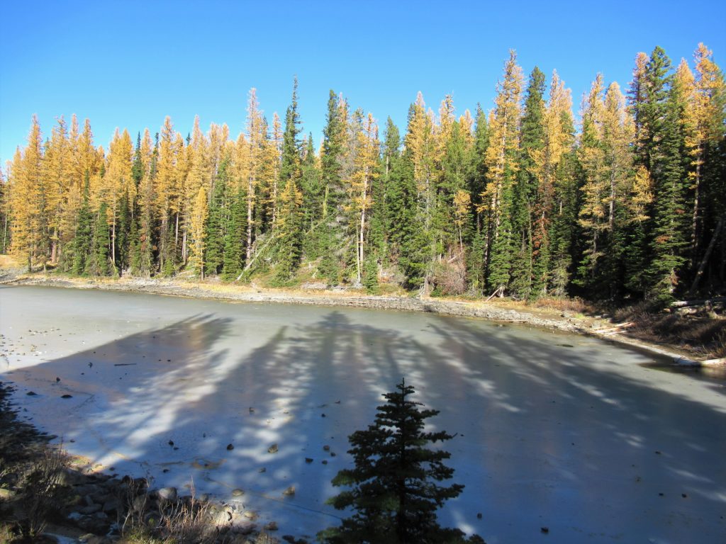
Quick Facts: Location: Mission Ridge, Okanogan-Wenatchee National Forest Land Agency: Okanogan-Wenatchee National Forest Roundtrip: 3.2 miles Elevation Gain: 960 feet Green Trails Map: Wenatchee/ Mission Ridge, WA- No 211S Access: Follow US 2 to Wenatchee turning south onto SR 285 and continuing for 4.5 miles until it turns east to cross the Columbia River into…
Read More