Posts Tagged ‘historic hike’
Gothic Basin and Foggy Lake — Spiraling peaks, buttressed ridges, and a hauntingly beautiful landscape
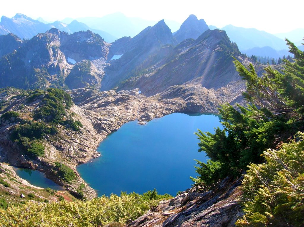
Quick Facts: Location: Mountain Loop Highway near Granite Falls Land Agency: Mount Baker-Snoqualmie National Forest Service and Washington Department of Natural Resources Roundtrip: 9.4 miles Elevation Gain: 2,900 feet Green Trails Maps: Mountain Loop Highway 111SX Access: From Granite Falls follow the Mountain Loop Highway east for 31 miles to Barlow Pass. Hike begins by walking up gated Monte Cristo…
Read MoreKloshe Nanitch
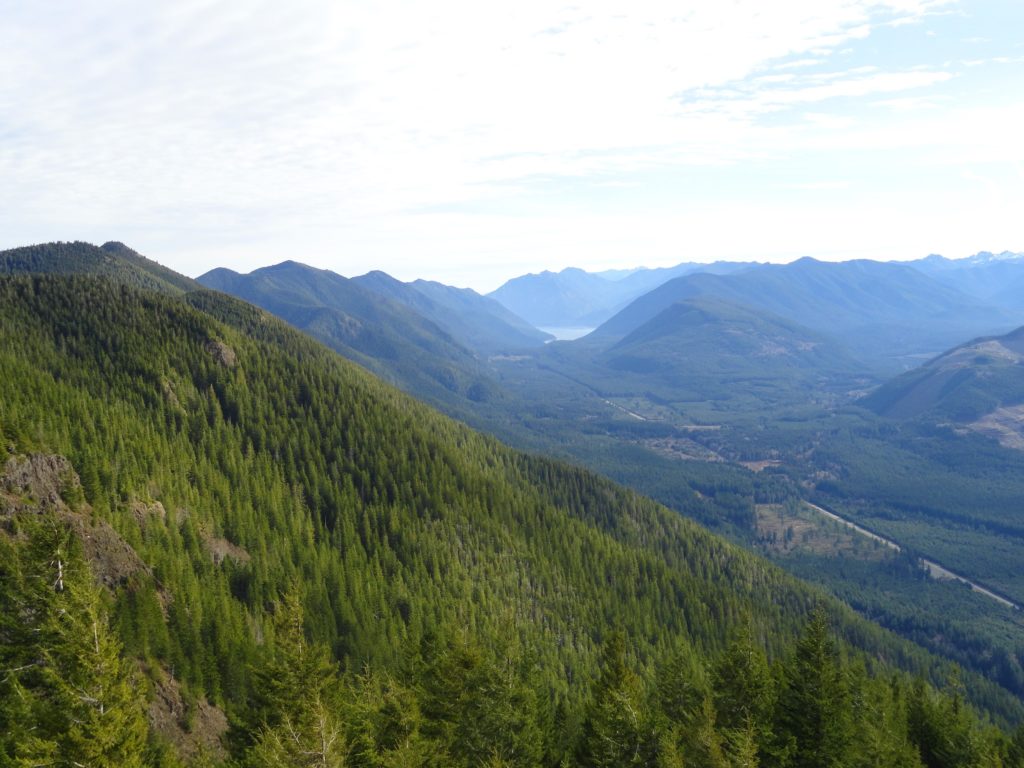
Stand watch over the Sol Duc Valley Quick Facts: Location: North Olympic Peninsula-Sol Duc Valley; Land Agency: Olympic National Forest; Roundtrip: 6.4 miles; Elevation gain: 2,400 feet; Contact: Olympic National Forest, Pacific District North, Forks; Notes: Discover Pass Required; Recommended Guidebook: Day Hiking Olympic Peninsula (2nd edition) Good to Know: Dog-friendly, Trail Less Traveled, Historic…
Read MoreFort Flagler Loop─Old defense post now protects undeveloped Puget Sound coastline
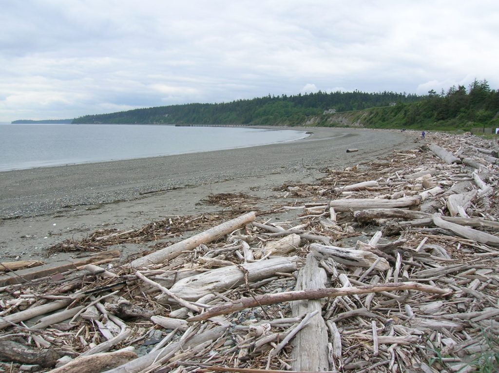
Quick Facts: Location: Marrowstone Island Land Agency: Washington State Parks Contact: Fort Flagler State Park Roundtrip: 5.6 miles Elevation Gain: 200 feet Access: From Kingston Ferry Terminal, follow SR 104 west for 15 miles turning right onto SR 19. Continue north for 9 miles to Chimicum turning right onto Irondale Road and proceeding 1.6 miles…
Read MoreMercer Slough Nature Park
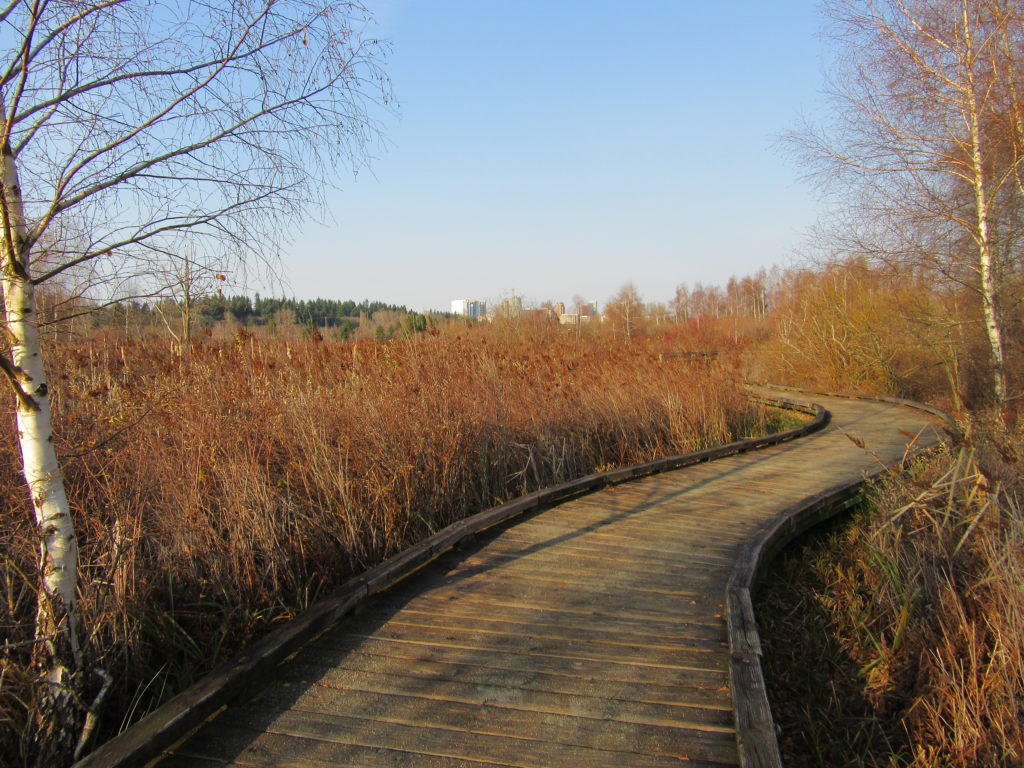
Hike a slew of trails near the heart of Bellevue Quick Facts: Location: Bellevue Land Agency: City of Bellevue Parks and Recreation Distance: more than 7.0 miles of trails Elevation Gain: minimal Contact: City of Bellevue Parks and Recreation Notes: dogs permitted on leash, Recommended Guidebook: Urban Trails Eastside (Mountaineers Book) Access: Take Exit 12…
Read MoreTrail of Ten Falls–Hike through a canyon of thundering cascades!
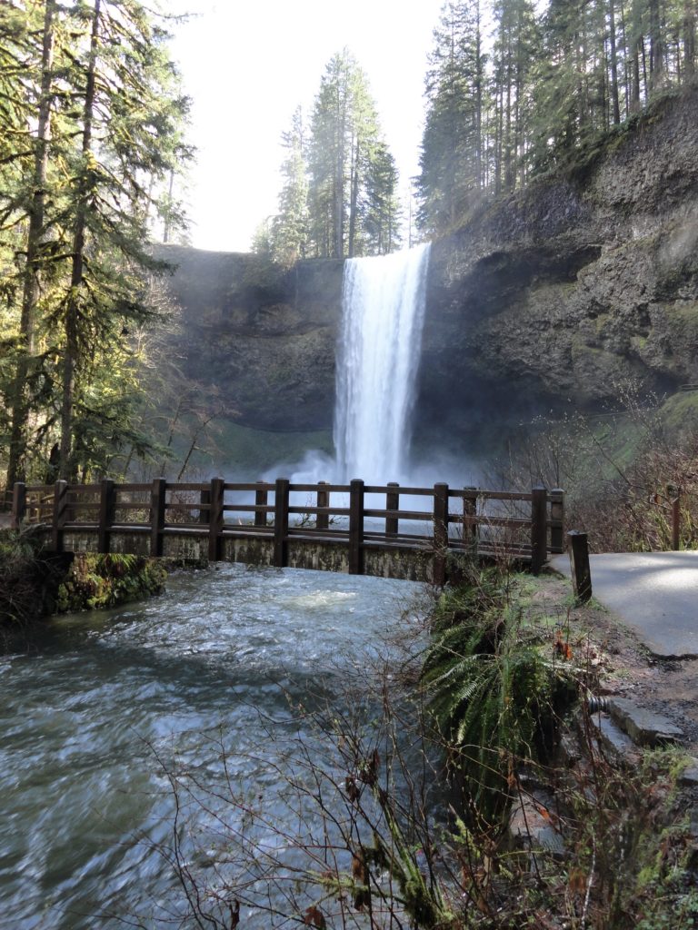
Quick Facts: Location: Silver Falls State Park near Silverton, Oregon Land Agency: Oregon State Parks Distance: 7.2 miles Elevation Gain: 600 feet Contact: Silver Falls State Park Notes: Dogs prohibited; $5.00 per vehicle entrance fee Access: From Salem, Oregon follow SR 22 east from I-5 for 5 miles to Exit 7. Then follow SR 214…
Read MoreFort Casey Historical State Park — Frolic through a fort, to a lighthouse, and on a pretty beach
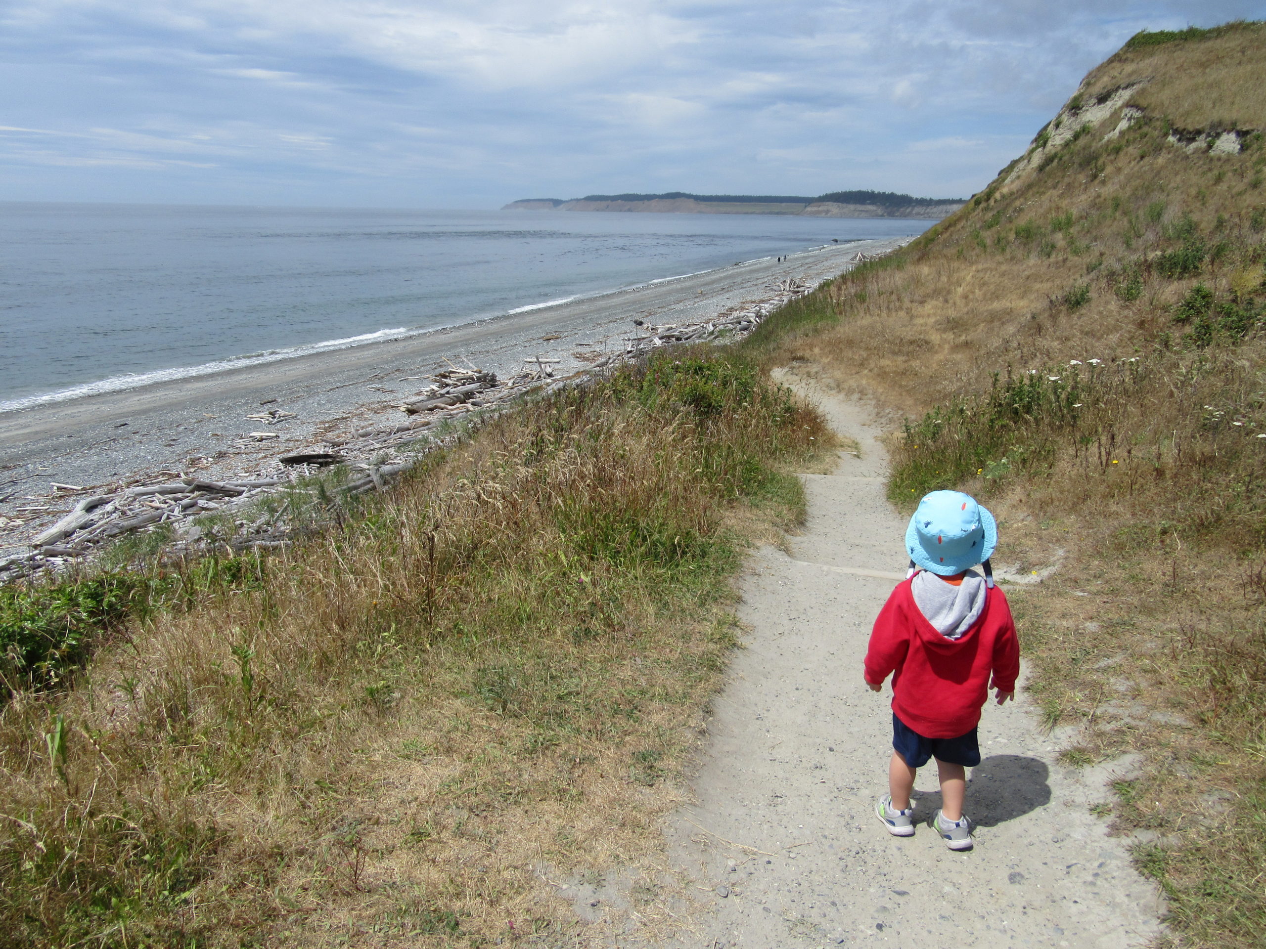
Quick Facts: Location: Whidbey Island Land Agency: Washington State Parks Round Trip: 1.8 miles of trails Elevation Gain: up to 90 feet Contact: Washington State Parks Recommended Resource: Urban Trails Everett (Mountaineers Books) Notes: Discover Pass required; Dogs allowed on leash Access: From Mukilteo take ferry to Clinton on Whidbey Island. Then continue north on…
Read MoreMillersylvania State Park─Amble among ancient trees just minutes from Olympia
Quick Facts: Location: Thurston County Land Agency: Washington State Parks Roundtrip: 3.0 miles Elevation Gain: 75 feet Contact: Washington State Parks Recommended Resource: Urban Trails Olympia Notes: Discover Pass required; Dogs must be leashed. Access: From Olympia, head south on I-5 to Exit 99. Continue southeast on SR 121 for 4.2 miles. Turn right (west) into main…
Read MoreDosewallips State Park Loop — Hike back in time through a quiet forest
Quick Facts: Location: Olympic Peninsula Land Agency: Washington State Parks Roundtrip: 3.6 miles Elevation Gain: 550 feet Contact: Dosewallips State Park Green Trails Map: Olympic Mountains East 168SX Detailed Information: Day Hiking Olympic Peninsula (Mountaineers Books) Notes: Discover Pass required; Dog must be leashed Recommended Resource: Day Hiking Olympic Peninsula Access: From Quilcene drive US 101 south for 12…
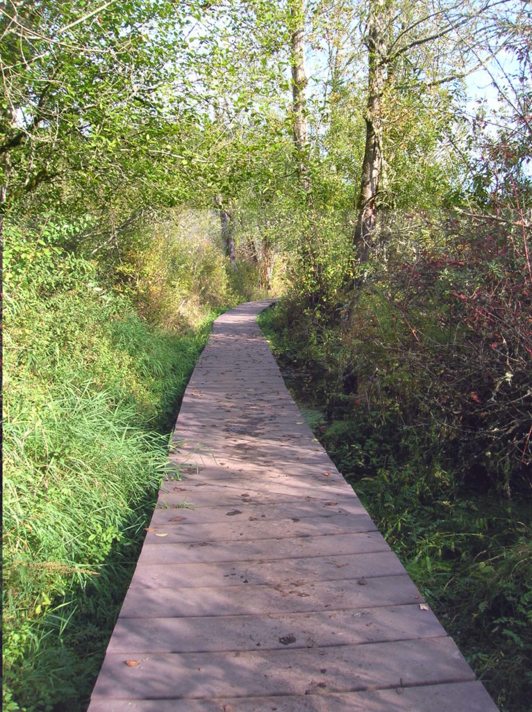
Read MoreBeaver Lake — Trail holds a “slough” of surprises
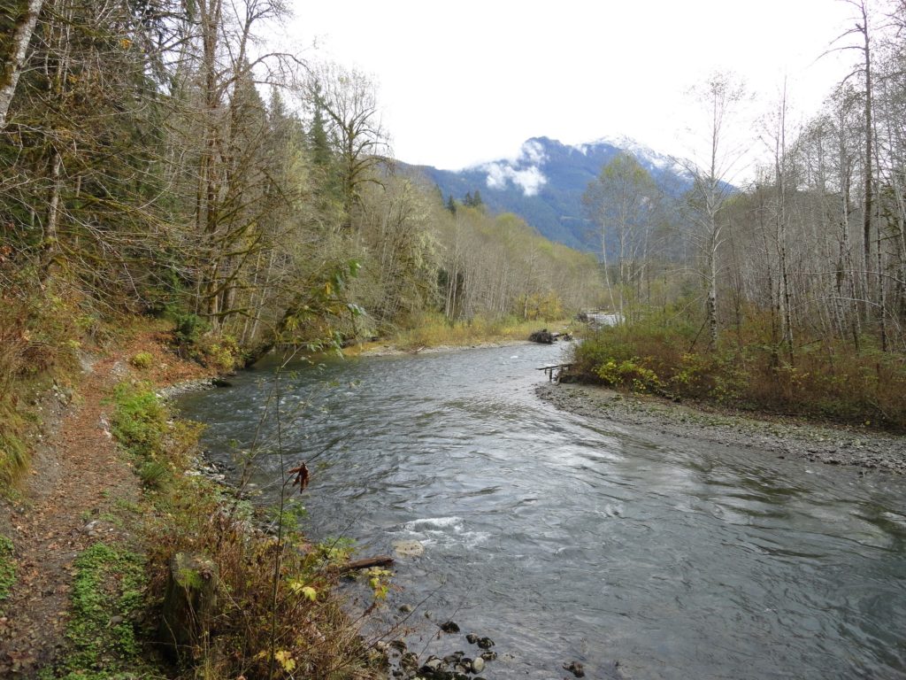
Quick Facts: Location: Mountain Loop Highway Land Agency: Mount Baker-Snoqualmie National Forest Roundtrip: 3.8 miles Elevation gain: 100 feet Green Trails Map: Mountain Loop Highway 111SX Contact: Darrington Ranger District: Mount Baker Snoqualmie National Forest Notes: Northwest Forest Pass or Interagency Pass required Access: From Darrington, follow Mountain Loop Highway for 9.0 miles to trailhead…
Read More