Posts Tagged ‘Historic’
Centennial Trail: Haller Park to Lake Bryant–river, wetlands, and rural charm
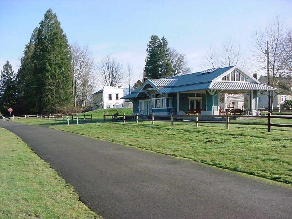
Quick Facts: Location: Arlington Land Agency: Snohomish County Parks Roundtrip: 6.2 miles Elevation Gain: 100 feet Contact: Snohomish County Parks Notes: Paved trail is also open to bicycles and is wheelchair accessible; dogs must be leashed. Access: Southern Access is from Haller Park in Arlington near the junction of SR 9 and SR 530, four miles…
Read MoreTwin Lakes (Monte Cristo) — Follow a rugged old miner’s path to a remote basin
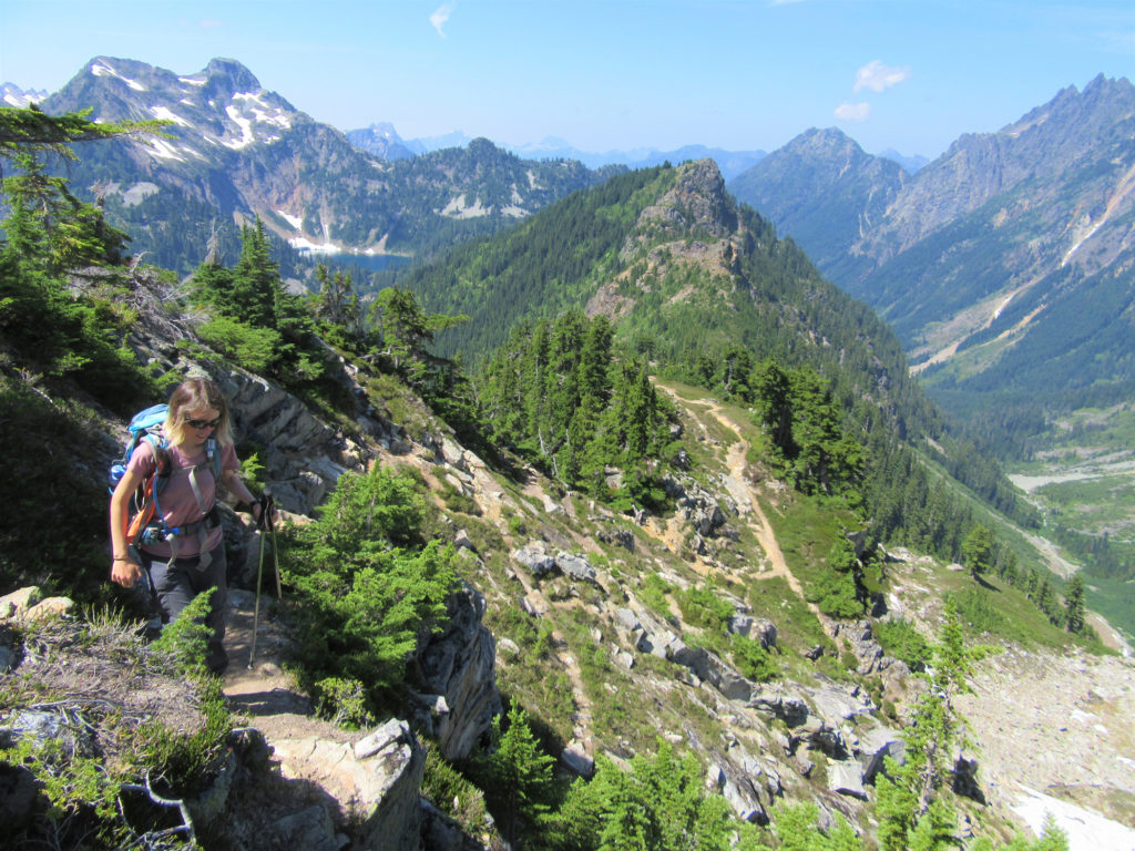
Quick Facts: Location: Mountain Loop Highway near Barlow Pass Land Agency: Mount Baker-Snoqualmie National Forest Roundtrip: 17.0 miles Elevation gain: 3,900 feet Green Trails Map: Mountain Loop Highway no. 111SX Contact: Darrington Ranger District: Mount Baker Snoqualmie National Forest Notes: Northwest Forest Pass or Interagency Pass required; A washout at the Twin Bridges requires…
Read MoreSourdough Mountain Lookout–Trail is 5.5 miles long and one mile straight up!
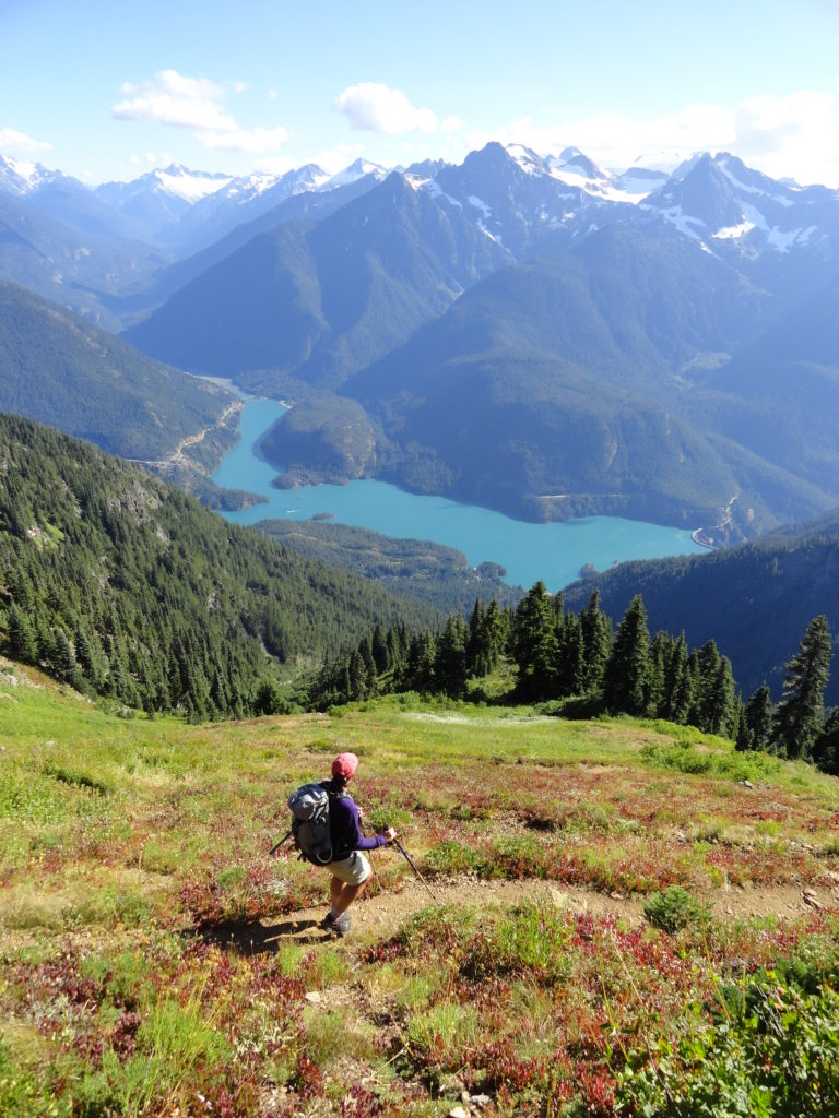
Quick Facts: Location: North Cascades Highway Land Agency: North Cascades National Park Roundtrip: 11.0 miles Elevation Gain: 5,100 feet Green Trails Maps: Diablo, WA-No. 48 Access: From Marblemount, follow the North Cascades Highway (SR 20) east for 20 miles. Turn left onto Diablo Road and proceed 0.7 mile crossing an iron bridge spanning Stetattle Creek. Bear right reaching the trailhead in…
Read MoreBig Four Ice Caves — Cool attraction is a hot destination
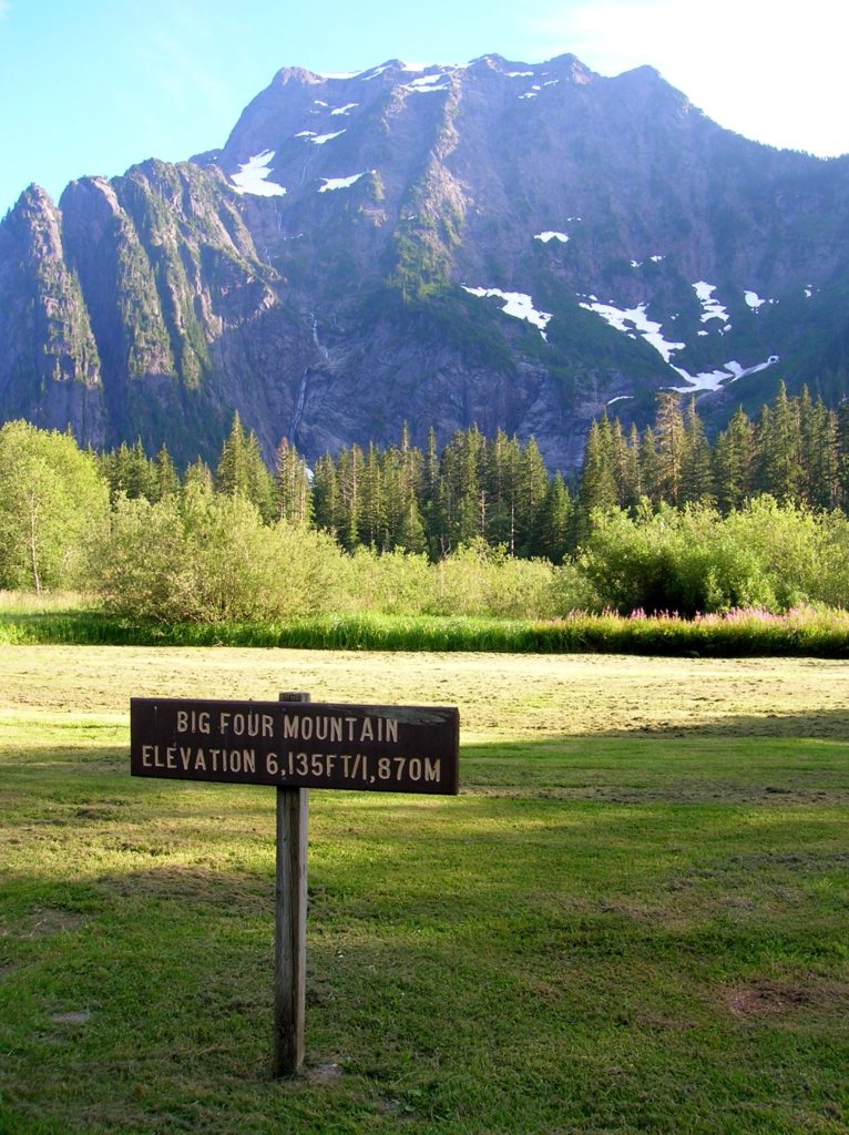
Quick Facts: Location: Mountain Loop Highway near Granite Falls Land Agency: Mount Baker-Snoqualmie National Forest Roundtrip: 2.2 miles Elevation gain: 200 feet Difficulty: easy Green Trails Map: Mountain Loop Highway 111SX Contact: Darrington Ranger District: Mount Baker- Snoqualmie National Forest or Verlot Public Service Center (summer weekends) (360) 691-7791 Notes: NW Forest Pass required; DO NOT…
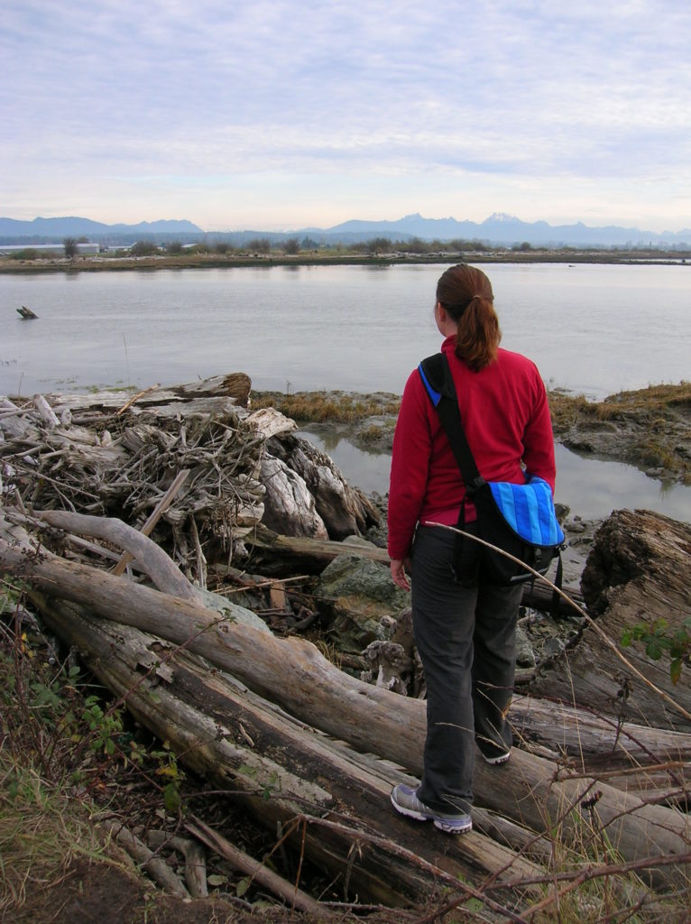
Read MoreNakashima Barn─Northern portal to long distance Centennial Trail
Quick Facts Location: SR 9 just south of Skagit County line Land Agency: Snohomish County Parks Roundtrip: 8.0 miles Elevation Gain: Minimal Access: From Arlington (junction of SR 530-SR 9), follow SR 9 north for 7.6 miles turning left into park. Proceed .1 mile to parking area. Notes: Dogs must be on leash. Contact: Snohomish…
Read MoreBalch Creek–Dramatic Ravine a Forest Park highlight
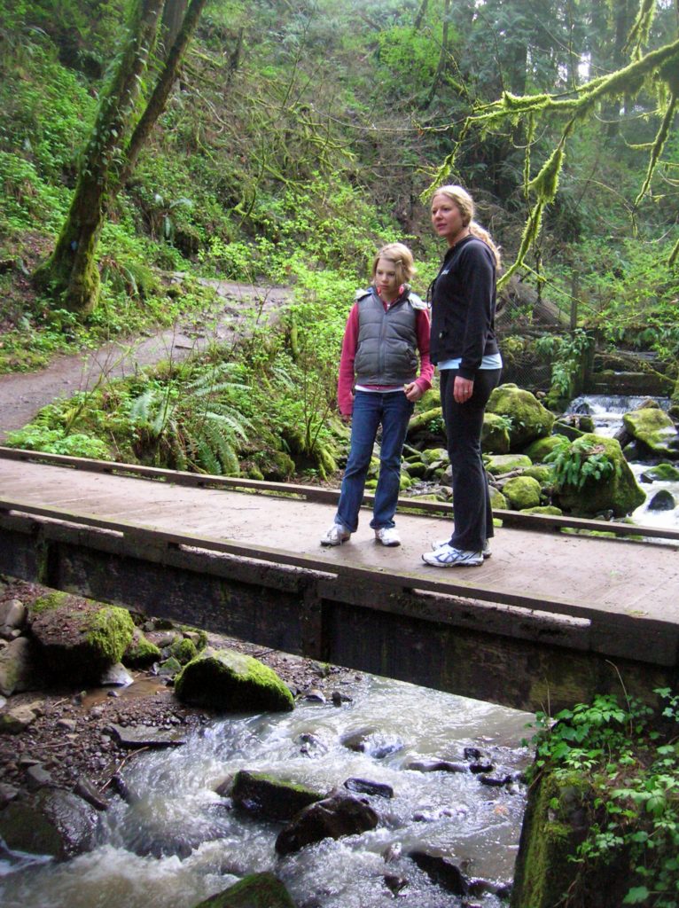
Location: Forest Park, Portland, Oregon Land Agency: Portland Parks and Recreation Roundtrip: 2.4 miles High Point: 425 feet Elevation gain: 300 feet Difficulty: easy Green Trails Map: Forest Park No 426S Contact: Contact/permits: Portland Parks and Recreation ; Forest Park Conservancy; Notes: dogs must be leashedAccess: From downtown Portland, follow NW Vaughn Street west turning…
Read MoreFlower Dome –Beauty blossoms from this peak deep within the Glacier Peak Wilderness
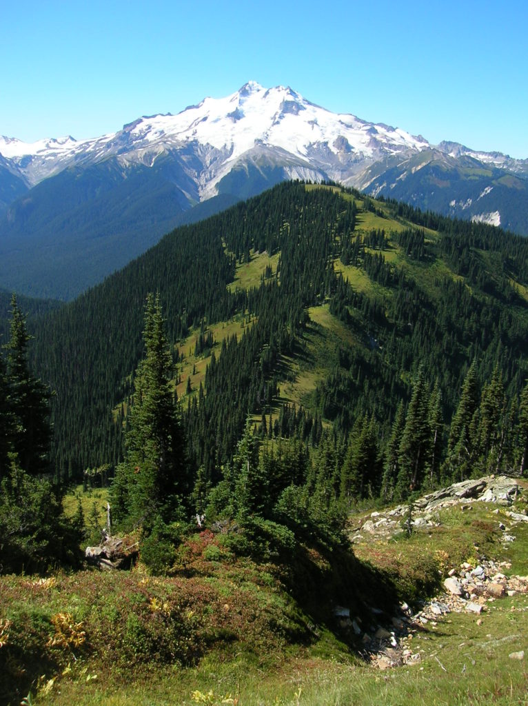
Quick Facts: Location: Glacier Peak Wilderness Land Agency: Mount Baker-Snoqualmie National Forest Roundtrip: 21.0 miles Elevation Gain: 3,700 feet Green Trails Map: Holden, WA- No. 113 Contact: Darrington Ranger District: Mount Baker Snoqualmie National Forest Notes: Northwest Forest Pass or Interagency Pass required Access: From Everett, head 85 miles east on US 2 to Coles Corner turning left onto…
Read MoreJennings Park─History, nature, gardens and more
Quick Facts: Location: Marysville Land Agency: Marysville Parks and Recreation Roundtrip: 1.5 miles Elevation Gain: 50 feet Contact: Marysville Parks Notes: Dogs must be leashed. Access: From Exit 199 on I-5, head east on SR 528 (4th Street) about 1.5 miles to parking and trailhead on left. Good to know: dog-friendly, kid-friendly, historic Jennings Park…
Read MoreMonte Cristo — Last Chance to visit Ghost Town for awhile
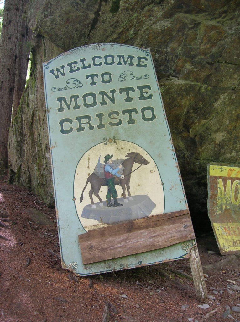
Quick Facts: Location: Mountain Loop Highway near Granite Falls Land Agency: Mount Baker-Snoqualmie National Forest Roundtrip: 8.0 miles High Point: 2,800 feet Elevation gain: 500 feet Difficulty: moderate Green Trails Maps: Sloan Peak, WA- No. 111; Monte Cristo, WA- No. 143 Contact: Darrington Ranger District: Mount Baker Snoqualmie National Forest Notes: Northwest Forest Pass required. Trail and town site closes on April 15th 2015 and…
Read MoreLeque Island–Where it snows geese in the winter!
Location: Stanwood Land Agency: Washington Department of Fish and Wildlife (WDFW) Roundtrip: 1.0 mile Elevation gain: None Difficulty: Easy Contact: Washington Department of Fish and Wildlife Notes: Discover Pass or WDFW Vehicle Use Permit required; Active hunting area from October to late January Access: From Exit 212 on I-5, travel west 5.0 miles to Stanwood.…
Read More