Posts Tagged ‘kid-friendly’
Fryingpan Lake
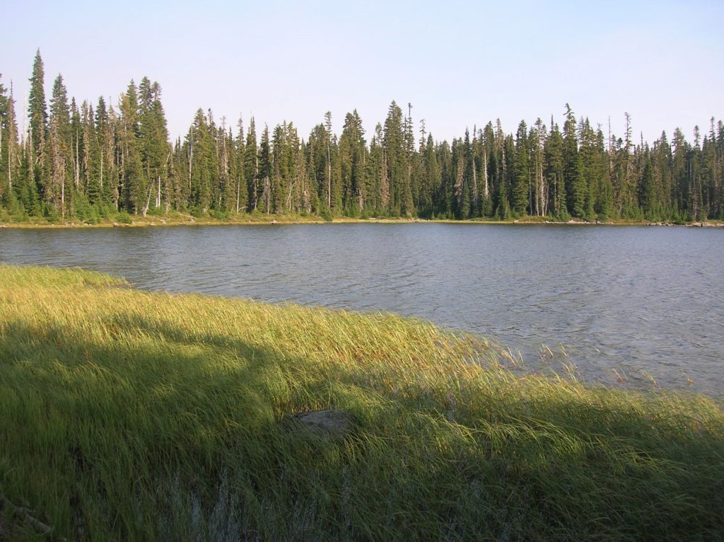
Onto the Trail and into a lovely lake setting Quick Facts: Location: William O. Douglas Wilderness Land Agency: National Forest Service Distance: 11.9 miles Elevation Gain: 2000 feet Contact: Naches Ranger District Gifford Pinchot National Forest Green Trails Map: Green Trails, White Pass, No. 303S Notes: Northwest Forest or Interagency Pass required; Overnight Permits required;…
Read MorePeek-a-boo Lake — peaceful little lake and peek-a-boo mountain views
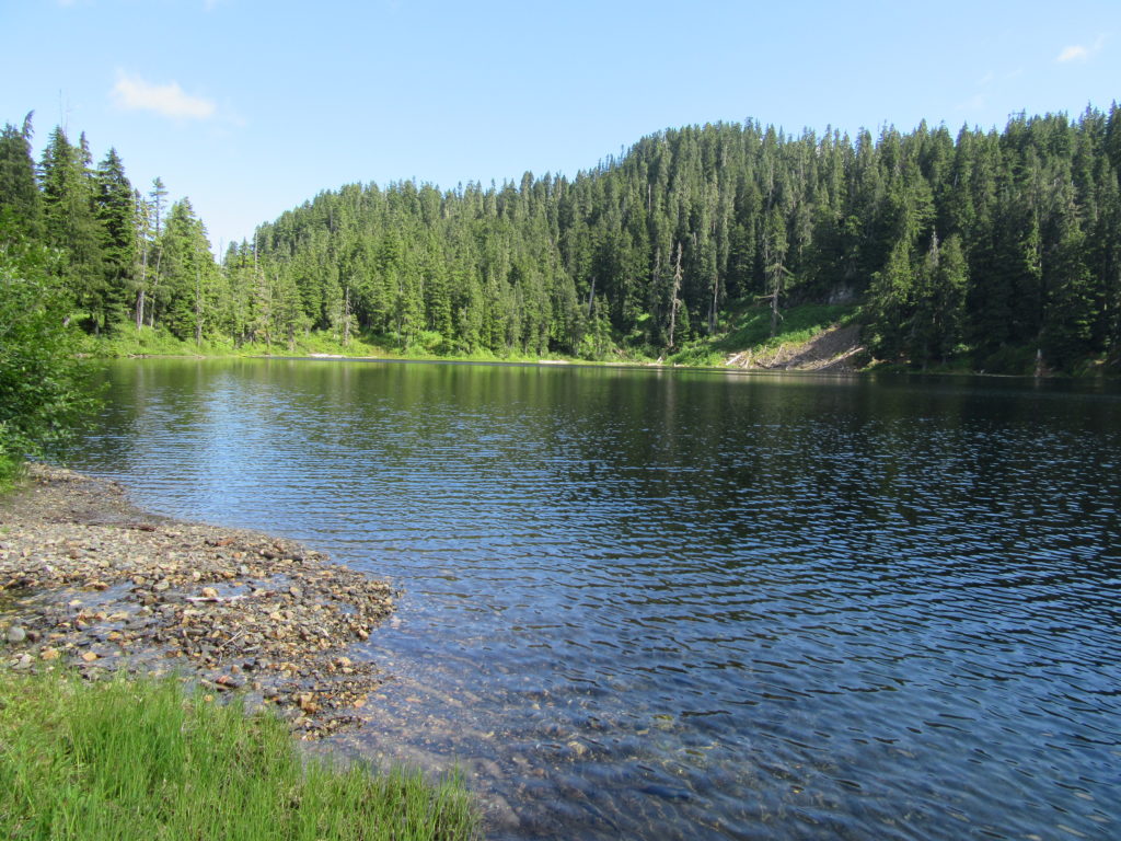
Quick Facts: Location: Mountain Loop Highway near Darrington Land Agency: Mount Baker-Snoqualmie National Forest Roundtrip: 5.0 miles Elevation gain: 1600 feet Green Trails Maps: Mountain Loop Highway 111 SX Contact: Mount Baker-Snoqualmie National Forest, Darrington Ranger District Notes: Access road is rough and brushy in spots. High clearance necessary. Access: From Darrington follow the Mountain Loop…
Read MoreAbercrombie Mountain– Northeast Washington’s second highest summit is first rate when it comes to views
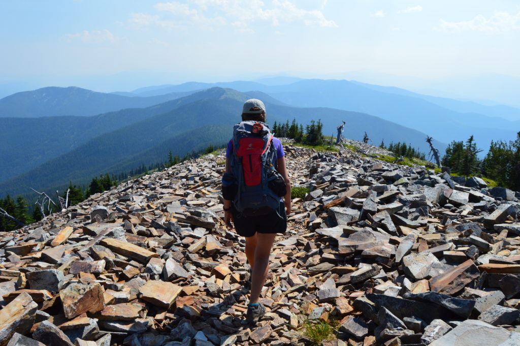
Quick Facts: Location: Abercrombie-Hooknose Roadless Area, Selkirk Mountains Land Agency: Colville National Forest Roundtrip: 7.4 miles Elevation gain: 2,300 feet Contact: Colville National Forest, Three Rivers Ranger District (Colville) (509) 684-3711 Notes: Access road requires high clearance vehicle Access: From Colville, Washington travel north on Aladdin Road (CR 9435) for 25 miles. Turn right on…
Read MoreSouth Coldwater Ridge — Elk, toppled tractors, and a stunning view of a volcano-formed lake
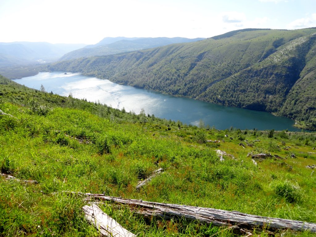
Quick Facts: Location: Spirit Lake Highway Mount St. Helens West Land Agency: Mount St. Helens National Volcanic Monument Roundtrip: 6.8 miles Elevation gain: 1525 feet Difficulty: moderate Green Trails Map: Mount St Helens 332S Recommended Guidebook: Day Hiking Mount St Helens Contact: Mount St. Helens National Volcanic Monument Access: From Castle Rock follow SR 504 east…
Read MoreBlack Lake─Wildflowers bring Black Lake back to life from past forest fires
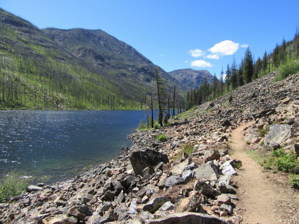
Quick Facts: Location: Chewuch River Valley Land Agency: National Forest Service Roundtrip: 10.2 miles Elevation Gain: 800 feet Contact: Methow Valley Ranger District: Okanogan-Wenatchee National Forest Green Trails Map: Methow Valley 51SX Recommended Guidebook: Day Hiking North Cascades 2nd edition Special Note: Northwest Forest Pass or Interagency Pass required. Good to Know: Dog-friendly, kid-friendly, wildflowers,…
Read MoreLower Gray Wolf River– A nice place to hang out with the pack

Quick Facts: Location: Northeast Olympic Peninsula Land Agency: Olympic National Forest Roundtrip: 7.0 miles Elevation gain: 900 feet Contact: Hood Canal Ranger District, Quilcene Green Trails Map: Olympic Mountains East no. 168SX Notes: wilderness rules apply Recommended Guidebook: Day Hiking Olympic Peninsula Good to Know: dog-friendly; kid-friendly; easy backpacking options, Buckhorn Wilderness Access: From US…
Read MoreMount Pisgah–Hike to a promising land of spectacular wildflowers
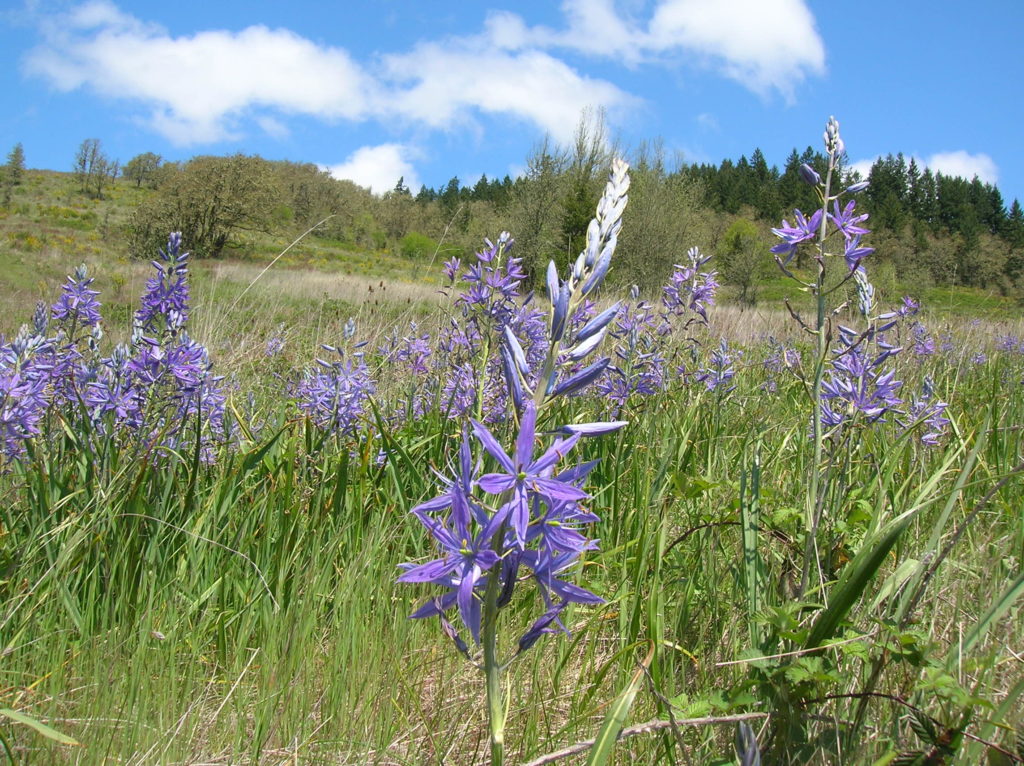
Quick Facts: Location: Willamette Valley south of Eugene Land Agency: Lane County Parks Roundtrip: 3.0 miles Elevation gain: 1,050 feet Map: Park map available online Contact: Friends of Buford Park and Mount Pisgah Notes: $5.00 day use fee; dogs must be leashed Access: From Eugene follow Franklin Blvd (Exit 189 I-5 southbound or Exit 188B northbound…
Read MoreCougar Mountain Wilderness Peak Loop
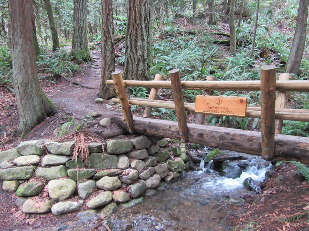
No views, but lots of big trees and pretty cascades Quick Facts: Location: Cougar Mountain Regional Wildland Park. Land Agency: King County Parks. Distance: 3.9 mile lollipop loop. Elevation Gain: 1200 feet. Contact: King County Parks. Green Trails Map: Cougar Mtn/ Squak Mtn No. 203S. Notes: dogs permitted on leash, Warning: car break-ins frequently occur…
Read MoreFort Flagler Loop─Old defense post now protects undeveloped Puget Sound coastline
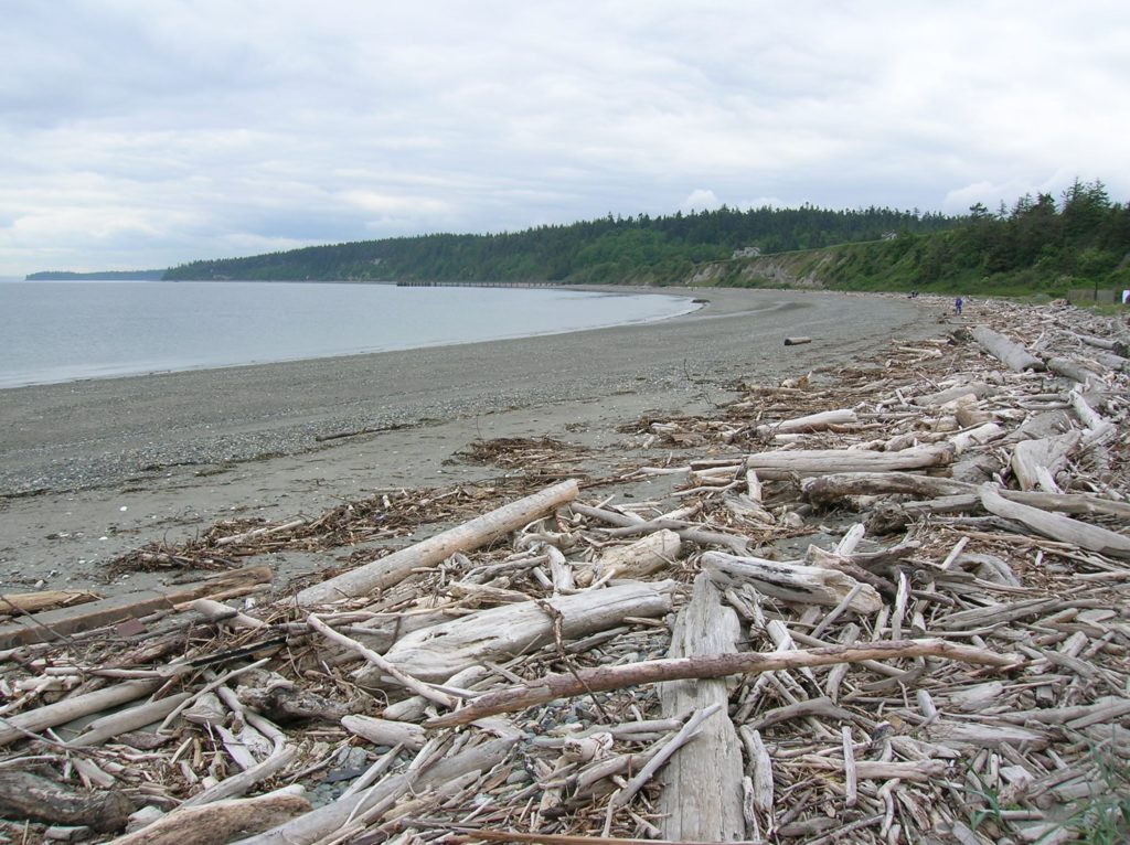
Quick Facts: Location: Marrowstone Island Land Agency: Washington State Parks Contact: Fort Flagler State Park Roundtrip: 5.6 miles Elevation Gain: 200 feet Access: From Kingston Ferry Terminal, follow SR 104 west for 15 miles turning right onto SR 19. Continue north for 9 miles to Chimicum turning right onto Irondale Road and proceeding 1.6 miles…
Read MoreWhistler Canyon-big on bighorn sheep and Okanogan River views
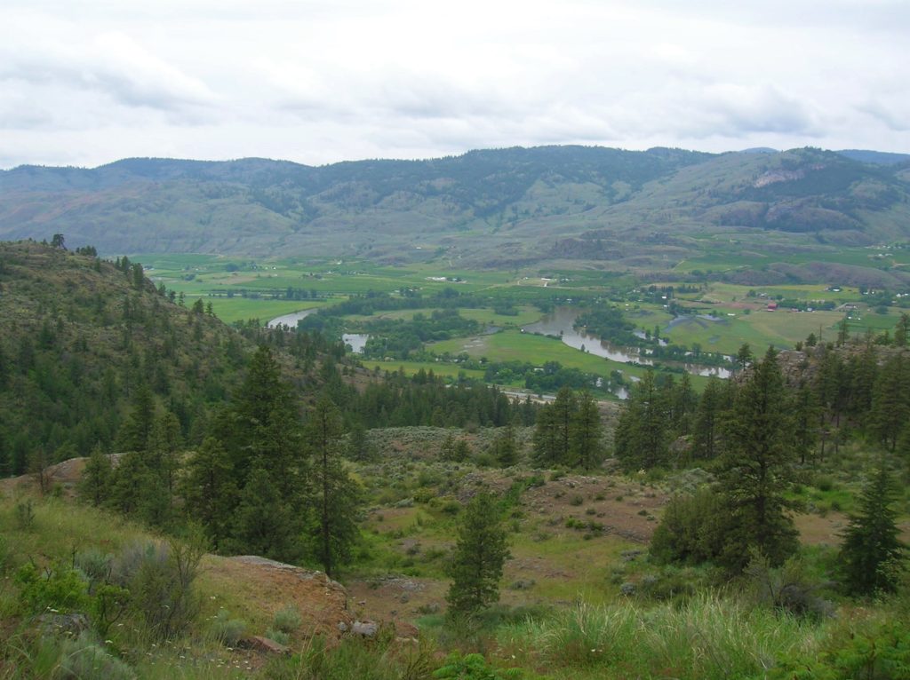
Location: Okanogan Valley near Oroville Land Agency: Okanogan-Wenatchee National Forest Roundtrip: 5.0 miles High Point: 1,950 feet Elevation gain: 1,250 feet Difficulty: moderate Contact: Pacific Northwest Trail Association Note: Dogs should be under strict control as to not disturb the bighorn sheep. Access: From Tonasket, follow US 97 north for 14.5 miles to trailhead turnoff…
Read More