Posts Tagged ‘kid-friendly’
North Creek Park─Enjoy being “bogged” down for the holidays

Quick Facts: Location: Mill Creek Land Agency: Snohomish County Parks Roundtrip: 2.0 miles Elevation Gain: 30 feet Access: From I-5 Exit 183 follow 164th Street SE east to SR 527. Turn south and follow SR 527 to 183rd Street SE. Turn right (west) and proceed for a 0.5 mile to park entrance on right. Alternatively take…
Read MoreLa Center Bottoms─Wintering bird haven on the East Fork of the Lewis River
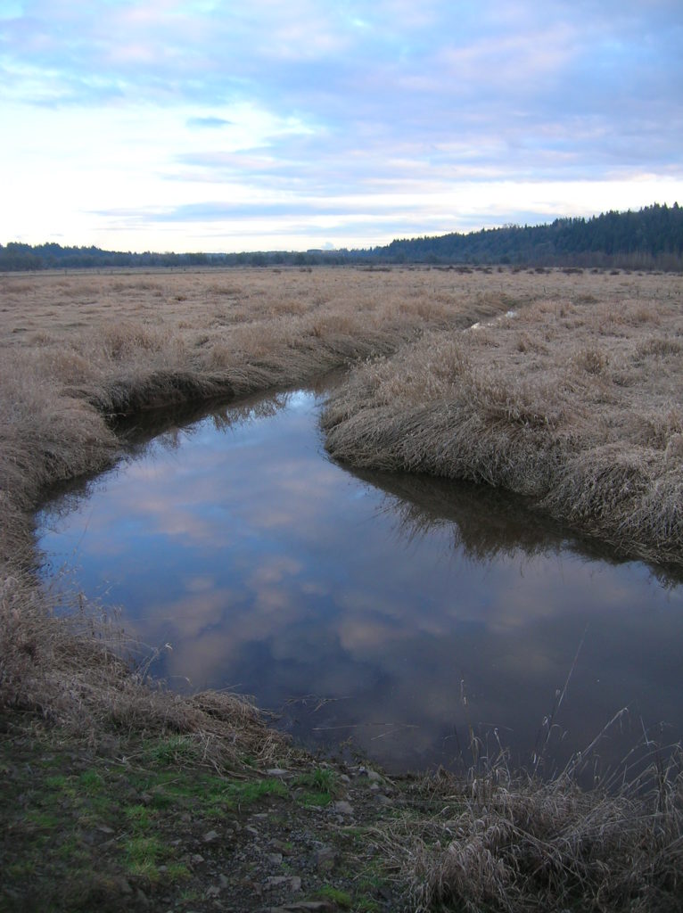
Quick Facts: Location: La Center, Clark County Wash. Land Agency: Clark County Parks Roundtrip: 2.0 miles Elevation Gain: 30 feet Special Note: Dogs permitted on leash. Access: From Vancouver, head north on I-5 to Exit 16. Turn right onto La Center Road and proceed for 1.6 miles to the bridge over the East Fork Lewis River.…
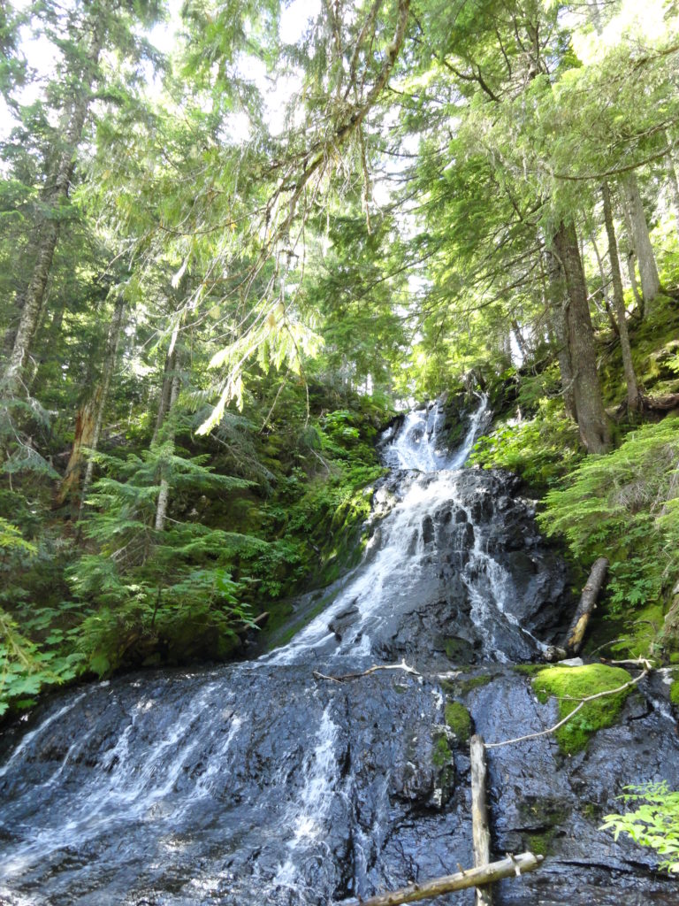
Read MoreLime Kiln Trail─Hop onboard for an historic hike along the Stillaguamish River

Quick Facts: Location: Stillaguamish River Valley, Granite Falls Land Agency: Snohomish County Parks Roundtrip: 7.0 miles Elevation Gain: 600 feet Contact: Snohomish County Parks Green Trails Map: Mountain Loop Highway 111SX Notes: Dogs must be on leash; park open dawn to dusk. Access: Follow SR 92 east to Granite Falls. Turn right onto Granite Ave. Continue…
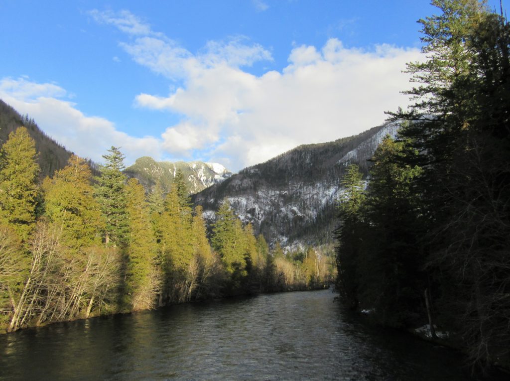
Read MoreWhite Chuck Bench Trail — Glacier-fed Whitewater
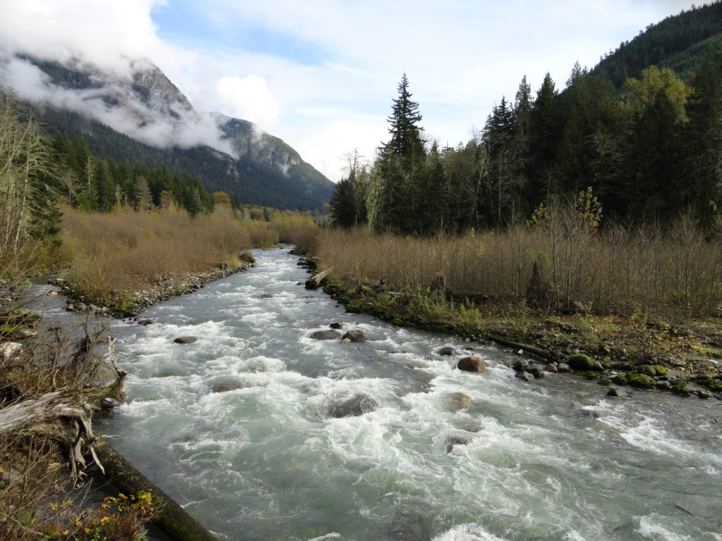
Quick Facts: Location: Mountain Loop Highway Land Agency: Mount Baker-Snoqualmie National Forest Roundtrip: 14 miles Elevation gain: 1500 feet Green Trails Map: Green Trails, Mountain Loop Highway, WA- no. 111SX Contact: Darrington Ranger District: Mount Baker Snoqualmie National Forest Access: From Darrington follow Mountain Loop Highway for 9.0 miles. Turn left onto FR 22 and…
Read MoreLewis and Clark State Park─Discover beautiful Old Growth Forest along the old highway ninety-nine
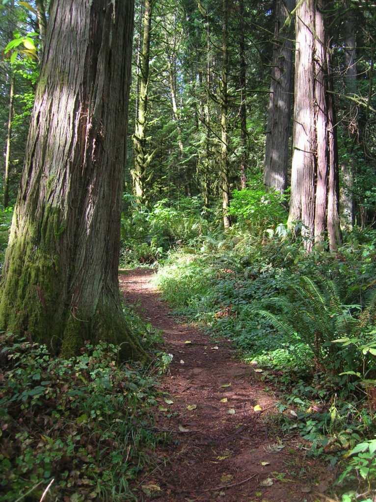
Quick Facts: Location: Chehalis River Valley Land Agency: Washington State Parks Roundtrip: 2.0 miles Elevation Gain: 125 feet Note: Discover Pass required; dogs permitted on leash. Access: From Exit 68 on I-5, proceed 2.5 miles east on US 12 to Mary’s Corner. Turn right onto Jackson Highway entering state park in .7 mile. Continue another…
Read MoreTracy Hill — Wild turkeys and sublime views
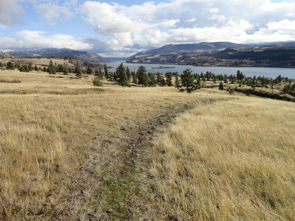
Quick Facts: Location: Columbia River Gorge National Scenic Area Land Agency: Columbia Gorge National Scenic Area Roundtrip: 5.0 miles Elevation gain: 1150 feet Difficulty: Moderate Contact: Columbia Gorge National Scenic Area Notes: Dogs permitted on leash. Be aware of ticks and poison oak. Green Trails Map: Columbia River Gorge East No. 432S Good to Know:…
Read MoreSkagit River Loop– Where eagles dine
Quick Facts: Location: Ross Lake National Recreation Area, North Cascades Scenic Highway Land Agency: National Park Service Roundtrip: 1.8 miles Elevation gain: 100 feet Contact: NCNP Visitors Center Sedro-Woolley Green Trails Map: Marblemount, WA- No. 47 Guidebook: Day Hiking North Cascades 2nd edition (Mountaineers Books) Notes: dogs must be leashed, Practice Leave No Trace Principles Access:…
Read MoreCutthroat Pass — Shiny granite, golden larches and splendid vistas
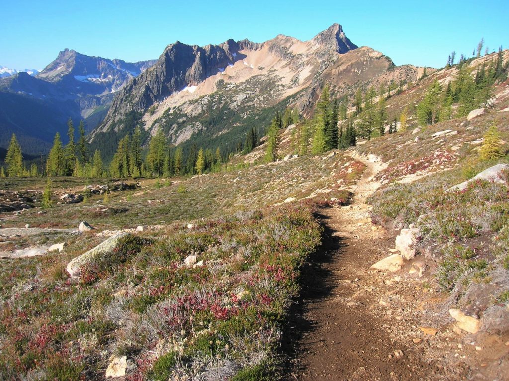
Quick Facts: Location: North Cascades Highway Land Agency: Okanogan-Wenatchee National Forest Round Trip: 10.0 miles Elevation Gain: 1850 feet Contact: Okanogan-Wenatchee National Forest, Methow Valley Ranger District, Green Trails Map: Washington Pass No. 50 Recommended Guidebook: Day Hiking North Cascades 2nd edition (Mountaineers Books) Notes: NW Forest Pass or Interagency Pass required. Access: From Marblemount,…
Read MoreTwisp Pass─Golden larches, fire-red meadows and sublime North Cascades views
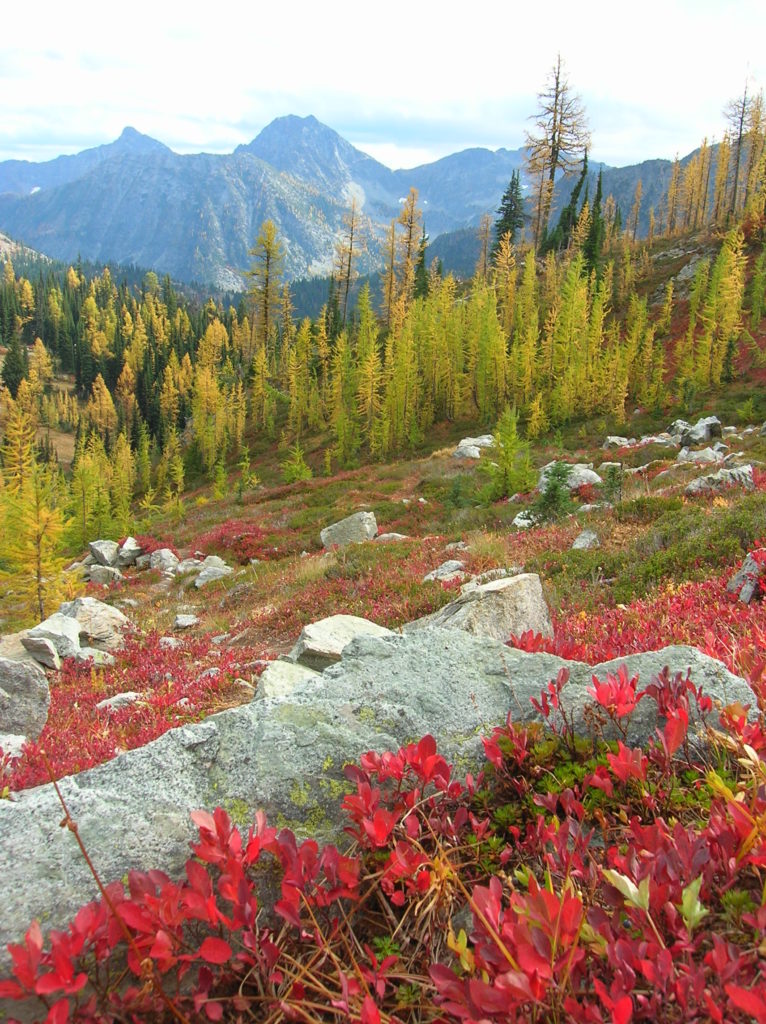
Quick Facts Location: Twisp River Valley-North Cascades Land Agency: US Forest Service and National Park Service Roundtrip: 9.2 miles Elevation Gain: 2,460 feet Green Trails Map: Stehekin, WA – No 82 Recommended Guidebook: Day Hiking North Cascades (Romano) Contact: Methow Valley Ranger District: Okanogan-Wenatchee National Forest Notes: Northwest Forest Pass required. Dogs prohibited beyond Twisp…
Read MoreCora Lake– Emerald lake cradled beneath craggy High Rock
Quick Facts: Location: Nisqually River Valley Land Agency: National Forest Service Roundtrip: 1.4 miles Elevation Gain: 400 feet Contact: Gifford Pinchot National Forest Green Trails Map: Randle, WA no. 301 Notes: no pass needed; creek crossing might be challenging early in the season; trail is open to mountain and motor bikes Access: From Elbe, follow SR 706 east…
Read More