Posts Tagged ‘kid-friendly’
Mount Seymour — See more of the BC Lower Mainland from this classic peak
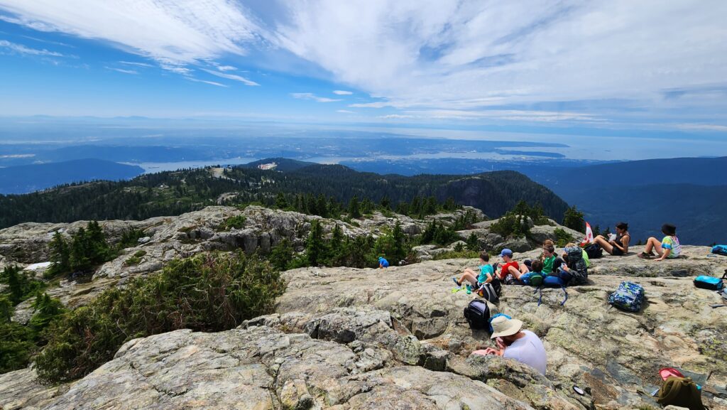
Quick Facts: Location: North Shore Mountains, North Vancouver, BC Distance: 8.4 km (5.2 miles) roundtrip Elevation Gain: 540 m (1772 feet) Contact: Mount Seymour Provincial Park Recommended Guidebook: Urban Trails Vancouver, BC (Mountaineers Books) Notes: Trail to Mount Seymour is snow free from July through October. Other trails in park outside of ski area are…
Read MoreEvergreen Mountain—short and easy hike in the Wild Sky

Quick Facts: Location: Wild Sky Wilderness near Skykomish River Valley Land Agency: National Forest Service Roundtrip: 3.0 miles Elevation Gain: 1,400 feet Access: From Everett head east on US 2 for 50 miles (just past Skykomish) turning left onto Beckler River Road (FR 65). Continue 12.6 miles to a five-way junction at Jack Pass. Take…
Read MoreFourth of July Pass─Declare your Independence this week in the North Cascades
Quick Facts: Location: Ross Lake National Recreation Area, North Cascades Scenic Highway (SR20) Land Agency: National Park Service Roundtrip: 9.0 miles Elevation Gain: 2,350 feet Green Trails Map: North Cascades Ross Lake 16SX Special Note: Dogs must be leashed. Contact: North Cascades National Park Visitors Center Newhalem Recommended Guidebook: Day Hiking North Cascades 2nd Edition Access: From Marblemount…
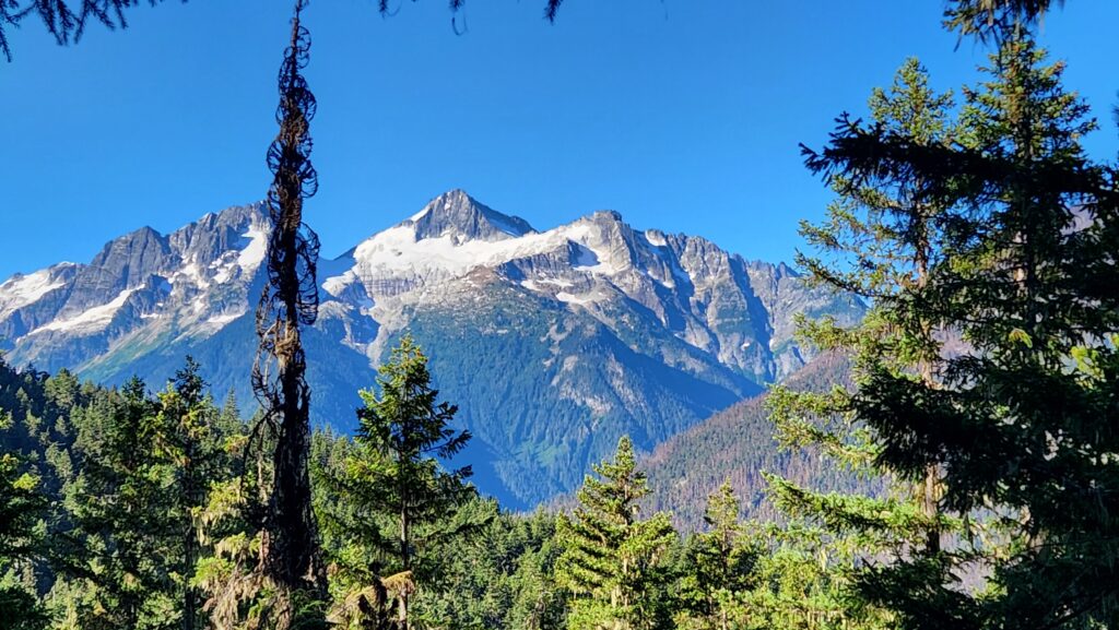
Read MoreAlpine Lookout –Wallow in good views and a chance to see a mountain goat or two
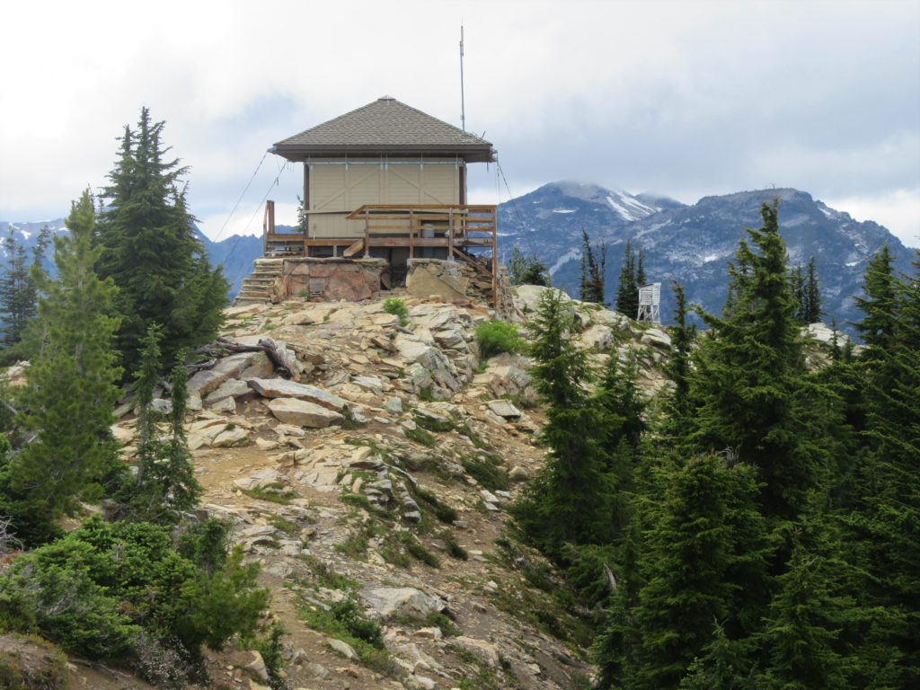
Quick Facts:Location: Stevens Pass-Lake Wenatchee regionLand Agency: Okanogan-Wenatchee National ForestRound Trip: 10.0 milesElevation Gain: 2,600 feetContact: Wenatchee River Ranger District (Leavenworth): Okanogan-Wenatchee National Forest Green Trails Map: Wenatchee Lake- No. 145Recommended Guidebook: Day Hiking Central Cascades 2nd editionNotes: NW Forest Pass or Interagency Pass Required.Several miles of trails on this hike are also open to mountain bikes…
Read MoreDiablo Lake– Hell of a lake, but not a devil of a hike
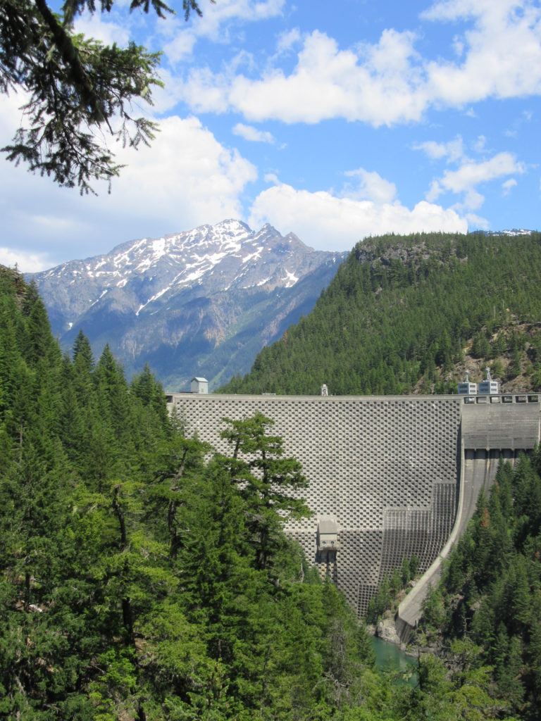
Quick Facts: Location: North Cascades Highway Land Agency: Ross Lake National Recreation Area Roundtrip: 7.6 miles Elevation Gain: 1400 feet Contact: North Cascades National Park Detailed Information: Day Hiking North Cascades 2nd edition (Mountaineers Books) Notes: Dogs must be leashed. Access road gated at 4:15 pm during winter Access: From Marblemount follow SR 20 east for 21.5 miles.…
Read MoreBoulder River- waterfalls among old-growth forest

Quick Facts: Location: Boulder River Wilderness, near Darrington Land Agency: National Forest Service Round trip: 8.6 miles Elevation Gain: 750 feet Green Trails Maps: Mountain Loop Highway 111SX Access: From Arlington follow SR 530 for 20 miles. Just beyond Milepost 41 near a subdivision turn right onto FR 2010 and continue for 3.7 miles to trailhead. Contact:…
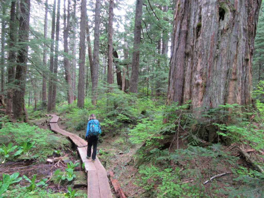
Read MoreLower Big Quilcene River─Lowland hike teems with primeval beauty
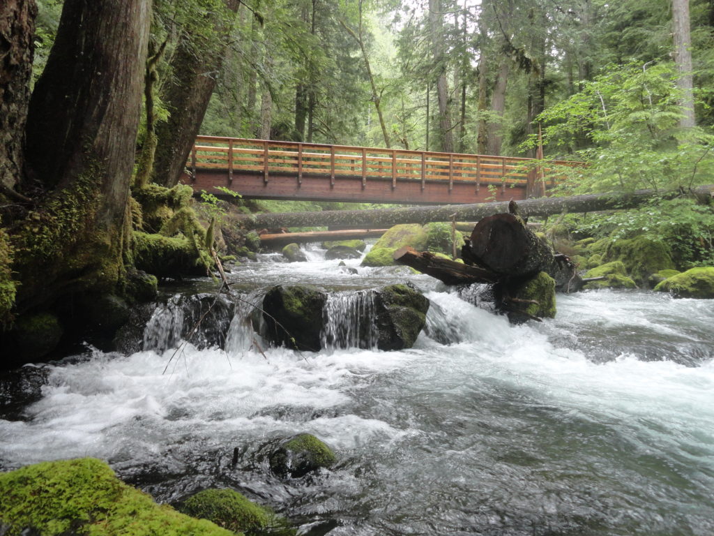
Quick Facts: Location: Olympic National Forest, Hood Canal District Land Agency: National Forest Service Roundtrip: To Camp Jolly 10.2 miles Green Trails Map: Olympic Mountains East 168SX Elevation Gain: 800 feet Contact: Hood Canal District, Quilcene Good to Know: kid-friendly, dog-friendly, open to mountain bikes, backpacking opportunities, old-growth, exceptional rhodies, Practice Leave No Trace Principles Access: From…
Read MoreAshland Lakes
Old growth forest serenity Quick Facts: Location: Mountain Loop Highway Land Agency: National Forest Service Roundtrip: 5.5 miles Elevation Gain: 800 feet Green Trails Map: Mountain Loop Highway no. 111SX Contact: Darrington Ranger District: Mount Baker- Snoqualmie National Forest Access: From Granite Falls follow the Mountain Loop Highway east to the Verlot Visitors Center. Proceed for…
Read MoreOzette Triangle–Classic Olympic Coast Hike packed with surprises
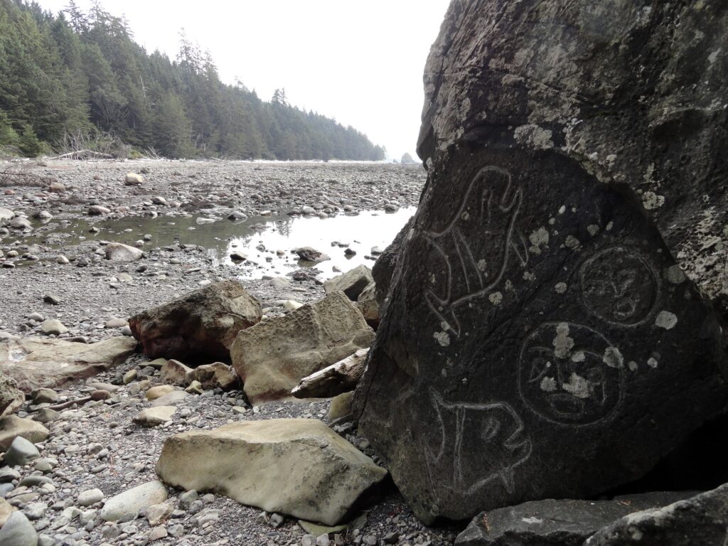
Quick Facts: Location: Olympic Coast Land Agency: Olympic National Park Roundtrip: 9.4 miles Elevation Gain: 400 feet Notes: National Park entry fee; dogs prohibited; coastal section can be difficult during high tides. Green Trails Map: Olympic Coast 99S Contact: Olympic National Park Access: From Port Angeles, follow US 101 west for 5 miles to SR 112. Continue on…
Read MoreSnoquera Falls — A touch of the Yosemite Valley in Washington
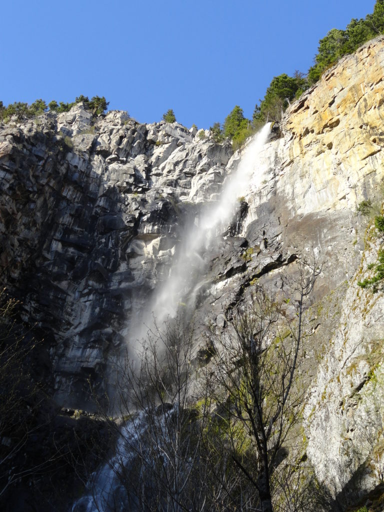
Quick Facts: Location: White River Valley Land Agency: Mount Baker-Snoqualmie National Forest Roundtrip: 4.2 miles Elevation Gain: 750 feet Contact: Snoqualmie Ranger District, Enumclaw office Green Trails Map: Greenwater no. 238 Notes: Northwest Forest Pass or Interagency Pass required; Dogs permitted on leash Access: From Enumclaw, follow SR 410 east for 28 miles. Turn left onto Camp Sheppard…
Read More