Posts Tagged ‘kid-friendly’
River Meadows Park─Wander along the Stillaguamish River
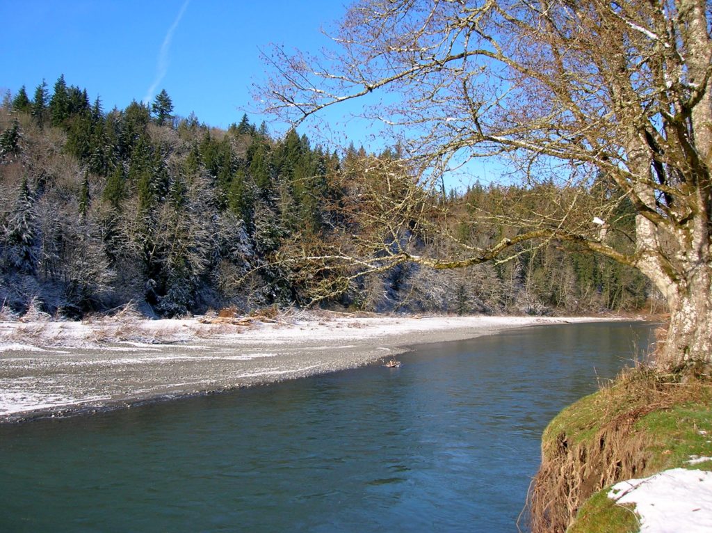
Quick Facts: Location: South Fork Stillaguamish River, near Arlington Land Agency: Snohomish County Parks Roundtrip: 2.5 miles Elevation Gain: 150 feet Contact: Snohomish County Parks Notes: Dogs must be leashed. Access: From Exit 208 on I-5 head east on SR 530 to Arlington. One mile beyond junction with SR 9 (just after crossing the South…
Read MoreChambers Creek Regional Park
Explore an old quarry resurrected as a grand park Quick Facts: Location: University Place (Tacoma) Distance: more than 6.0 miles of trails Elevation Gain: up to 230 feet Contact: Pierce County Parks Recommended Guidebook: Urban Trails Tacoma (Mountaineers Books) Notes: dogs permitted on leash and there is an off-leash area; some trails jogger-stroller and wheel…
Read MoreSaint Edward State Park
Explore a different—and wilder side of Lake Washington Quick Facts: Location: Eastside (Seattle) Distance: more than 9.0 miles of trails Elevation Gain: up to 500 feet Contact: Washington State Parks Recommended Guidebook: Urban Trails Eastside (Mountaineers Books) Notes: Discover Pass required; dogs permitted on leash; park open 8am to dusk Trailhead directions: From Bellevue follow…
Read MoreCedar Butte–Bad spelling on the summit and bad tidings at Christmas Lake below

Location: Snoqualmie Valley near North Bend Land Agency: Washington State Parks Roundtrip: 4.0 miles Elevation gain: 900 feet Green Trails Maps: Rattlesnake Mountain Upper Snoqualmie Valley No. 205S Contact: Washington State Parks (360) 902-8844 Notes: Discover Pass required; Dogs must be leashed Access: From Seattle take I-90 east to exit 32 in North Bend turning right (south)…
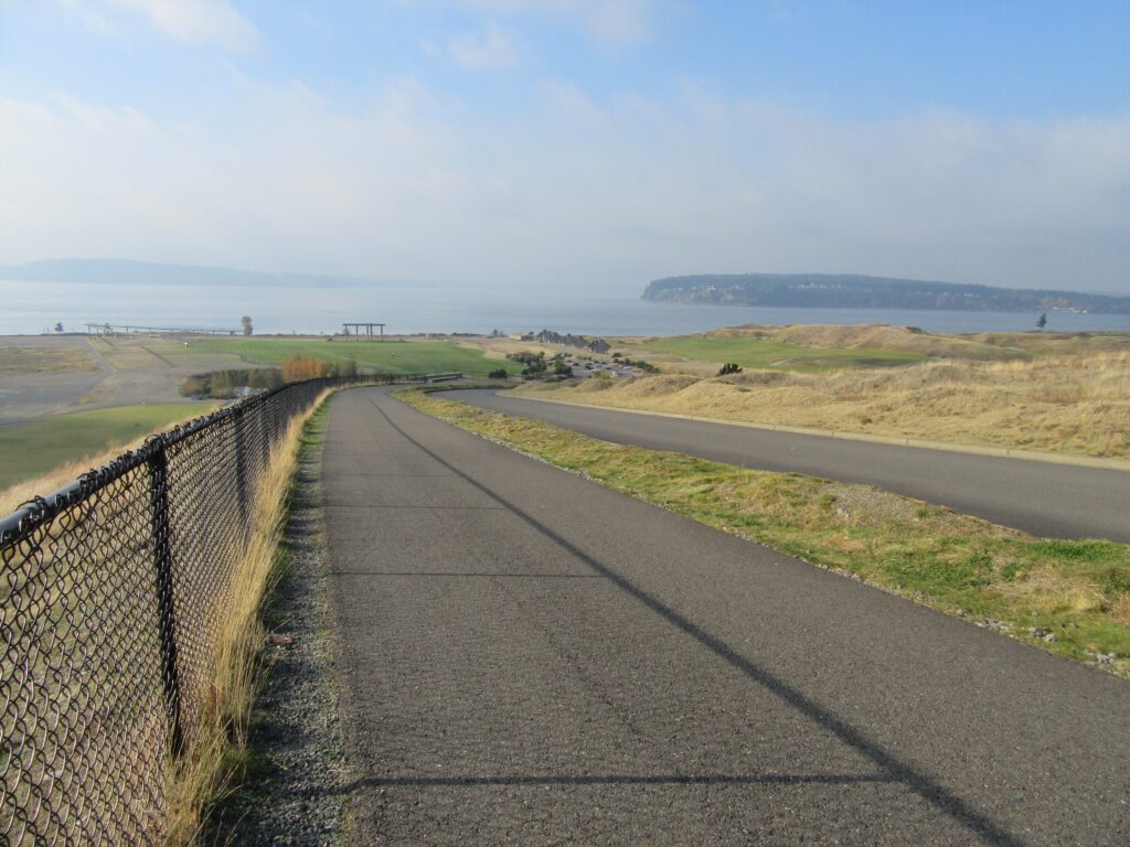
Read MoreDugualla State Park
Quiet ambling on Skagit Bay Quick Facts: Location: Whidbey Island Distance: more than 5.0 miles of trails Elevation Gain: up to 500 feet Contact: Washington State Parks Recommended Guidebook: Urban Trails Everett (Mountaineers Books) Notes: Discover Pass required; dogs permitted on leash Trailhead directions: From Oak Harbor, follow State Route 20 for 4.0 miles and…
Read MoreTurtlehead — It’s one shell of a view from this Turtleback Mountain summit
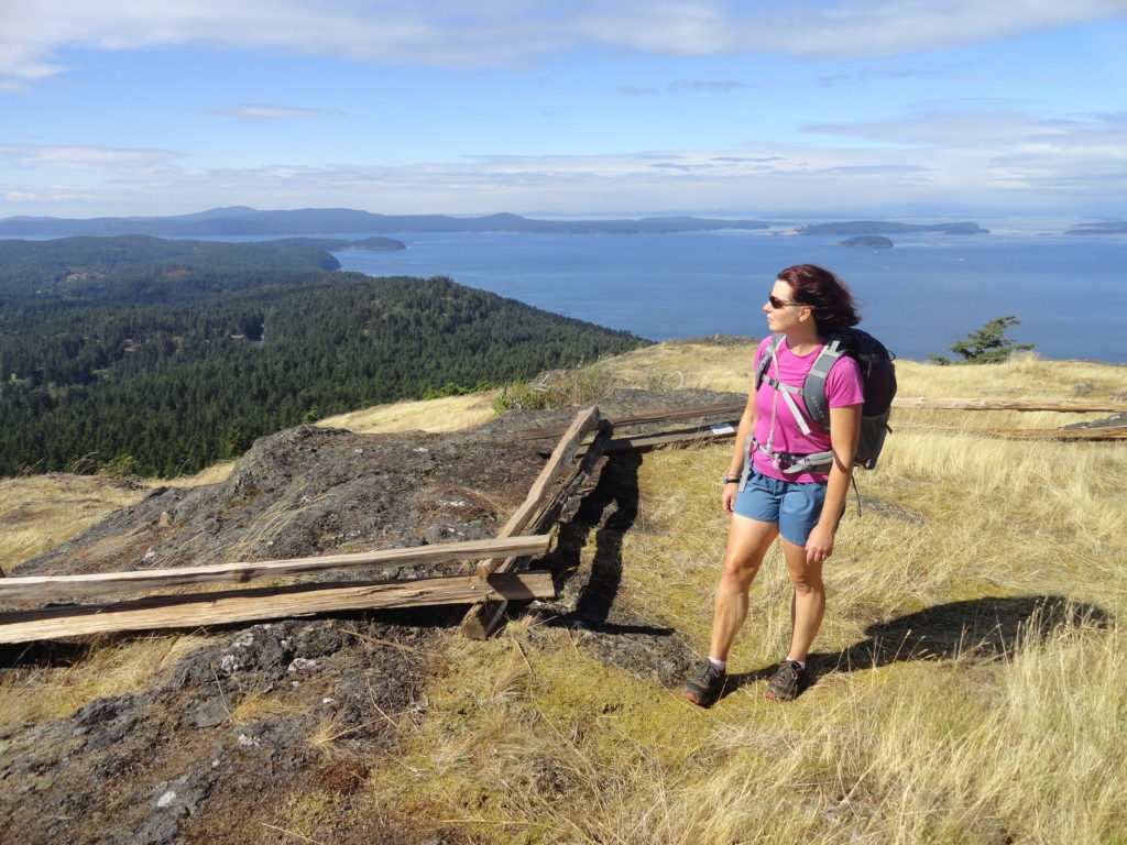
Quick Facts: Location: Orcas Island, San Juan Islands Land Agency: San Juan County Land Bank Roundtrip: 5.6 miles Elevation Gain: 1295 feet Contact: San Juan County Land Bank Notes: Dogs permitted on leash; trail (partial) open to bikes (even days) and horses (odd days) Access: Take Washington State Ferry from Anacortes to Orcas Island. Then head…
Read MorePonytail Falls Loop
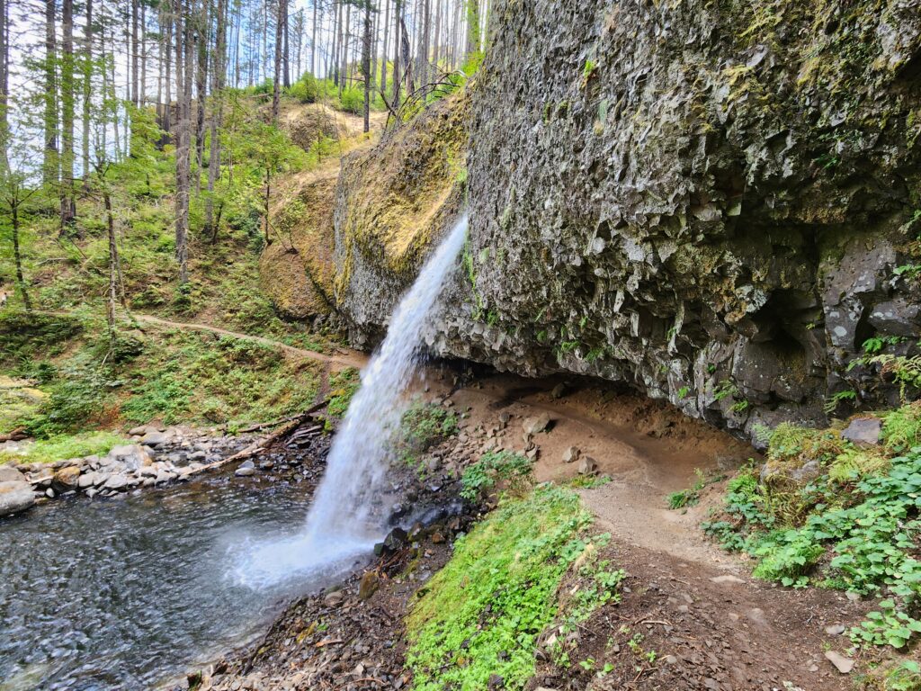
Behind the scenes beauty! Quick Facts: Location: Columbia River Gorge Oregon Distance: 2.7 miles round trip Elevation Gain: 450 feet Contact: Columbia River Gorge National Scenic Area Maps: Green Trails Columbia River Gorge–West No. 428S Recommended Guidebook: Day Hiking Columbia River Gorge (Mountaineers Books) Notes: Dogs allowed on-leash. Trailhead directions: From Portland or Hood River,…
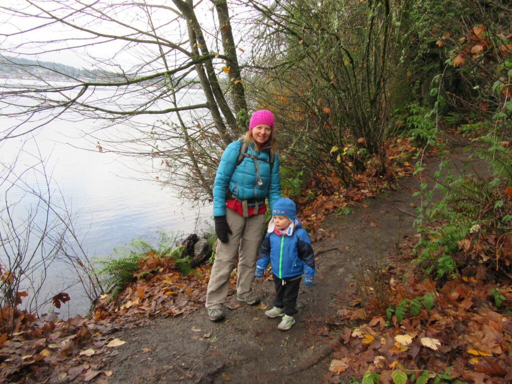
Read MoreLittle Cranberry Lake — A perfect complement hike to your Thanksgiving Day celebration
Quick Facts: Location: Anacortes-Fidalgo Island Land Agency: Anacortes Community Forest Lands Roundtrip: 1.9 miles Elevation Gain: 100 feet Access: From Exit 230 on I-5 in Burlington, head west on SR 20 to junction with SR 20-Spur. Continue right on SR 20-Spur to Anacortes. At traffic light near old town, continue left on 12th Street (still SR 20-Spur and12th Street…
Read MoreBarlow Point–Little known lookout site on Mountain Loop Highway
Location: Mountain Loop Highway near Granite Falls Land Agency: Mount Baker-Snoqualmie National Forest Roundtrip: 2.5 miles High Point: 3,222 feet Elevation gain: 850 feet Difficulty: moderate Green Trails Maps: Mountain Loop Highway 111SX Contact: Darrington Ranger District: Mount Baker Snoqualmie National Forest Note: Northwest Forest Pass or Inter-agency Pass required Access: From Granite Falls, follow…
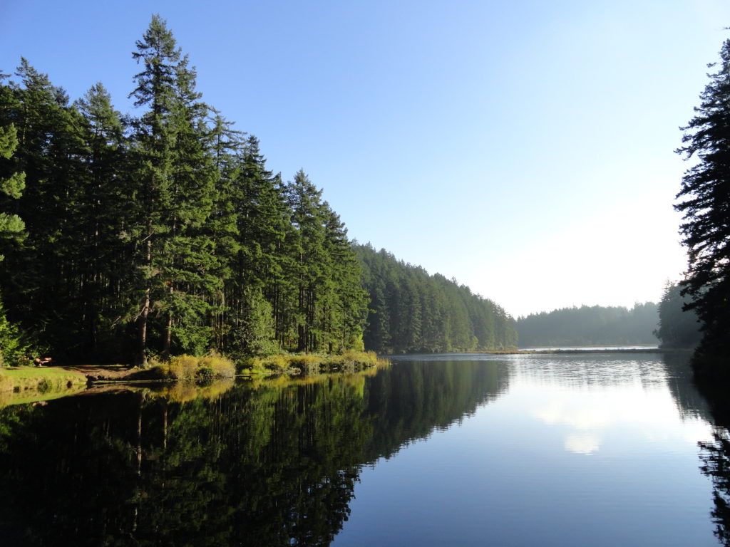
Read MoreSullivan Lake — Enjoy an “On Golden Pond” moment
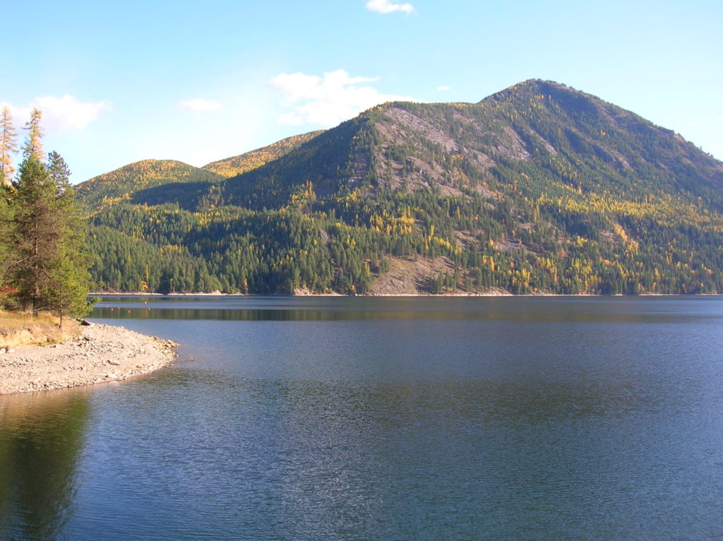
Quick Facts: Location: Selkirk Mountains Northeastern Washington Land Agency: Colville National Forest Roundtrip: 9.2 miles Elevation Gain: 650 feet Access: From Metaline Falls, Washington drive 2 miles north on SR 31. Turn right onto Sullivan Lake Road. Continue on this road for 4.7 miles before turning left onto FR 22. Proceed 0.4 mile, then turn right onto…
Read More