Posts Tagged ‘Mount Baker Snoqualmie National Forest’
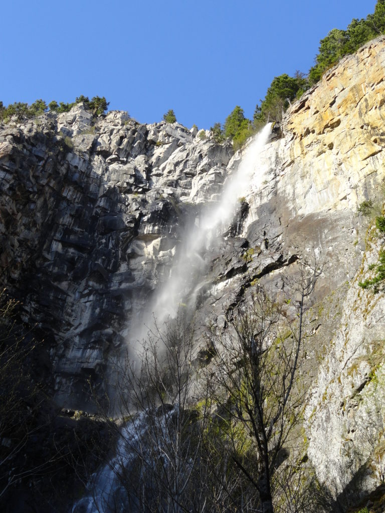
Lake Twentytwo─waterfalls, big cedars and a beautiful lake beneath Mount Pilchuck
Quick Facts Location: Mountain Loop Highway near Granite Falls Land Agency: Mount Baker-Snoqualmie National Forest Roundtrip: 5.4 miles Elevation Gain: 1,350 feet Green Trails Map: Mountain Loop Highway 111SX Notes: NW Forest Pass required; dogs permitted on leash; trail can get busy, practice Leave No Trace ethics and consider visiting on a weekday. Access: From…
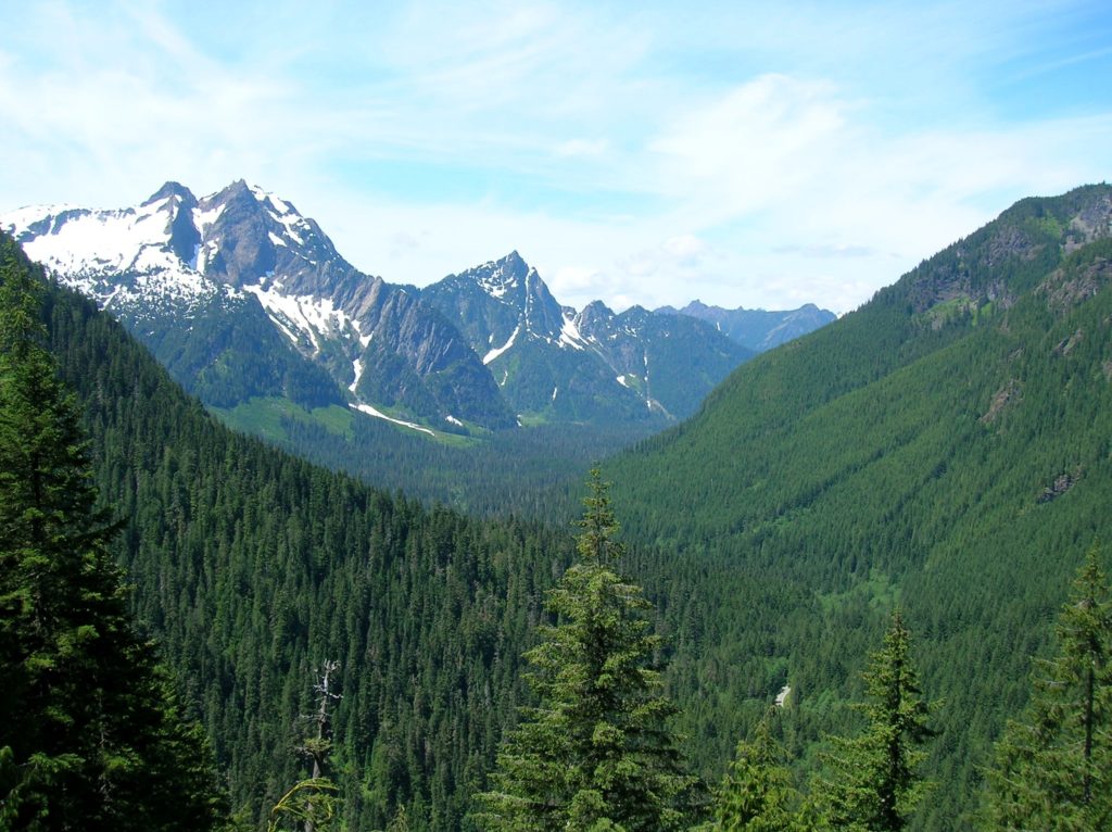
Read MoreSuiattle River– A wild river and majestic primeval forest within the shadows of Glacier Peak
Quick Facts: Location: Suiattle River Road Land Agency: Mount Baker-Snoqualmie National Forest Roundtrip: 13.0 miles Elevation gain: 1,000 feet Green Trails Maps: Mountain Loop Highway no. 111SX Contact: Darrington Ranger District: Mount Baker-Snoqualmie National Forest Notes: Northwest Forest Pass or interagency pass required Access: From Darrington travel north on SR 530 for 7.5 miles turning…
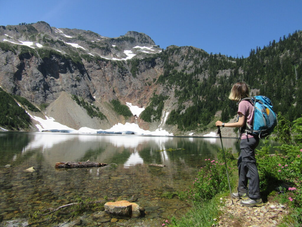
Read MoreMelakwa Lake–The buzz is out on this great Snoqualmie Pass hike
Location: Snoqualmie Pass region Land Agency: Mount Baker-Snoqualmie National Forest Roundtrip: 9.0 miles High Point: 4,600 feet Elevation gain: 2,400 feet Difficulty: difficult Green Trails Map: Snoqualmie Pass Gateway, WA- No 207SX Contact: North Bend Ranger District: Mount Baker Snoqualmie National Forest Notes: NW Forest Pass or Interagency Pass required; dogs must be on a…
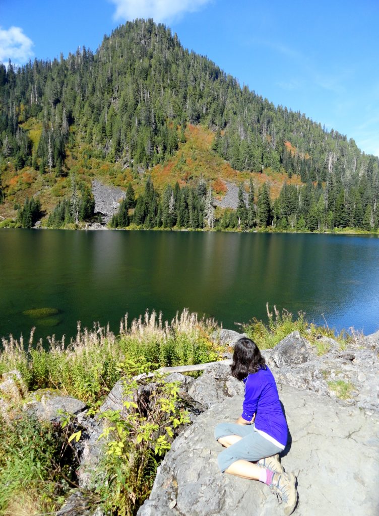
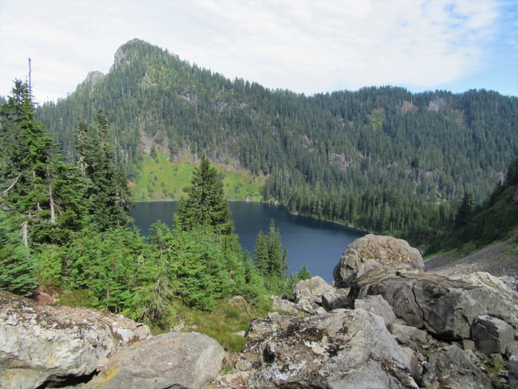
Read MoreSilver Lake─Precious body of water above old mining district
Quick Facts: Location: Mountain Loop Highway near Granite Falls Land Agency: Mount Baker-Snoqualmie National Forest Roundtrip: 13.0 miles Elevation Gain: 2,100 feet Green Trails Map: Mountain Loop Highway 111SX Access: From Granite Falls, follow the Mountain Loop Highway east for 31 miles to Barlow Pass. Hike begins by walking up gated Monte Cristo Road. Note: Northwest…
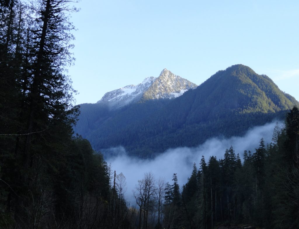
Read MoreWest Cady Ridge—from wildflowers to autumn colors
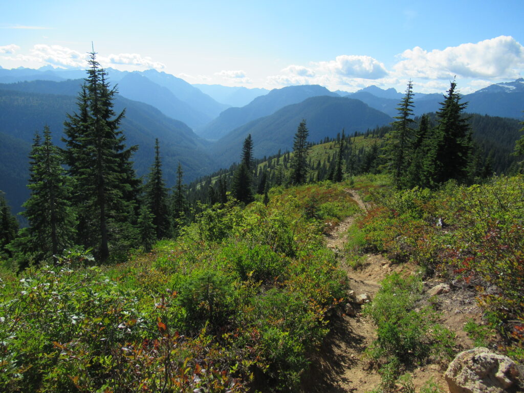
Quick Facts: Location: Wild Sky and Henry Jackson Wildernesses, North Fork Skykomish River Valley Land Agency: National Forest Service Roundtrip: 8.0 miles Elevation Gain: 2,300 feet Green Trails Map: Monte Cristo, WA- No. 143 Recommended source: Day Hiking Central Cascades 2nd edition (Mountaineers Books) Contact: Skykomish Ranger District: Mount Baker Snoqualmie National Forest Notes: Northwest…
Read MoreNorth Lake–Secluded Lake off popular Mountain Loop Highway
Quick Facts: Location: Mountain Loop Highway near Granite Falls Land Agency: Mount Baker-Snoqualmie National Forest Roundtrip: 6.0 miles High Point: 4,925 feet Elevation gain: 2,250 feet Difficulty: difficult Green Trails Map: Mountain Loop Highway no. 111SX Contact: Darrington Ranger District Notes: Access road is rough in spots; high clearance recommended Access: From Granite Falls follow the Mountain Loop Highway east for 26 miles. Just…
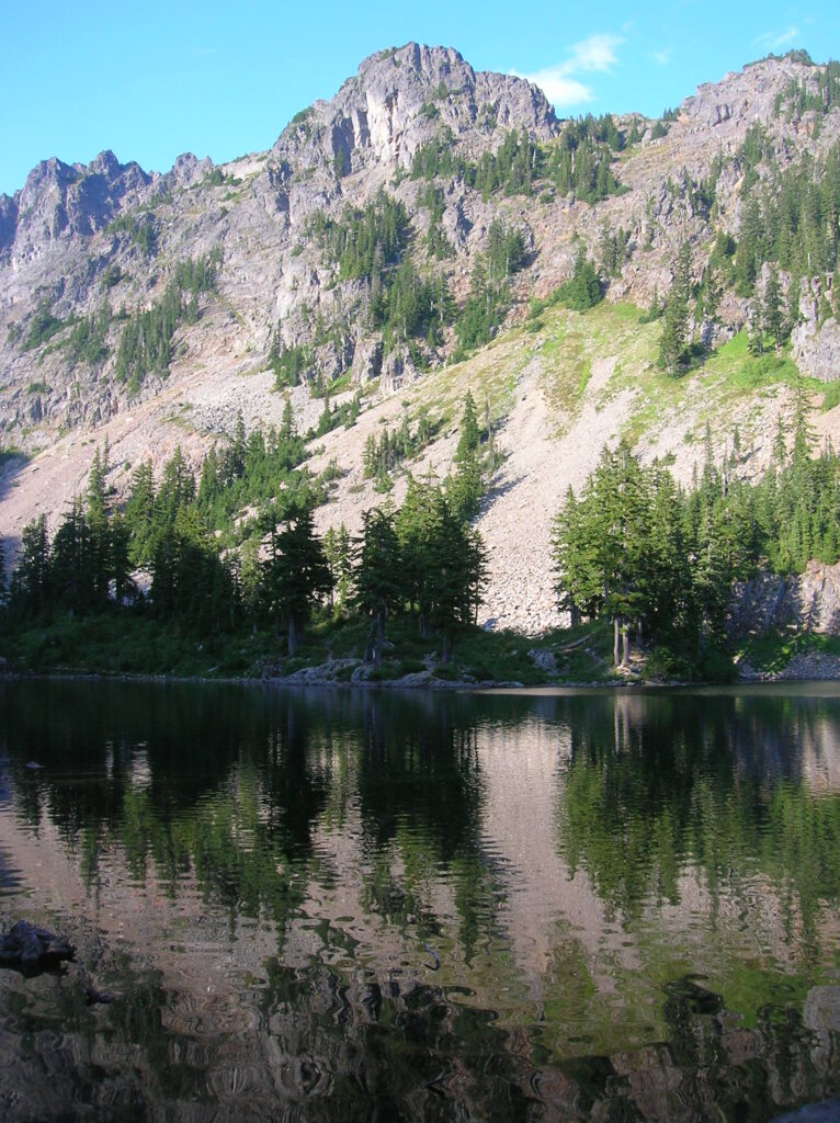
Read MoreFisher Lake–Quiet backcountry lake beyond Tonga Ridge
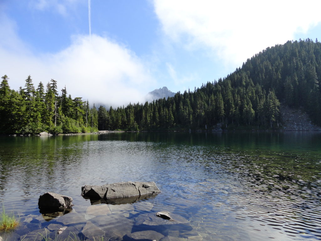
Quick Facts: Location: Skykomish Valley Land Agency: National Forest Service Round Trip: 10.0 miles Elevation Gain: 1350 feet Contact: Skykomish Ranger District, Mount Baker-Snoqualmie National Forest Green Trails Maps: Alpine Lakes West Stevens Pass No 176S Notes: Northwest Forest Pass or Interagency Pass required Access: Follow US 2 east to Skykomish. Then continue east for 1.9 miles…
Read MoreBoulder River- waterfalls among old-growth forest

Quick Facts: Location: Boulder River Wilderness, near Darrington Land Agency: National Forest Service Round trip: 8.6 miles Elevation Gain: 750 feet Green Trails Maps: Mountain Loop Highway 111SX Access: From Arlington follow SR 530 for 20 miles. Just beyond Milepost 41 near a subdivision turn right onto FR 2010 and continue for 3.7 miles to trailhead. Contact:…
Read MoreSnoquera Falls — A touch of the Yosemite Valley in Washington
Quick Facts: Location: White River Valley Land Agency: Mount Baker-Snoqualmie National Forest Roundtrip: 4.2 miles Elevation Gain: 750 feet Contact: Snoqualmie Ranger District, Enumclaw office Green Trails Map: Greenwater no. 238 Notes: Northwest Forest Pass or Interagency Pass required; Dogs permitted on leash Access: From Enumclaw, follow SR 410 east for 28 miles. Turn left onto Camp Sheppard…
Read MoreBarlow Point–Little known lookout site on Mountain Loop Highway
Location: Mountain Loop Highway near Granite Falls Land Agency: Mount Baker-Snoqualmie National Forest Roundtrip: 2.5 miles High Point: 3,222 feet Elevation gain: 850 feet Difficulty: moderate Green Trails Maps: Mountain Loop Highway 111SX Contact: Darrington Ranger District: Mount Baker Snoqualmie National Forest Note: Northwest Forest Pass or Inter-agency Pass required Access: From Granite Falls, follow…
Read More