Posts Tagged ‘Mountain Loop Highway’
Gothic Basin and Foggy Lake — Spiraling peaks, buttressed ridges, and a hauntingly beautiful landscape
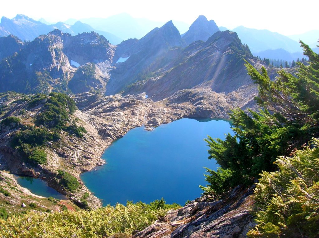
Quick Facts: Location: Mountain Loop Highway near Granite Falls Land Agency: Mount Baker-Snoqualmie National Forest Service and Washington Department of Natural Resources Roundtrip: 9.4 miles Elevation Gain: 2,900 feet Green Trails Maps: Mountain Loop Highway 111SX Access: From Granite Falls follow the Mountain Loop Highway east for 31 miles to Barlow Pass. Hike begins by walking up gated Monte Cristo…
Read MorePeek-a-boo Lake — peaceful little lake and peek-a-boo mountain views
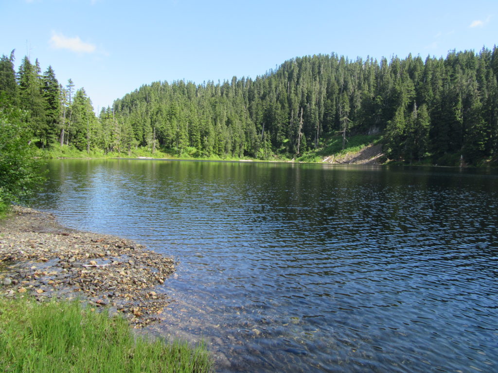
Quick Facts: Location: Mountain Loop Highway near Darrington Land Agency: Mount Baker-Snoqualmie National Forest Roundtrip: 5.0 miles Elevation gain: 1600 feet Green Trails Maps: Mountain Loop Highway 111 SX Contact: Mount Baker-Snoqualmie National Forest, Darrington Ranger District Notes: Access road is rough and brushy in spots. High clearance necessary. Access: From Darrington follow the Mountain Loop…
Read MoreWhite Chuck Bench Trail — Glacier-fed Whitewater
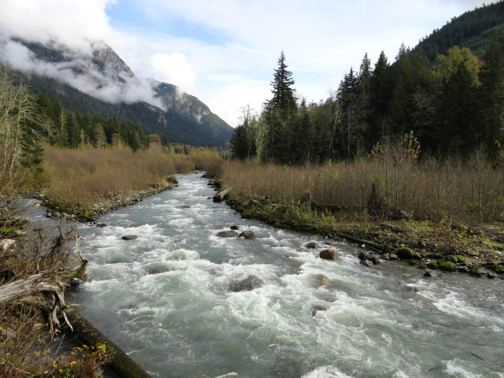
Quick Facts: Location: Mountain Loop Highway Land Agency: Mount Baker-Snoqualmie National Forest Roundtrip: 14 miles Elevation gain: 1500 feet Green Trails Map: Green Trails, Mountain Loop Highway, WA- no. 111SX Contact: Darrington Ranger District: Mount Baker Snoqualmie National Forest Access: From Darrington follow Mountain Loop Highway for 9.0 miles. Turn left onto FR 22 and…
Read MoreOld Government Trail–Follow in the footsteps of long gone miners and adventurers
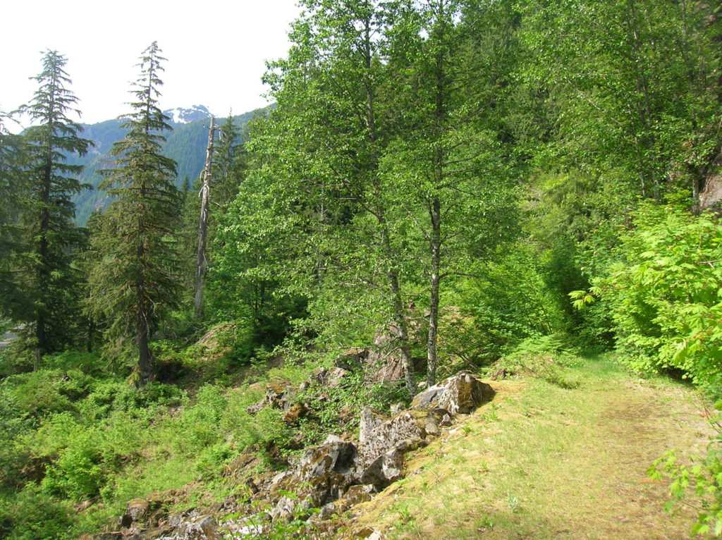
Location: Mountain Loop Highway near Granite Falls Land Agency: Mount Baker-Snoqualmie National Forest Roundtrip: 4.0 miles High Point: 2,450 feet Elevation gain: 400 feet Difficulty: difficult Green Trails Map: Mountain Loop Highway 111SX Contact: Darrington Ranger District: Mount Baker Snoqualmie National Forest ( Notes: Northwest Forest Pass required Access: : From Granite Falls, follow the Mountain…
Read MoreMeadow Lake- serene subalpine lake above the Suiattle and White Chuck rivers
Quick Facts: Location: White Chuck River Valley, Mountain Loop Highway Land Agency: Mount Baker-Snoqualmie National Forest Service Roundtrip: 16.0 miles Elevation Gain: 2,900 feet Green Trails Map: Mountain Loop Highway 111SX Access: Take Exit 208 off of I-5 following SR 530 east for 32 miles to Darrington. Then head south on the Mountain Loop Highway proceeding 9.0…
Read MoreKelcema Lake-Satisfying snowshoe trip to ancient forest flanked subalpine lake
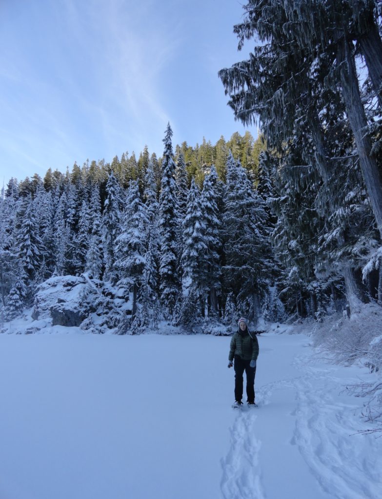
Quick Facts: Location: Mountain Loop Highway near Granite Falls Land Agency: Mount Baker-Snoqualmie National Forest Roundtrip: 9.6 miles Elevation gain: 1,600 feet Green Trails Map: Mountain Loop Highway 111SX Contact: Darrington Ranger District: Mount Baker Snoqualmie National Forest Access: From Granite Falls, follow the Mountain Loop Highway east for 23.5 miles to Deer Creek Parking…
Read MoreCutthroat Lakes– Hike to a set of beautiful tarns beneath Bald Mountain
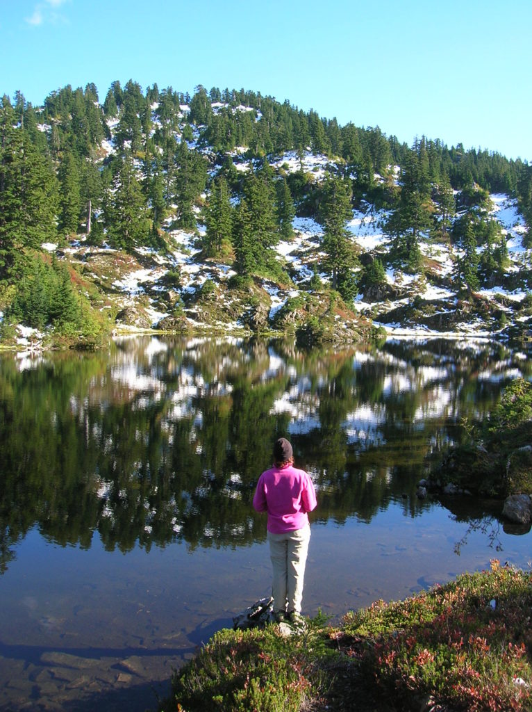
Quick Facts: Location: Mountain Loop Highway Land Agency: Mount Baker-Snoqualmie National Forest; Washington Department of Natural Resources Roundtrip: 6.0 miles Elevation gain: 1,700 feet Green Trails Maps: Mountain Loop Highway 111SX Recommended Resource: Day Hiking North Cascades (Romano; Mountaineers Books) Contact: Darrington Ranger District: Mount Baker-Snoqualmie National Forest Notes: access road is narrow and parking is limited.…
Read MoreMount Dickerman–arduous climb to sweeping alpine views
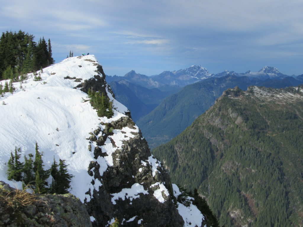
Quick Facts: Location: Mountain Loop Highway near Granite Falls Land Agency: Mount Baker-Snoqualmie National Forest Roundtrip: 8.6 miles High Point: 5,723 feet Elevation gain: 3,900 feet Difficulty: difficult Green Trails Map: Mountain Loop Highway No. 111SX Contact: Darrington Ranger District: Mount Baker Snoqualmie National Forest Notes: Northwest Forest Pass required Access: From Granite Falls follow…
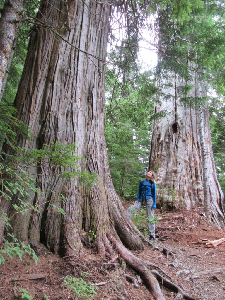
Read MoreNorth Fork Sauk River — Walk among ancient giants
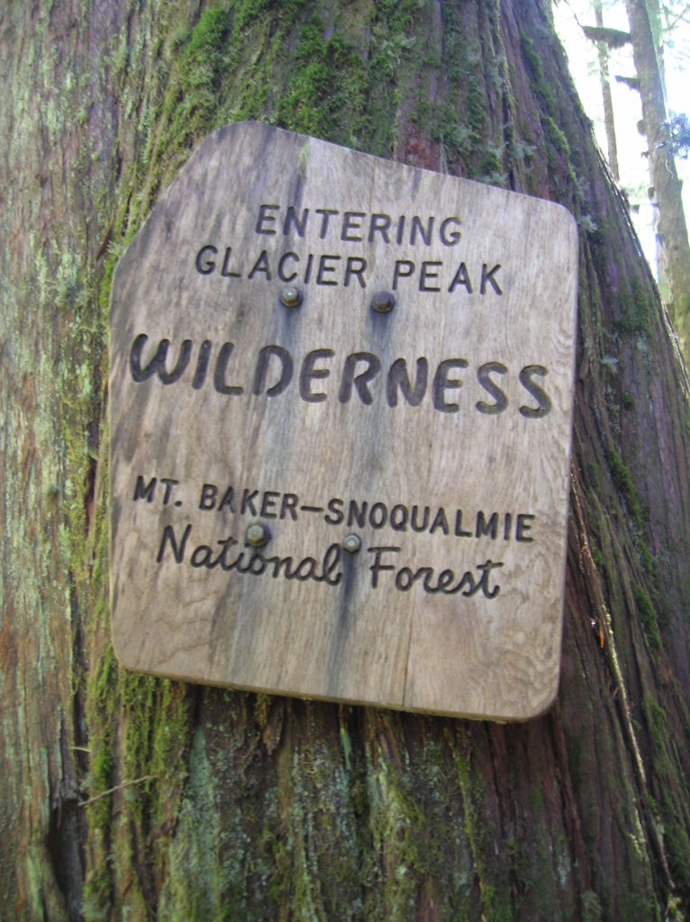
Quick Facts: Location: Mountain Loop Highway Land Agency: Mount Baker-Snoqualmie National Forest Roundtrip: 11.6 miles Elevation gain: 900 feet Green Trails Maps: Mountain Loop Highway Map 111SX Contact: Darrington Ranger District: Mount Baker Snoqualmie National Forest Guidebook Resource: Day Hiking North Cascades (Mountaineers Books) Notes: NW Forest Pass or Interagency Pass required Access: From Darrington,…
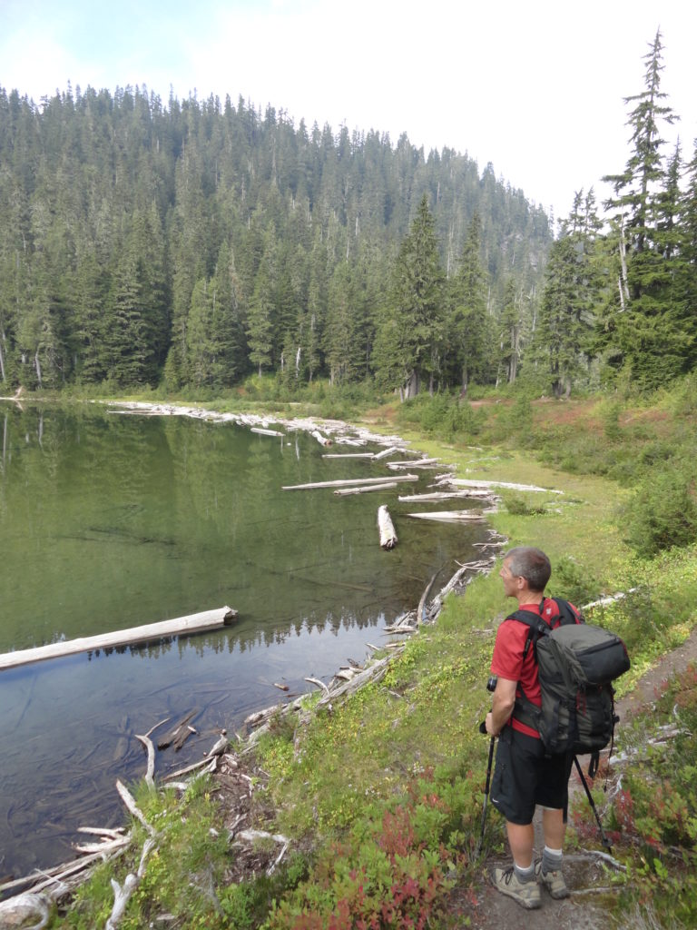
Read MorePinnacle Lake — Pretty little lake perched on a shoulder of Mount Pilchuck
Quick Facts: Location: Mountain Loop Highway, near Granite Falls Land Agency: Mount Baker-Snoqualmie National Forest; Washington State Parks Roundtrip: 4.2 miles Elevation gain: 1,100 feet Green Trails Maps: Mountain Loop Highway 111SX Contact: Darrington Ranger District: Mount Baker-Snoqualmie National Forest Notes: access road is rough, high clearance vehicles recommended. Access: From Granite Falls follow the…
Read More