Posts Tagged ‘Mountain Loop Highway’
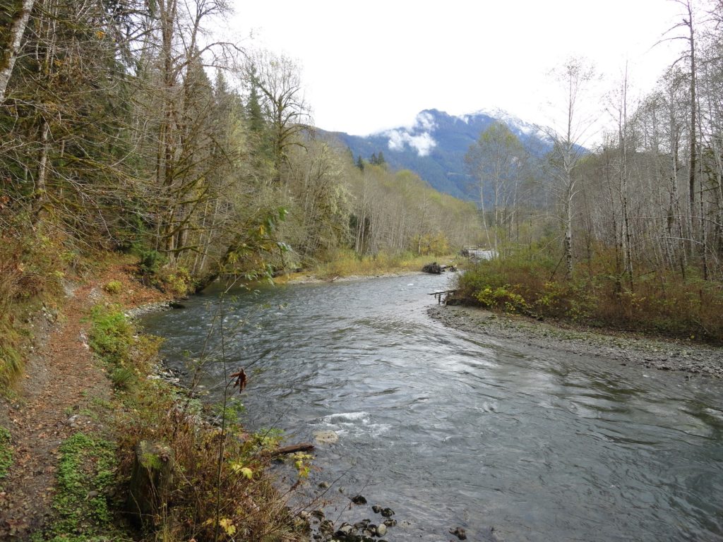
Twin Lakes (Monte Cristo) — Follow a rugged old miner’s path to a remote basin
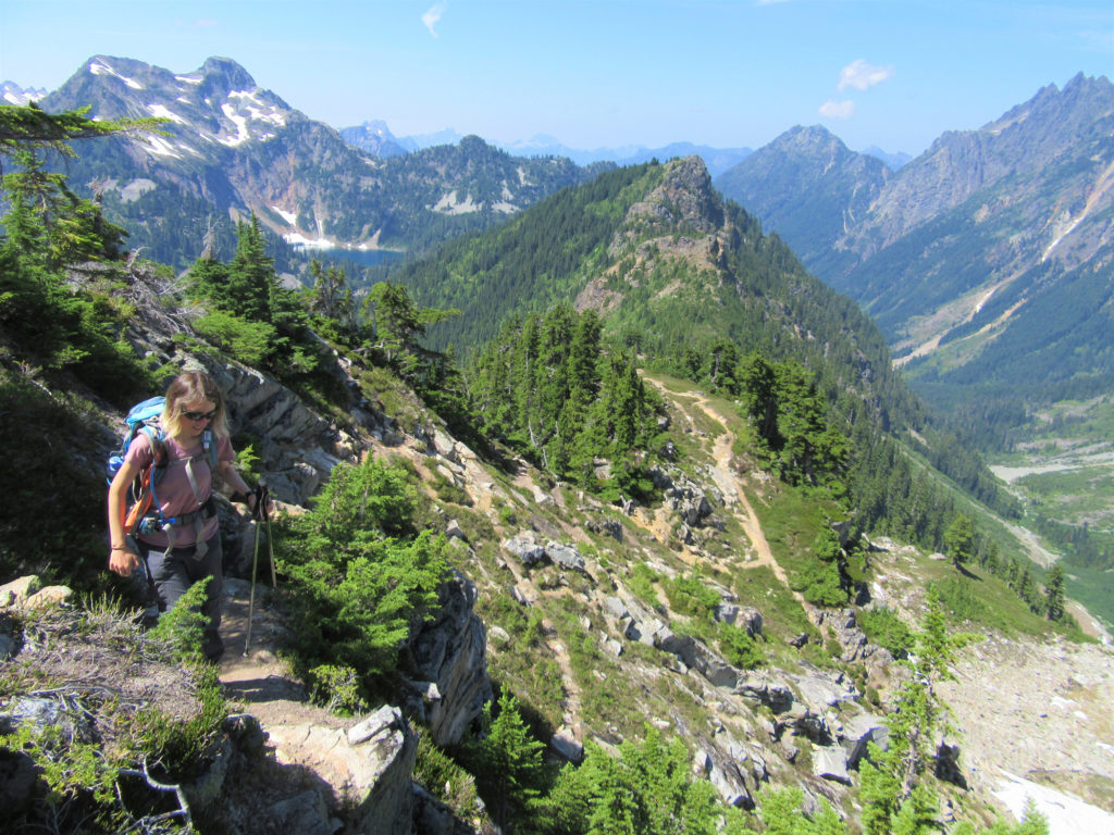
Quick Facts: Location: Mountain Loop Highway near Barlow Pass Land Agency: Mount Baker-Snoqualmie National Forest Roundtrip: 17.0 miles Elevation gain: 3,900 feet Green Trails Map: Mountain Loop Highway no. 111SX Contact: Darrington Ranger District: Mount Baker Snoqualmie National Forest Notes: Northwest Forest Pass or Interagency Pass required; A washout at the Twin Bridges requires…
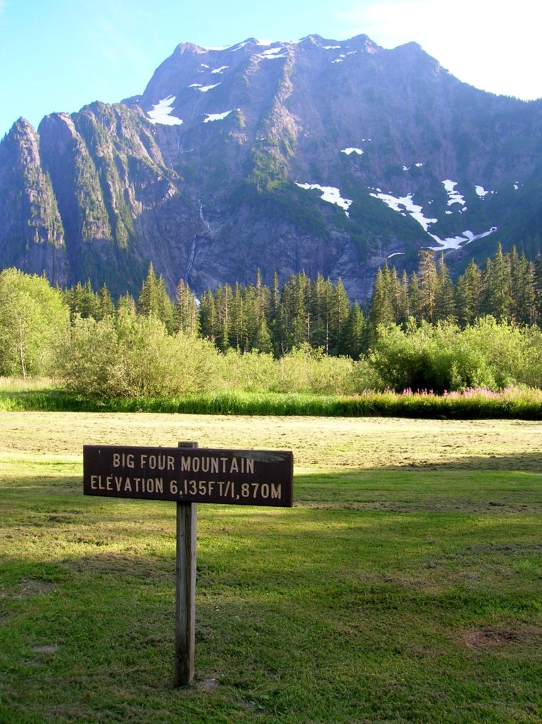
Read MoreBedal Basin–Lonesome and beautiful basin beneath awe-inspiring Sloan Peak
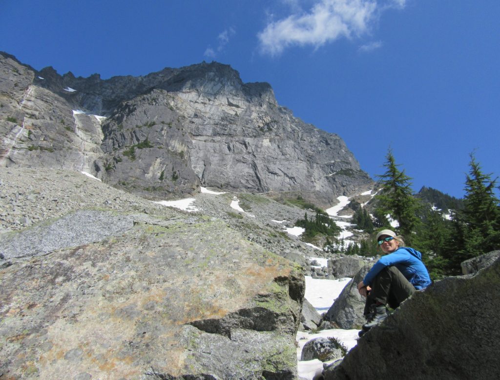
Location: Mountain Loop Highway Land Agency: Mount Baker-Snoqualmie National Forest Roundtrip: 5.2 miles High Point: 4,650 feet Elevation gain: 1,900 feet Difficulty: challenging Green Trails Maps: Mountain Loop Highway No. 111SX Contact: Darrington Ranger District: Mount Baker Snoqualmie National Forest Access: Take Exit 208 off of I-5 following SR 530 east for 32 miles to Darrington.…
Read MoreChokwich Trail─Chock full of solitude
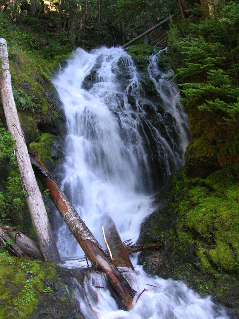
Quick Facts: Location: Mountain Loop Highway near Darrington Land Agency: Mount Baker-Snoqualmie National Forest Roundtrip: 7.0 miles Elevation Gain: 900 feet Green Trails Map: Mountain Loop Highway no.111SX Note: NW Forest Pass required Access: From Granite Falls follow the Mountain Loop Highway east for 31 miles to Barlow Pass and end of pavement. Continue for 3.5 miles turning…
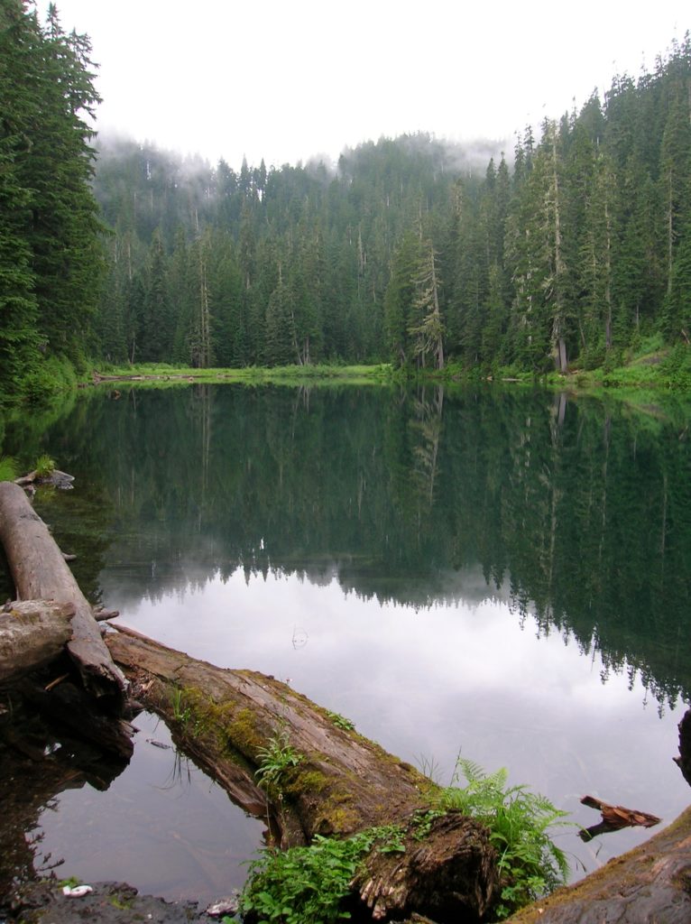
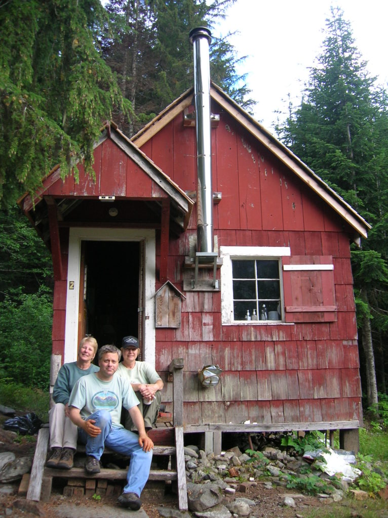
Read MoreLake Evan and Boardman Lake–Enjoy an easy hike to two family friendly lakes
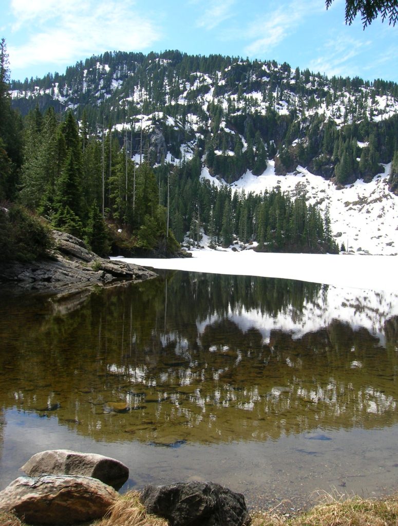
Quick Facts: Location: Mountain Loop Highway near Granite Falls Land Agency: Mount Baker-Snoqualmie National Forest Roundtrip: 2.0 miles Elevation gain: 300 feet Difficulty: easy (with some rough footing) Green Trails Map: Mountain Loop Highway 111SX Contact: Darrington Ranger District: Mount Baker-Snoqualmie National Forest Access: From Granite Falls, follow the Mountain Loop Highway east to the Verlot…
Read MoreBeaver Lake — Trail holds a “slough” of surprises
Quick Facts: Location: Mountain Loop Highway Land Agency: Mount Baker-Snoqualmie National Forest Roundtrip: 3.8 miles Elevation gain: 100 feet Green Trails Map: Mountain Loop Highway 111SX Contact: Darrington Ranger District: Mount Baker Snoqualmie National Forest Notes: Northwest Forest Pass or Interagency Pass required Access: From Darrington, follow Mountain Loop Highway for 9.0 miles to trailhead…
Read MoreBig Four Ice Caves — Cool attraction is a hot destination
Quick Facts: Location: Mountain Loop Highway near Granite Falls Land Agency: Mount Baker-Snoqualmie National Forest Roundtrip: 2.2 miles Elevation gain: 200 feet Difficulty: easy Green Trails Map: Mountain Loop Highway 111SX Contact: Darrington Ranger District: Mount Baker- Snoqualmie National Forest or Verlot Public Service Center (summer weekends) (360) 691-7791 Notes: NW Forest Pass required; DO NOT…
Read MoreCircle Peak–Round this summit for fantastic 360-degree views

Location: White Chuck River Valley, Mountain Loop Highway Land Agency: Mount Baker-Snoqualmie National Forest Roundtrip: 18.6 miles High Point: 5,983 feet Elevation gain: 4,800 feet Difficulty: challenging Notes:FR 23 is currently is closed at mile 4 due to a washout Green Trails Maps: Mountain Loop Highway no. 111SX Recommended Guidebook: Day Hiking North Cascades 2nd…
Read MoreMonte Cristo — Last Chance to visit Ghost Town for awhile
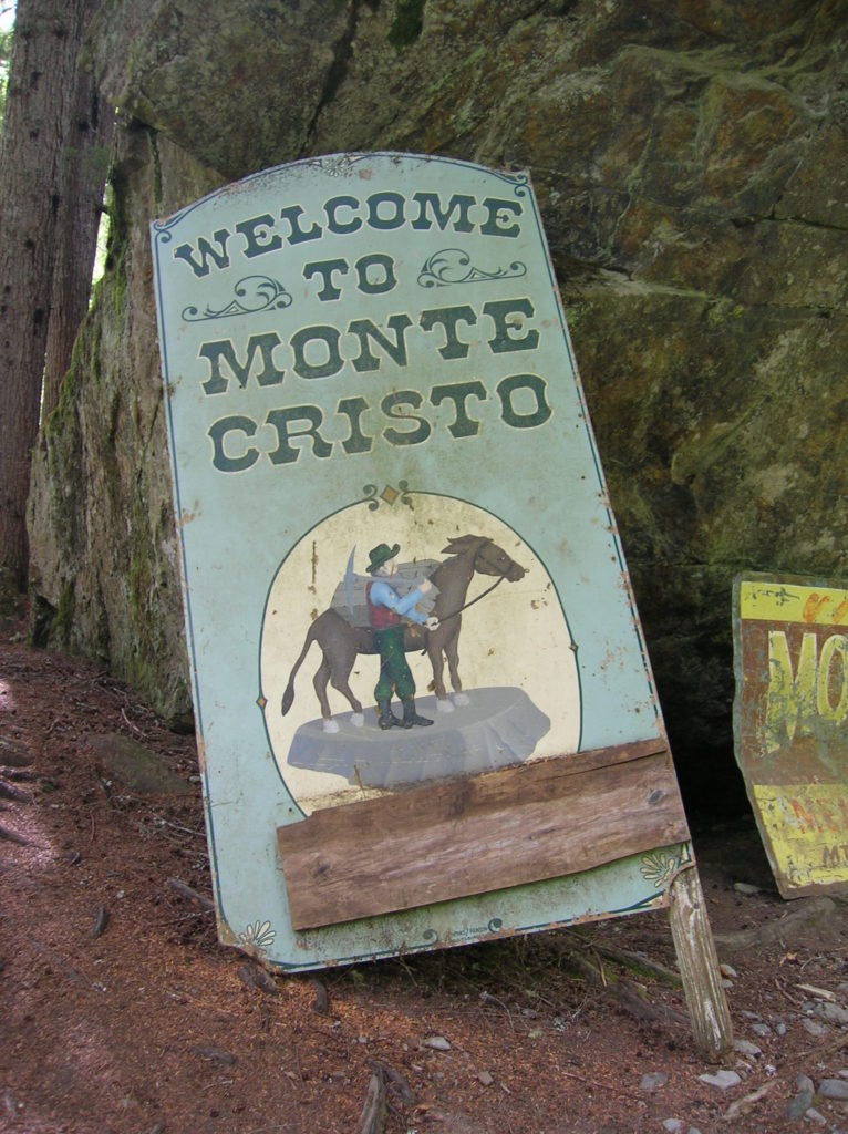
Quick Facts: Location: Mountain Loop Highway near Granite Falls Land Agency: Mount Baker-Snoqualmie National Forest Roundtrip: 8.0 miles High Point: 2,800 feet Elevation gain: 500 feet Difficulty: moderate Green Trails Maps: Sloan Peak, WA- No. 111; Monte Cristo, WA- No. 143 Contact: Darrington Ranger District: Mount Baker Snoqualmie National Forest Notes: Northwest Forest Pass required. Trail and town site closes on April 15th 2015 and…
Read MoreIndependence Lake–A great place to celebrate the 4th of July and the Freedom of the Hills
Quick Facts Location: Mountain Loop Highway near Granite Falls Land Agency: Mount Baker-Snoqualmie National Forest Roundtrip: 1.5 miles…
Read MoreMonte Cristo–Count down is near for clean-up of historic mining town
Quick Facts Location: Mountain Loop Highway near Granite Falls Land Agency: Mount Baker-Snoqualmie National Forestuntain Loop Highway near Granite Falls Roundtrip: 8.0 miles High Point: 2,800 feet Elevation gain: 500 feet Difficulty: moderate Green Trails Maps: Sloan Peak, WA- No. 111; Monte Cristo, WA- No. 143 Contact: Darrington Ranger District: Mount Baker Snoqualmie National Forest…
Read More