Posts Tagged ‘Snohomish County’
Devil’s Butte–A Frightful name but delightful hike in Lord Hill Park
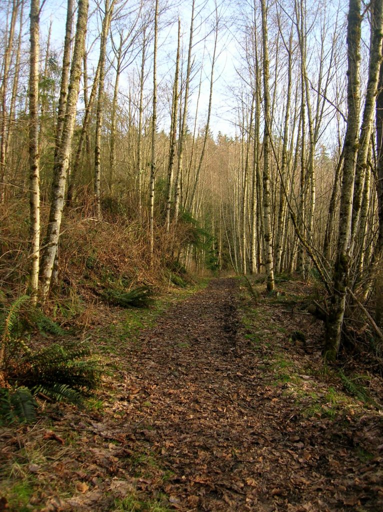
Quick Facts Location: Lord Hill Park near Snohomish Land Agency: Snohomish County Parks Roundtrip: 3.5 miles High Point: 650 feet Elevation gain: 400 feet Difficulty: moderate Contact: Snohomish County Parks Notes: Dogs must be on leash; trails open to bikes and horses Access: From the city of Snohomish, exit SR 9 onto 2nd Street. Proceed…
Read MoreLake Janus — quiet alternative to nearby Lake Valhalla
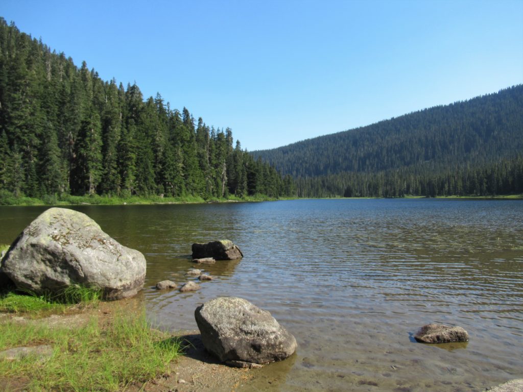
Quick Facts: Location: Pacific Crest Trail near Stevens Pass Land Agency: Mount Baker-Snoqualmie National Forest Roundtrip: 6.5 miles Elevation gain: 1,550 feet Green Trails Map: Benchmark MT- No. 144 Contact: Skykomish Ranger District: Mount Baker -Snoqualmie National Forest Notes: Self-issued free wilderness permit available at trailhead. Wilderness regulations apply. No fires allowed near lake. Practice…
Read MoreEight Mile Creek–Enjoy elegant cedars and polished granite outcroppings on the way to Squire Creek Pass
Quick Facts: Location: Boulder River Wilderness, Mountain Loop Highway Land Agency: Mount Baker-Snoqualmie National Forest Roundtrip: 6.0 miles High Point: 4,075 feet Elevation gain: 2,300 feet Difficulty: difficult Green Trails Maps: Mountain Loop Highway 111SX Contact: Darrington Ranger District: Mount Baker Snoqualmie National Forest Recommended Guidebook: Day Hiking North Cascades 2nd edition Access: From Darrington, follow…
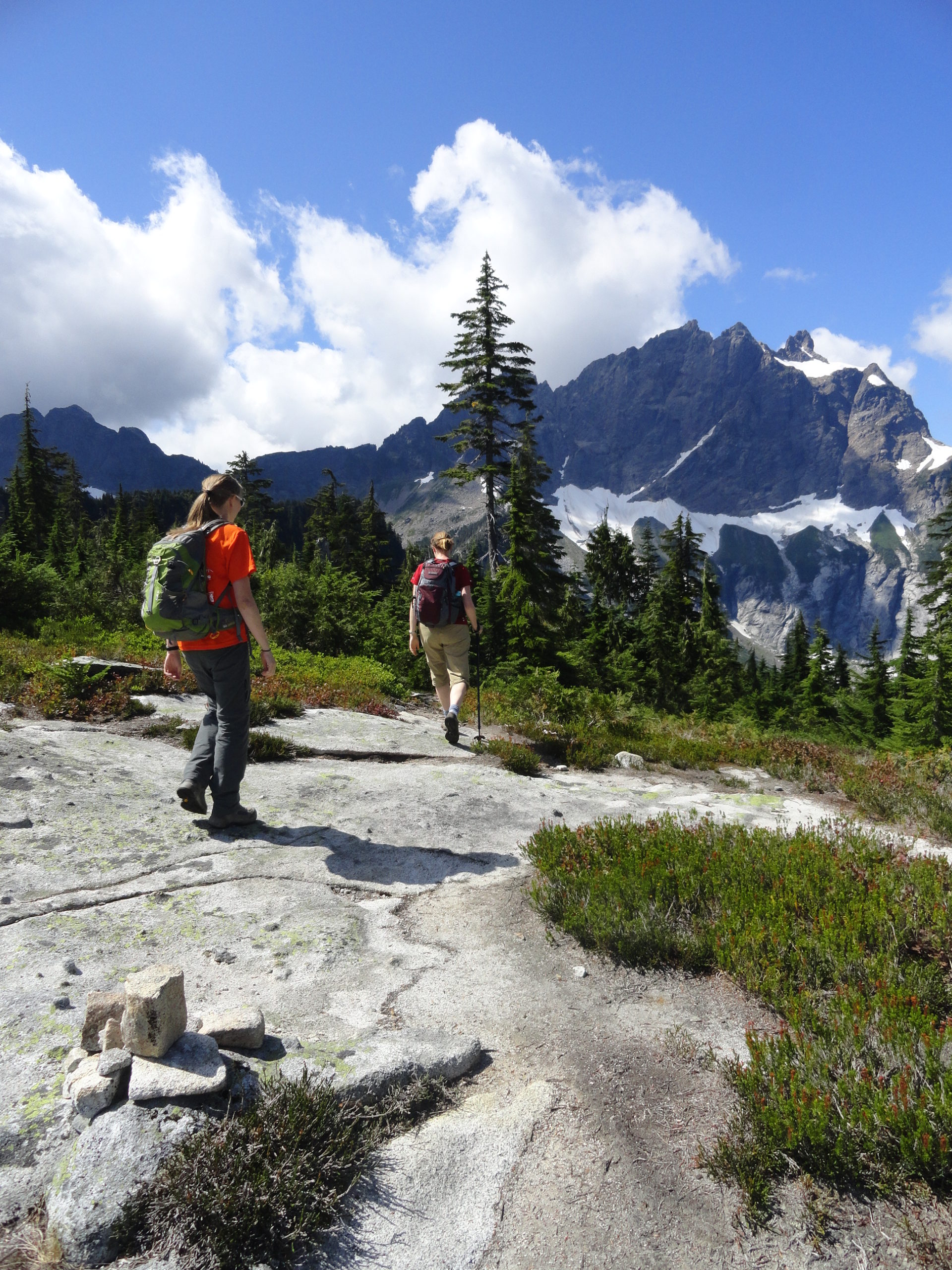
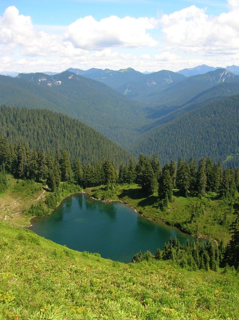
Read MoreGothic Basin and Foggy Lake — Spiraling peaks, buttressed ridges, and a hauntingly beautiful landscape
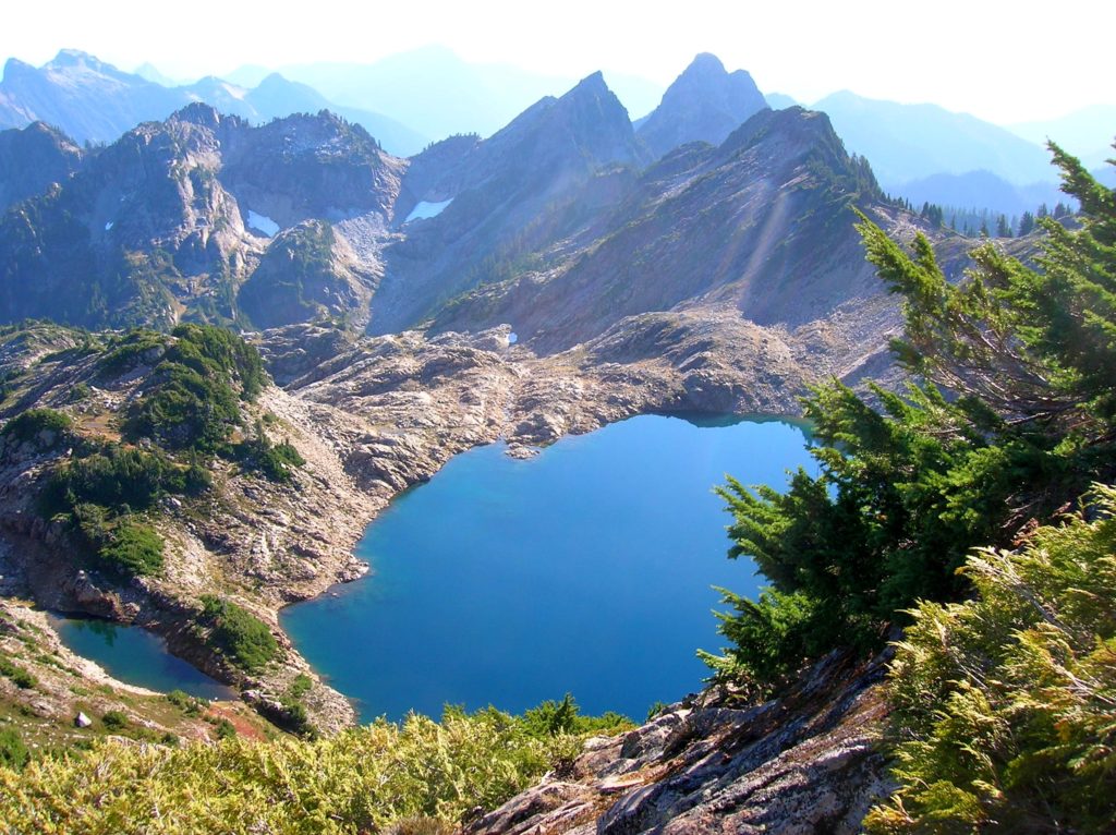
Quick Facts: Location: Mountain Loop Highway near Granite Falls Land Agency: Mount Baker-Snoqualmie National Forest Service and Washington Department of Natural Resources Roundtrip: 9.4 miles Elevation Gain: 2,900 feet Green Trails Maps: Mountain Loop Highway 111SX Access: From Granite Falls follow the Mountain Loop Highway east for 31 miles to Barlow Pass. Hike begins by walking up gated Monte Cristo…
Read MoreBenchmark Mountain–The meadows here measure up among the best
Quick Facts: Location: North Fork Skykomish River Valley Land Agency: Mount Baker-Snoqualmie National Forest Roundtrip: 14.2 miles High Point: 5,816 feet Elevation gain: 3,700 feet Green Trails Maps: Monte Cristo, WA-No. 143, Benchmark MT- No. 144 Contact: Skykomish Ranger District: Mount Baker-Snoqualmie National Forest Note: Northwest Forest or Interagency Pass Required Access: From Everett head…
Read MoreBob Heirman Wildlife Preserve at Thomas’ Eddy – Swans, steelhead, and serenity on the Snohomish River

Quick Facts: Location: Snohomish River, south of Snohomish Land Agency: Snohomish County Parks Roundtrip: 1.5 miles Elevation Gain: 50 feet Contact: Snohomish County Parks and Recreation Special Note: Dogs prohibited. Trails can flood during rainy period. Expect wet and muddy trails. Access: From the city of Snohomish, travel south on SR 9 for 2.6 miles…
Read MoreRiverview Wildlife Refuge –Quiet bird sanctuary on the Snohomish River

Quick Facts Location: City of Snohomish Land Agency: Snohomish Department of Parks and Volunteer Programs Roundtrip: 2.2 miles Elevation gain: minimal Difficulty: Easy Contact: City of Snohomish and Pilchuck Audubon Society Notes: Dogs must be on a leash. Access: From Everett head east on US 2 to SR 9. Then follow SR 9 south exiting…
Read MoreWhite Chuck Bench Trail — Glacier-fed Whitewater
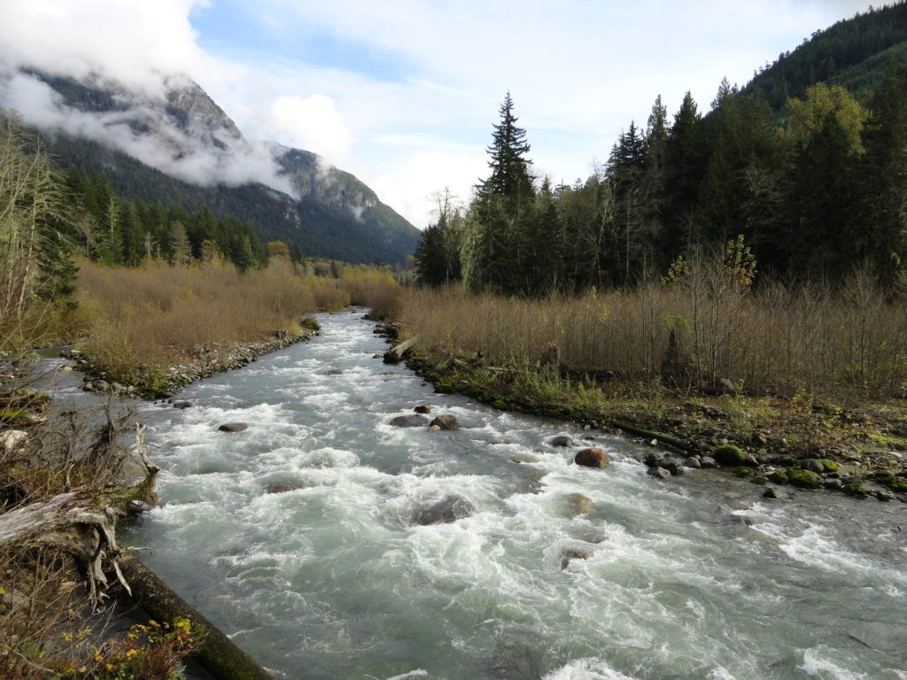
Quick Facts: Location: Mountain Loop Highway Land Agency: Mount Baker-Snoqualmie National Forest Roundtrip: 14 miles Elevation gain: 1500 feet Green Trails Map: Green Trails, Mountain Loop Highway, WA- no. 111SX Contact: Darrington Ranger District: Mount Baker Snoqualmie National Forest Access: From Darrington follow Mountain Loop Highway for 9.0 miles. Turn left onto FR 22 and…
Read MoreOld Government Trail–Follow in the footsteps of long gone miners and adventurers
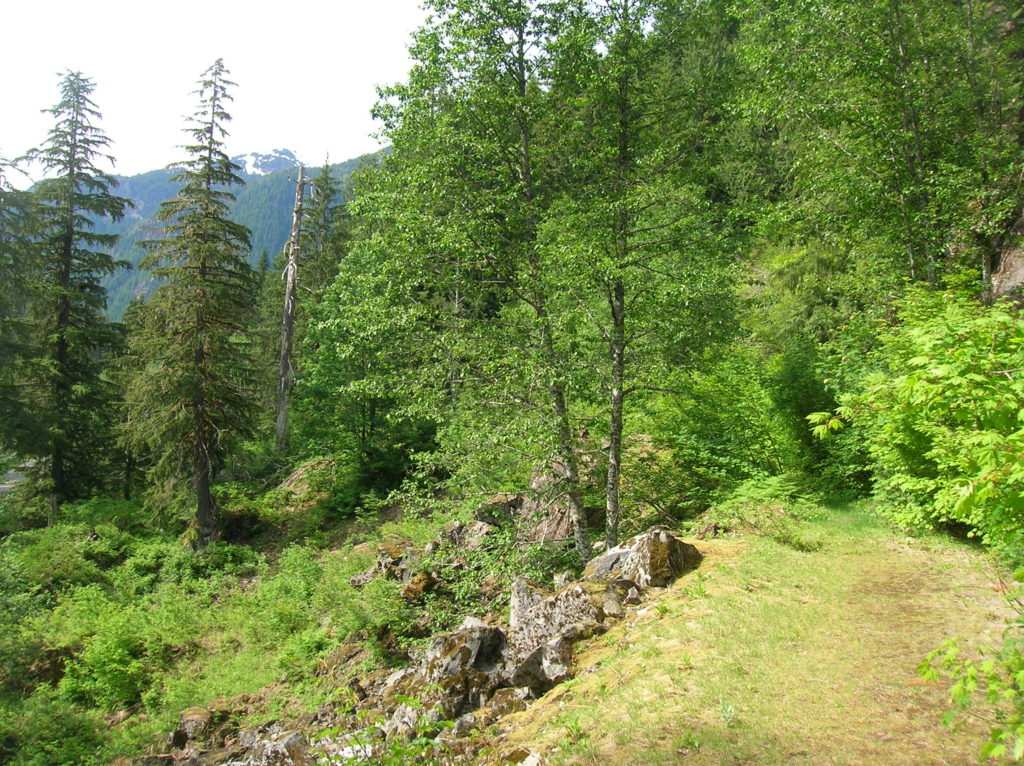
Location: Mountain Loop Highway near Granite Falls Land Agency: Mount Baker-Snoqualmie National Forest Roundtrip: 4.0 miles High Point: 2,450 feet Elevation gain: 400 feet Difficulty: difficult Green Trails Map: Mountain Loop Highway 111SX Contact: Darrington Ranger District: Mount Baker Snoqualmie National Forest ( Notes: Northwest Forest Pass required Access: : From Granite Falls, follow the Mountain…
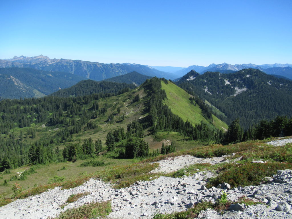
Read MoreJohnson Ridge–Ridgeline hike in the Wild Sky Wilderness
Location: Beckler River near Skykomish Land Agency: Mount Baker-Snoqualmie National Forest Roundtrip: 9.0 miles High Point: 5,540 feet Elevation gain: 2,650 feet Difficulty: difficult Green Trails Maps: Alpine Lakes West Stevens Pass No. 176S Contact: Skykomish Ranger District: Mount Baker-Snoqualmie National Forest Access: From Everett head east on US 2 for 50 miles turning left onto…
Read More