Posts Tagged ‘snow-free winter hike’
Skagit-Sauk Reach Trail
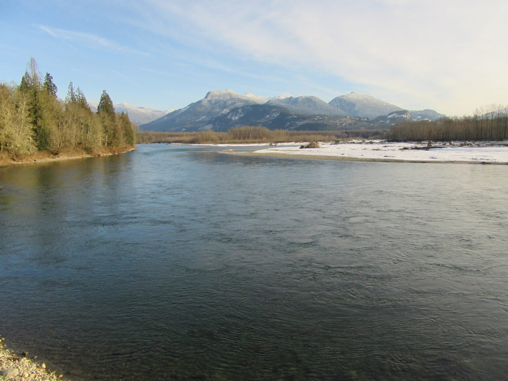
Watch for eagles along an old remote rail line Quick Facts: Location: Skagit Valley Land Agency: Skagit County Parks Round Trip: 3.5 miles Elevation Gain: minimal Contact: Howard Miller Steelhead Park Detailed Information: Day Hiking North Cascades Second edition (Mountaineers Books) Notes: Dogs permitted on leash. Access: From Burlington (exit 230 on I-5), travel 38…
Read MoreWeowna Park
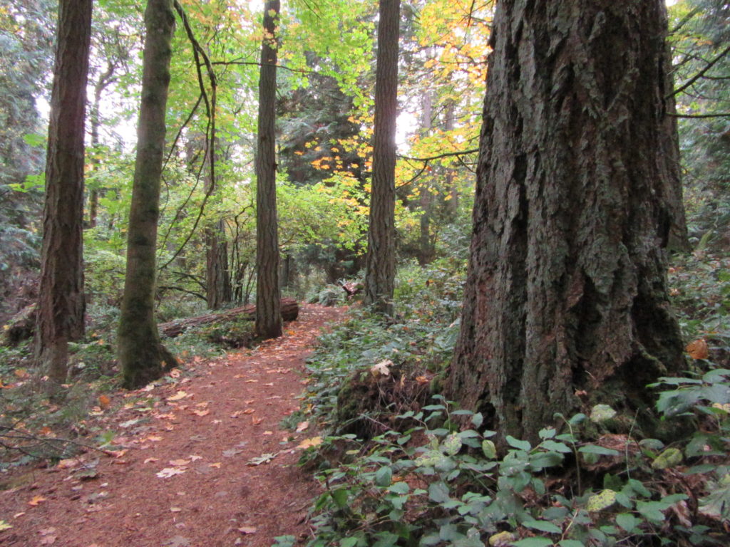
Hike a quiet forested bluff above Lake Sammamish Quick Facts: Location: Bellevue, WA Land Agency contact: city of Bellevue Parks and Recreation Round Trip: 2.5 miles of trails Elevation Gain: up to 500 feet Detailed Information: Urban Trails Eastside (Mountaineers Books) Map: online Notes: dogs permitted on leash Access: From I-90 exit 11B in Bellevue…
Read MoreWest Hylebos Wetlands Park
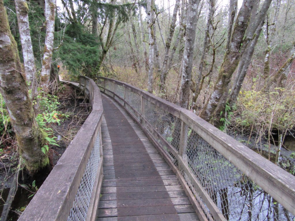
Exceptional peat bog in heart of Puget Sound urban sprawl Quick Facts: Location: Federal Way, WA Land Agency contact: city of Federal Way Parks and Recreation Round Trip: 1.4 miles of trails Elevation Gain: 225 feet Detailed Information: Urban Trails Tacoma (Mountaineers Books) Notes: Dogs prohibited. Park open dusk to dawn Access: From I-5 Exit…
Read MoreMount Erie
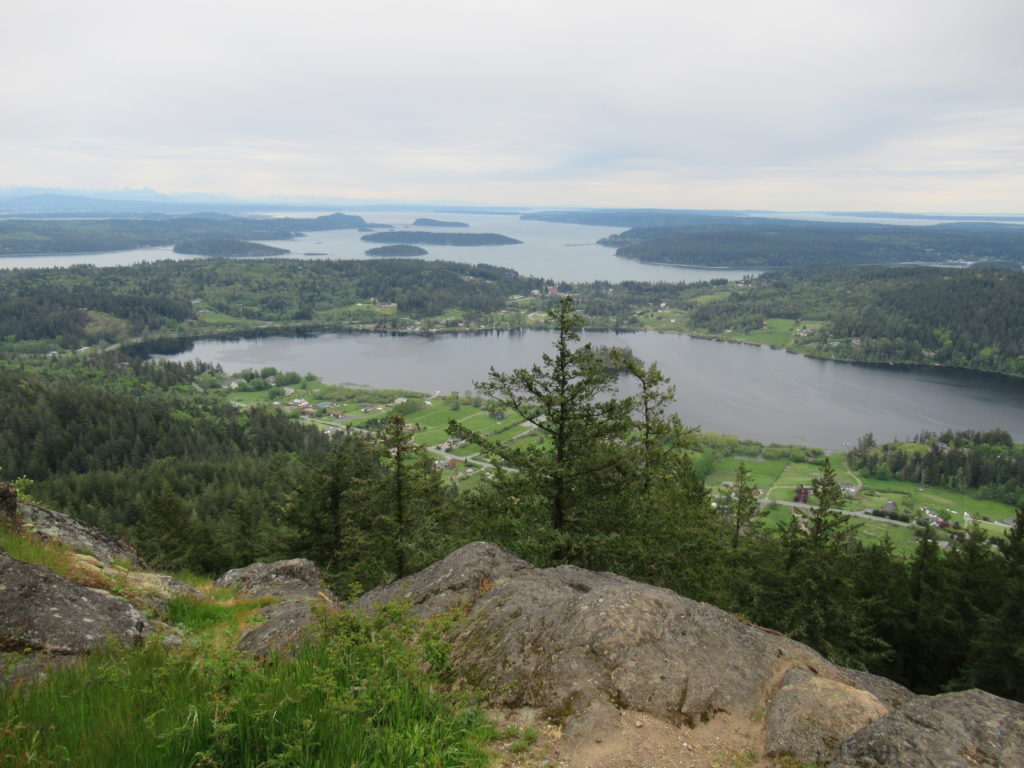
Fidalgo Island highpoint grants sweeping views Quick Facts: Location: Fidalgo Island Land Agency: Anacortes Community Forest Lands (ACFL) Round Trip: 5.2 miles Elevation Gain: 910 feet Contact: Anacortes Parks and Recreation Detailed Information: Day Hiking San Juans and Gulf Islands (Mountaineers Books) Map: online Notes: Dogs permitted on leash. Some trails open to bicycles, horses…
Read MoreLucia Falls Regional Park
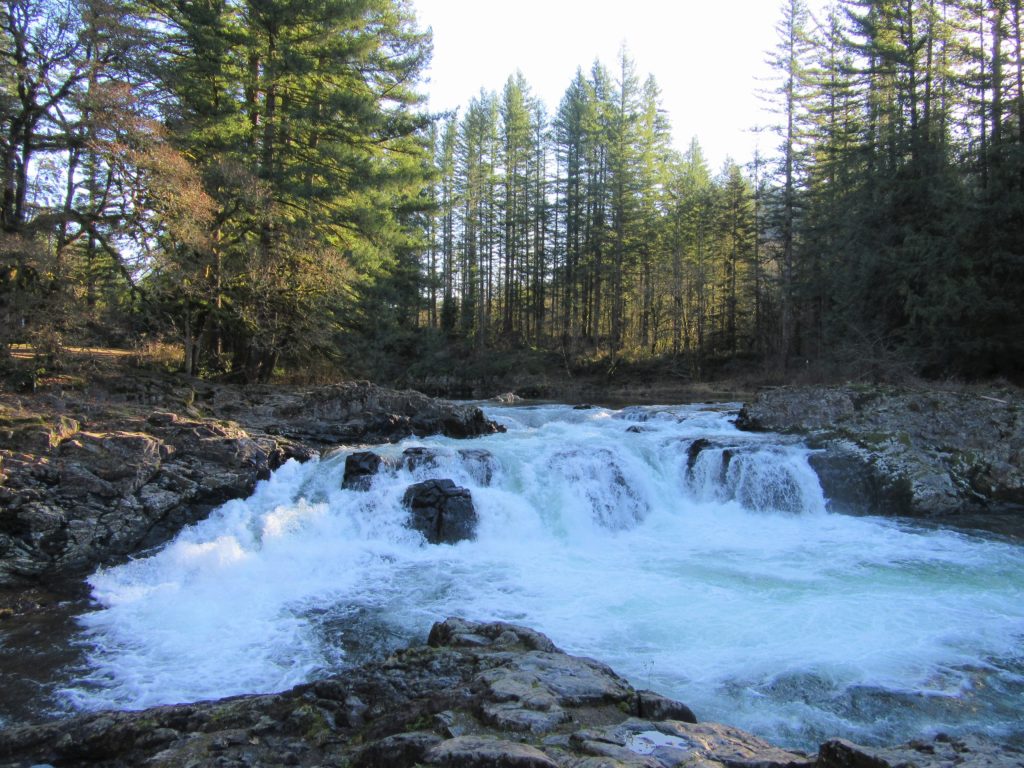
Small falls roar come winter Quick Facts: Location: East Fork Lewis River, Clark County WA Land Agency: Clark County Parks Round Trip: 1.0 mile Elevation Gain: 60 feet Contact: Clark County Parks Detailed Information: Urban Trails Vancouver WA (Mountaineers Books) Notes: Dogs permitted on leash. Park is open 7 am until dusk Access: From Battle…
Read MorePenrose Point State Park
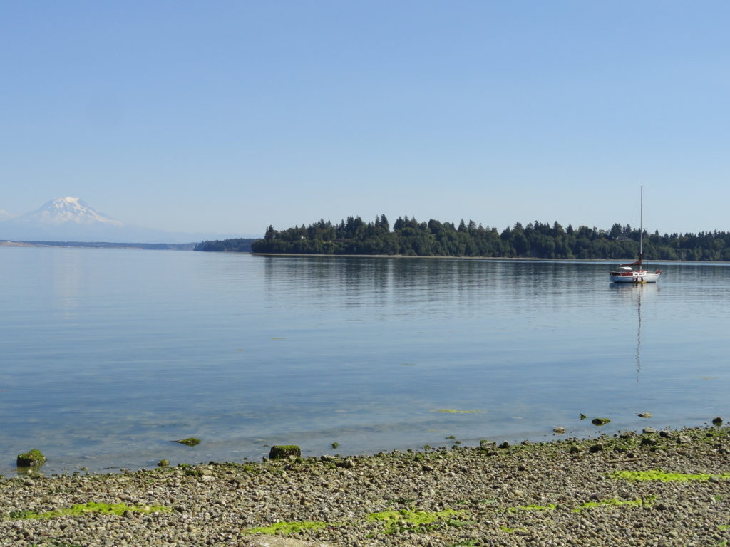
Madronas, big maples and sweeping views of Mount Rainier Quick Facts: Location: Key Peninsula Land Agency: Washington State Parks Round Trip: 2.5 miles of trails Elevation Gain: 200 feet Contact: Penrose Point State Park Detailed Information: Urban Trails Kitsap (Mountaineers Books) Notes: Discover Pass required, Dogs permitted on leash Access: From Purdy (just north of…
Read MoreLake Tye—Greenbelt Park preserves history and scenery
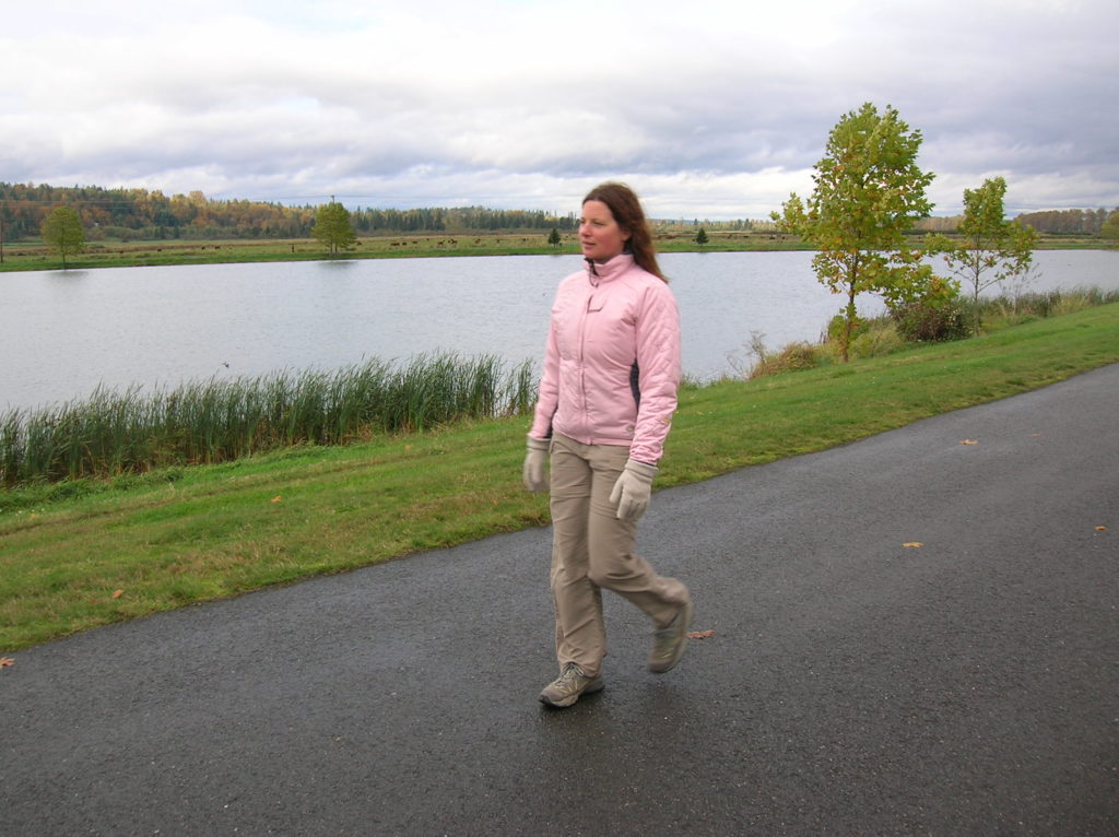
Quick Facts: Location: City of Monroe Land Agency: Monroe Parks and Recreation Department Roundtrip: 1.6 miles Elevation Gain: None Notes: Dogs must be on leash. Access: From Everett follow US 2 east towards Monroe. Turn right at first traffic light onto Fryelands Boulevard. Continue for .7 mile to junction with Wales Street. Turn right into…
Read MoreLookout Tree Trail — Snag a glimpse into the past
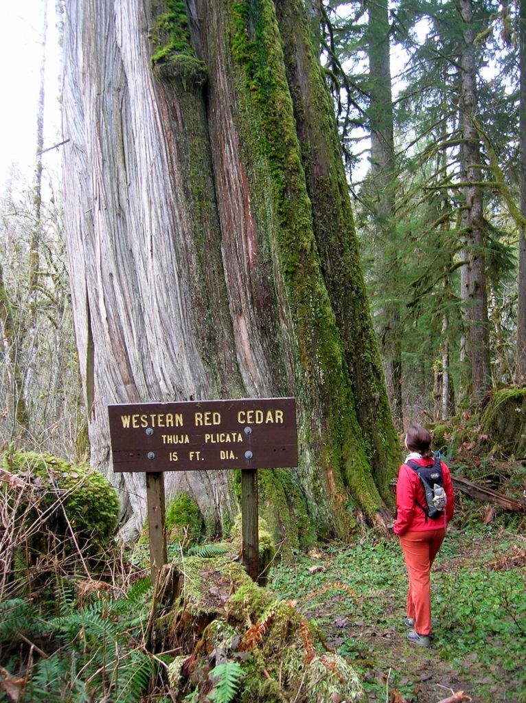
Quick Facts: Location: Mountain Loop Highway Land Agency: Mount Baker-Snoqualmie National Forest Roundtrip: 1.5 mile Elevation gain: 200 feet Green Trails Map: Mountain Loop Highway 111SX Contact: Darrington Ranger District: Mount Baker Snoqualmie National Forest Notes: No passes needed Access: From Darrington, follow Mountain Loop Highway for 11.3 miles to unmarked trailhead located on your…
Read MoreWarrior Rock Lighthouse─A scenic and historic hike on Oregon’s largest island
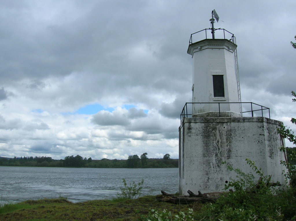
Quick Facts: Location: Sauvie Island (Portland, Oregon) Land Agency: Oregon Department of Fish and Wildlife Roundtrip: 6.5 miles Elevation Gain: 10 feet Access: From downtown Portland, follow US 30 west for just shy of 11 miles turning right onto the Sauvie Island Bridge. Follow Sauvie Island Road passing Cracker Barrel Grocery in .3 mile (where…
Read MoreEvans Creek Preserve
A glimpse of the Eastside pre-Microsoft Quick Facts: Location: Sammamish Land Agency: Sammamish Parks and Recreation Distance: 3.5 miles of trails Elevation Gain: up to 475 feet Contact: Sammamish Parks and Recreation Detailed Information: Urban Trails Eastside (Mountaineers Books) Notes: Dogs permitted on leash Access: From Redmond Head east on SR 202 for 4.0 miles…
Read More