Posts Tagged ‘snowfree winter hike’
Scriber Lake–Wetland Wonder in the heart of Lynnwood
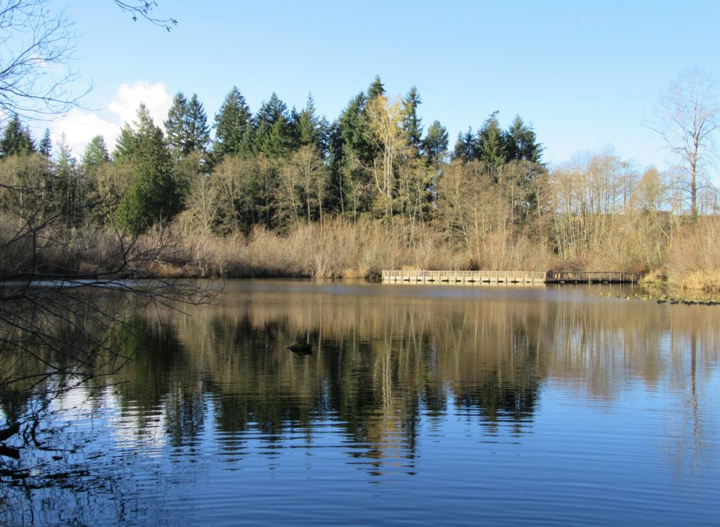
Quick Facts: Location: Lynnwood Land Agency: City of Lynnwood Parks and Recreation Roundtrip: 1.2 miles Elevation gain: none Difficulty: Easy Contact: Lynnwood Parks and Recreation Department; (425-771-4030) Notes: Dogs must be leashed Access: From Seattle take I-5 to exit 181. Turn left onto 44th Ave NW. At third light turn left onto SR 524 (196th…
Read MoreDevil’s Butte–A Frightful name but delightful hike in Lord Hill Park
Quick Facts Location: Lord Hill Park near Snohomish Land Agency: Snohomish County Parks Roundtrip: 3.5 miles High Point: 650 feet Elevation gain: 400 feet Difficulty: moderate Contact: Snohomish County Parks Notes: Dogs must be on leash; trails open to bikes and horses Access: From the city of Snohomish, exit SR 9 onto 2nd Street. Proceed…
Read MoreMoulton Falls
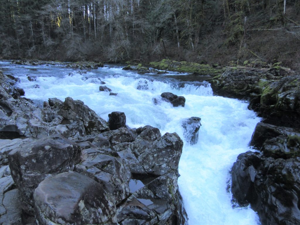
Walk along a wild river to an impressive set of rapids Quick Facts: Location: Clark County, WA Land Agency: Clark County Parks Roundtrip: 5.4 miles Elevation Gain: 200 feet Access: From Vancouver head north on I-5 to Exit 11 following SR 502 east for 6.0 miles to Battle Ground. Turn left onto SR 503 and…
Read MoreWhite Chuck Bench Trail — Glacier-fed Whitewater
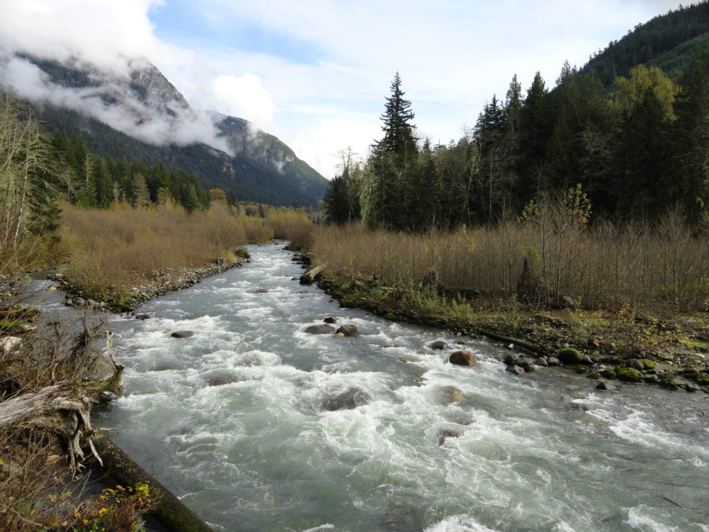
Quick Facts: Location: Mountain Loop Highway Land Agency: Mount Baker-Snoqualmie National Forest Roundtrip: 14 miles Elevation gain: 1500 feet Green Trails Map: Green Trails, Mountain Loop Highway, WA- no. 111SX Contact: Darrington Ranger District: Mount Baker Snoqualmie National Forest Access: From Darrington follow Mountain Loop Highway for 9.0 miles. Turn left onto FR 22 and…
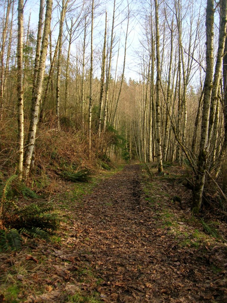
Read MoreBeaver Lake Loop–wetland wonderland on Lord Hill
Location: Lord Hill Park near Snohomish Land Agency: Snohomish County Parks Roundtrip: 2.2 miles High Point: 650 feet Elevation gain: 200 feet Difficulty: easy Contact: Snohomish County Parks Notes: Dogs must be on leash; Map available online Access: From Everett, head east on US 2 for 8.0 miles and take 88th Street SE Exit. Turn right…
Read MoreArlington Airport Trail–Come Fly with Me on a walk around an historic airport
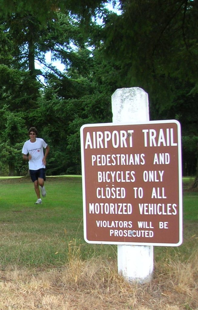
Quick Facts: Location: Arlington Land Agency: City of Arlington Roundtrip: 5.5 miles Elevation gain: 50 feet Difficulty: Easy Contact: Arlington Airport Commission Notes: Dogs must be on leash Access: From Everett, head north on I-5 to Exit 206. Continue east on SR 531 (172nd Street NE) for 1.4 miles. Turn left onto 59th Avenue NE and…
Read MoreScarborough Hill─Giant Sitka Spruces at historic fort on the Columbia River
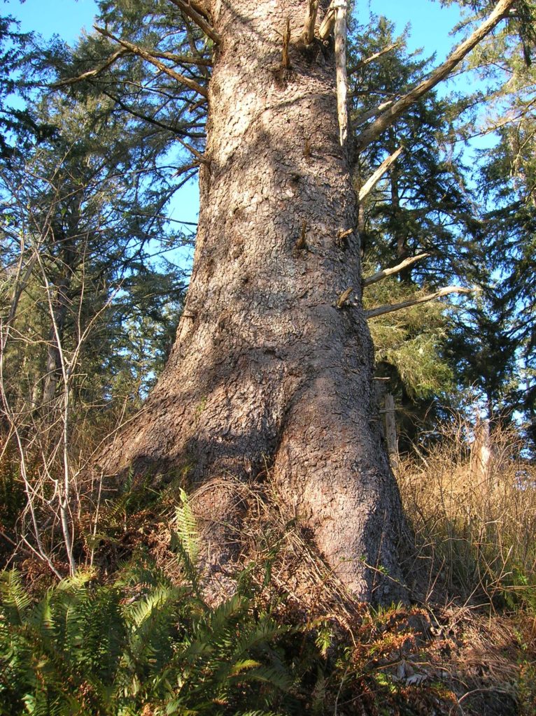
Quick Facts Location: Fort Columbia State Park, Pacific County, WA Land Agency: Washington State Parks Roundtrip: 2.4 miles Elevation Gain: 630 feet Access: From Kelso head west 56 miles on SR 4 to Naselle. Turn left onto SR 401 proceeding 12 miles to a junction with US 101 at the Astoria-Megler Bridge. Continue west on…
Read MoreBrowns Point -Kalaloch–Kid and dog friendly hike on the wild Olympic Coast
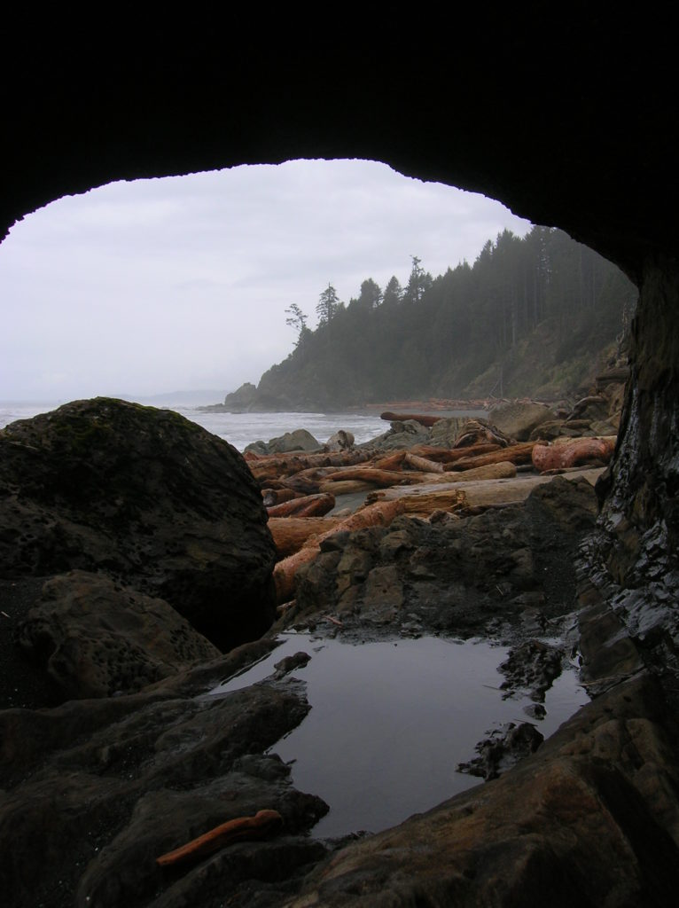
Location: Olympic National Park coast Land Agency: National Park Service Roundtrip: 4.0 miles Elevation gain: 50 feet Contact: Olympic National Park Wilderness Information Center Green Trails Map: Olympic Coast 99S Recommended Resource: Day Hiking Olympic Peninsula 2ed (Mountaineers Books) Notes: Dogs must be leashed; Browns Point can only be rounded during low tides; Practice Leave No…
Read MoreCatherine Creek Rock Arch–A touch of Utah in the Northwest!
Location: Columbia River Gorge National Scenic Area Land Agency: Columbia Gorge National Scenic Area Roundtrip: 2.3 miles Elevation gain: 370 feet Difficulty: Easy Contact: Columbia Gorge National Scenic Area Notes: Dogs permitted on leash. Be aware or ticks and poison oak. Green Trails Map: Columbia River Gorge East No. 432S Good to Know: kid-friendly, dog-friendly…
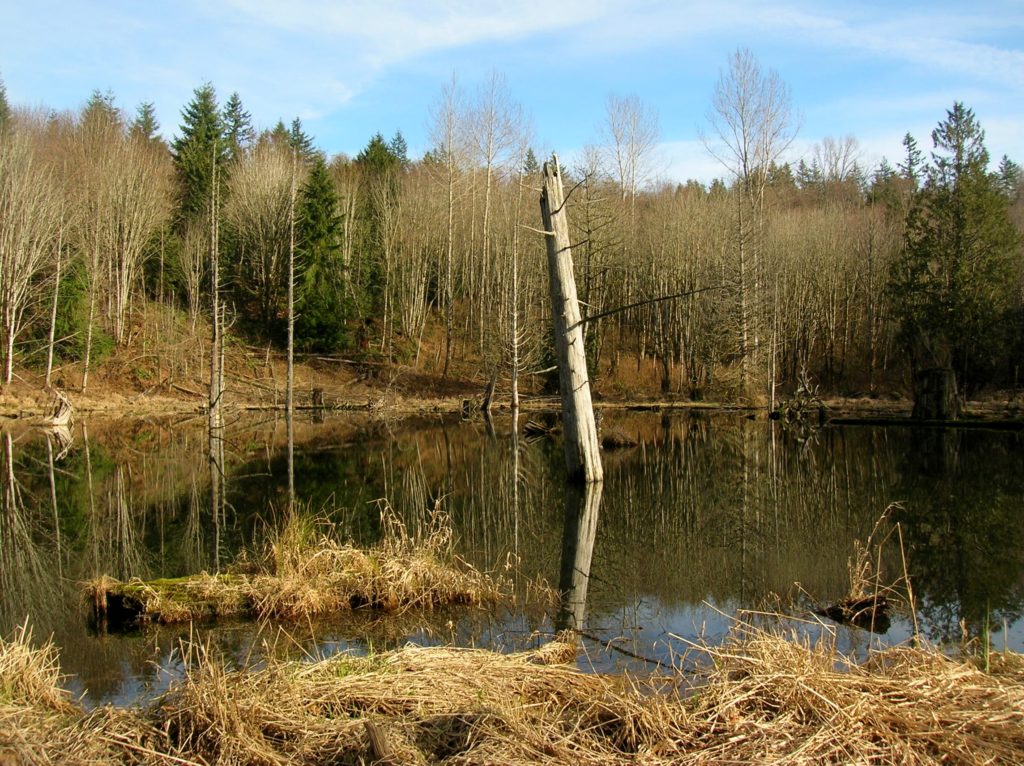
Read MoreBeaver Lake — Trail holds a “slough” of surprises
Quick Facts: Location: Mountain Loop Highway Land Agency: Mount Baker-Snoqualmie National Forest Roundtrip: 3.8 miles Elevation gain: 100 feet Green Trails Map: Mountain Loop Highway 111SX Contact: Darrington Ranger District: Mount Baker Snoqualmie National Forest Notes: Northwest Forest Pass or Interagency Pass required Access: From Darrington, follow Mountain Loop Highway for 9.0 miles to trailhead…
Read More