Sage Hills Trail
Bloomin’ good hike in Wenatchee Foothills
Quick Facts:
Location: Wenatchee Foothills
Round Trip: 9.6 miles
Elevation Gain: 1125 feet
Contact: Chelan-Douglas Land Trust
Detailed Information: Day Hiking Central Cascades 2nd edition (Mountaineers Books)
Notes: Trail is closed from Dec 1 until March 31 to protect wintering mule deer. Dogs must be leashed; trail open to mountain bikes; be aware for ticks and rattlesnakes
Access: In Wenatchee head west on 5th Street to Number One Canyon Road. Then continue 0.4 mile to trail parking (signed) on right at the junction with Sage Hills Drive. Do not park on Sage Hills Drive. Overflow parking is allowed on 5th Street.
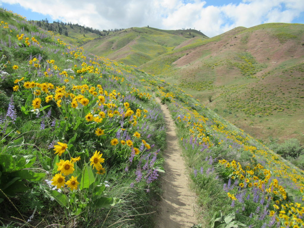
Good to Know: kid-friendly, dog-friendly, exceptional wildflowers
Traverse rolling golden hills wedged between the Cascade Mountains and the city of Wenatchee. Come in the spring and be dazzled by brilliant blossoms and the sweet scent of sage. Start your hike by walking up Sage Hills Drive to the trailhead. The Sage Hills trail system was developed through a wide consortium of people and organizations, including the Chelan-Douglas Land Trust (CDLT), the Chelan County PUD, and private citizens like the Lester family. Adhere to all rules, closures and posted property. Many unofficial trails have been built in this complex over the years and land agencies are reviewing which to keep and upgrade and which to close.
Start switchbacking through open country of golden grasses and fragrant sagebrush. Walk along the base of towering hills to the west while skirting housing developments on the right. Pass a path that heads east to the Day Drive trailhead (limited parking). Then on an easy grade, the way contours rolling hills, dips into a draw, and begins a long ascent via gentle switchbacks crossing a powerline swath and jeep track several times. After passing some sandstone ledges the trail reaches Three Trail Saddle, a good spot to turnaround for a short hike.
Here the Balsamroot Trail heads straight dropping into Broadview Canyon. You want to go left continuing on the Sage Hills Trail. Then soon bear right descending into Coyote Canyon. Next climb to Gut Saddle and take in excellent views of Burch Mountain to the north, Badger Mountain to the east, and the Sage Hills and Saddle Rock to the south.
Continue straight into Rattlesnake Canyon. Cross a spring fed creek above a mini badlands home to copious yellow belled marmots. Then switchback out of the canyon into CDLT’s Horse Lake Reserve coming to a high gap. The trail then gently flows across open slopes coming to the Homestead Trail. Bear right and gently ascend traversing flowering slopes over Rattlesnake Canyon. Pass a side trail left, crest a ridge and slightly descend coming to the northern trailhead at the Horse Lake Reserve parking area at 4.6 miles. Now return unless you’ve arranged for a one-way journey.
For more details on this hike and many others in the area, pick up a copy of my just released Day Hiking Central Cascade 2nd edition (Mountaineers Books)