Posts Tagged ‘dog-friendly’
Lake Evan and Boardman Lake–Enjoy an easy hike to two family friendly lakes
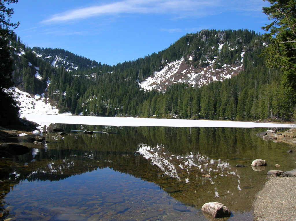
Quick Facts: Location: Mountain Loop Highway near Granite Falls Land Agency: Mount Baker-Snoqualmie National Forest Roundtrip: 2.0 miles Elevation gain: 300 feet Difficulty: easy (with some rough footing) Green Trails Map: Mountain Loop Highway 111SX Contact: Darrington Ranger District: Mount Baker-Snoqualmie National Forest Access: From Granite Falls, follow the Mountain Loop Highway east to the Verlot…
Read MoreNotch Pass–Hike through history over Quilcene Ridge
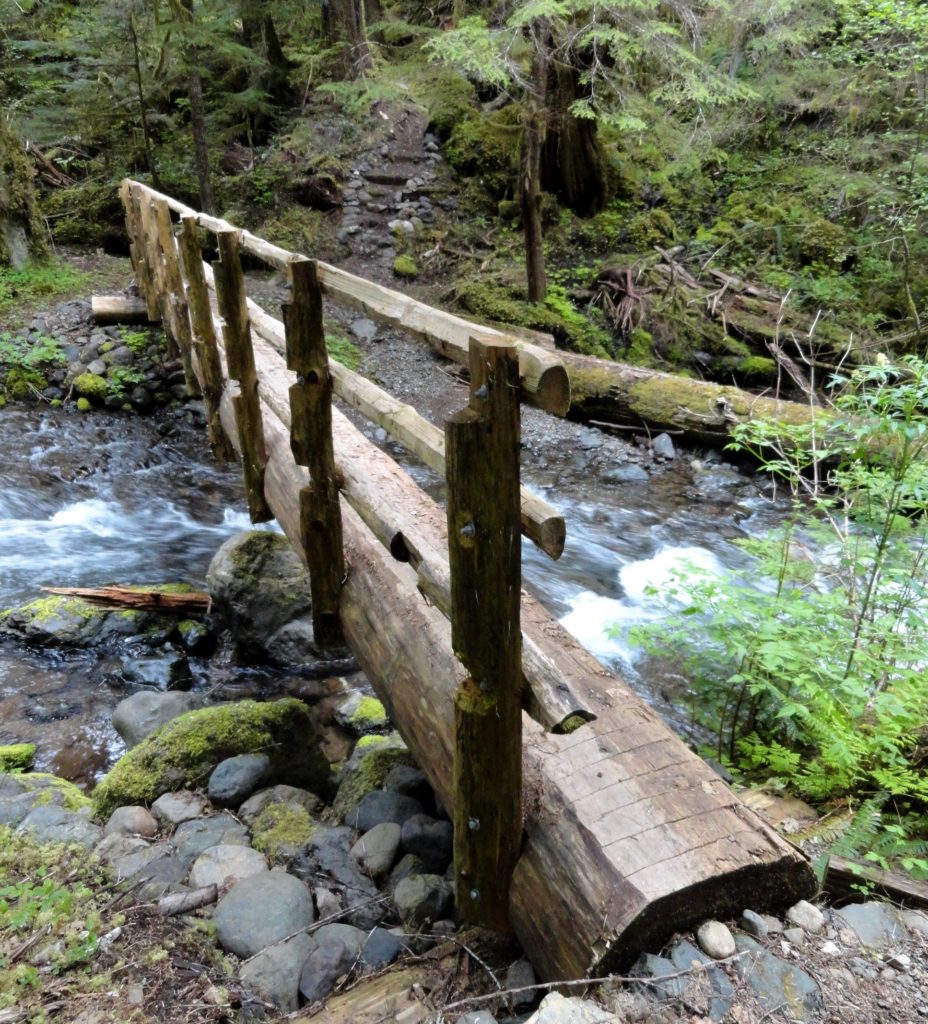
Location: Quilcene Valley, Northeast Olympic Peninsula Land Agency: National Forest Service Roundtrip: 8.4 miles Elevation gain: 2,800 feet Contact: Hood Canal Ranger District Olympic National Forest Guidebook: Day Hiking Olympic Peninsula 3rd Edition) Notes: Practice Leave No Trace Principles Access: From Quilcene drive US 101 south for 1.5 miles turning right onto Penny Creek Road. After 1.5…
Read MoreQuarry Loop Trail─Lord Hill Park Trail is a cut above
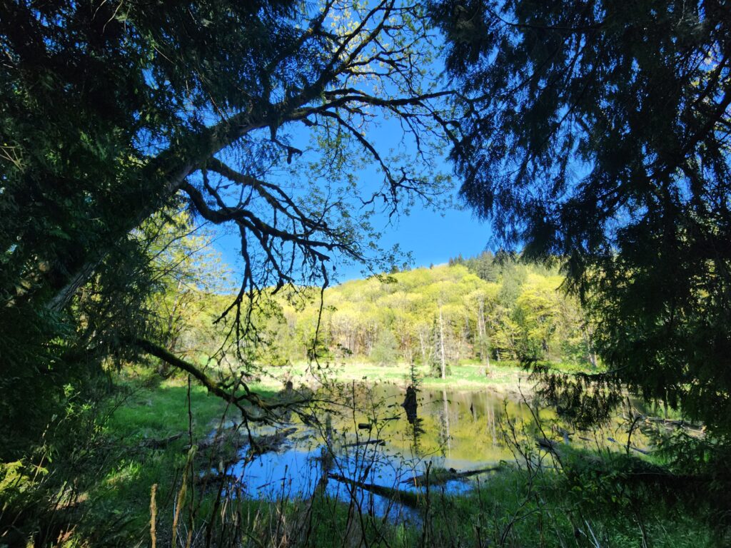
Quick Facts: Location: Lord Hill Regional Park Land Agency: Snohomish County Parks Roundtrip: 2.0 miles Elevation Gain: 250 feet Access: From Monroe, exit SR 522 onto Main Street heading west and immediately coming to a roundabout. Bear right onto Tester Road and proceed 3.0 miles to a T-intersection just after passing under SR 522. Turn left and proceed to Tester…
Read MoreSouth Whidbey State Park—Amble among ancient trees above the sound
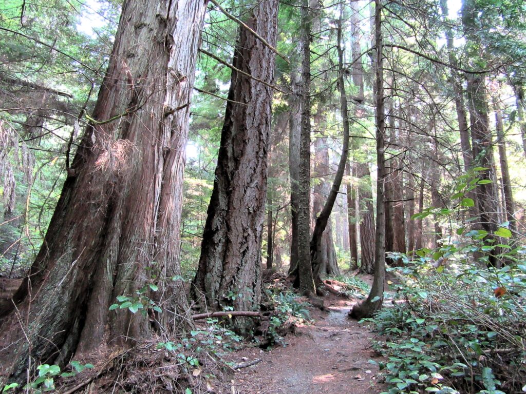
Quick Facts: Location: Whidbey Island Land Agency: Washington State Parks Roundtrip: 2.3 miles Elevation Gain: 200 feet Contact: South Whidbey State Park Notes: Discover Pass Required: Dogs must be leashed Access: From the Clinton Ferry Terminal on Whidbey Island follow SR 525 north for 9.4 miles turning left onto Bush Point Road. After 2.2 miles road…
Read MoreTumwater Pipeline Trail—Hike along “strong water” watching rafters and rapids
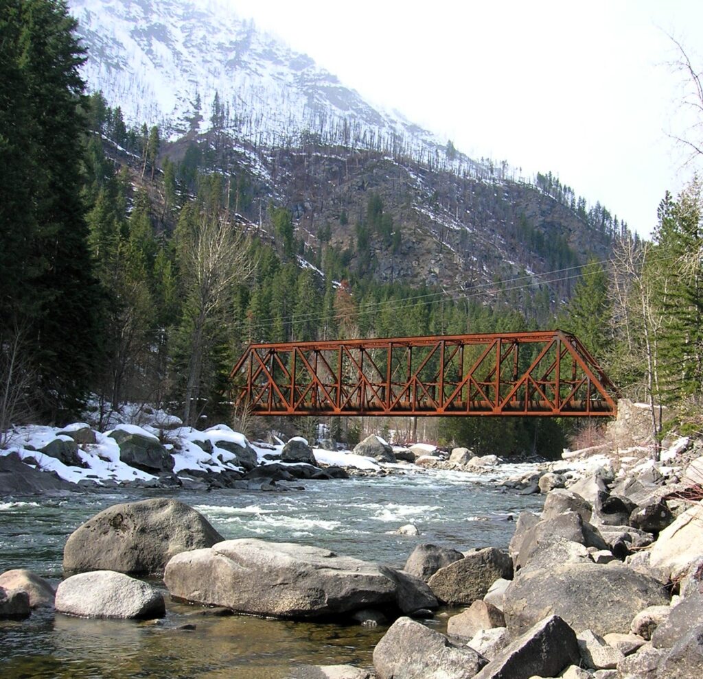
Quick Facts: Location: Wenatchee River Valley Land Agency: Okanogan-Wenatchee National Forest Roundtrip: 2.4 miles Elevation Gain: 100 feet Green trails Map: Leavenworth- No. 178 Access: From Everett head east on US 2 passing Stevens Pass to Coles Corner. Continue east on US 2 for 12.7 miles to trailhead located on your right (between Mileposts 97…
Read MoreQuinault Rainforest Loop — Easily accessible trail system through an Olympic Rainforest
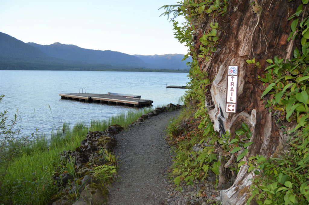
Quick Facts: Location: Lake Quinault Land Agency: Olympic National Forest Roundtrip: 3.9 miles Elevation Gain: 500 feet Contact: Olympic National Forest, Pacific Ranger District, Quinault Detailed Information: Day Hiking Olympic Peninsula 3rd edition (Mountaineers Books) Notes: Northwest Forest Pass or Interagency Pass required; dogs should on leash Access: From Hoquiam travel north on US 101 for 35 miles.…
Read MoreDalles Ridge — Wintering Elk and Sublime Alpine views
Quick Facts: Location: Mount Baker-Snoqualmie National Forest Land Agency: US Forest Service Round Trip: 8.2 miles Elevation Gain: 1900 feet Green Trails Map: Greenwater no. 238 Contact: Mount Baker-Snoqualmie National Forest Notes: During periods of low snow levels, parking may be difficult. Access: From Enumclaw follow SR 410 for 13.6 miles turning left (shortly after passing…
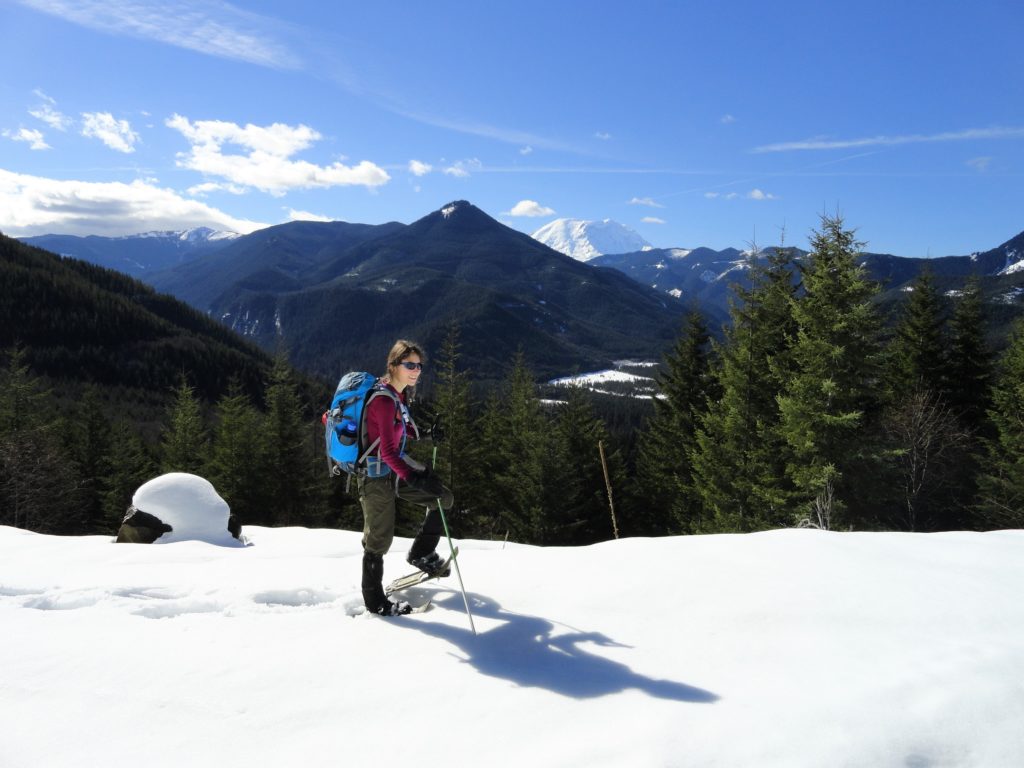
Read MoreCorral Pass –Challenging snow shoe trip to high pass on Castle Mountain

Quick Facts: Location: Mount Baker-Snoqualmie National Forest Land Agency: National Forest Service Roundtrip: 11.5 miles Elevation Gain: 2,800 feet Contact: Mount Baker-Snoqualmie National Forest Green Trails Maps: Greenwater no. 238, Lester no. 239, and on Mount Rainier National Park 269S Notes: When snow level is low, parking here can be a challenge. Do not block access…
Read MoreSouth Indian Island — Enjoy peaceful shoreline strolling along a line of defense
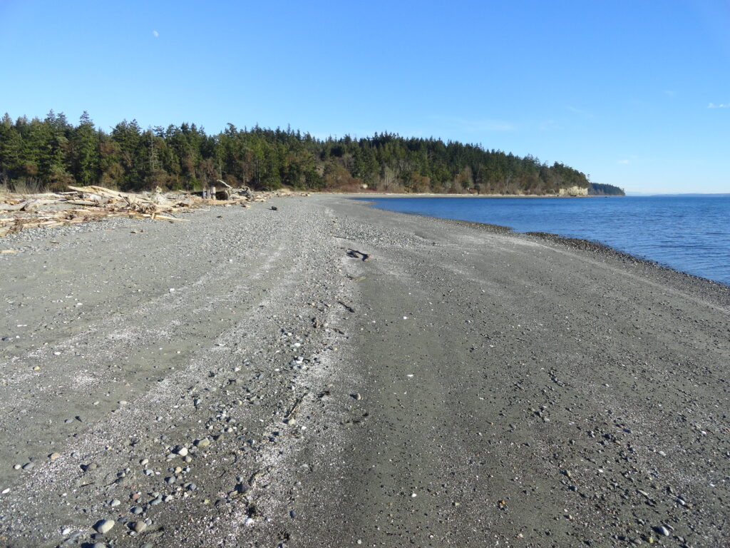
Quick Facts: Location: Indian Island near Port Hadlock Land Agency: Jefferson County Parks Roundtrip: 4.0 miles Elevation Gain: 70 feet Notes: Detailed information can be found in Day Hiking Olympic Peninsula (Mountaineers Books) Contact: Jefferson County Parks Access: From Kingston, drive State Route 104 turning right onto SR 19. Then continue north for 9 miles turning right onto…
Read MorePadilla Bay Dike Trail–shore fine hike in the Skagit Valley
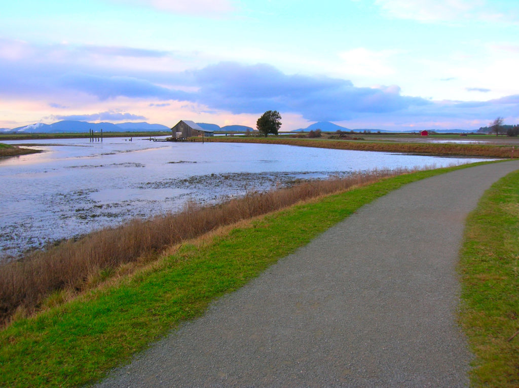
Quick Facts: Location: Skagit County Land Agency: Padilla Bay National Estuarine Research Reserve Roundtrip: 4.8 miles Elevation Gain: 30 feet Contact: Padilla Bay NERR Access: From Burlington (exit 231 on I-5) proceed through roundabouts and head west on Josh Wilson Road for 6.4 miles. Upon entering the village of Bay View turn left onto 2nd Street…
Read More