Palouse Falls–showy cataract of Eastern Washington’s coulee country
Quick Facts:
Location: Channeled Scablands Eastern Washington
Land Agency: Washington State Parks
Roundtrip: 1.3 miles
Elevation Gain: 150 feet
Contact: Washington State Parks
Guidebook: Day Hiking Eastern Washington (Mountaineers Books)
Notes: Discover Pass required. Dogs permitted on leash. Watch for rattlesnakes
Access: From Pasco, take US 395 north to Connell. Then follow SR 260 east for 25 miles turning right onto SR 261. Reach state park turnoff after 8.6 miles. From Spokane, follow I-90 west to Exit 221 in Ritzville. Then continue south on SR 261 for 41.5 miles turning left onto Palouse Falls Road. Reach trailhead after 2.4 miles.
Good to Know: exceptional wildflowers, exceptional waterfall
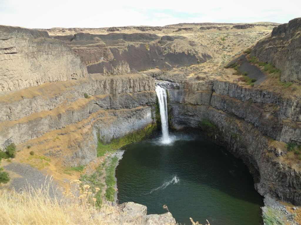
Plummeting nearly 200 feet within a stark canyon of basalt, Palouse Falls is one of the most striking waterfalls in the Pacific Northwest. While you can easily view this spectacle of nature from the parking lot, a couple of enticing trails lead along the canyon rim high above the plunging waters—and deep into the canyon to a series of rapids upriver from the awesome falls.
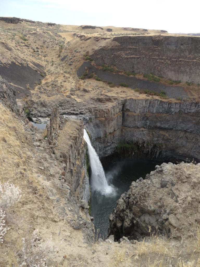
Upon exiting your vehicle immediately be greeted by the roar of the Palouse River dropping 198 feet into a plunge pool beneath steep shelved-cliff walls. Feel free to first walk the paved path to falls vistas and interpretive signs. Then start your hike which begins on a service road at the north end of the parking area. Saunter past willows and through sage and flowers—lots of them. Depending upon the season, look for camas, lupine, desert parsley, arrowleaf balsamroot, bluebells, yellow bells and more.
Soon a well-defined path branches right following along the canyon rim above the falls. Take it and proceed with caution staying a safe distance away from the canyon’s edge. Avoid the social paths that head into the canyon as they can be extremely dangerous. Look for snakes and yellow bellied marmots along the way—and of course stop to marvel at the river below.
Peer down at Castle Rock with its turrets and parapets. Then continue along the rim enjoying vertigo-inducing views into the chasm below. A series of rapids in a bend in the river beneath an impressive face of columnar basalt soon comes into view. That’s your destination.
Eventually come to the end of a service road. The trail continues right through a small gap, steeply dropping (use caution) down to a set of railroad tracks. The line is still in use, so stay clear. Walk right along the tracks for 500 feet and then pick up trail again. Descend across a basalt talus slope reaching the canyon floor in another 500 feet. Then on easy trail continue through pockets of head-high sage reaching river’s edge at the rapids. This is a nice spot to sit and ponder; or feel free to scout around the canyon floor, but do stay snake awake! When ready to return, retrace steps to the service road and follow it back to the trailhead.
For detailed information on this hike (and the Native legend of how the falls came to be); and on 124 other great hikes throughout Eastern Washington, pick up a copy of my (co-written with Rich Landers) Day Hiking Eastern Washington (Mountaineers Books)